 Wayfarrow
Enfield–Suffield Covered Bridge
Covered bridge · Capitol County, Connecticut
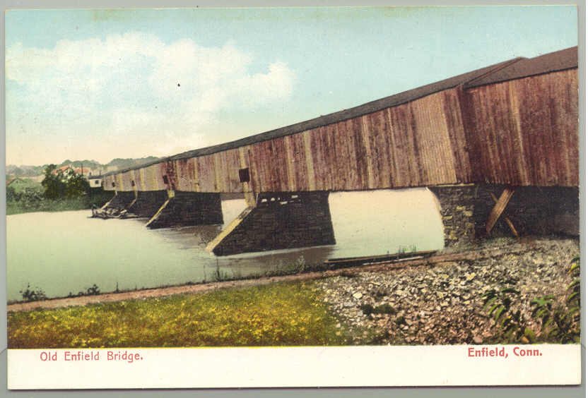
Enfield–Suffield Covered Bridge is a covered bridge in Capitol County, Connecticut, described in its record as bridge in United States of America. Connecticut has 9 covered bridges on record at Wayfarrow, 2 of them in Capitol County.
It crosses Connecticut River; the structure is built of wood.
Its record gives 1900 as the year this covered bridge was demolished, destroyed or taken out of existence, so it may no longer stand; check its status before you travel. It stands at 41.9751° N, 72.6062° W.
Key facts
| Crosses | Connecticut River |
|---|---|
| Material | wood |
| Record end date (demolished or lost) | 1900 |
| Coordinates | 41.97510, -72.60620 |
Nearby places
- Crescent Groveghost town · Capitol County · 5.4 mi
- Old Toll Bridge (Springfield, Massachusetts)covered bridge · Hampden County · 8.7 mi
- Spoonvilleghost town · Capitol County · 9.1 mi
- Paucatuckghost town · Hampden County · 10.3 mi
- Barber Cornerghost town · Capitol County · 13.8 mi
- Hartford Toll Bridge (1818)covered bridge · Capitol County · 14.5 mi
- Rocky Hillghost town · Capitol County · 16.2 mi
- Hassunadchuauckghost town · Capitol County · 16.4 mi
- Plainvilleghost town · Hampden County · 16.5 mi
- Naubucghost town · Capitol County · 17.5 mi
- Gay City State Parkghost town · Capitol County · 19.2 mi
- Enfieldghost town · Hampshire County · 27.5 mi
Questions
Where is Enfield–Suffield Covered Bridge?
Enfield–Suffield Covered Bridge is in Capitol County, Connecticut, at 41.9751, -72.6062.
How many covered bridges are in Capitol County?
Capitol County, Connecticut has 2 covered bridges on record at Wayfarrow.
- Wikidata — Wikidata item (CC0)
- Wikidata — Wikipedia article (linked as a source; text not used) (CC0)
Facts marked "approximately" carry an uncertain date in the source. Text on this page is generated from the sources above; no encyclopedia prose is copied. Last updated 2026-11-05.