 Wayfarrow
West Cornwall Covered Bridge
Covered bridge · Northwest Hills County, Connecticut
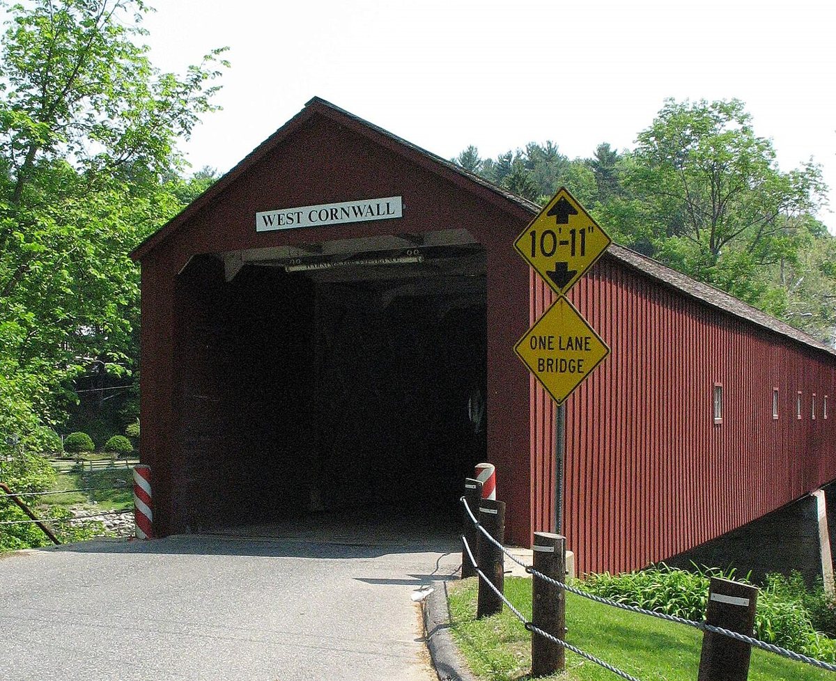
West Cornwall Covered Bridge is a covered bridge in Northwest Hills County, Connecticut, described in its record as lattice truss bridge in Cornwall, US. Connecticut has 9 covered bridges on record at Wayfarrow, 2 of them in Northwest Hills County.
It crosses Housatonic River; it is about 172 feet long.
Status check, 2026-11: Town lattice bridge still carrying CT Route 128 over the Housatonic. The date is only 'circa' or 'most likely' 1864, so it is left null. A steel support deck was added in 1973, and an oversized vehicle damaged the bridge in April 2025 before it reopened. West Cornwall Covered Bridge is listed on the National Register of Historic Places. It stands at 41.8717° N, 73.3644° W.
Key facts
| Crosses | Housatonic River |
|---|---|
| Length | 172 ft |
| Heritage designation | National Register of Historic Places listed place |
| National Register | Listed |
| Coordinates | 41.87167, -73.36444 |
Nearby places
- Dudley Townghost town · Northwest Hills County · 4.5 mi
- Foleyghost town · Northwest Hills County · 10.4 mi
- Emmons Cityghost town · Northwest Hills County · 13.7 mi
- Bull's Bridgecovered bridge · Northwest Hills County · 15.5 mi
- Old Covered Bridgecovered bridge · Berkshire County · 17.5 mi
- Questingghost town · Berkshire County · 18.3 mi
- Acropolisghost town · Naugatuck Valley County · 24.6 mi
- Joycelandghost town · Western Connecticut County · 25.3 mi
- Esopus Meadows Lightlighthouse · Ulster County · 29.7 mi
- Rondout Lightlighthouse · Ulster County · 31 mi
- Great Plainghost town · Western Connecticut County · 31.4 mi
- Spoonvilleghost town · Capitol County · 31.7 mi
Questions
Where is West Cornwall Covered Bridge?
West Cornwall Covered Bridge is in Northwest Hills County, Connecticut, at 41.8717, -73.3644.
How many covered bridges are in Northwest Hills County?
Northwest Hills County, Connecticut has 2 covered bridges on record at Wayfarrow.
- Wikidata — Wikidata item (CC0)
- National Register of Historic Places — National Register of Historic Places record (public-domain)
- Wikidata — Wikipedia article (linked as a source; text not used) (CC0)
- Wayfarrow status check (web sources) — Checked for current status (facts)
- Wayfarrow status check (web sources) — Checked for current status (facts)
- Wayfarrow status check (web sources) — Checked for current status (facts)
- Wayfarrow status check (web sources) — Checked for current status (facts)
Facts marked "approximately" carry an uncertain date in the source. Text on this page is generated from the sources above; no encyclopedia prose is copied. Last updated 2026-11-05.