 Wayfarrow
Kilgore Mill Covered Bridge and Mill Site
Covered bridge · Walton County, Georgia
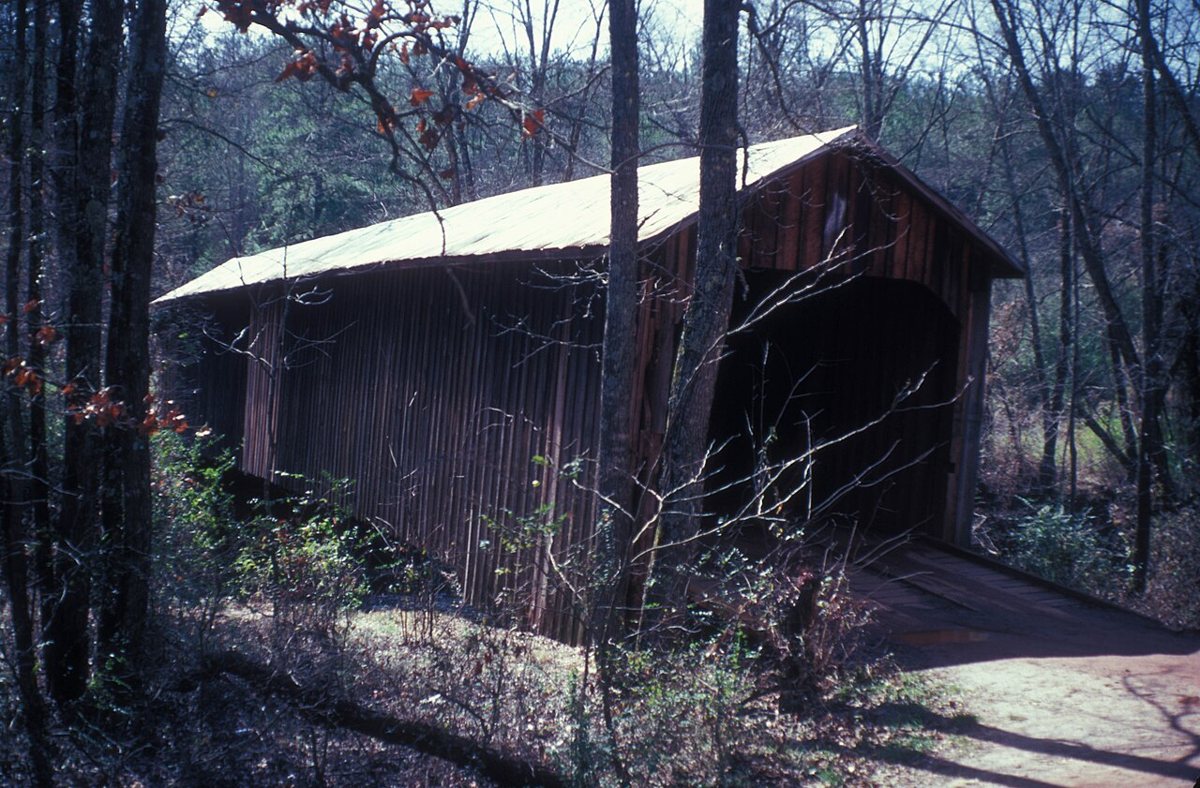
Kilgore Mill Covered Bridge and Mill Site is a covered bridge in Walton County, Georgia. Georgia has 16 covered bridges on record at Wayfarrow.
It was built in 1894, in the late 19th century, making it the 5th oldest of the 9 in Georgia with a recorded construction date; it crosses Apalachee River.
Its record gives 1993 as the year this covered bridge was demolished, destroyed or taken out of existence, so it may no longer stand; check its status before you travel. Kilgore Mill Covered Bridge and Mill Site is listed on the National Register of Historic Places. It stands at 33.8997° N, 83.7395° W.
Key facts
| Year built | 1894 |
|---|---|
| Crosses | Apalachee River |
| Heritage designation | National Register of Historic Places listed place |
| National Register | Listed |
| Record end date (demolished or lost) | 1993 |
| Coordinates | 33.89966, -83.73948 |
Nearby places
- Cleatonghost town · Walton County · 9.2 mi
- Algernonghost town · Barrow County · 11.7 mi
- Marcusghost town · Jackson County · 12.6 mi
- Cains Courthouseghost town · Barrow County · 13.2 mi
- Grapevineghost town · Gwinnett County · 13.9 mi
- Talasseeghost town · Jackson County · 15.4 mi
- Princetonghost town · Rockdale County · 16.4 mi
- Rehobothghost town · Morgan County · 17.2 mi
- Sardumghost town · Rockdale County · 18.7 mi
- Yellow Riverghost town · Gwinnett County · 19.8 mi
- Cobbhamghost town · Clarke County · 20.2 mi
- McGuiresghost town · Gwinnett County · 20.4 mi
- Wikidata — Wikidata item (CC0)
- National Register of Historic Places — National Register of Historic Places record (public-domain)
- Wikidata — Wikipedia article (linked as a source; text not used) (CC0)
Facts marked "approximately" carry an uncertain date in the source. Text on this page is generated from the sources above; no encyclopedia prose is copied. Last updated 2026-11-05.