 Wayfarrow
Colville Covered Bridge
Covered bridge · Bourbon County, Kentucky
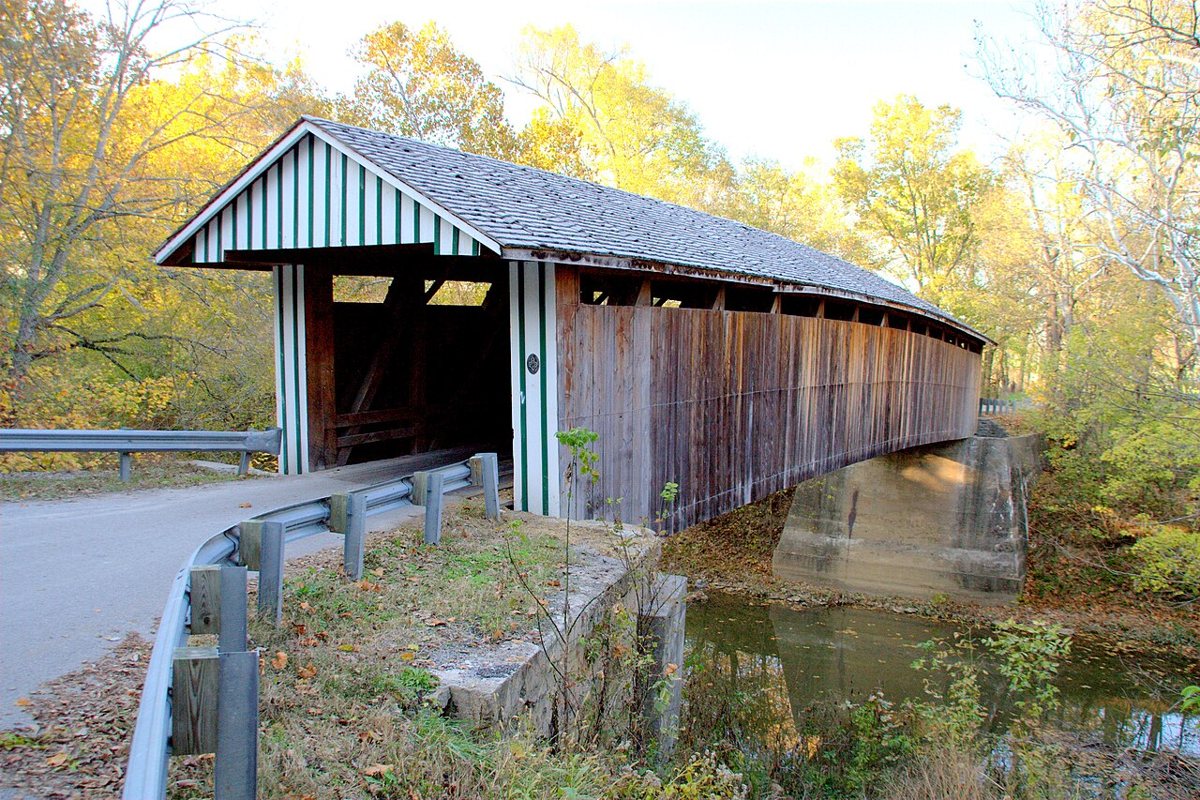
Colville Covered Bridge is a covered bridge in Bourbon County, Kentucky. Kentucky has 15 covered bridges on record at Wayfarrow.
Status check, 2026-11: The 1877 Burr-truss bridge over Hinkston Creek collapsed in a 1997 flood and was rebuilt in 2001–02 with new and salvaged materials, so 1877 isn't clearly the current structure's date; sources give its length as 124 ft or 120 ft. Colville Covered Bridge is listed on the National Register of Historic Places. It stands at 38.3244° N, 84.2033° W.
Key facts
| Heritage designation | National Register of Historic Places listed place |
|---|---|
| National Register | Listed |
| Coordinates | 38.32444, -84.20333 |
Nearby places
- Jones Shopghost town · Harrison County · 4.2 mi
- Covered Bridge over the South Fork of Licking Rivercovered bridge · Harrison County · 6.8 mi
- Adelineghost town · Lawrence County · 9.7 mi
- Hickory Ridgeghost town · Nicholas County · 10.1 mi
- White Oakghost town · Harrison County · 11.3 mi
- Curryghost town · Clinton County · 13.4 mi
- Dutch Chapelghost town · Clinton County · 13.6 mi
- Collettsghost town · Shelby County · 14.7 mi
- Richlandghost town · Clinton County · 15.3 mi
- Mount Pleasantghost town · Robertson County · 15.3 mi
- Plum Lickghost town · Montgomery County · 15.4 mi
- Peytonsghost town · Montgomery County · 15.5 mi
Sources and licences
- Wikidata — Wikidata item (CC0)
- National Register of Historic Places — National Register of Historic Places record (public-domain)
- Wikidata — Wikipedia article (linked as a source; text not used) (CC0)
- Wayfarrow status check (web sources) — Checked for current status (facts)
- Wayfarrow status check (web sources) — Checked for current status (facts)
- Wayfarrow status check (web sources) — Checked for current status (facts)
Facts marked "approximately" carry an uncertain date in the source. Text on this page is generated from the sources above; no encyclopedia prose is copied. Last updated 2026-11-05.