 Wayfarrow
Babb's Bridge
Covered bridge · Cumberland County, Maine
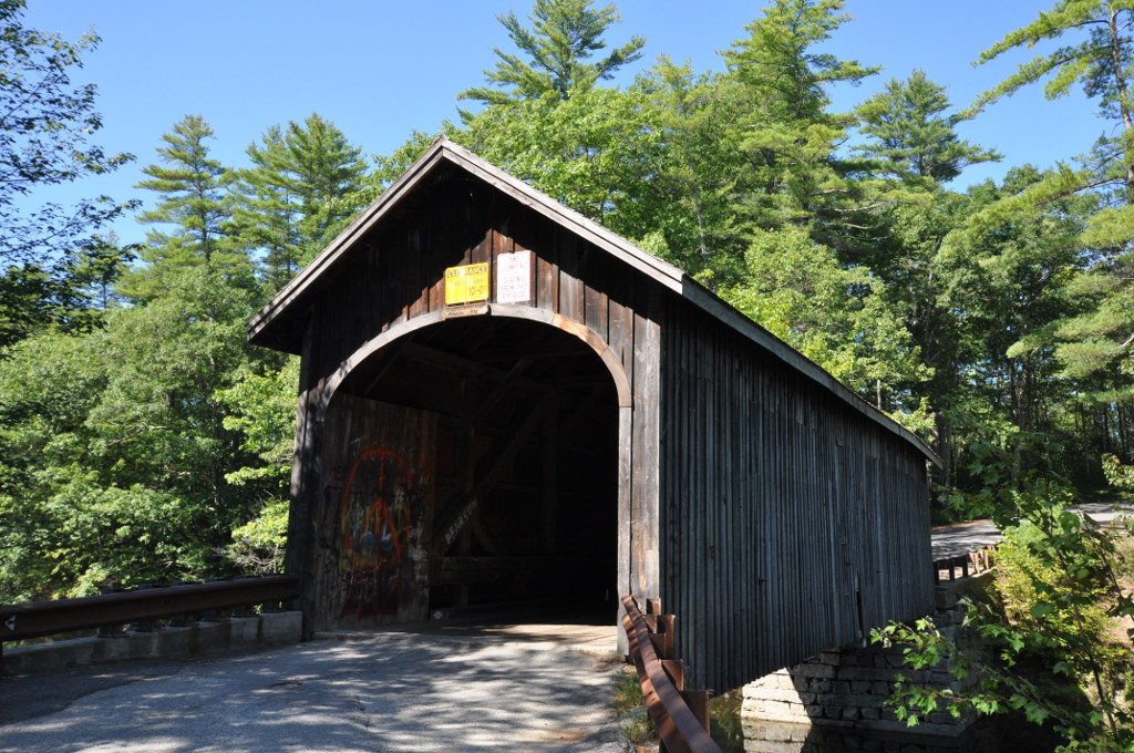
Babb's Bridge is a covered bridge in Cumberland County, Maine, described in its record as place in Maine listed on National Register of Historic Places. Maine has 14 covered bridges on record at Wayfarrow, 2 of them in Cumberland County.
It was built in 1976, in the postwar decades, making it the 10th oldest of the 11 in Maine with a recorded construction date; it crosses Presumpscot River; it is about 79 feet long.
Status check, 2026-11: This is a 1976 replica. Arsonists burned the original (dated 1840, 1843, or 1864) in 1973, and the bridge has since been removed from the NRHP. An overweight truck broke through the deck in Aug 2024; it reopened on Feb 20, 2025. Babb's Bridge is listed on the National Register of Historic Places. It stands at 43.7661° N, 70.4481° W.
Key facts
| Current structure built | 1976 |
|---|---|
| Crosses | Presumpscot River |
| Length | 79 ft |
| Heritage designation | National Register of Historic Places listed place |
| National Register | Listed |
| Coordinates | 43.76610, -70.44810 |
Nearby places
- Great Fallsghost town · Cumberland County · 2.6 mi
- Gates Hillghost town · Cumberland County · 3.6 mi
- Lowells Cornerghost town · Cumberland County · 5.8 mi
- Village of Halidonghost town · Cumberland County · 6.6 mi
- Riverton Covered Bridgecovered bridge · Cumberland County · 7.5 mi
- West Falmouthghost town · Cumberland County · 7.9 mi
- Grubb Hillghost town · Cumberland County · 8.4 mi
- Summit View Parkghost town · Cumberland County · 8.5 mi
- Lone Creek Villageghost town · Cumberland County · 11.2 mi
- Upper Villageghost town · Cumberland County · 12.9 mi
- Portland Breakwater Lightlighthouse · Cumberland County · 13.1 mi
- Danish Villageghost town · Cumberland County · 13.3 mi
Questions
Where is Babb's Bridge?
Babb's Bridge is in Cumberland County, Maine, at 43.7661, -70.4481.
How many covered bridges are in Cumberland County?
Cumberland County, Maine has 2 covered bridges on record at Wayfarrow.
- Wikidata — Wikidata item (CC0)
- National Register of Historic Places — National Register of Historic Places record (public-domain)
- Wikidata — Wikipedia article (linked as a source; text not used) (CC0)
- Wayfarrow status check (web sources) — Checked for current status (facts)
- Wayfarrow status check (web sources) — Checked for current status (facts)
- Wayfarrow status check (web sources) — Checked for current status (facts)
- Wayfarrow status check (web sources) — Checked for current status (facts)
Facts marked "approximately" carry an uncertain date in the source. Text on this page is generated from the sources above; no encyclopedia prose is copied. Last updated 2026-11-05.