 Wayfarrow
Bog Bridge
Covered bridge · Merrimack County, New Hampshire
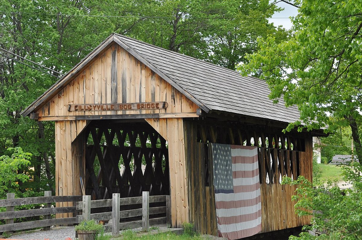
Bog Bridge is a covered bridge in Merrimack County, New Hampshire. New Hampshire has 51 covered bridges on record at Wayfarrow, 9 of them in Merrimack County.
It was built in 1887, in the late 19th century, making it the 22nd oldest of the 33 in New Hampshire with a recorded construction date; it is about 53 feet long (16th longest of 16 measured in New Hampshire).
Status check, 2026-11: Also called the Cilleyville-Bog Bridge in Andover, this Town lattice bridge has been foot-traffic only since NH 11 bypassed it. It was closed in 1997 and restored and reopened in 2003. The 53 ft is the floor length; measured gable to gable it is about 56 ft. Bog Bridge is listed on the National Register of Historic Places. It stands at 43.4303° N, 71.8697° W.
Key facts
| Current structure built | 1887 |
|---|---|
| Length | 53 ft |
| Heritage designation | National Register of Historic Places listed place |
| National Register | Listed |
| Coordinates | 43.43030, -71.86970 |
Nearby places
- Shaw Cornerghost town · Merrimack County · 9.2 mi
- Waterloo Covered Bridgecovered bridge · Merrimack County · 9.9 mi
- Dalton Covered Bridgecovered bridge · Merrimack County · 11 mi
- Bement Covered Bridgecovered bridge · Merrimack County · 12.2 mi
- Contoocook Covered Bridgecovered bridge · Merrimack County · 16.3 mi
- Contoocook Railroad Bridgecovered bridge · Merrimack County · 16.3 mi
- Corbin Covered Bridgecovered bridge · Sullivan County · 16.6 mi
- Rowell's Covered Bridgecovered bridge · Merrimack County · 17.5 mi
- Henniker Covered Bridgecovered bridge · Merrimack County · 17.6 mi
- Pier Bridgecovered bridge · Sullivan County · 19.3 mi
- Wright's Bridgecovered bridge · Sullivan County · 20.2 mi
- Meriden Bridgecovered bridge · Sullivan County · 21.6 mi
Questions
Where is Bog Bridge?
Bog Bridge is in Merrimack County, New Hampshire, at 43.4303, -71.8697.
How many covered bridges are in Merrimack County?
Merrimack County, New Hampshire has 9 covered bridges on record at Wayfarrow.
- Wikidata — Wikidata item (CC0)
- National Register of Historic Places — National Register of Historic Places record (public-domain)
- Wikidata — Wikipedia article (linked as a source; text not used) (CC0)
- Wayfarrow status check (web sources) — Checked for current status (facts)
- Wayfarrow status check (web sources) — Checked for current status (facts)
- Wayfarrow status check (web sources) — Checked for current status (facts)
- Wayfarrow status check (web sources) — Checked for current status (facts)
Facts marked "approximately" carry an uncertain date in the source. Text on this page is generated from the sources above; no encyclopedia prose is copied. Last updated 2026-11-05.