 Wayfarrow
Bunker Hill Covered Bridge
Covered bridge · Catawba County, North Carolina
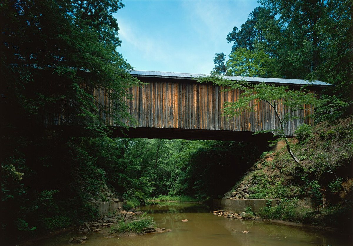
Bunker Hill Covered Bridge is a covered bridge in Catawba County, North Carolina. North Carolina has 2 covered bridges on record at Wayfarrow.
It was built in 1895, in the late 19th century.
Status check, 2026-11: Only surviving wooden Haupt truss bridge, restored in 1994 and named a National Civil Engineering Landmark in 2001. Sources give its length as about 80 or 81 ft, so no length is listed. Bunker Hill Covered Bridge is listed on the National Register of Historic Places. It stands at 35.7215° N, 81.1152° W.
Key facts
| Current structure built | 1895 |
|---|---|
| Heritage designation | National Register of Historic Places listed place |
| National Register | Listed |
| Coordinates | 35.72150, -81.11520 |
Nearby places
- Mooresghost town · Iredell County · 2.8 mi
- Brevardghost town · Iredell County · 9.2 mi
- Wattsghost town · Iredell County · 10.3 mi
- Cowinghost town · Iredell County · 12.6 mi
- Liberty Hillghost town · Iredell County · 12.9 mi
- Matthewghost town · Iredell County · 14.2 mi
- Concordghost town · Caldwell County · 15.3 mi
- Pleasantghost town · Lincoln County · 15.9 mi
- New Hopeghost town · Iredell County · 16.5 mi
- Bairdghost town · Caldwell County · 16.9 mi
- River Viewghost town · Mecklenburg County · 17.2 mi
- Snow Creekghost town · Iredell County · 17.5 mi
Sources and licences
- Wikidata — Wikidata item (CC0)
- National Register of Historic Places — National Register of Historic Places record (public-domain)
- Wikidata — Wikipedia article (linked as a source; text not used) (CC0)
- Wayfarrow status check (web sources) — Checked for current status (facts)
- Wayfarrow status check (web sources) — Checked for current status (facts)
- Wayfarrow status check (web sources) — Checked for current status (facts)
- Wayfarrow status check (web sources) — Checked for current status (facts)
Facts marked "approximately" carry an uncertain date in the source. Text on this page is generated from the sources above; no encyclopedia prose is copied. Last updated 2026-11-05.