 Wayfarrow
Pisgah Covered Bridge
Covered bridge · Randolph County, North Carolina
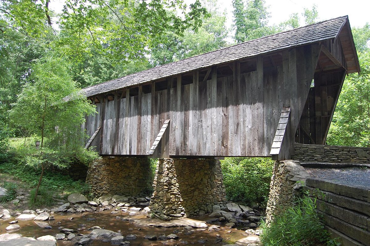
Pisgah Covered Bridge is a covered bridge in Randolph County, North Carolina, described in its record as bridge in North Carolina, U.S. North Carolina has 2 covered bridges on record at Wayfarrow.
It is about 54 feet long.
Status check, 2026-11: The original bridge, usually dated 1911, washed away in an August 2003 flood. It was rebuilt in 2004 on the same site using more than 90% of the recovered parts, and it stayed on the National Register. The year is null because you could count it as 1911 or 2004, and some sources date the original to 1910. Pisgah Covered Bridge is listed on the National Register of Historic Places. It stands at 35.5421° N, 79.8939° W.
Key facts
| Length | 54 ft |
|---|---|
| Heritage designation | National Register of Historic Places listed place |
| National Register | Listed |
| Coordinates | 35.54210, -79.89390 |
Nearby places
- Shilohghost town · Montgomery County · 10.6 mi
- Wind Hillghost town · Davidson County · 11.6 mi
- Stokes Ferryghost town · Davidson County · 16.4 mi
- Rocky Meadowghost town · Davidson County · 19.2 mi
- Millertonghost town · Rowan County · 19.8 mi
- Edenghost town · Davidson County · 22.6 mi
- Allinghost town · Rowan County · 24.2 mi
- Poolghost town · Rowan County · 24.9 mi
- Drys Millghost town · Cabarrus County · 25.2 mi
- Jimesghost town · Davidson County · 26.9 mi
- Garfieldghost town · Rowan County · 27.3 mi
- Brummelsghost town · Davidson County · 27.5 mi
- Wikidata — Wikidata item (CC0)
- National Register of Historic Places — National Register of Historic Places record (public-domain)
- Wikidata — Wikipedia article (linked as a source; text not used) (CC0)
- Wayfarrow status check (web sources) — Checked for current status (facts)
- Wayfarrow status check (web sources) — Checked for current status (facts)
- Wayfarrow status check (web sources) — Checked for current status (facts)
- Wayfarrow status check (web sources) — Checked for current status (facts)
Facts marked "approximately" carry an uncertain date in the source. Text on this page is generated from the sources above; no encyclopedia prose is copied. Last updated 2026-11-05.