 Wayfarrow
Belknap Bridge
Covered bridge · Lane County, Oregon
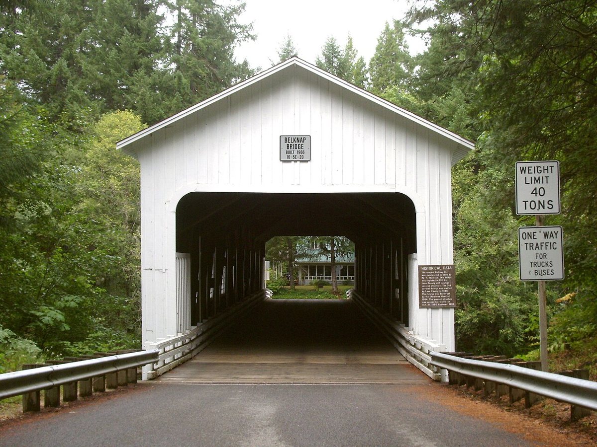
Belknap Bridge is a covered bridge in Lane County, Oregon, described in its record as bridge in United States of America. Oregon has 57 covered bridges on record at Wayfarrow, 20 of them in Lane County.
It was built in 1966, in the postwar decades, making it the 38th oldest of the 41 in Oregon with a recorded construction date; it crosses McKenzie River; it is about 120 feet long (5th longest of 35 measured in Oregon).
Status check, 2026-11: This is the fourth covered bridge on the site (after ones from 1890, 1911 and 1939) and replaced the bridge destroyed in the 1964 Christmas Flood. It is a covered Howe truss, listed on the NRHP in 1979. Belknap Bridge is listed on the National Register of Historic Places. It stands at 44.1680° N, 122.2280° W.
Key facts
| Current structure built | 1966 |
|---|---|
| Crosses | McKenzie River |
| Length | 120 ft |
| Heritage designation | National Register of Historic Places listed place |
| National Register | Listed |
| Coordinates | 44.16800, -122.22800 |
Nearby places
- Goodpasture Bridgecovered bridge · Lane County · 17.9 mi
- Short Bridgecovered bridge · Linn County · 20.8 mi
- Wendling Bridgecovered bridge · Lane County · 28.4 mi
- Weddle Bridgecovered bridge · Linn County · 29.2 mi
- Earnest Bridgecovered bridge · Lane County · 30.2 mi
- Armetghost town · Lane County · 30.3 mi
- Bryant Cityghost town · Linn County · 30.5 mi
- Unity Bridgecovered bridge · Lane County · 31.2 mi
- Office Bridgecovered bridge · Lane County · 31.3 mi
- Anidemghost town · Linn County · 31.3 mi
- Lowell Bridgecovered bridge · Lane County · 32.7 mi
- Bollyghost town · Lane County · 33 mi
Questions
Where is Belknap Bridge?
Belknap Bridge is in Lane County, Oregon, at 44.1680, -122.2280.
How many covered bridges are in Lane County?
Lane County, Oregon has 20 covered bridges on record at Wayfarrow.
- Wikidata — Wikidata item (CC0)
- National Register of Historic Places — National Register of Historic Places record (public-domain)
- Wikidata — Wikipedia article (linked as a source; text not used) (CC0)
- Wayfarrow status check (web sources) — Checked for current status (facts)
- Wayfarrow status check (web sources) — Checked for current status (facts)
- Wayfarrow status check (web sources) — Checked for current status (facts)
- Wayfarrow status check (web sources) — Checked for current status (facts)
Facts marked "approximately" carry an uncertain date in the source. Text on this page is generated from the sources above; no encyclopedia prose is copied. Last updated 2026-11-05.