 Wayfarrow
Bailey Covered Bridge
Covered bridge · Washington County, Pennsylvania
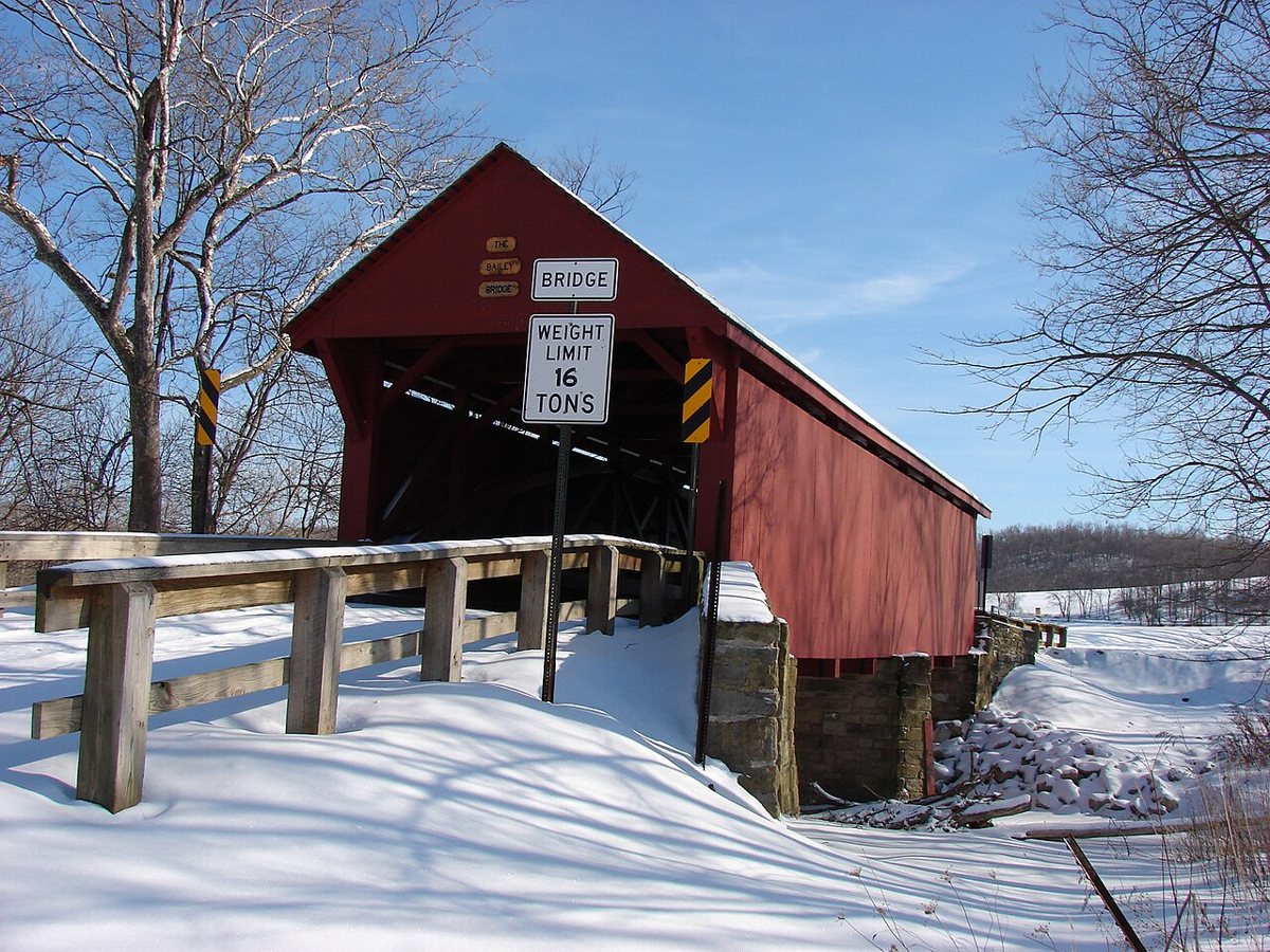
Bailey Covered Bridge is a covered bridge in Washington County, Pennsylvania. Pennsylvania has 231 covered bridges on record at Wayfarrow, 26 of them in Washington County.
It is about 71 feet long (52nd longest of 83 measured in Pennsylvania).
Status check, 2026-11: The original 1889 Burr arch bridge over Ten Mile Creek (Washington County) was burned by arson in July 1994 and rebuilt as a replica, reportedly reusing the original Burr arches. Sources disagree on whether the rebuild was 1998 or 1999. Bailey Covered Bridge is listed on the National Register of Historic Places. It stands at 40.0206° N, 80.1958° W.
Key facts
| Length | 71 ft |
|---|---|
| Heritage designation | National Register of Historic Places listed place |
| National Register | Listed |
| Coordinates | 40.02056, -80.19583 |
Nearby places
- Hughes Covered Bridgecovered bridge · Washington County · 2.1 mi
- Martin's Mill Covered Bridgecovered bridge · Washington County · 3.4 mi
- Grimes Covered Bridgecovered bridge · Greene County · 5 mi
- Day Covered Bridgecovered bridge · Washington County · 5.2 mi
- Cox Farm Covered Bridgecovered bridge · Greene County · 6.5 mi
- Lippincott Covered Bridgecovered bridge · Greene County · 6.5 mi
- Horn Davis Overholtzer Bridgecovered bridge · Washington County · 7.1 mi
- Scott Brownlee Covered Bridgecovered bridge · Washington County · 10.8 mi
- Nettie Woods Covered Bridgecovered bridge · Greene County · 11.1 mi
- Sprowl's Covered Bridgecovered bridge · Washington County · 11.2 mi
- Clokeyvilleghost town · Washington County · 11.5 mi
- Scott Covered Bridgecovered bridge · Greene County · 11.5 mi
Questions
Where is Bailey Covered Bridge?
Bailey Covered Bridge is in Washington County, Pennsylvania, at 40.0206, -80.1958.
How many covered bridges are in Washington County?
Washington County, Pennsylvania has 26 covered bridges on record at Wayfarrow.
- Wikidata — Wikidata item (CC0)
- National Register of Historic Places — National Register of Historic Places record (public-domain)
- Wikidata — Wikipedia article (linked as a source; text not used) (CC0)
- Wayfarrow status check (web sources) — Checked for current status (facts)
- Wayfarrow status check (web sources) — Checked for current status (facts)
- Wayfarrow status check (web sources) — Checked for current status (facts)
- Wayfarrow status check (web sources) — Checked for current status (facts)
Facts marked "approximately" carry an uncertain date in the source. Text on this page is generated from the sources above; no encyclopedia prose is copied. Last updated 2026-11-05.