 Wayfarrow
Bitzer's Mill Covered Bridge
Covered bridge · Lancaster County, Pennsylvania
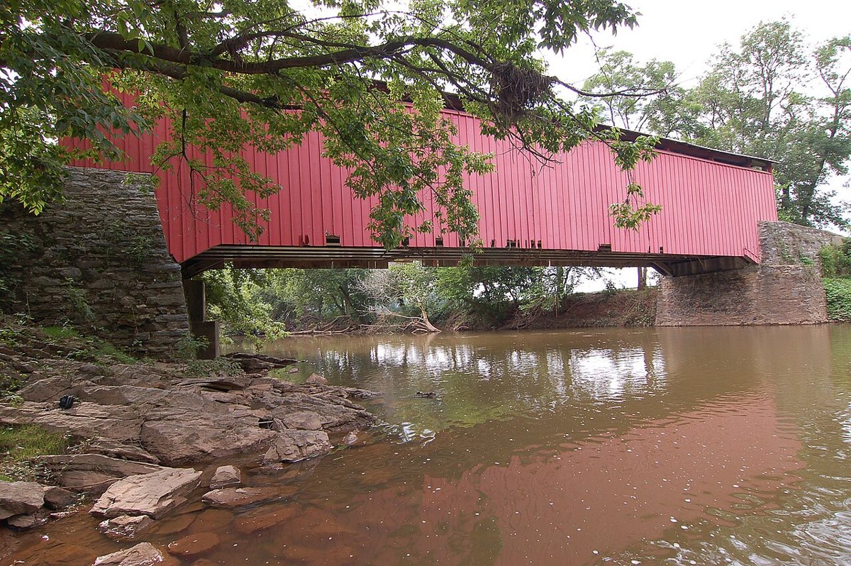
Bitzer's Mill Covered Bridge is a covered bridge in Lancaster County, Pennsylvania, described in its record as bridge in Pennsylvania, United States. Pennsylvania has 231 covered bridges on record at Wayfarrow, 32 of them in Lancaster County.
It crosses Conestoga River.
Status check, 2026-11: Usually dated 1846 and called Lancaster County's oldest covered bridge still in use, but lostbridges.org dates it c1870 (after an 1869 flood destroyed the bridge there), and it was reconstructed in 1997. Sources give its length as 90, 98 or 99 ft. Bitzer's Mill Covered Bridge is listed on the National Register of Historic Places. It stands at 40.1404° N, 76.1519° W.
Key facts
| Crosses | Conestoga River |
|---|---|
| Heritage designation | National Register of Historic Places listed place |
| National Register | Listed |
| Coordinates | 40.14040, -76.15190 |
Nearby places
- Zook's Mill Covered Bridgecovered bridge · Lancaster County · 4.3 mi
- Red Run Covered Bridgecovered bridge · Lancaster County · 4.4 mi
- Keller's Mill Covered Bridgecovered bridge · Lancaster County · 4.6 mi
- Bucher's Mill Covered Bridgecovered bridge · Lancaster County · 4.8 mi
- Erb's Covered Bridgecovered bridge · Lancaster County · 5.2 mi
- Pinetown Bushong's Mill Covered Bridgecovered bridge · Lancaster County · 5.6 mi
- Hunsecker's Mill Covered Bridgecovered bridge · Lancaster County · 6.3 mi
- Buck Hill Farm Covered Bridgecovered bridge · Lancaster County · 7.9 mi
- Weaver's Mill Covered Bridgecovered bridge · Lancaster County · 8.1 mi
- Willow Hill Covered Bridgecovered bridge · Lancaster County · 8.4 mi
- Daniel Good's Fording Covered Bridgecovered bridge · Lancaster County · 8.5 mi
- Herr's Mill Covered Bridgecovered bridge · Lancaster County · 9.1 mi
Questions
Where is Bitzer's Mill Covered Bridge?
Bitzer's Mill Covered Bridge is in Lancaster County, Pennsylvania, at 40.1404, -76.1519.
How many covered bridges are in Lancaster County?
Lancaster County, Pennsylvania has 32 covered bridges on record at Wayfarrow.
- Wikidata — Wikidata item (CC0)
- National Register of Historic Places — National Register of Historic Places record (public-domain)
- Wikidata — Wikipedia article (linked as a source; text not used) (CC0)
- Wayfarrow status check (web sources) — Checked for current status (facts)
- Wayfarrow status check (web sources) — Checked for current status (facts)
- Wayfarrow status check (web sources) — Checked for current status (facts)
- Wayfarrow status check (web sources) — Checked for current status (facts)
Facts marked "approximately" carry an uncertain date in the source. Text on this page is generated from the sources above; no encyclopedia prose is copied. Last updated 2026-11-05.