 Wayfarrow
Thomas Mill Covered Bridge
Covered bridge · Philadelphia County, Pennsylvania
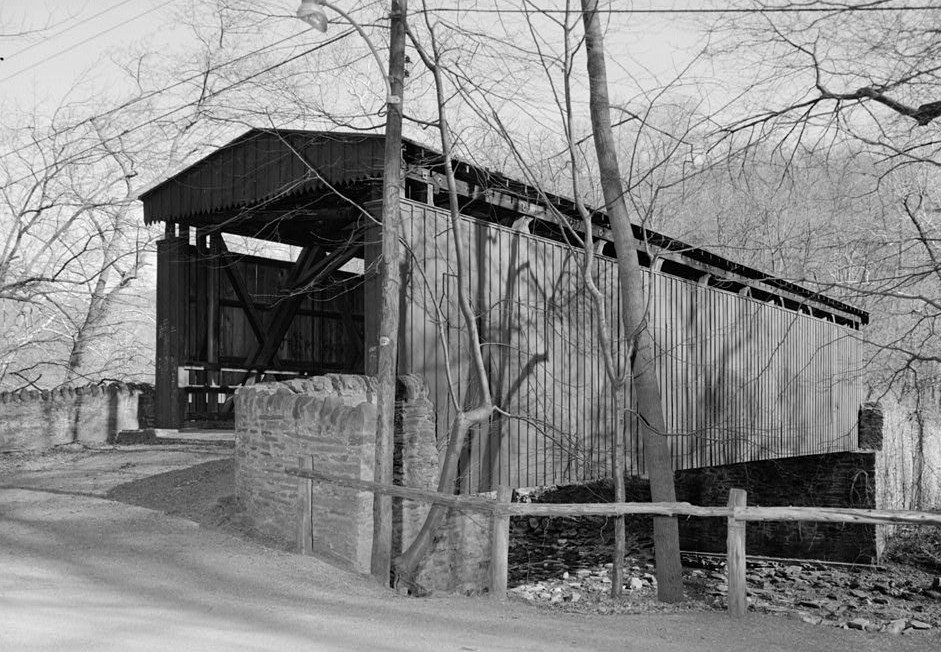
Thomas Mill Covered Bridge is a covered bridge in Philadelphia County, Pennsylvania. Pennsylvania has 231 covered bridges on record at Wayfarrow, 2 of them in Philadelphia County.
It was built in 1855, in the Civil War era, making it the 20th oldest of the 134 in Pennsylvania with a recorded construction date; it crosses Wissahickon Creek.
Status check, 2026-11: Howe truss restored by the WPA in the late 1930s and again around 1999; Friends of the Wissahickon gives 1737 as the original date, which likely means an earlier crossing, and length is given as 85 to 86.5 ft. Thomas Mill Covered Bridge is listed on the National Register of Historic Places. It stands at 40.0719° N, 75.2256° W.
Key facts
| Current structure built | 1855 |
|---|---|
| Crosses | Wissahickon Creek |
| Heritage designation | National Register of Historic Places listed place |
| National Register | Listed |
| Coordinates | 40.07187, -75.22559 |
Nearby places
- Hillsideghost town · Montgomery County · 6 mi
- Turtle Rock Lightlighthouse · Philadelphia County · 7.3 mi
- Coopertownghost town · Delaware County · 7.4 mi
- Corezeghost town · Delaware County · 7.4 mi
- Schuylkill Permanent Bridgecovered bridge · Philadelphia County · 8.5 mi
- Bell Roadghost town · Philadelphia County · 11.4 mi
- Bartram's Covered Bridgecovered bridge · Chester County · 12.6 mi
- Cabin Run Covered Bridgecovered bridge · Bucks County · 13.2 mi
- Tinicum Island Rear Range Lightlighthouse · Gloucester County · 15.5 mi
- Tinicum Island Range Front Lightlighthouse · Gloucester County · 15.6 mi
- Neshaminyghost town · Bucks County · 16.1 mi
- Pine Valley Covered Bridgecovered bridge · Bucks County · 16.3 mi
Questions
Where is Thomas Mill Covered Bridge?
Thomas Mill Covered Bridge is in Philadelphia County, Pennsylvania, at 40.0719, -75.2256.
How many covered bridges are in Philadelphia County?
Philadelphia County, Pennsylvania has 2 covered bridges on record at Wayfarrow.
- Wikidata — Wikidata item (CC0)
- National Register of Historic Places — National Register of Historic Places record (public-domain)
- Wikidata — Wikipedia article (linked as a source; text not used) (CC0)
- Wayfarrow status check (web sources) — Checked for current status (facts)
- Wayfarrow status check (web sources) — Checked for current status (facts)
- Wayfarrow status check (web sources) — Checked for current status (facts)
- Wayfarrow status check (web sources) — Checked for current status (facts)
Facts marked "approximately" carry an uncertain date in the source. Text on this page is generated from the sources above; no encyclopedia prose is copied. Last updated 2026-11-05.