 Wayfarrow
Swamp Meadow Bridge
Covered bridge · Providence County, Rhode Island
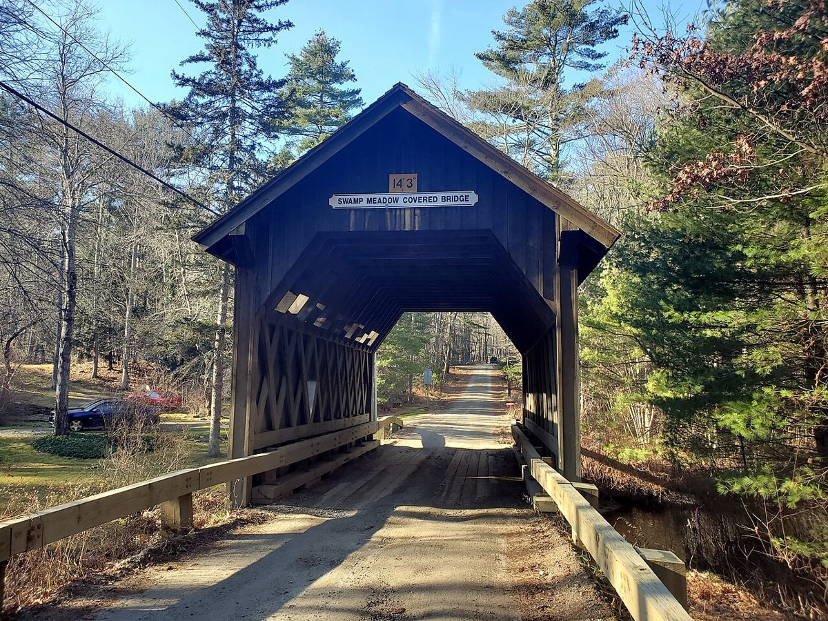
Swamp Meadow Bridge is a covered bridge in Providence County, Rhode Island. Rhode Island has 1 covered bridges on record at Wayfarrow.
It was built in 1994, in the postwar decades; it is about 36 feet long.
Status check, 2026-11: Built in 1994 to replace the first covered bridge on this site, which was dedicated in 1993 and burned by vandals about four months later. Most lists give 36 ft, but some sources say 40 ft. It stands at 41.7996° N, 71.7294° W.
Key facts
| Current structure built | 1994 |
|---|---|
| Length | 36 ft |
| Coordinates | 41.79957, -71.72943 |
Nearby places
- Ponagansetghost town · Providence County · 2.9 mi
- Rocklandghost town · Providence County · 3.3 mi
- Elliotvilleghost town · Northeastern Connecticut County · 5.9 mi
- Richmondghost town · Providence County · 5.9 mi
- South Scituateghost town · Providence County · 6.5 mi
- Ashlandghost town · Providence County · 6.7 mi
- Elmdaleghost town · Providence County · 6.8 mi
- Acquidaneckghost town · Northeastern Connecticut County · 7.2 mi
- Kentghost town · Providence County · 8.1 mi
- Birch Hillghost town · Kent County · 12.1 mi
- Blackwell Brook Covered Bridgecovered bridge · Northeastern Connecticut County · 13 mi
- Field Stationghost town · Providence County · 13.2 mi
Sources and licences
- Wikidata — Wikidata item (CC0)
- Wikidata — Wikipedia article (linked as a source; text not used) (CC0)
- Wayfarrow status check (web sources) — Checked for current status (facts)
- Wayfarrow status check (web sources) — Checked for current status (facts)
- Wayfarrow status check (web sources) — Checked for current status (facts)
- Wayfarrow status check (web sources) — Checked for current status (facts)
Facts marked "approximately" carry an uncertain date in the source. Text on this page is generated from the sources above; no encyclopedia prose is copied. Last updated 2026-11-05.