 Wayfarrow
Halpin Covered Bridge
Covered bridge · Addison County, Vermont
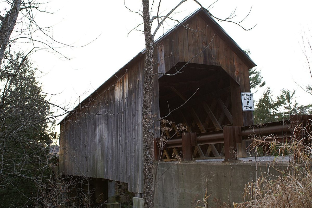
Halpin Covered Bridge is a covered bridge in Addison County, Vermont, described in its record as bridge in Middlebury, Vermont. Vermont has 91 covered bridges on record at Wayfarrow, 5 of them in Addison County.
It was built in 1824, in the first half of the 19th century, making it the oldest of the 57 in Vermont with a recorded construction date; it is about 66 feet long (32nd longest of 46 measured in Vermont).
Status check, 2026-11: Built about 1824 and also called the High Covered Bridge, it sits about 41 ft above the water, making it Vermont's highest covered bridge. In 1994 it was taken off its old marble abutments and set on new concrete ones. Halpin Covered Bridge is listed on the National Register of Historic Places. It stands at 44.0500° N, 73.1411° W.
Key facts
| Current structure built | 1824 |
|---|---|
| Length | 66 ft |
| Heritage designation | National Register of Historic Places listed place |
| National Register | Listed |
| Coordinates | 44.05000, -73.14111 |
Nearby places
- Pulp Mill Covered Bridgecovered bridge · Addison County · 2.5 mi
- Cedar Swamp Covered Bridgecovered bridge · Addison County · 9.3 mi
- Towtaidghost town · Addison County · 12.8 mi
- Spade Farm Covered Bridgecovered bridge · Addison County · 14 mi
- Crown Point Lightlighthouse · Essex County · 14 mi
- East Shoreham Covered Railroad Bridgecovered bridge · Addison County · 14.4 mi
- Warren Covered Bridgecovered bridge · Washington County · 14.7 mi
- Barber's Point Lightlighthouse · Essex County · 14.9 mi
- Branch Schoolghost town · Addison County · 15.3 mi
- Quinlan's Covered Bridgecovered bridge · Chittenden County · 15.8 mi
- Sequin Covered Bridgecovered bridge · Chittenden County · 16.5 mi
- Split Rock Point Lightlighthouse · Essex County · 17.6 mi
Questions
Where is Halpin Covered Bridge?
Halpin Covered Bridge is in Addison County, Vermont, at 44.0500, -73.1411.
How many covered bridges are in Addison County?
Addison County, Vermont has 5 covered bridges on record at Wayfarrow.
- Wikidata — Wikidata item (CC0)
- National Register of Historic Places — National Register of Historic Places record (public-domain)
- Wikidata — Wikipedia article (linked as a source; text not used) (CC0)
- Wayfarrow status check (web sources) — Checked for current status (facts)
- Wayfarrow status check (web sources) — Checked for current status (facts)
- Wayfarrow status check (web sources) — Checked for current status (facts)
- Wayfarrow status check (web sources) — Checked for current status (facts)
Facts marked "approximately" carry an uncertain date in the source. Text on this page is generated from the sources above; no encyclopedia prose is copied. Last updated 2026-11-05.