 Wayfarrow
Naguchee
Ghost town · White County, Georgia
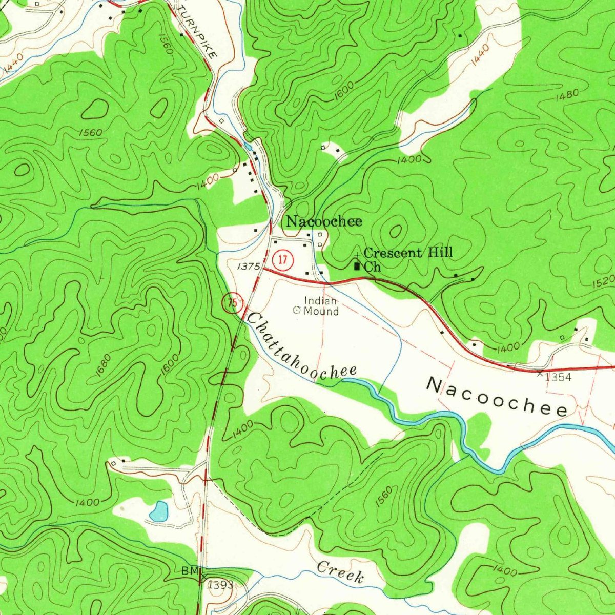
Naguchee is a ghost town in White County, Georgia. It is one of 5 former communities in White County on the federal names register. That ranks the county 48th among the 125 Georgia counties with a vanished settlement on record.
The U.S. Geological Survey lists Naguchee as a historical populated place on the Helen topographic quadrangle: the name is no longer in official use for a community, whether the settlement was abandoned, absorbed into a neighbouring town or renamed. The recorded location is 34.6834° N, 83.7082° W.
Key facts
| USGS quadrangle | Helen |
|---|---|
| Elevation | 1,355 ft |
| Nearest living town | Sautee-Nacoochee, GA |
| Distance to it | 1.5 miles |
| GNIS feature ID | 351267 |
| Coordinates | 34.68343, -83.70823 |
What's there now
Naguchee is no longer a community in its own right. The nearest living town is Sautee-Nacoochee, GA (population 507), about 1.5 miles away in a straight line, and the site sits at roughly 1,355 feet above sea level. Much of the land around former townsites is private; check access before you visit.
Nearby places
- Lynchghost town · White County · 2.7 mi
- Stovall Mill Covered Bridgecovered bridge · White County · 3.5 mi
- Mauldinsghost town · Habersham County · 3.6 mi
- Eastburnghost town · White County · 5.6 mi
- Pleasant Retreatghost town · White County · 10.4 mi
- Bertghost town · Habersham County · 10.7 mi
- Gatesghost town · Lumpkin County · 10.8 mi
- Oculusghost town · White County · 11 mi
- Soqueeghost town · Habersham County · 11.1 mi
- Willowghost town · Lumpkin County · 11.8 mi
- Habersham Stationghost town · Habersham County · 11.9 mi
- Walnutghost town · Lumpkin County · 12.2 mi
Questions
Where is Naguchee?
Naguchee is in White County, Georgia, at 34.6834, -83.7082.
How many ghost towns are in White County?
White County, Georgia has 5 ghost towns on record at Wayfarrow.
- USGS Geographic Names Information System (Domestic Names) — GNIS Domestic Names, feature record (public-domain)
- U.S. Census Bureau TIGER/Line and ACS — Census Gazetteer + ACS 5-year population (public-domain)
Facts marked "approximately" carry an uncertain date in the source. Text on this page is generated from the sources above; no encyclopedia prose is copied. Last updated 2026-11-05.