 Wayfarrow
Baker Island Light
Lighthouse · Hancock County, Maine
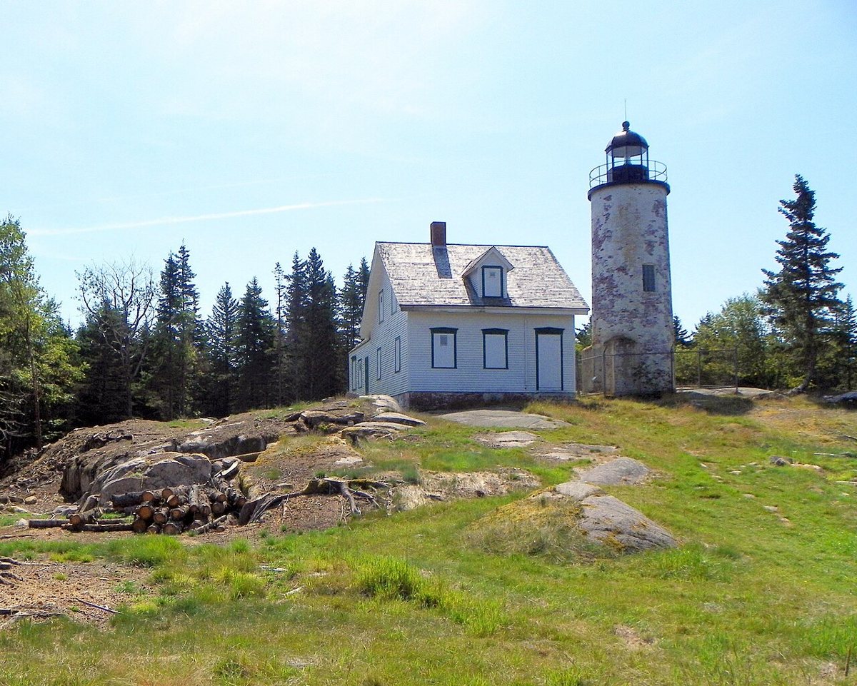
Baker Island Light is a lighthouse in Hancock County, Maine. Maine has 70 lighthouses on record at Wayfarrow, 14 of them in Hancock County.
It was built in 1855, in the Civil War era, making it the 14th oldest of the 61 in Maine with a recorded construction date; the tower stands about 43 feet tall (18th tallest of 53 measured in Maine); its light sits 105 feet above the water; the light characteristic is recorded as Fl W 10s (a white flash every 10 seconds), with a range of about 10 nautical miles; the structure is built of brick.
Status check, 2026-11: The station dates to 1828, but the current brick tower replaced the original in 1855; it is now in Acadia National Park and was put on Lighthouse Digest's Doomsday List in 2022. Baker Island Light is listed on the National Register of Historic Places. It is not reachable by road: the nearest road is about 4 miles away, so it is seen from shore or reached by water. It stands at 44.2412° N, 68.1990° W.
Key facts
| Current structure built | 1855 |
|---|---|
| Tower height | 43 ft |
| Focal height | 105 ft |
| Light characteristic | Fl W 10s |
| Range | 10 nautical miles |
| Material | brick |
| Heritage designation | National Register of Historic Places listed place |
| National Register | Listed |
| Coordinates | 44.24121, -68.19901 |
Nearby places
- Bear Island Lightlighthouse · Hancock County · 4.6 mi
- Bass Harbor Head Lightlighthouse · Hancock County · 7 mi
- Great Duck Island Lightlighthouse · Hancock County · 7.2 mi
- Egg Rock Lightlighthouse · Hancock County · 8.4 mi
- Burnt Coat Harbor Lightlighthouse · Hancock County · 14.4 mi
- Prospect Harbor Point Lightlighthouse · Hancock County · 14.5 mi
- Blue Hill Bay Lightlighthouse · Hancock County · 14.9 mi
- Crabtree Ledge Lightlighthouse · Hancock County · 16 mi
- Petit Manan Lightlighthouse · Washington County · 18.7 mi
- Mount Desert Lightlighthouse · Maine · 19.2 mi
- Narraguagus Lightlighthouse · Washington County · 23.5 mi
- Isle Au Haut Lightlighthouse · Knox County · 25.6 mi
Questions
Where is Baker Island Light?
Baker Island Light is in Hancock County, Maine, at 44.2412, -68.1990.
How many lighthouses are in Hancock County?
Hancock County, Maine has 14 lighthouses on record at Wayfarrow.
- Wayfarrow status check (web sources) — Checked for current status (facts)
- Wayfarrow status check (web sources) — Checked for current status (facts)
- Wayfarrow status check (web sources) — Checked for current status (facts)
- Wayfarrow status check (web sources) — Checked for current status (facts)
- Wikidata — Wikidata item (CC0)
- National Register of Historic Places — National Register of Historic Places record (public-domain)
- Wikidata — Wikipedia article (linked as a source; text not used) (CC0)
Facts marked "approximately" carry an uncertain date in the source. Text on this page is generated from the sources above; no encyclopedia prose is copied. Last updated 2026-11-05.