 Wayfarrow
Frying Pan Shoals Light
Lighthouse · North Carolina
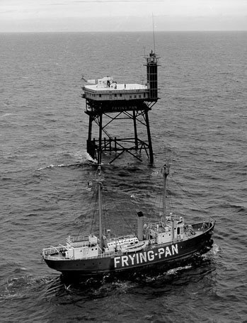
Frying Pan Shoals Light is a lighthouse in North Carolina. North Carolina has 18 lighthouses on record at Wayfarrow.
It guards North Atlantic Ocean; it was deactivated in 2003.
It stands at 33.4833° N, 77.5833° W.
Key facts
| Deactivated | 2003 |
|---|---|
| Body of water | North Atlantic Ocean |
| Coordinates | 33.48333, -77.58333 |
Nearby places
- Bald Head Lighthouselighthouse · Brunswick County · 36.1 mi
- Oak Island Lightlighthouse · Brunswick County · 38.4 mi
- Cape Fear Lightlighthouse · Brunswick County · 38.4 mi
- Price Creek Lightlighthouse · Brunswick County · 39.1 mi
Sources and licences
- Wikidata — Wikidata item (CC0)
- Wikidata — Wikipedia article (linked as a source; text not used) (CC0)
Facts marked "approximately" carry an uncertain date in the source. Text on this page is generated from the sources above; no encyclopedia prose is copied. Last updated 2026-11-05.