 Wayfarrow
Sabin Point Light
Lighthouse · Providence County, Rhode Island
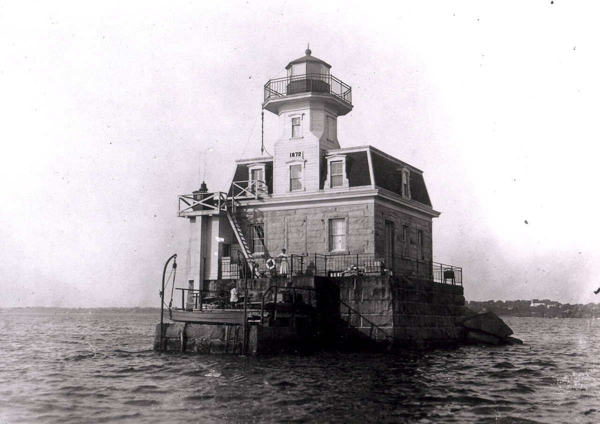
Sabin Point Light is a lighthouse in Providence County, Rhode Island. Rhode Island has 31 lighthouses on record at Wayfarrow, 5 of them in Providence County.
It was built in 1872, in the late 19th century, making it the 13th oldest of the 22 in Rhode Island with a recorded construction date; its light sits 36 feet above the water; the light characteristic is recorded as F R (a steady light), with a range of about 6.5 nautical miles; it guards Providence River; it was deactivated in 1968.
Its record gives 1968 as the year this lighthouse was demolished, destroyed or taken out of existence, so it may no longer stand; check its status before you travel. It stands at 41.7619° N, 71.3742° W.
Key facts
| Year built | 1872 |
|---|---|
| Focal height | 36 ft |
| Light characteristic | F R |
| Range | 6.5 nautical miles |
| Deactivated | 1968 |
| Body of water | Providence River |
| Record end date (demolished or lost) | 1968 |
| Coordinates | 41.76194, -71.37417 |
Nearby places
- Pomham Rocks Lightlighthouse · Providence County · 1.1 mi
- Bullock's Point Lightlighthouse · Providence County · 1.8 mi
- Bellefonteghost town · Providence County · 1.9 mi
- Fuller Rock Lightlighthouse · Providence County · 2.2 mi
- Sassafras Point Lightlighthouse · Providence County · 2.8 mi
- Nayatt Point Lightlighthouse · Bristol County · 3.1 mi
- Conimicut Lightlighthouse · Kent County · 3.4 mi
- Fort Hillghost town · Providence County · 3.6 mi
- Cork Hillghost town · Providence County · 4.2 mi
- Sowamsghost town · Bristol County · 5 mi
- Waylandghost town · Providence County · 5 mi
- Omegaghost town · Providence County · 5.1 mi
Questions
Where is Sabin Point Light?
Sabin Point Light is in Providence County, Rhode Island, at 41.7619, -71.3742.
How many lighthouses are in Providence County?
Providence County, Rhode Island has 5 lighthouses on record at Wayfarrow.
- Wikidata — Wikidata item (CC0)
- Wikidata — Wikipedia article (linked as a source; text not used) (CC0)
Facts marked "approximately" carry an uncertain date in the source. Text on this page is generated from the sources above; no encyclopedia prose is copied. Last updated 2026-11-05.