 Wayfarrow
7 Ghost Towns You Can Still Drive To in Texas: A Road Trip
7 stops253 milesabout 5 hr 45 min of drivingTexas
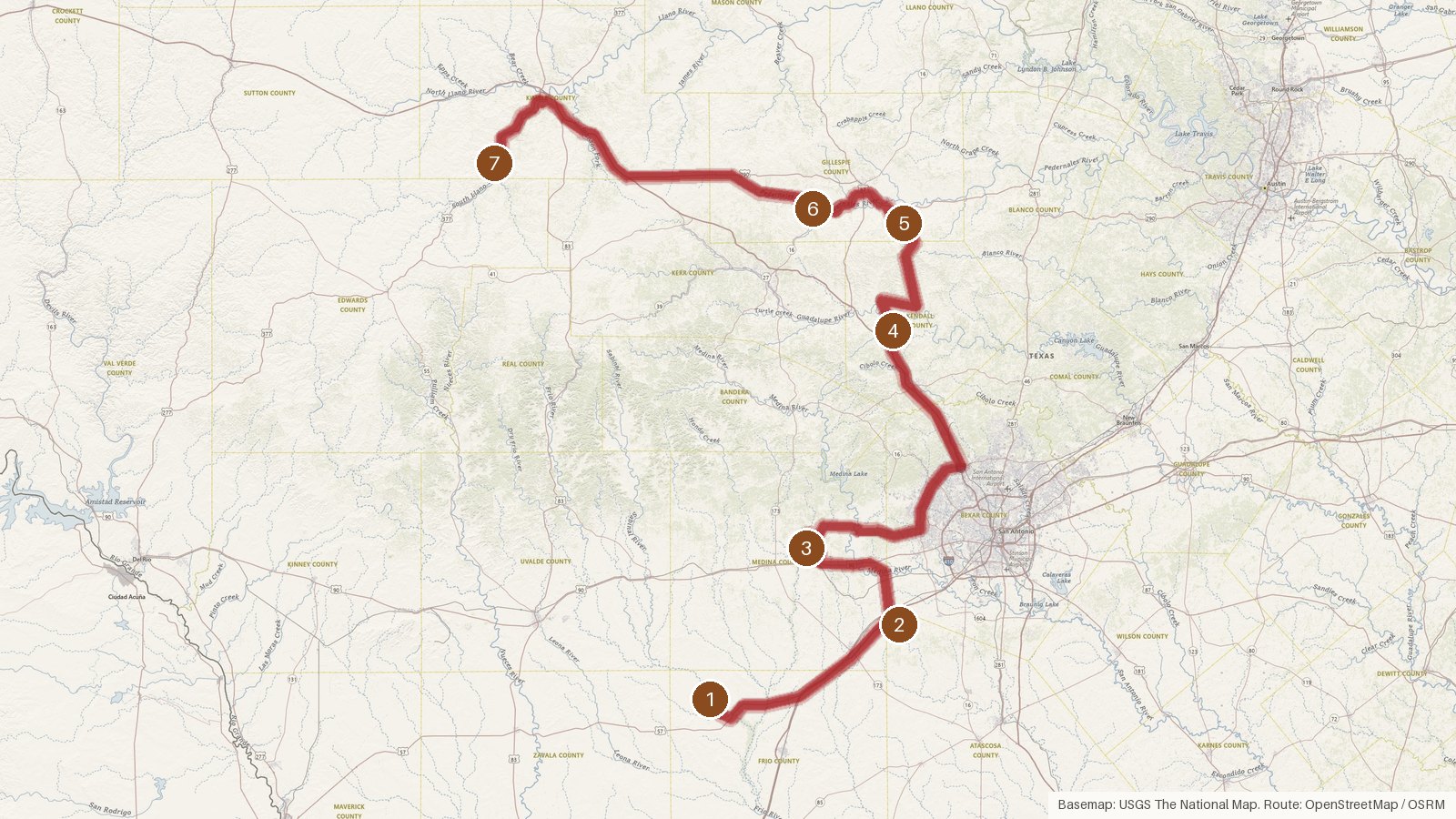
This route links seven places in Texas listed as ghost towns, starting at Frio Town in Frio County and finishing at Telegraph in Kimble County. Along the way it passes through Atascosa, Medina, Kendall and Gillespie counties, with two stops in Gillespie alone. The full run is 253 miles, and the driving adds up to roughly five and three-quarter hours, so call it about six hours behind the wheel. Of the six stops with an elevation on record, each sits higher than the last, from 624 feet at Frio Town to 1,848 feet at Telegraph. Frio Town is the only stop with a founding year in the data, 1871. These are places on the public record rather than living settlements, so check access locally before you set out. Start early, carry what you need, and don't count on cell coverage between towns, since it can be patchy in rural areas.
Route and drive times from OpenStreetMap routing (OSRM). Times are estimates without stops; roads to remote sites can be unpaved or seasonal.
-
1. Frio Town
Frio County, Texas
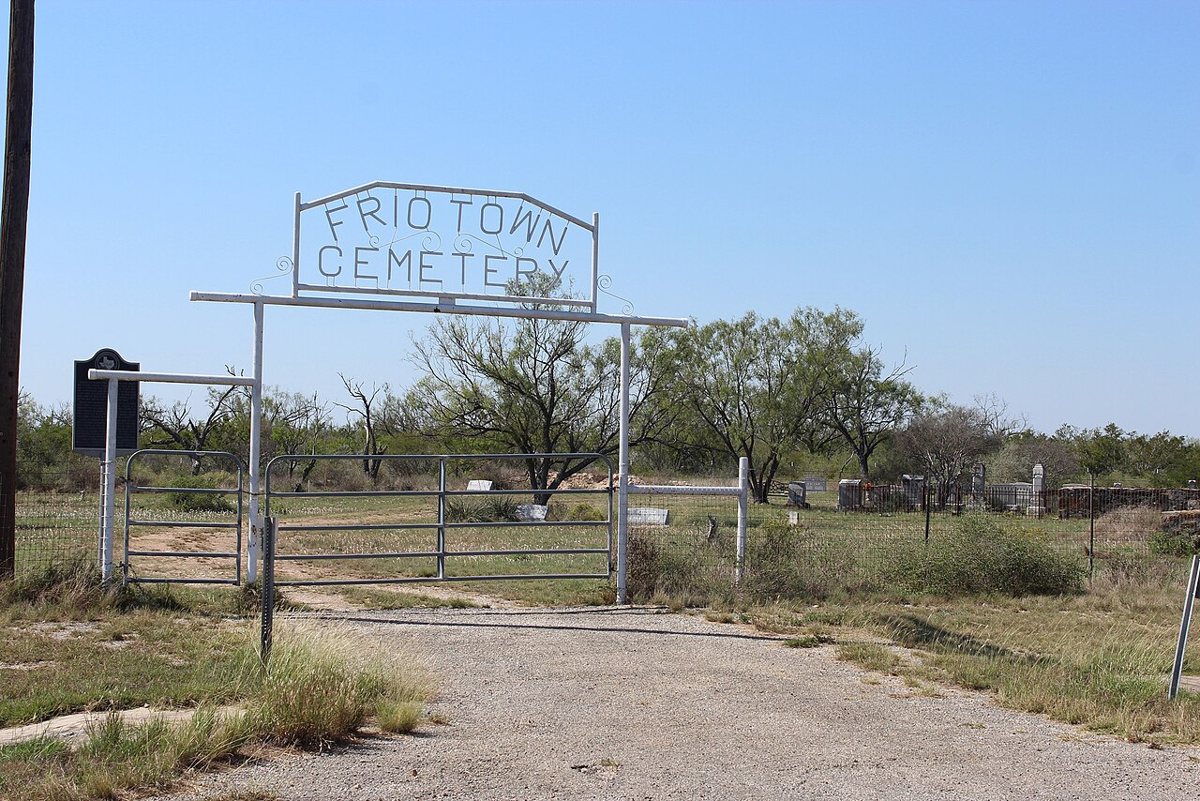
Darrylpearson / Wikimedia Commons · CC BY-SA 4.0 Frio Town is where the route begins, in Frio County. The record gives it a founding year of 1871 and an elevation of 624 feet. The nearest town is Yancey, TX, about 13.1 miles away, with a population of 221. It's listed as a ghost town, so think of it as a place on the map rather than a working community, and check access locally.
-
↓ 41.4 miles, about 52 min
2. Benton City
Atascosa County, Texas
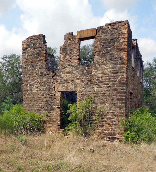
Siricruz / Wikimedia Commons · CC BY-SA 3.0 Allow about 52 minutes for the 41.4 miles from Frio Town. Benton City is recorded as a ghost town in Atascosa County, at an elevation of 644 feet, only 20 feet above where you started. Lytle, TX, population 2,484, is the nearest town and just 2.6 miles off, so a living community is close by on this stop.
-
↓ 26.7 miles, about 47 min
3. Quihi
Medina County, Texas
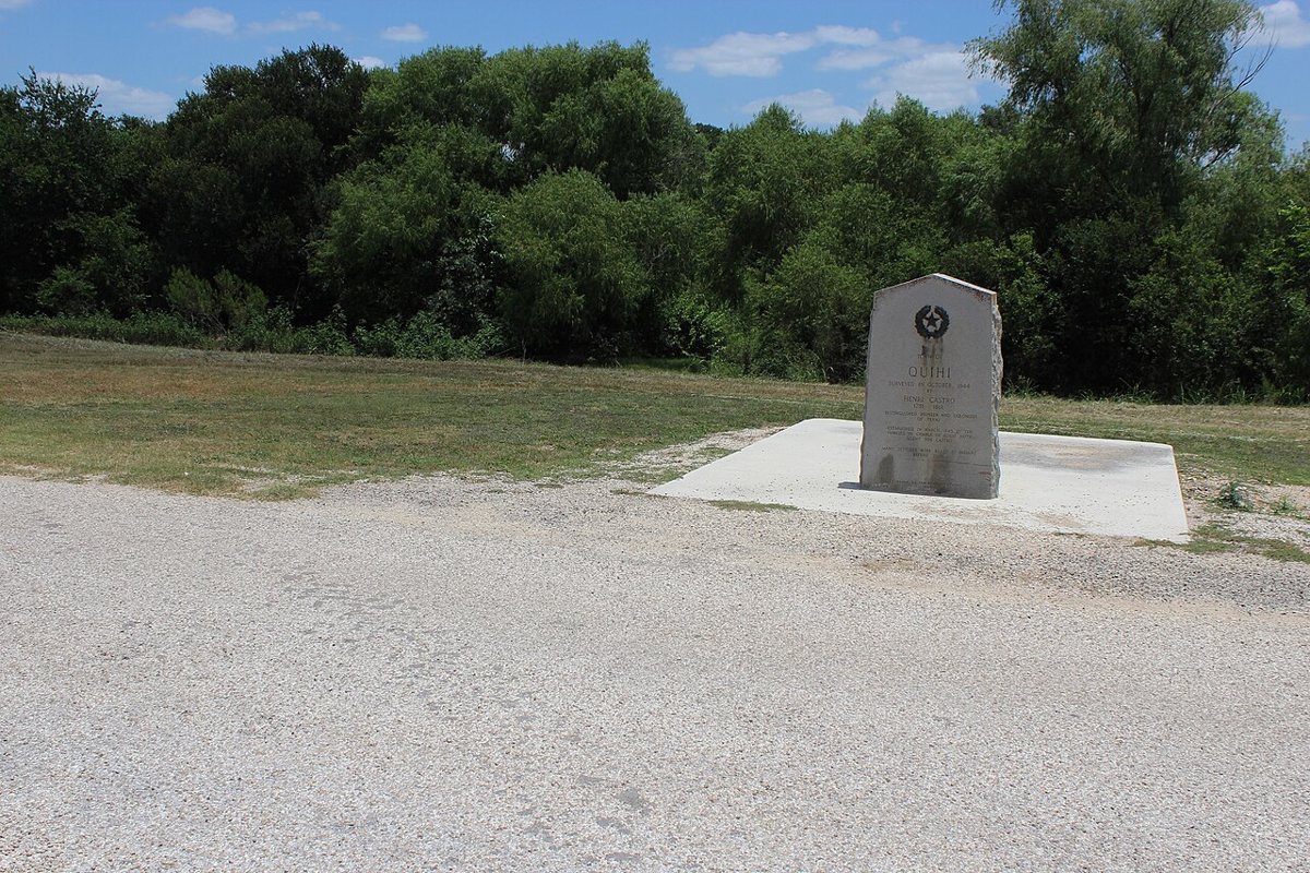
Darrylpearson / Wikimedia Commons · CC BY-SA 4.0 Quihi, in Medina County, comes next, 26.7 miles and about 47 minutes from Benton City. The record is brief here: it's listed as a ghost town, with no elevation given. Hondo, TX is the nearest town, 8.3 miles away, and with a population of 8,508 it's a good deal bigger than most of the nearest towns on this route.
-
↓ 65.4 miles, about 1 hr 22 min
4. Welfare
Kendall County, Texas
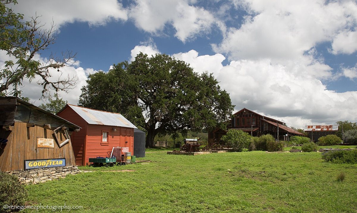
Renelibrary / Wikimedia Commons · CC BY-SA 4.0 Plan on about 82 minutes for this one, a 65.4-mile run up into Kendall County. Welfare is listed as a ghost town at 1,352 feet, a big step up from the stops before it. Comfort, TX is the nearest town, 7.9 miles away, with a population of 1,917. Worth checking access locally before you go.
-
↓ 27.8 miles, about 41 min
5. Luckenbach
Gillespie County, Texas
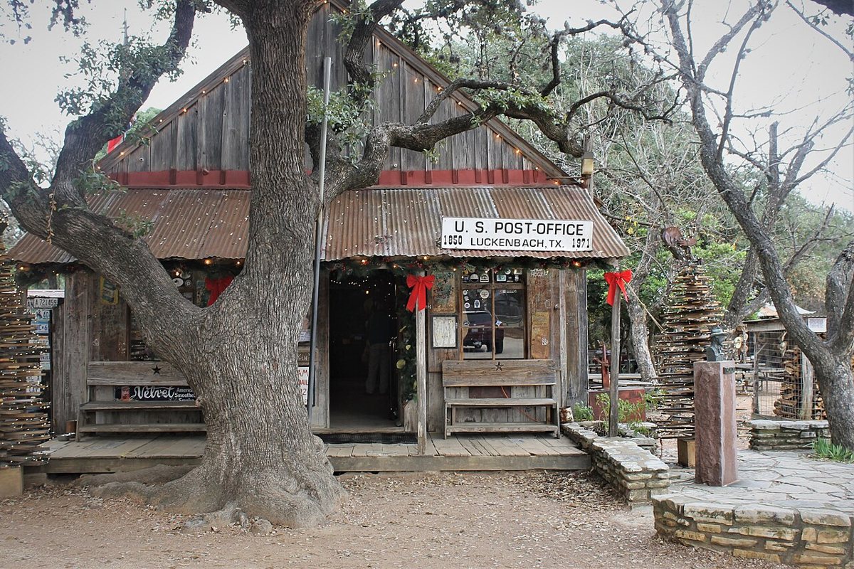
Hot Furnace / Wikimedia Commons · CC BY-SA 4.0 Luckenbach is the one stop on this route with a population on record, and it's tiny: 3 people, which is also the recorded peak. It sits in Gillespie County at 1,580 feet, 27.8 miles and around 41 minutes on from Welfare. Stonewall, TX, with 347 residents, is the nearest town at 7.6 miles.
-
↓ 20 miles, about 32 min
6. Morris Ranch
Gillespie County, Texas
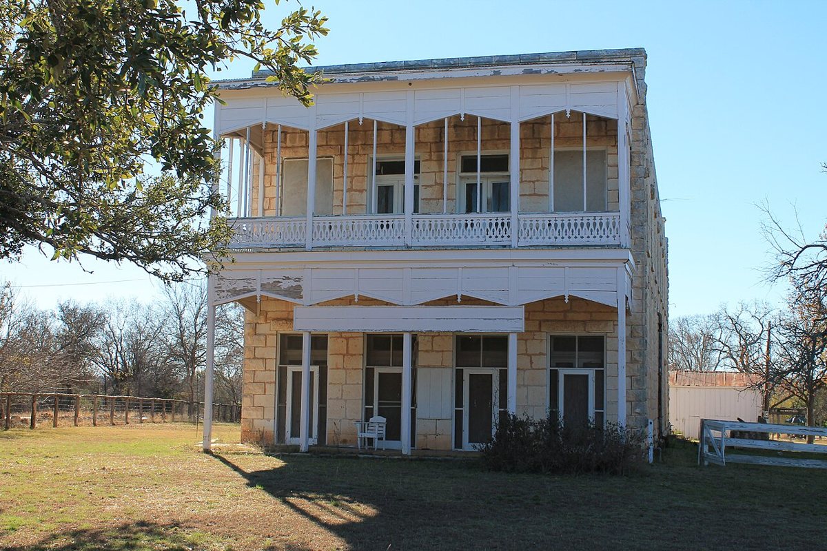
Renelibrary / Wikimedia Commons · CC BY-SA 3.0 A 20-mile hop of about 32 minutes brings you to Morris Ranch, the second Gillespie County stop on the route. It's listed as a ghost town at an elevation of 1,737 feet. Fredericksburg, TX is the nearest town, 8.8 miles away, and with 11,254 people it's a much bigger place than Stonewall, near the previous stop.
-
↓ 71.6 miles, about 1 hr 31 min
7. Telegraph
Kimble County, Texas
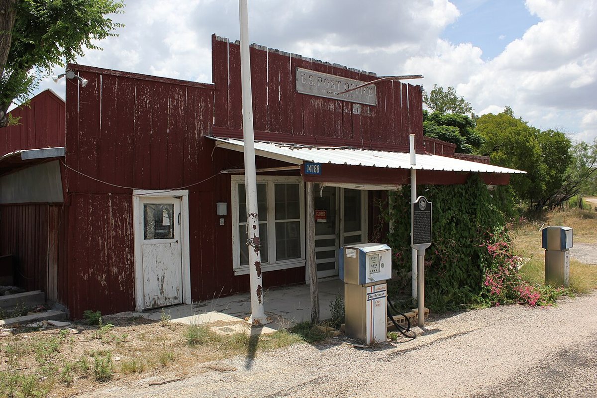
Nicolas Henderson from Coppell, Texas / Wikimedia Commons · CC BY 2.0 Save some energy for the end: the final leg to Telegraph runs 71.6 miles and takes about 91 minutes. Telegraph is recorded as a ghost town in Kimble County at 1,848 feet, more than 1,200 feet above Frio Town. Junction, TX, population 2,439, is the nearest town, 13.8 miles away, so check access locally before heading out.
Every stop on this route links to its own page with coordinates, sourced facts and image licences. The text above was written from those records and checked against them before publishing. More ghost towns: all ghost towns in Texas.