 Wayfarrow
Baltimore and St. Mary's Counties, Maryland Lighthouse Road Trip: 10 Lights, About 7 Hours of Driving
10 stops252 milesabout 7 hr 14 min of drivingBaltimore and St. Mary's Counties, Maryland
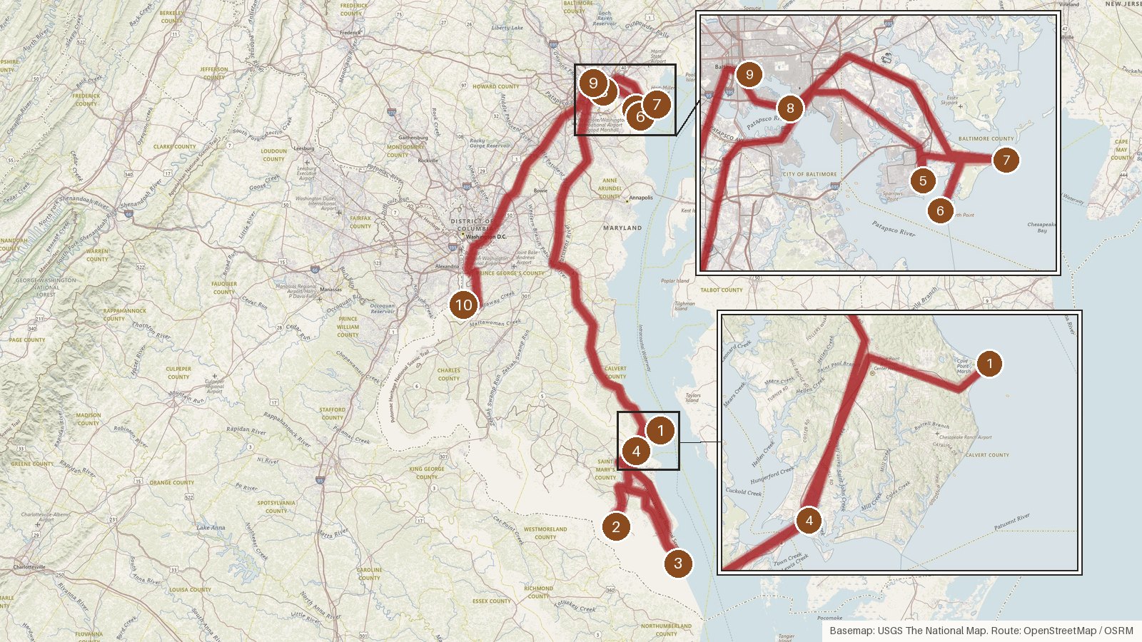
This route links ten lighthouses across four Maryland counties: Calvert, St. Mary's, Baltimore and Prince George's. It runs about 252 miles, with a little over 7 hours of driving in total. The lights sit on the Chesapeake Bay and the Potomac River, and most were built within a span of about sixty years, from John Donahoo's 1828 brick tower at Cove Point to the Craighill Channel range lights first lit in 1886. Several went dark in the twentieth century. Lazaretto Point's tower came down in 1926, Drum Point was decommissioned in 1962, Piney Point in 1964 and Seven Foot Knoll in 1987. The longest leg, about two hours ten minutes, takes you from Drum Point's museum home in Solomons up to Baltimore County. Start early, and check access locally before you set out. These sites are on public record, but arrangements can change.
Route and drive times from OpenStreetMap routing (OSRM). Times are estimates without stops; roads to remote sites can be unpaved or seasonal.
-
1. Cove Point Light
Calvert County, Maryland · built 1828
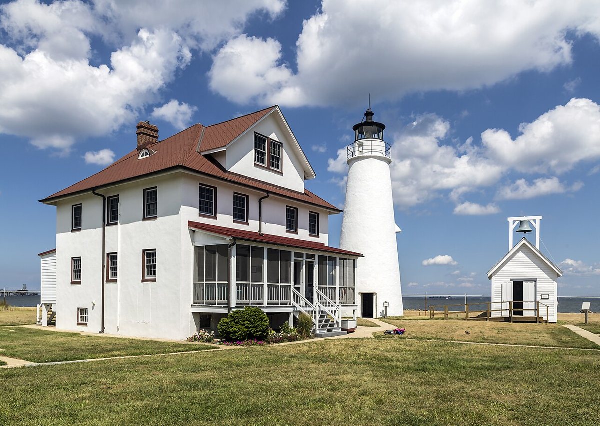
Acroterion / Wikimedia Commons · CC BY-SA 4.0 Start with the oldest continuously operating light on the Chesapeake Bay. John Donahoo built this brick tower in 1828, and it's listed on the National Register of Historic Places. Its height is a muddle: originally 38 ft, reportedly raised to 51 ft around 1912, with the USCG still saying 38 and Wikipedia 52. The focal height is 46 ft, and it flashes white every 10 seconds with a 12 nautical mile range.
-
↓ 27.5 miles, about 50 min
2. Piney Point Light
St. Mary's County, Maryland · built 1836
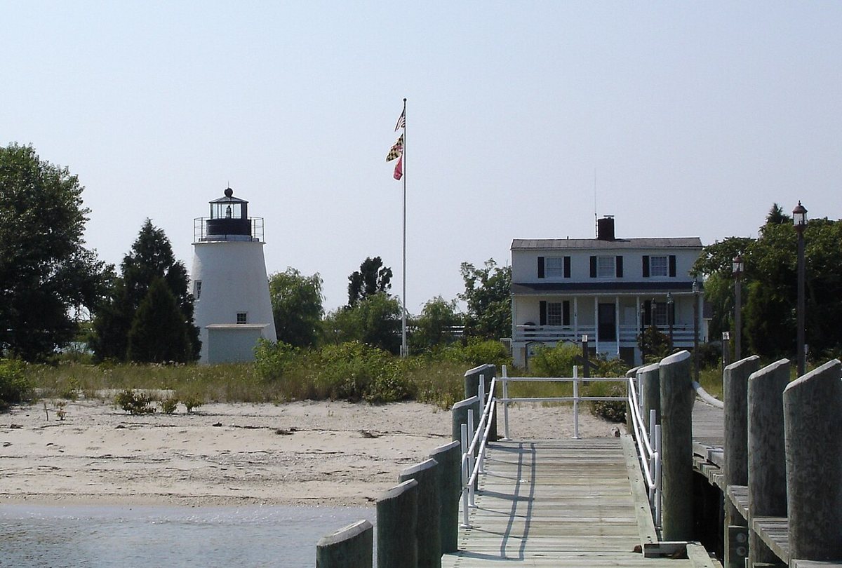
Aaron Linville / Wikimedia Commons · CC BY-SA 4.0 About 50 minutes and 27.5 miles on, Piney Point Light is the oldest lighthouse on the Potomac. It dates from 1836 and was decommissioned in 1964, and the record notes it's now a county museum. Sources can't agree on its height, putting it at 30, 34 or 35 ft. It's listed on the National Register of Historic Places.
-
↓ 29.3 miles, about 53 min
3. Point Lookout Light
St. Mary's County, Maryland · built 1830
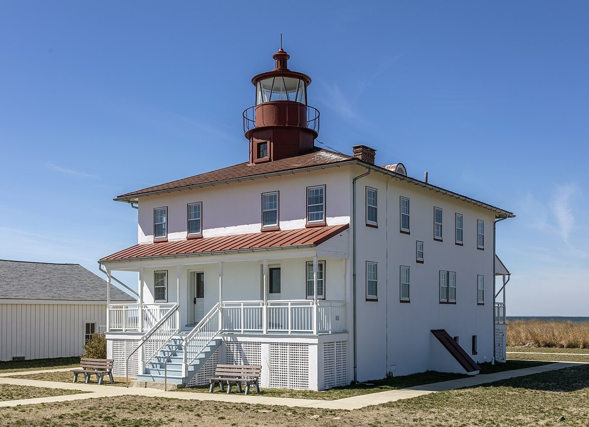
Acroterion / Wikimedia Commons · CC BY-SA 4.0 Built in 1830, Point Lookout began as a combined dwelling and lantern on the Potomac, about 53 minutes from Piney Point. It was raised to two stories in 1883 and enlarged into a duplex in 1927. Records give both 1965 and 1966 for when it went dark. The focal height is listed as 39 ft. A 41 ft figure is its height above water, and the U.S. Lighthouse Society gives 30 ft from base to lantern.
-
↓ 27.6 miles, about 49 min
4. Drum Point Light
Calvert County, Maryland · built 1883
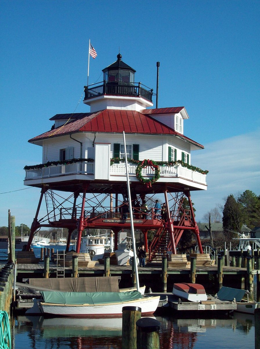
Pubdog (talk) / Wikimedia Commons · Public domain Heading to the Chesapeake side, about 49 minutes away, Drum Point Light is an 1883 screwpile cottage standing 46 ft. It was decommissioned in 1962 and moved in 1975 to the Calvert Marine Museum in Solomons, where the record lists it as an exhibit. Note that its coordinates point to the museum, not the original Drum Point site. It's on the National Register.
-
↓ 86 miles, about 2 hr 10 min
5. Craighill Channel Upper Range Rear Light
Baltimore County, Maryland · built 1886
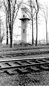
Unknown authorUnknown author / Wikimedia Commons · Public domain The longest leg, 86 miles and about 2 hours 10 minutes, brings you to Baltimore County. This Cut-off Channel rear range light, an iron skeleton frame around a wooden stair tower, was first lit January 15, 1886. Height figures vary: 64 ft above water, 70 ft for the tower, or about 90 ft per Wikidata. The focal height is listed at 74 ft. It's on the National Register.
Facts, map and sources for Craighill Channel Upper Range Rear Light →
-
↓ 5.6 miles, about 17 min
6. Craighill Channel Upper Range Front Light
Baltimore County, Maryland · built 1886
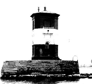
US Coast Guard / Wikimedia Commons · Public domain Only 17 minutes away stands the front light of the same Craighill Channel Upper Range, a 25 ft octagonal brick tower first lit in January 1886. It was built on the 1822 stone pier of the old North Point Range rear light. Wikipedia's 15 ft figure is the light's height above water, not the tower's. Its characteristic is listed as F R, originally white, and it's on the National Register.
Facts, map and sources for Craighill Channel Upper Range Front Light →
-
↓ 4.3 miles, about 12 min
7. Craighill Channel Lower Range Rear Light
Baltimore County, Maryland
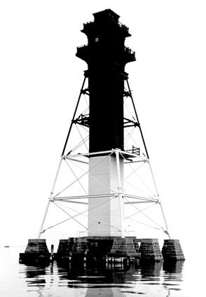
Wikimedia Commons · Public domain Twelve minutes and 4.3 miles on is the tallest lighthouse in Maryland, a 105 ft iron exoskeleton range tower with a 105 ft focal height and a 16 nautical mile range. Its date is tangled: a temporary light was shown on the unfinished structure in 1873, the tower was finished in 1875, and USLHS gives 1886. It's listed on the National Register of Historic Places.
Facts, map and sources for Craighill Channel Lower Range Rear Light →
-
↓ 13.4 miles, about 25 min
8. Lazaretto Point Light
Baltimore County, Maryland · built 1985
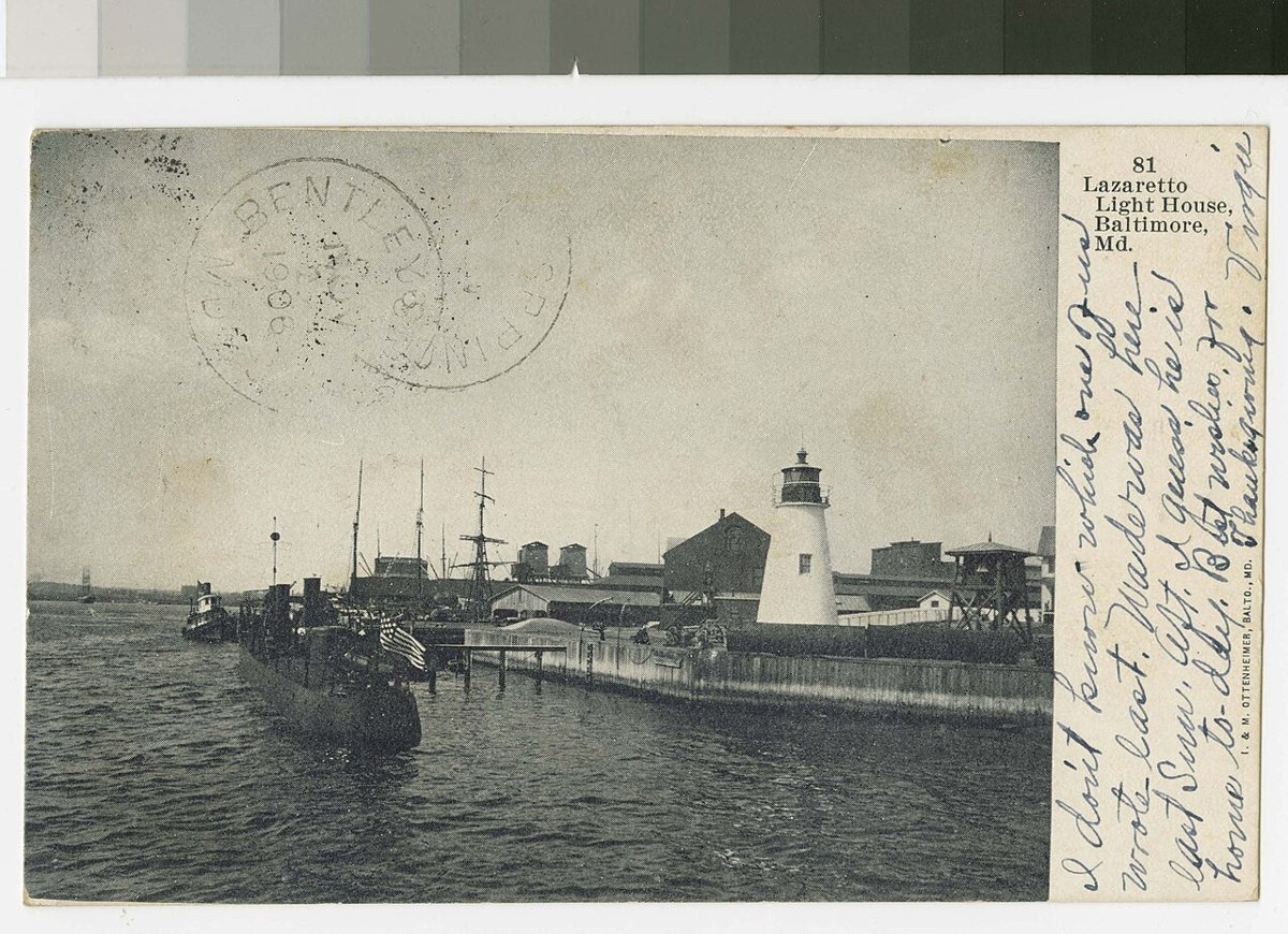
National Trust Library Historic Postcard Collection, Special Collections, University of Maryland Libraries. / Wikimedia Commons · Public domain What stands at Lazaretto Point is a 1985 memorial replica, built by Rukert Terminals from the original plans. The 1831 brick tower it recalls was torn down in 1926. The replica is 31 ft tall, isn't an active light and is classed as a monument. Allow about 25 minutes for the 13.4 miles from the last Craighill stop.
-
↓ 4.3 miles, about 11 min
9. Seven Foot Knoll Light
Baltimore County, Maryland · built 1855
A short 11 minutes away, at Pier 5 in Baltimore's Inner Harbor, is Seven Foot Knoll, an 1855 screwpile lighthouse (a few sources say 1856). It stood at the mouth of the Patapsco River until it was deactivated in 1987, and it was moved in 1988. The record lists it as an inactive museum, with its height given as 40, 42 or 47 ft. It's on the National Register.
-
↓ 53.9 miles, about 1 hr 27 min
10. Fort Washington Light
Prince George's County, Maryland · built 1882
Finish with an 87 minute, 53.9 mile drive to the Potomac in Prince George's County. Fort Washington Light began as a wooden fog-bell tower in 1882 and was made taller and given a light in 1901. The USCG puts it at 28 ft, while other sources give 32 ft for the original bell tower. Its focal height is 94 ft, with an 8 nautical mile range.
Every stop on this route links to its own page with coordinates, sourced facts and image licences. The text above was written from those records and checked against them before publishing. More lighthouses: all lighthouses in Maryland.