 Wayfarrow
California Lighthouse Road Trip: 9 Lights in One Day
9 stops158 milesabout 4 hr 50 min of drivingCalifornia
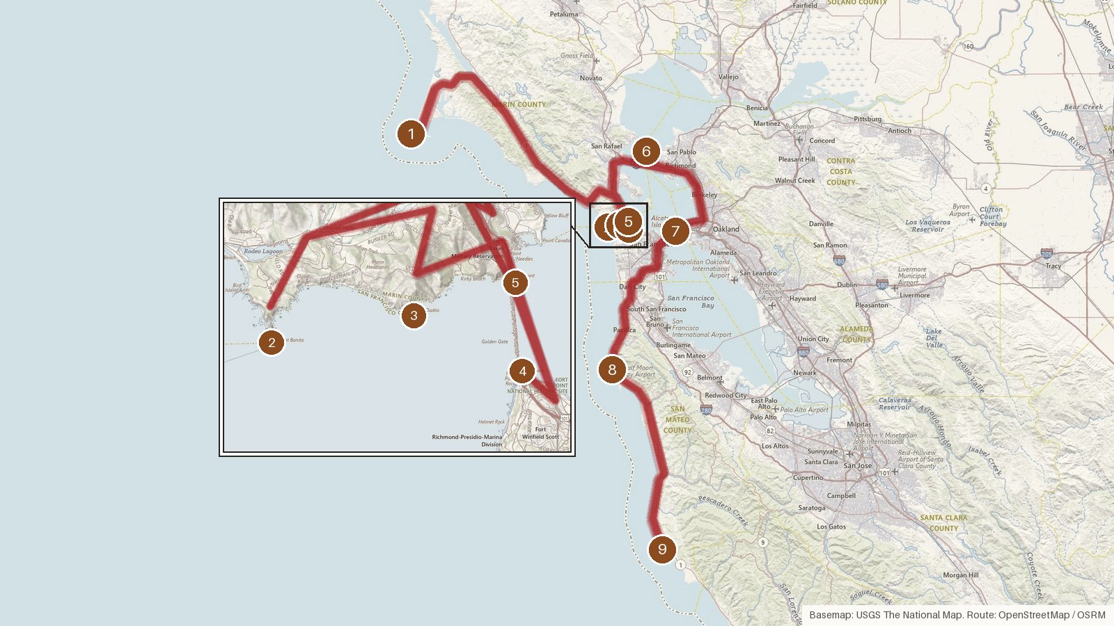
This route strings together nine lights around the Golden Gate and down the San Mateo coast. It covers 158 miles with just under five hours of driving. It starts at Point Reyes on the Gulf of the Farallones, works through Marin, crosses into San Francisco and Contra Costa counties on San Francisco Bay, then finishes on the Pacific shore in San Mateo County. The structures span a long stretch of years. Fort Point's iron tower went up in 1864 and Point Diablo's wooden shack in 1923. Point Montara's tower was built in 1881 in Massachusetts and put up again in California in 1928. Several stops mark endings too, with Fort Point shut off in 1934 and Point Reyes retired in 1975. Six of the nine are listed on the National Register. Start early, since the legs add up, and check access locally before heading to any stop.
Route and drive times from OpenStreetMap routing (OSRM). Times are estimates without stops; roads to remote sites can be unpaved or seasonal.
-
1. Point Reyes Lighthouse
Marin County, California · built 1870
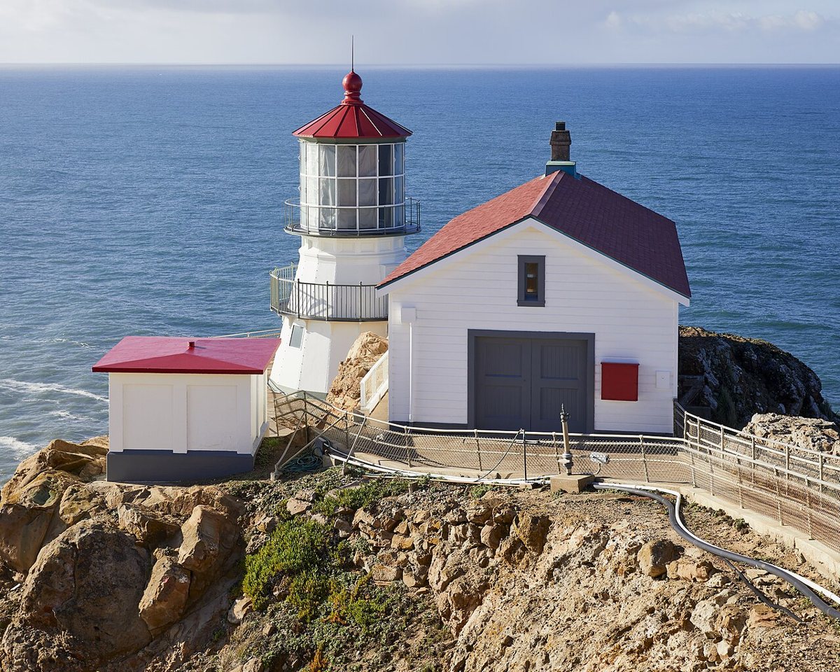
Frank Schulenburg / Wikimedia Commons · CC BY-SA 4.0 First lit on December 1, 1870, this 16-sided cast-iron tower faces the Gulf of the Farallones. It has a focal height of 102 ft and a listed range of 21 nautical miles. It was retired in 1975 when an automated light was installed below it. Sources disagree on the tower's height, 35 or 37 ft, so we've left it open. It's on the National Register.
-
↓ 54.8 miles, about 1 hr 45 min
2. Point Bonita Lighthouse
Marin County, California · built 1877
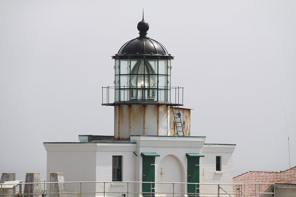
Allan J. Cronin / Wikimedia Commons · CC BY-SA 3.0 Allow about 105 minutes for the 54.8-mile drive from Point Reyes. The first tower here was a 56-ft structure from 1855 that sat higher up and was often hidden by fog. The light was moved to this lower 33-ft tower, which went into service in 1877. Its focal plane is 125 ft, the light shows Oc W 4s, and it's on the National Register.
-
↓ 4 miles, about 15 min
3. Point Diablo Light
Marin County, California · built 1923
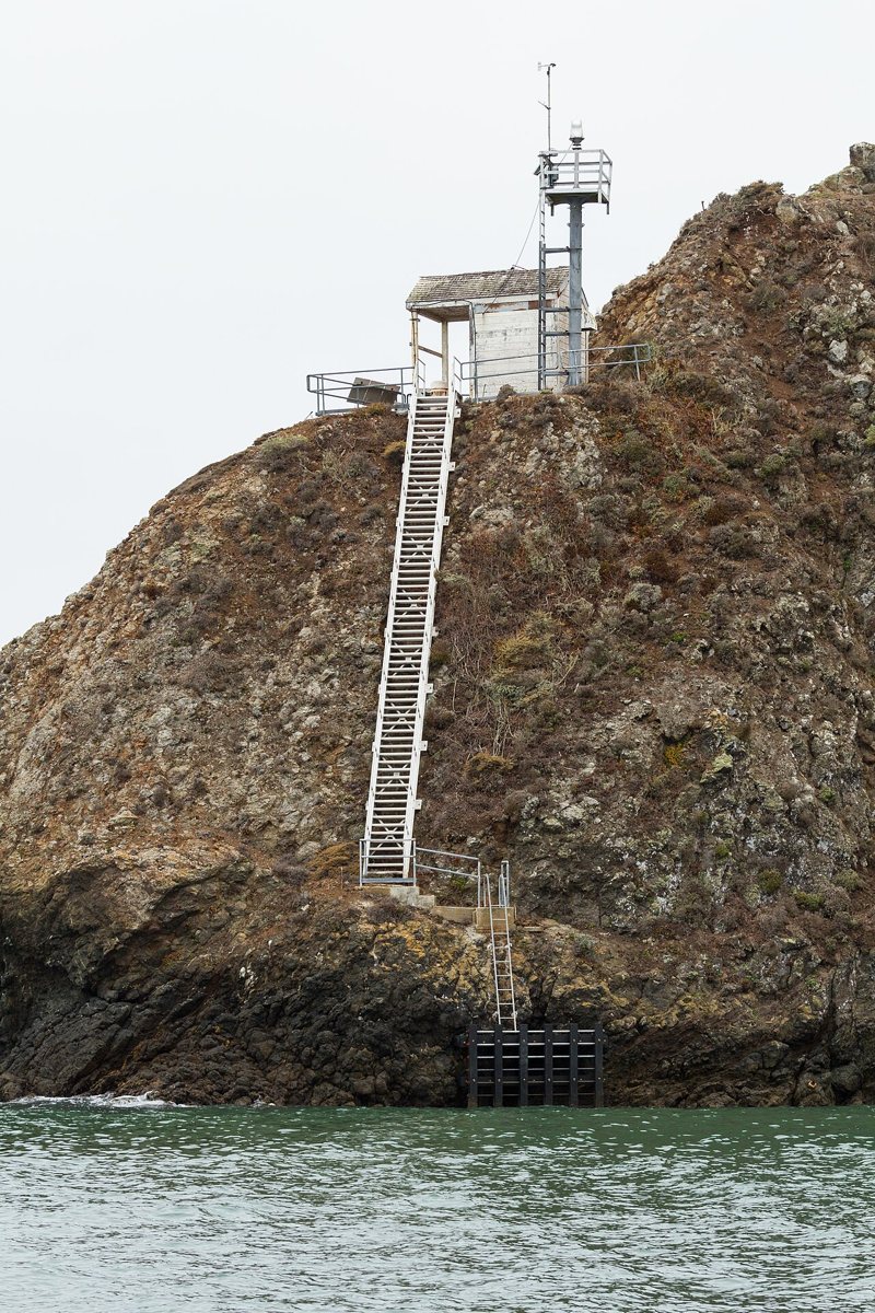
Frank Schulenburg / Wikimedia Commons · CC BY-SA 4.0 Only 4 miles and about 15 minutes on, Point Diablo is a minor light: a small wooden shack from 1923 with a solar-powered beacon on top. No tower height is published, but the focal plane sits at about 85 ft. Its light characteristic is listed as Iso W 6s, if you like to note these things.
-
↓ 4.8 miles, about 14 min
4. Fort Point Light, San Francisco
San Francisco County, California · built 1864
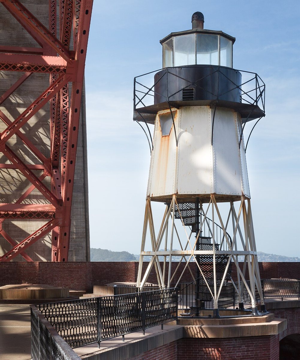
Frank Schulenburg / Wikimedia Commons · CC BY-SA 3.0 A 4.8-mile hop of about 14 minutes brings you to San Francisco. The tower standing here is the third on the site, an iron one built on the fort's roof in 1864 and shut off in 1934. The earlier wooden tower from 1855 was torn down in 1863. Records give 27 ft, while the Park Service's structure report says about 28 ft 8 in including the lantern.
Facts, map and sources for Fort Point Light, San Francisco →
-
↓ 2.2 miles, about 6 min
5. Lime Point Light
Marin County, California · built 1883
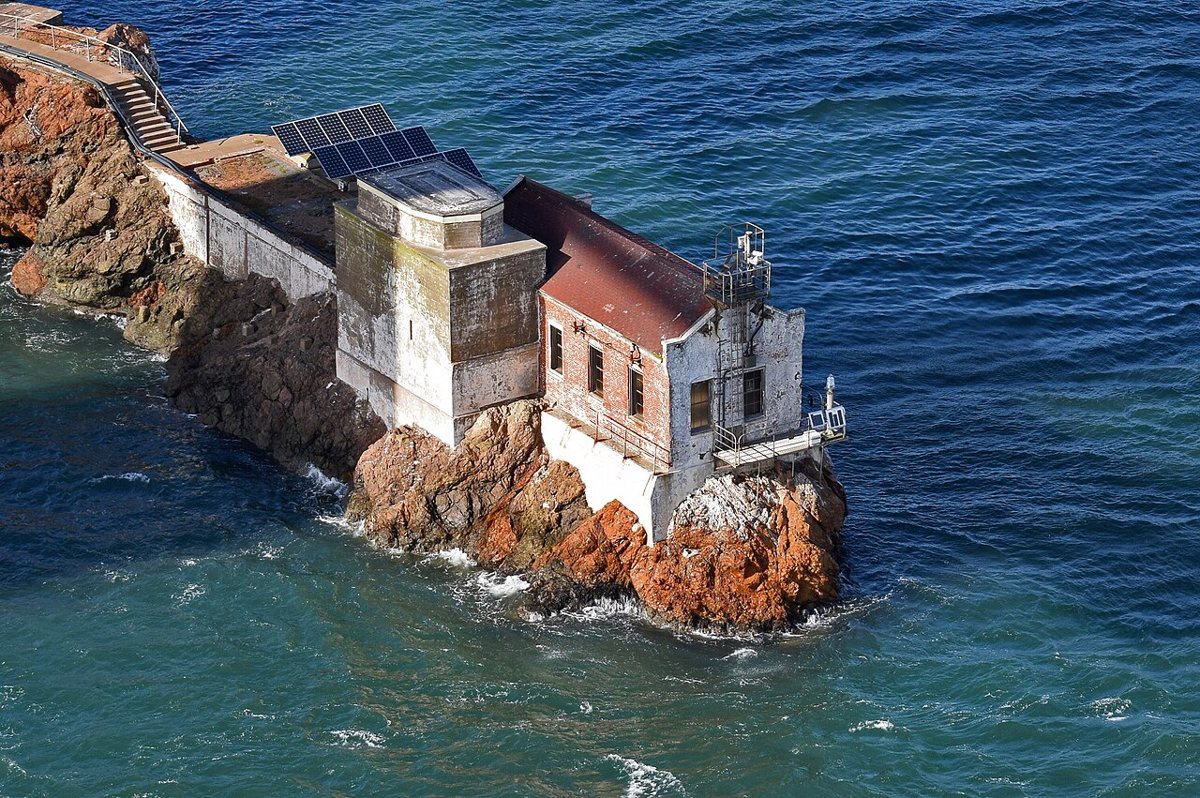
Photograph: Radomianin / Wikimedia Commons · Public domain Back in Marin, 2.2 miles and about 6 minutes away, Lime Point Light has no real tower. It's the brick fog-signal building from 1883, which got a lens lantern in 1900. When the station was automated in 1961, every other building was torn down. The focal height is only 16 ft, and the record places it below the Golden Gate Bridge.
-
↓ 20.9 miles, about 38 min
6. East Brother Island Light
Contra Costa County, California
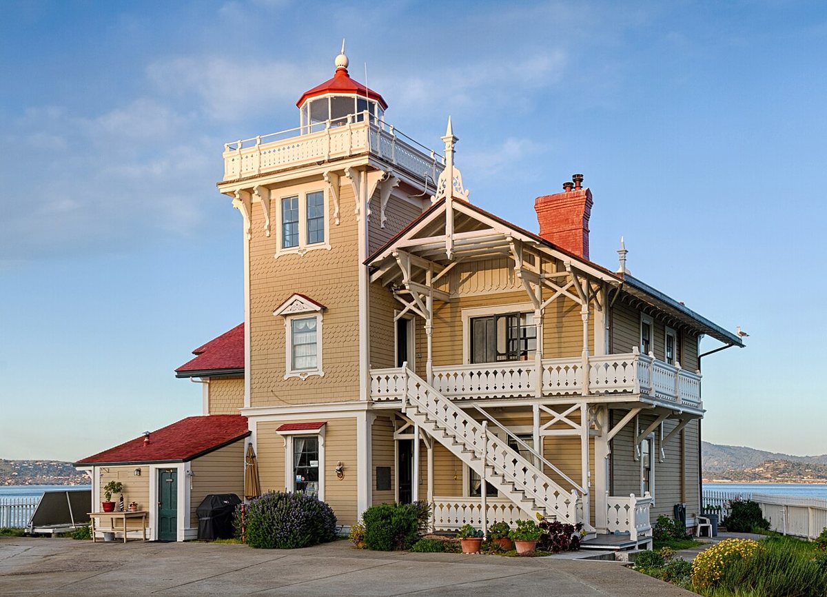
Frank Schulenburg / Wikimedia Commons · CC BY-SA 3.0 Plan on about 38 minutes for the 20.9 miles to Contra Costa County. Designed by architect Paul J. Pelz, this 48-ft wooden lighthouse was built in 1873, the date the National Register uses. It was first lit on March 1, 1874, which is why the Coast Guard gives 1874. Its focal plane is 62 ft above San Francisco Bay.
-
↓ 18.6 miles, about 34 min
7. Yerba Buena Light
San Francisco County, California · built 1875
Some 18.6 miles and about 34 minutes later you reach Yerba Buena, back in San Francisco County. The wooden octagonal tower is the original from 1875. It stands only 25 ft tall but has a focal plane of 95 ft. It was automated in 1958 and added to the National Register in 1991. Its listed range is 14 nautical miles.
-
↓ 24.7 miles, about 36 min
8. Point Montara Light
San Mateo County, California · built 1881
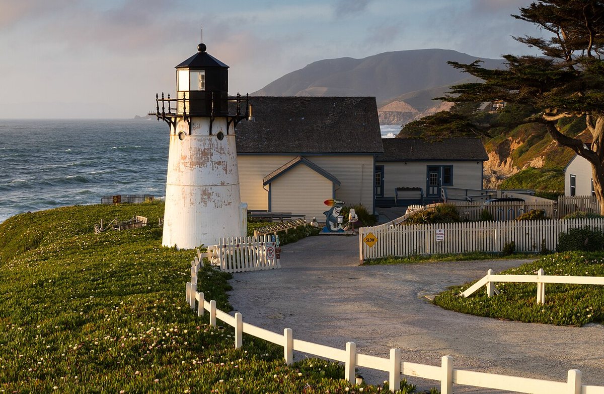
Frank Schulenburg / Wikimedia Commons · CC BY-SA 3.0 This tower has travelled. It was built in 1881 as the Mayo Beach Light in Wellfleet, MA, and put up again at Point Montara in 1928, though the station itself dates from 1875. It's about 36 minutes and 24.7 miles from Yerba Buena. The 30-ft tower's light sits 69 ft above the Pacific, and it's a California Point of Historical Interest.
-
↓ 28.2 miles, about 42 min
9. Pigeon Point Lighthouse
San Mateo County, California · built 1872
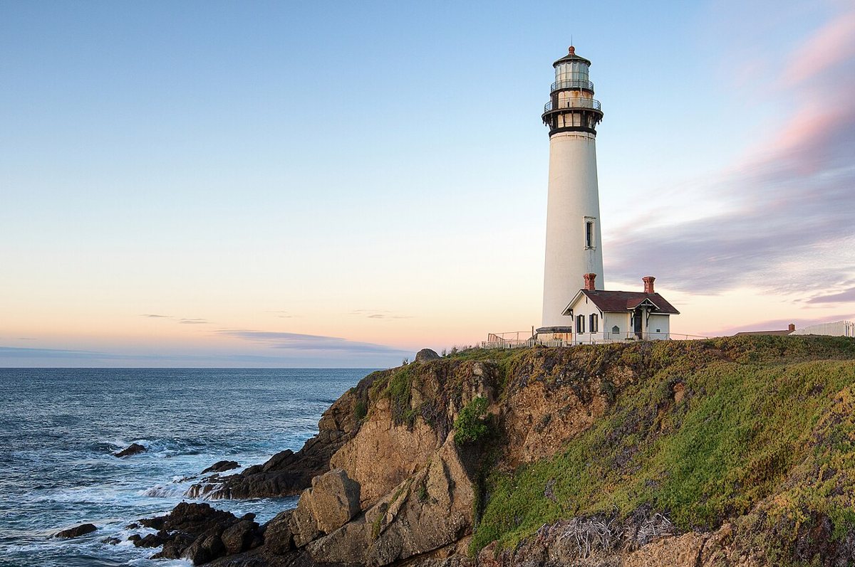
Frank Schulenburg / Wikimedia Commons · CC BY-SA 4.0 The last leg runs 28.2 miles, about 42 minutes, to Pigeon Point. Construction on this 115-ft brick tower began in 1871, and it was first lit on November 15, 1872. Its focal plane is 148 ft above the Pacific, with a listed range of 24 nautical miles. Pieces fell from the top in 2001, so check access locally. It's a California Historical Landmark.
Every stop on this route links to its own page with coordinates, sourced facts and image licences. The text above was written from those records and checked against them before publishing. More lighthouses: all lighthouses in California.