 Wayfarrow
Central Wisconsin Lighthouse Road Trip: 11 Lights, About 6 Hours of Driving
11 stops233 milesabout 6 hr 22 min of drivingCentral Wisconsin
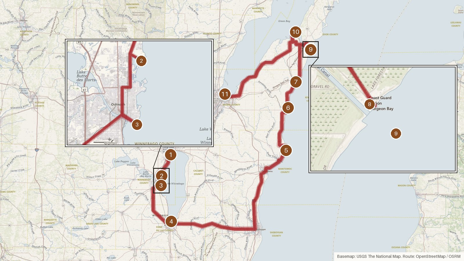
This route links 11 Wisconsin lights across six counties: Winnebago, Fond du Lac, Manitowoc, Kewaunee, Door and Brown. It covers 233 miles and about six hours and twenty minutes of driving, so it fits one long day or two easier ones. The first four stops sit on Lake Winnebago. The route then crosses to Lake Michigan and works north into Door County before finishing in Brown County. The build dates run from 1872 to 1945, and the builders are a varied lot. One was a WPA project, one was put up by local volunteers, and another was built privately for a single owner. Two of the lights were switched off in the 1960s, Rockwell in 1965 and Grassy Island in 1966. Start early, because the drive from Fond du Lac to Rawley Point takes a big bite out of the day. Check access locally before you set out.
Route and drive times from OpenStreetMap routing (OSRM). Times are estimates without stops; roads to remote sites can be unpaved or seasonal.
-
1. Neenah Light
Winnebago County, Wisconsin · built 1945
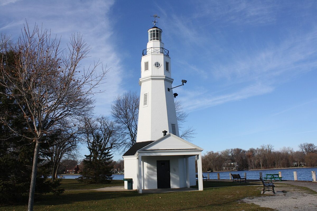
Royalbroil / Wikimedia Commons · CC BY-SA 3.0 The route opens at Neenah Light on Lake Winnebago, which also goes by Kimberly Point Lighthouse. It was built in 1945 at about 40 ft tall, then raised to 49 ft in 1954. It's listed on the National Register of Historic Places, and its light characteristic is recorded as Fl W 4.5s, a white flash every 4.5 seconds.
-
↓ 11.7 miles, about 24 min
2. Asylum Light
Winnebago County, Wisconsin · built 1937
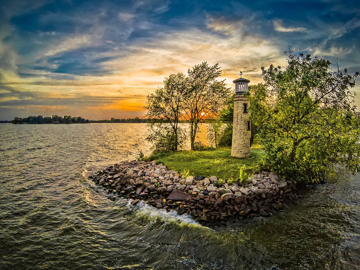
Christopher Rand / Wikimedia Commons · CC BY-SA 4.0 About 24 minutes and 11.7 miles on, Asylum Light is a stone tower built as a WPA project in 1937. It was restored in 2007. It never became an official lit aid to navigation, though. The details get fuzzy here: sources give its height as 24, 30 or 31 ft, and one puts the build year at 1940.
-
↓ 6.4 miles, about 16 min
3. Rockwell Light
Winnebago County, Wisconsin
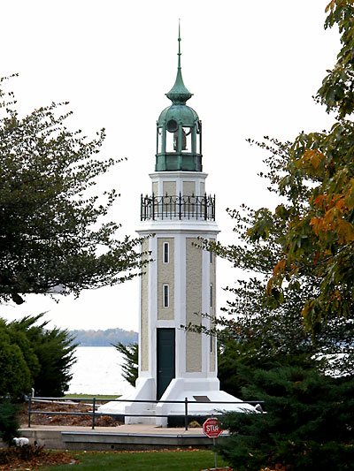
Jjegers at English Wikipedia / Wikimedia Commons · CC BY 2.5 Sixteen minutes and 6.4 miles further, in Oshkosh, is the privately built Bray's Point (Rockwell) Lighthouse. George A. Rockwell designed it for William Bray. Sources can't settle on a build year (1909, 1910 or 1911) or a height (42 or 44 ft). The light was deactivated in 1965, and its characteristic is recorded as F R, a fixed red light.
-
↓ 23.2 miles, about 36 min
4. Fond du Lac Light
Fond du Lac County, Wisconsin · built 1933
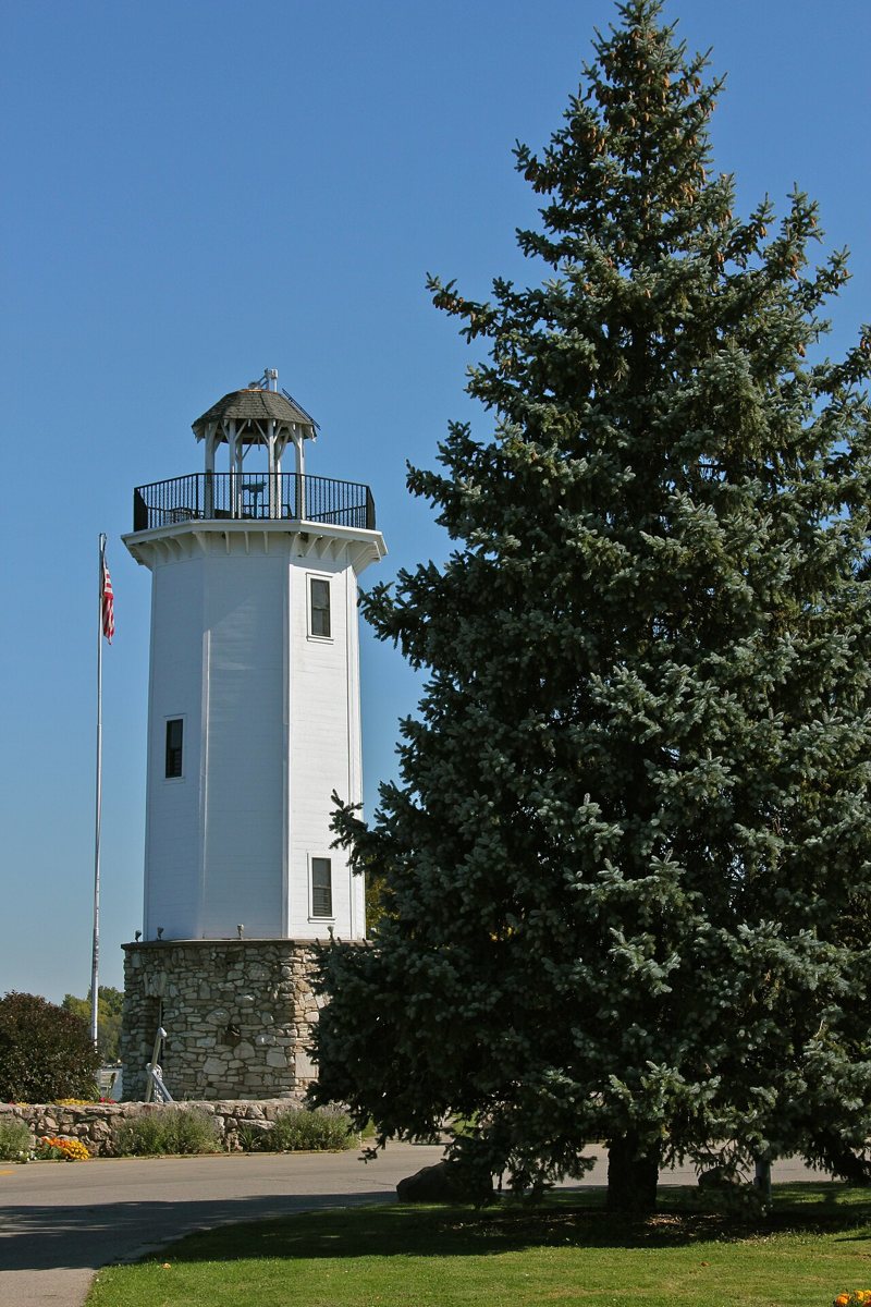
hakkun / Wikimedia Commons · CC BY-SA 3.0 Fond du Lac Light is 23.2 miles and about 36 minutes south, in Lakeside Park. Local volunteers built this eight-sided tower in 1933, and it was restored in 1993. It's city-owned. Sources give it 40 ft, which doesn't match the record's 17 m. It's the last Lake Winnebago stop before the route heads east.
-
↓ 74.9 miles, about 1 hr 45 min
5. Rawley Point Light
Manitowoc County, Wisconsin · built 1894
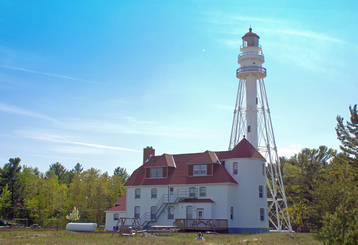
Shadle / Wikimedia Commons · CC BY-SA 3.0 Here comes the big leg of the day: 74.9 miles and 105 minutes to Rawley Point on Lake Michigan. The steel skeletal tower dates from 1894. It started out as a Chicago River light and was rebuilt taller for this site. It replaced an 1853 wooden tower and an 1874 brick one. Sources give 111 or 113 ft, and the range is recorded as 21 nautical miles.
-
↓ 21.7 miles, about 38 min
6. Kewaunee Pierhead Lighthouse
Kewaunee County, Wisconsin · built 1931
Kewaunee's pierhead tower, 21.7 miles and 38 minutes up the shore, is a layered piece of work. The tower was added in 1931 on top of a 1909 fog signal building, and it reuses the lantern from an 1891 range light. It's listed at 43 ft, though the USCG gives 45. The tower is on the National Register, and its range is 15 nautical miles.
-
↓ 12.2 miles, about 20 min
7. Algoma Pierhead Light
Kewaunee County, Wisconsin · built 1908
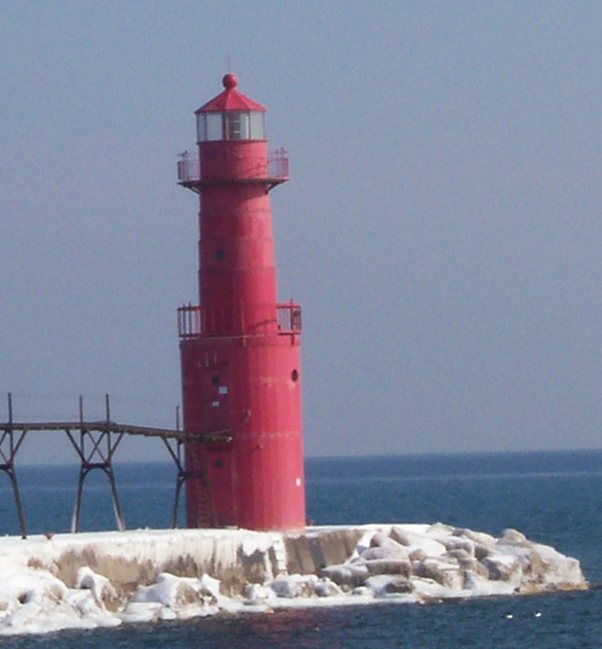
User:Royalbroil / Wikimedia Commons · CC BY-SA 2.5 Just 20 minutes and 12.2 miles on, Algoma Pierhead Light began in 1908 as a 26-ft steel tower. In 1932 it was set on a new steel base that raised it to 42 ft. The 48 ft figure you'll sometimes see is the focal height. Its light characteristic is recorded as Iso R 6s, with a range of 16 nautical miles.
-
↓ 21.8 miles, about 38 min
8. Sturgeon Bay Canal Light
Door County, Wisconsin
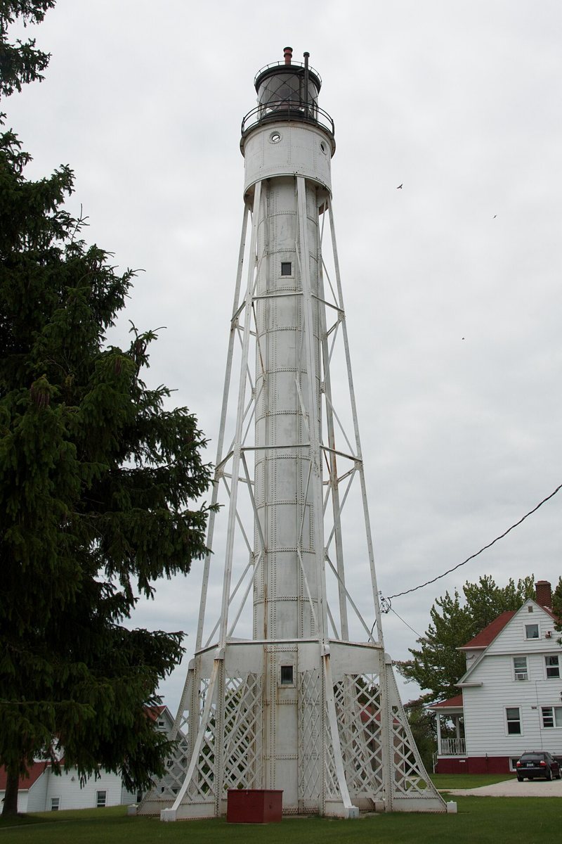
Pete Markham from Loretto, USA / Wikimedia Commons · CC BY-SA 2.0 Into Door County, 21.8 miles and 38 minutes north, the Sturgeon Bay Canal Light rises 98 ft. It was built to an experimental steel-cylinder design that vibrated badly. The Coast Guard gives 1903 as the year the current tower was first lit, while most sources say 1899. It's on the National Register, flashing red every ten seconds with a 17-nautical-mile range.
-
↓ 0 miles, about 0 min
9. Sturgeon Bay Canal North Pierhead Light
Door County, Wisconsin · built 1903
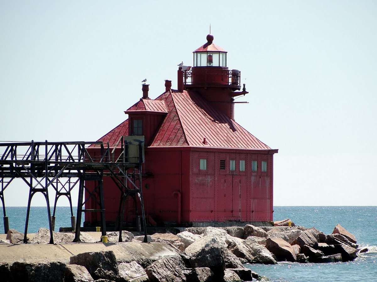
Greg Tally - User: (WT-shared) WineCountryInn at wts wikivoyage / Wikimedia Commons · CC BY-SA 3.0 No extra driving is logged for the Sturgeon Bay Canal North Pierhead Light, so it pairs naturally with the previous stop. The station dates back to 1882. The current red tower and fog signal building went up in 1903 and were automated in 1972. The tower is 39 ft tall, and its light flashes red every 2.5 seconds with a 9-nautical-mile range.
Facts, map and sources for Sturgeon Bay Canal North Pierhead Light →
-
↓ 15.1 miles, about 35 min
10. Sherwood Point Light
Door County, Wisconsin · built 1883
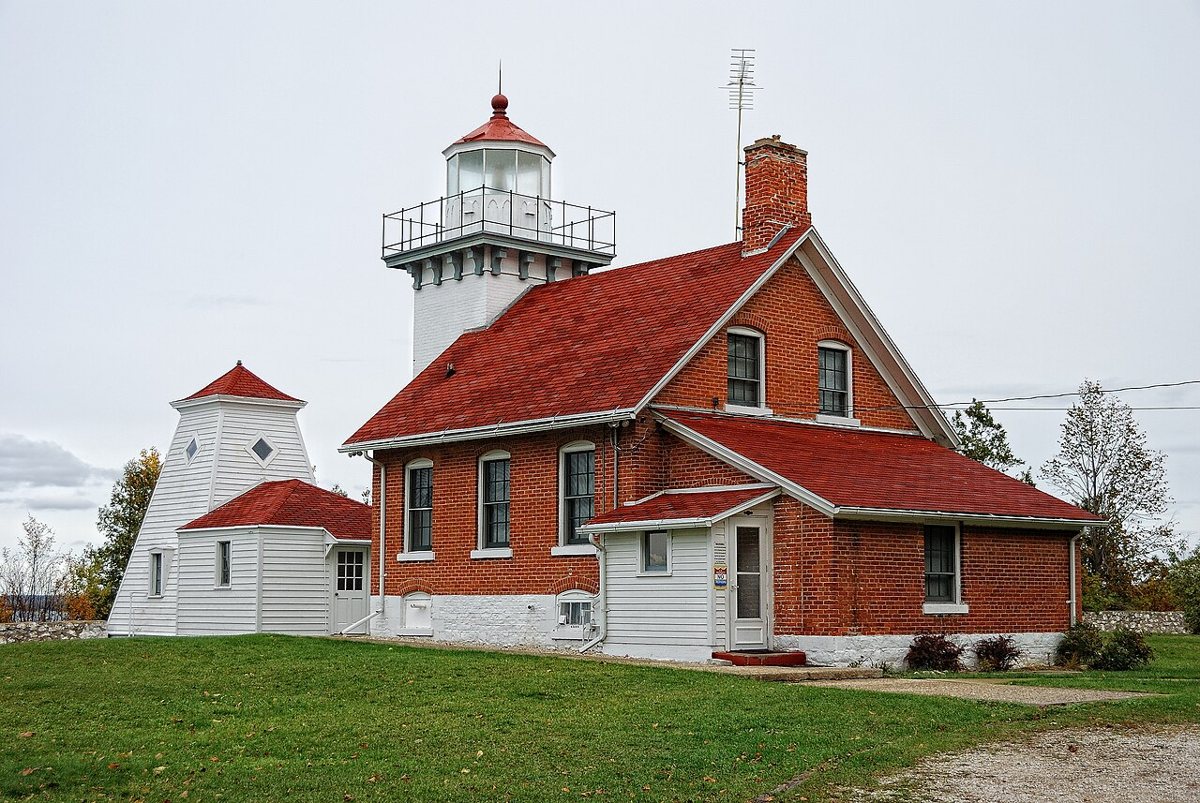
Dave from Beaver Dam, WI., United States / Wikimedia Commons · CC BY 2.0 About 35 minutes and 15.1 miles on, Sherwood Point Light is a red-brick station finished in 1883. It holds a real distinction: it was the last manned lighthouse on the Great Lakes until it was automated in 1983. Sources put the tower at 37 or 35 ft, and the focal height is 61 ft. It's listed on the National Register.
-
↓ 45.6 miles, about 1 hr 9 min
11. Grassy Island Range Lights
Brown County, Wisconsin · built 1872
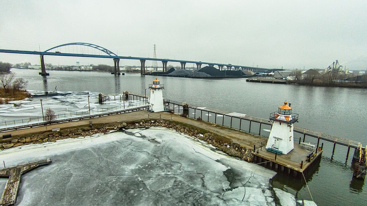
Chris Rand / Wikimedia Commons · CC BY-SA 4.0 The route ends 45.6 miles and 69 minutes away in Brown County, at the Grassy Island Range Lights. This pair of wooden towers was built on Grassy Island in 1872 and switched off in 1966. That same year they were moved ashore, and in 1999 they went to the Green Bay Yacht Club breakwater. They're National Register listed. Check access locally.
Every stop on this route links to its own page with coordinates, sourced facts and image licences. The text above was written from those records and checked against them before publishing. More lighthouses: all lighthouses in Wisconsin.