 Wayfarrow
Cheshire and Merrimack Counties, New Hampshire Covered Bridge Road Trip: 11 Bridges in One Day
11 stops161 milesabout 4 hr 30 min of drivingCheshire and Merrimack Counties, New Hampshire
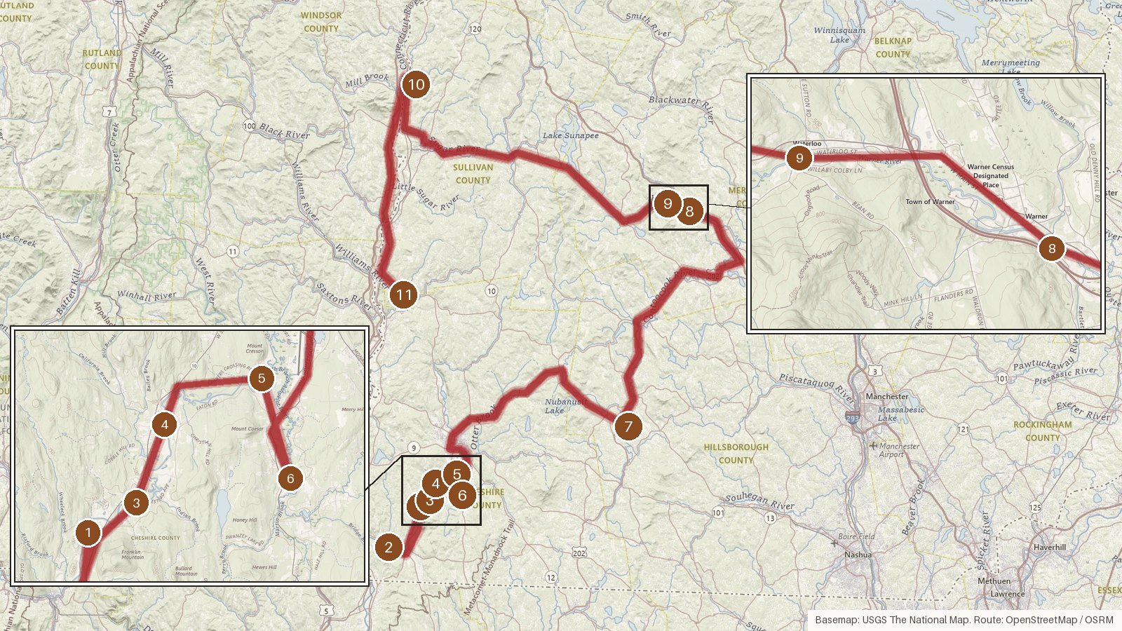
This route strings together 11 covered bridges across four New Hampshire counties, starting in Cheshire and passing through Hillsborough and Merrimack before finishing in Sullivan. It runs 161 miles with about four and a half hours of driving, so plan on a full day once you add time at each bridge. The first stretch follows one river: five bridges cross the Ashuelot and a sixth spans its South Branch. After that come the Contoocook and a pair over the Warner River. Six of the eleven are Town lattice trusses, and the dates on record run from 1832 at West Swanzey to a 2001 reproduction at Slate. Every stop is listed on the National Register of Historic Places. The longer legs fall in the second half, one of them 65 minutes. Start early, check access locally, and expect cell coverage to be patchy on rural roads.
Route and drive times from OpenStreetMap routing (OSRM). Times are estimates without stops; roads to remote sites can be unpaved or seasonal.
-
1. Coombs Covered Bridge
Cheshire County, New Hampshire
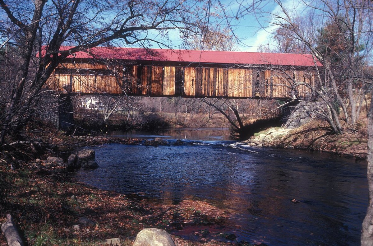
JERRYE & ROY KLOTZ MD / Wikimedia Commons · CC BY-SA 3.0 The day opens in Winchester at this Town lattice bridge over the Ashuelot River, listed on the National Register. Its records don't quite agree. Most sources date it to 1837, though Wikipedia's text says 1843, and the length appears as either 107 or 118 ft. Either way, it's a fitting first look at the lattice style you'll see again on this river.
-
↓ 7.7 miles, about 14 min
2. Ashuelot Covered Bridge
Cheshire County, New Hampshire · built 1864
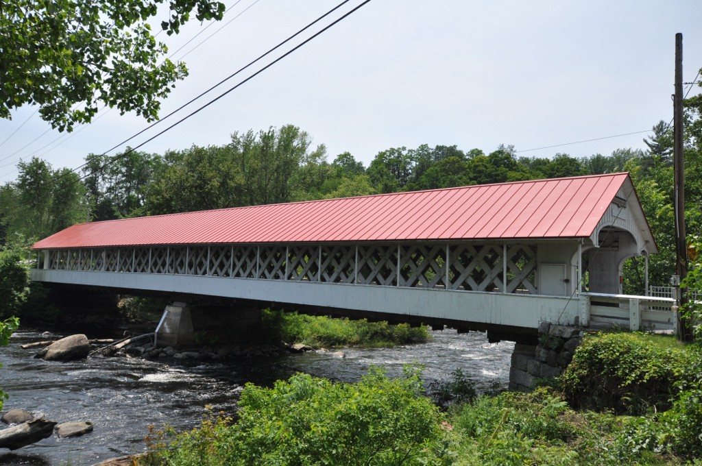
User:Magicpiano / Wikimedia Commons · CC BY-SA 4.0 About 14 minutes on (7.7 miles), this two-span Town lattice bridge also crosses the Ashuelot River. It was approved in 1864 and paid for by March 1865, then reopened in 1999 after a $667,000 rehabilitation. Sources list its length as 159, 169 or 178 ft, so no single figure is given here.
-
↓ 8.6 miles, about 15 min
3. Slate Covered Bridge
Cheshire County, New Hampshire · built 2001
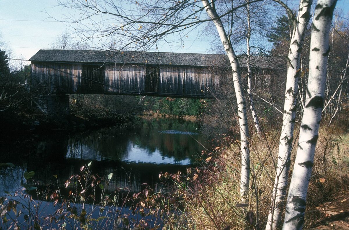
JERRYE & ROY KLOTZ MD / Wikimedia Commons · CC BY-SA 3.0 The Slate Covered Bridge in Swanzey is a 2001 reproduction of an 1862 Town lattice bridge that arsonists destroyed on March 8, 1993. It's about 15 minutes (8.6 miles) from the Ashuelot bridge and crosses the same river. The listed length is 142 ft, while Bridgehunter gives 143.1 ft.
-
↓ 2.4 miles, about 5 min
4. West Swanzey Covered Bridge
Cheshire County, New Hampshire · built 1832
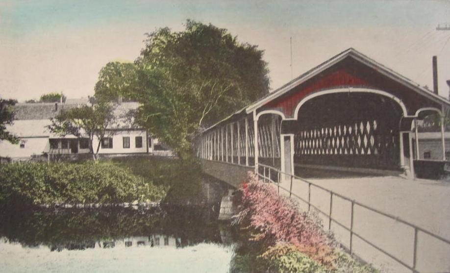
Unknown authorUnknown author / Wikimedia Commons · Public domain Only five minutes down the road, you reach the West Swanzey Covered Bridge, also called the Thompson Bridge. Zadoc Taft built this two-span Town lattice bridge over the Ashuelot River in 1832. Length figures vary quite a bit: 136 ft 10 in, 151 ft, or about 156 ft depending on the source.
-
↓ 3.2 miles, about 7 min
5. Sawyers Crossing Covered Bridge
Cheshire County, New Hampshire · built 1859
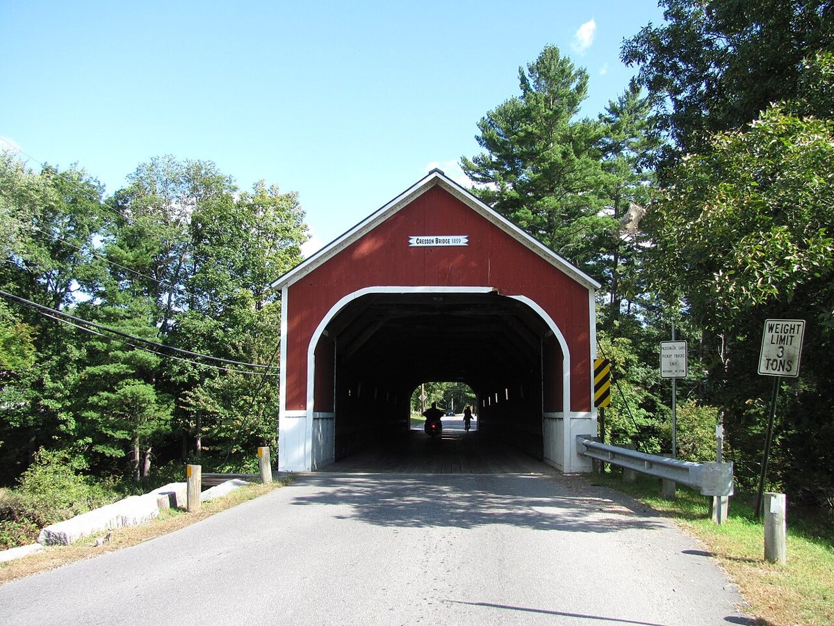
John Phelan / Wikimedia Commons · CC BY 3.0 Seven minutes and 3.2 miles further, Sawyers Crossing Covered Bridge, also known as the Cresson Bridge, dates from 1859. It's a two-span Town lattice bridge over the Ashuelot River, built to replace a bridge from 1771. Sources can't settle the length, offering 158, 159 or 117 ft.
Facts, map and sources for Sawyers Crossing Covered Bridge →
-
↓ 2.6 miles, about 6 min
6. Carleton Bridge
Cheshire County, New Hampshire · built 1869
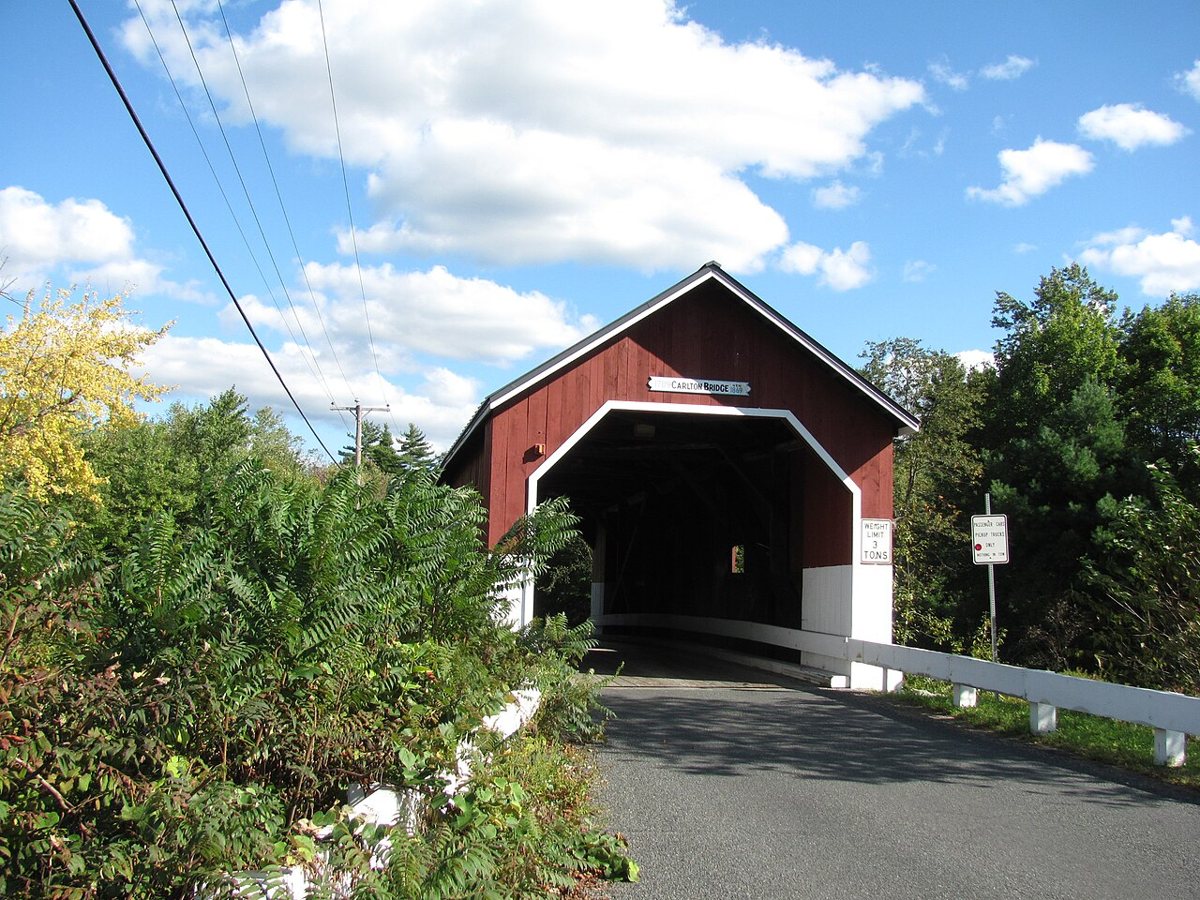
John Phelan / Wikimedia Commons · CC BY 3.0 There's been a bridge at this spot on the South Branch Ashuelot River since about 1789. The current one, built in 1869 and measuring 67 ft 3 in, is the area's only surviving 19th-century Queenpost truss, a change from the lattice designs earlier in the day. It was repaired and reopened in 1997. The drive from Sawyers Crossing is about six minutes.
-
↓ 32.8 miles, about 54 min
7. Hancock-Greenfield Bridge
Hillsborough County, New Hampshire · built 1937
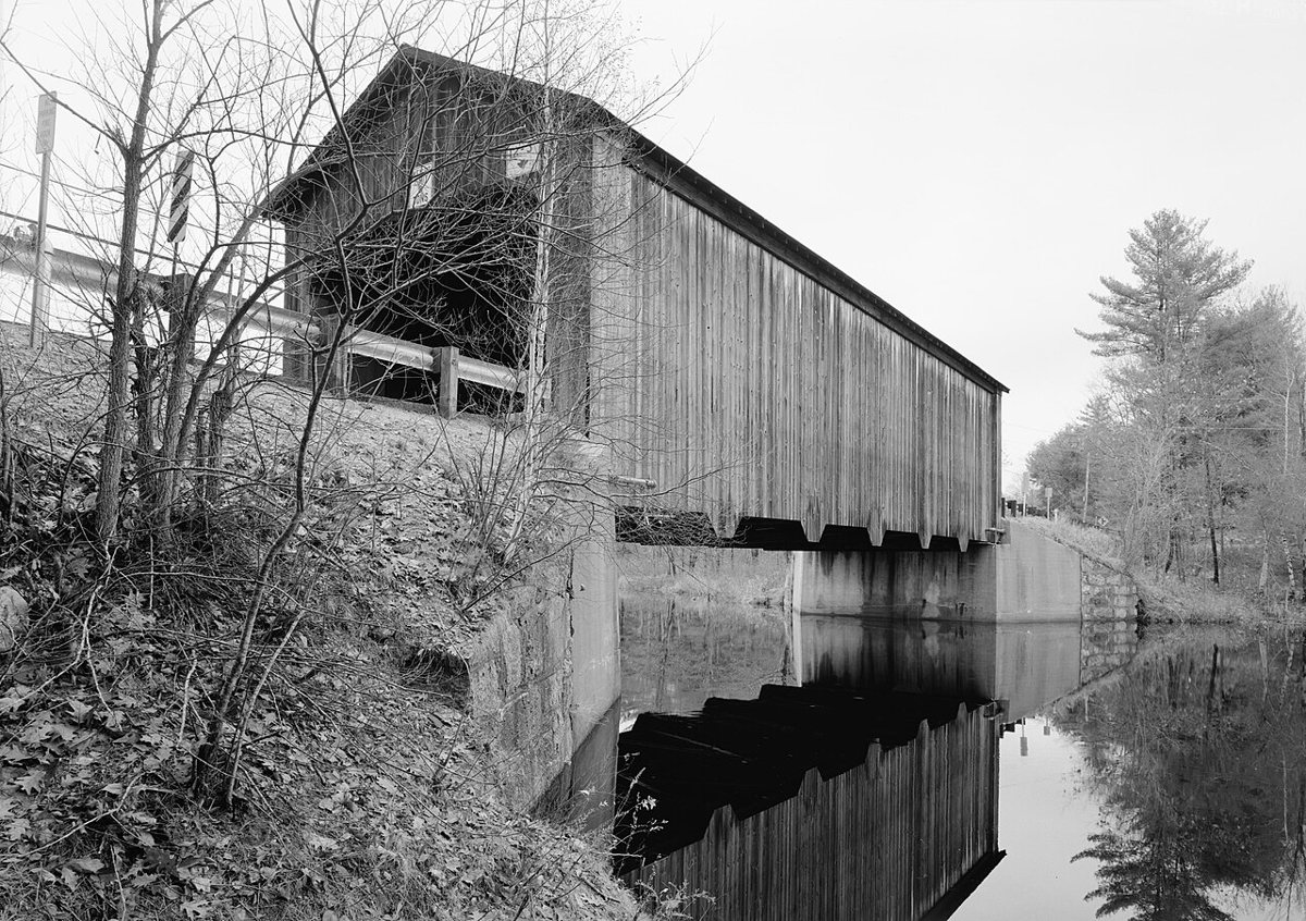
Jet Lowe / Wikimedia Commons · Public domain Allow about 54 minutes (32.8 miles) for the run into Hillsborough County. Also called County Bridge, this crossing of the Contoocook River went up in 1937 with a timber Teco-Pratt truss, replacing an 1852 bridge damaged in the 1936 flood. It's listed at 88 ft, with Bridgehunter giving 87.9 ft total.
-
↓ 34.9 miles, about 55 min
8. Dalton Covered Bridge
Merrimack County, New Hampshire · built 1853
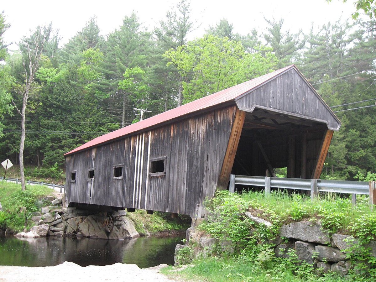
Ken Gallager at en.wikipedia / Wikimedia Commons · CC BY-SA 3.0 Another long leg, about 55 minutes and 34.9 miles, brings you to Warner, where the Dalton Covered Bridge carries Joppa Road over the Warner River. Joshua Sanborn built it, the record gives 1853 as its year, and it was rebuilt in 1963-64. Length figures differ: a 76 ft span, 77 ft, or 84 ft total.
-
↓ 2.7 miles, about 6 min
9. Waterloo Covered Bridge
Merrimack County, New Hampshire
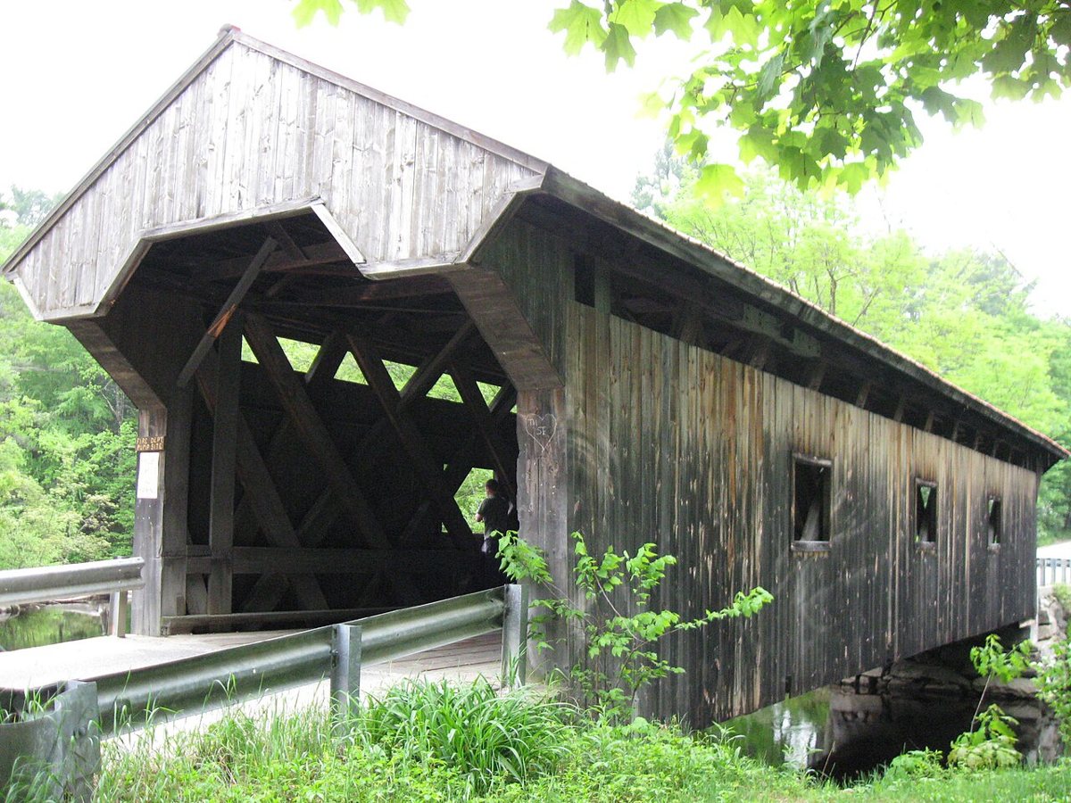
Ken Gallager at en.wikipedia / Wikimedia Commons · CC BY-SA 3.0 Just six minutes away, the Waterloo Covered Bridge is a Town lattice truss carrying Newmarket Road over the same Warner River. Its date is unsettled, with sources giving 1840, 1857 or 1859-60, and one source says it was rebuilt in 1970. The length on record is 84 ft.
-
↓ 39.3 miles, about 1 hr 5 min
10. Dingleton Hill Covered Bridge
Sullivan County, New Hampshire · built 1882
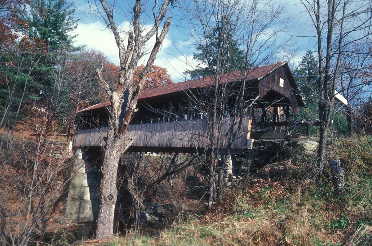
JERRYE & KLOTZ MD / Wikimedia Commons · CC BY-SA 3.0 A 65-minute drive (39.3 miles) leads to Cornish and James Tasker's multiple kingpost truss over Mill Brook. The record gives 1882 as the build year, with Tasker paid in 1883, and the bridge was rededicated in 1983 after restoration. Its length is given as 77 ft 9 in, 78 ft or 81 ft exterior.
-
↓ 26.6 miles, about 43 min
11. Prentiss Bridge
Sullivan County, New Hampshire · built 1874
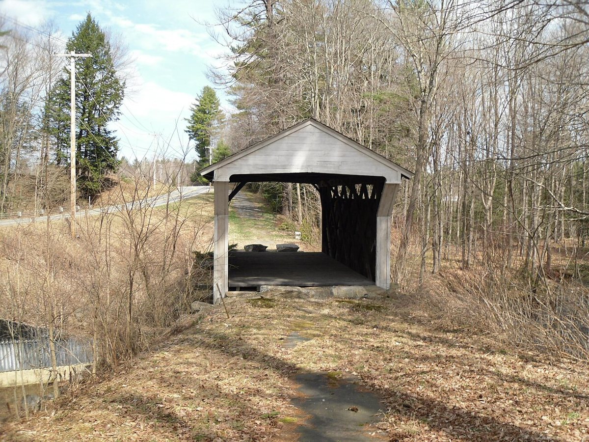
Dougtone / Wikimedia Commons · CC BY-SA 2.0 The route ends about 43 minutes (26.6 miles) on at the shortest historic covered bridge in New Hampshire. Dating from 1874, the Prentiss Bridge was bypassed in 1954-55. Even its modest size is debated: the NRHP form says 30 ft, while other sources give 35 or 36 ft.
Every stop on this route links to its own page with coordinates, sourced facts and image licences. The text above was written from those records and checked against them before publishing. More covered bridges: all covered bridges in New Hampshire.