 Wayfarrow
Eastern Michigan Lighthouse Road Trip: 7 Lights, About 7 Hours of Driving
7 stops274 milesabout 7 hr 2 min of drivingEastern Michigan
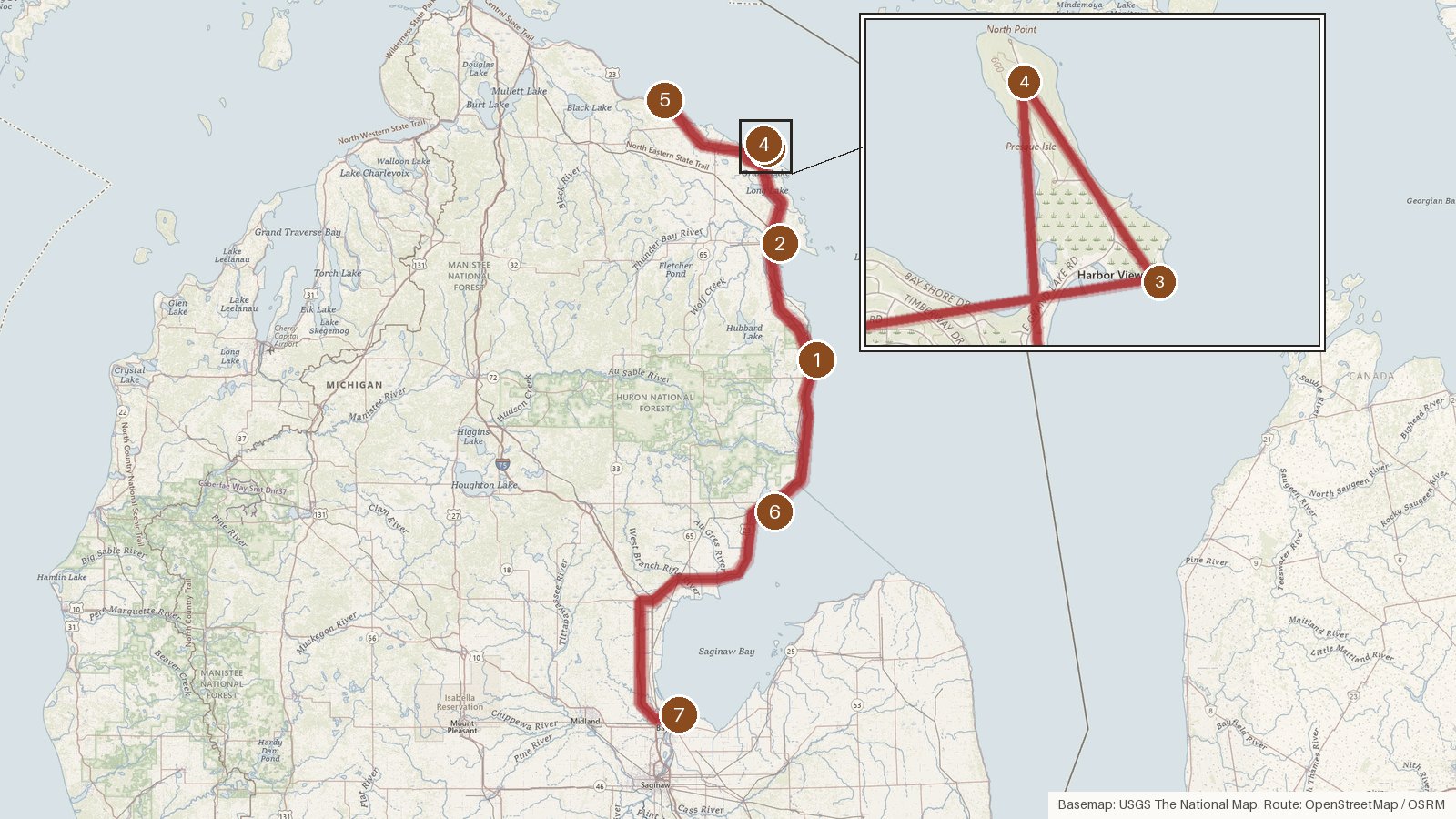
This route links seven Michigan lighthouses, five of them on Lake Huron. It runs from Alcona County up through Alpena and Presque Isle counties, then back down through Iosco County to the Saginaw River in Bay County. It covers 274 miles with about seven hours of driving. The longest single leg, Forty Mile Point to Tawas Point, takes around two and a half hours. The towers span more than seven decades, from Old Presque Isle in 1840 to Alpena's steel skeleton tower of 1914, and every stop is listed on the National Register of Historic Places. Two of the lights went dark long ago: Old Presque Isle in 1871 and the Saginaw River Rear Range Light around 1960. The builders on record include the United States Lighthouse Board, Orlando Metcalfe Poe and Godfrey Weitzel. Start early, check access locally before you set out, and expect patchy cell coverage along the rural stretches.
Route and drive times from OpenStreetMap routing (OSRM). Times are estimates without stops; roads to remote sites can be unpaved or seasonal.
-
1. Sturgeon Point Light
Alcona County, Michigan · built 1869
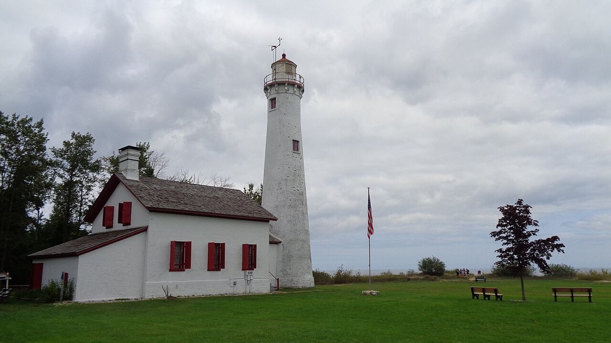
Notorious4life (talk) (Uploads) / Wikimedia Commons · CC0 Start at Sturgeon Point on Lake Huron, where a brick tower designed by the United States Lighthouse Board rises 70 ft 9 in, usually rounded to 71. Most sources date it to 1869, though some tourism sites say it was completed in November 1870. Its Fl W 6s signal reaches 9 nautical miles from a focal height of 69 ft, and the Alcona Historical Society looks after it.
-
↓ 30.7 miles, about 56 min
2. Alpena Light
Alpena County, Michigan · built 1914
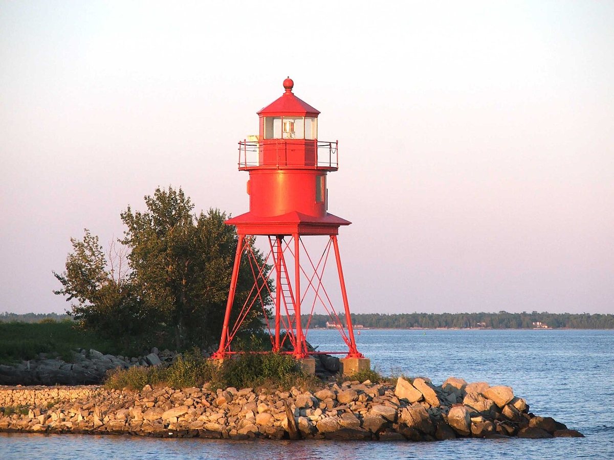
by Dylan L. Tanner / Wikimedia Commons · CC BY-SA 2.5 About 56 minutes and 30.7 miles on, Alpena's red steel skeleton tower, known as 'Little Red', dates from 1914 and is the third light at this Lake Huron spot. The 1875 date you may see belongs to a temporary pole light. Sources can't agree on its height, so we've left it out, but the focal height is 43 ft and its Fl R 6s light has a 12-nautical-mile range.
-
↓ 29.7 miles, about 48 min
3. Old Presque Isle Light
Presque Isle County, Michigan · built 1840
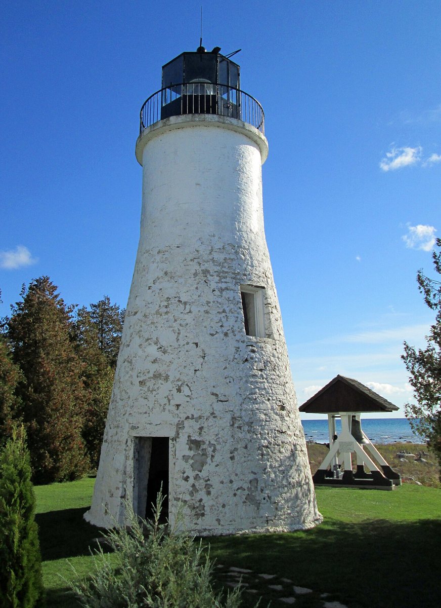
Mason Christensen / Wikimedia Commons · CC BY-SA 3.0 Built in 1840, Old Presque Isle Light is one of the oldest surviving lighthouses on the Great Lakes, a drive of about 48 minutes (29.7 miles) from Alpena. It stands on Lake Huron and served until 1871, when the New Presque Isle Light replaced it. Height figures vary: the owner says 30 ft, LighthouseFriends 31 ft and Wikipedia 38 ft.
-
↓ 1.3 miles, about 5 min
4. New Presque Isle Light
Presque Isle County, Michigan · built 1870
Only 1.3 miles and five minutes away is the tower that took over from the old one. Orlando Metcalfe Poe designed this 113-ft Poe-style tower, which most sources date to 1870, though it was finished and first lit in 1871. It's recorded as still active, showing Fl W 15s from a focal height of 121 ft, with a range of 22 nautical miles.
-
↓ 27.5 miles, about 39 min
5. Forty Mile Point Light
Presque Isle County, Michigan · built 1896
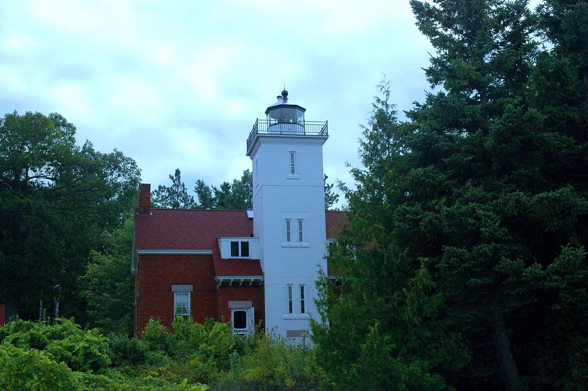
NOAA Photo Library / Wikimedia Commons · Public domain Forty Mile Point, 27.5 miles and about 39 minutes on, is a square brick tower built into a duplex keepers' house on Lake Huron. It was finished in November 1896 and first lit in 1897. It stands 52 ft (michigan.org's 62 ft is an outlier), and its Iso W 6s light reaches 14 nautical miles. Presque Isle County owns it and the 40 Mile Point Lighthouse Society runs it.
-
↓ 108.1 miles, about 2 hr 35 min
6. Tawas Point Light
Iosco County, Michigan · built 1876
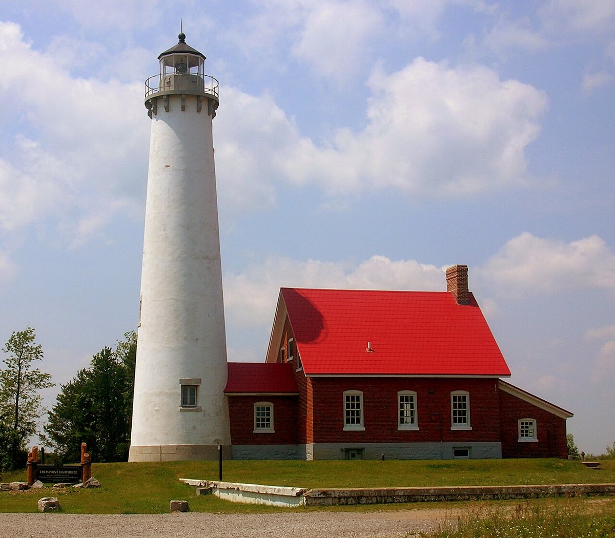
Asher196 (talk) 03:32, 18 July 2008 (UTC) / Wikimedia Commons · CC BY-SA 3.0 The longest leg comes next: 108.1 miles and about 155 minutes to Tawas Point. The 1853 date in the record belongs to the first tower, which shifting sands left ineffective. Its 1876 replacement stands 67 ft, or 70 ft with the base, and shows Oc W 4s with a red sector from 045° to 135°. The Coast Guard decommissioned it in 2016.
-
↓ 76.6 miles, about 1 hr 59 min
7. Saginaw River Rear Range Light
Bay County, Michigan · built 1876
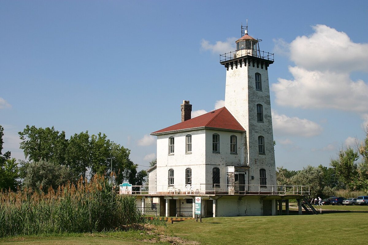
Charles W. Bash / Wikimedia Commons · CC BY 2.5 Finish on the Saginaw River in Bay County, 76.6 miles and about 119 minutes from Tawas Point. Godfrey Weitzel designed this brick rear range tower, which went up with its keeper's house in 1876, replacing an earlier light from 1839 to 1841. It was deactivated around 1960, and reported heights run anywhere from 53 to 68 ft.
Every stop on this route links to its own page with coordinates, sourced facts and image licences. The text above was written from those records and checked against them before publishing. More lighthouses: all lighthouses in Michigan.