 Wayfarrow
Eastern Ohio Covered Bridge Road Trip: 11 Bridges, About 8 Hours of Driving
11 stops301 milesabout 7 hr 58 min of drivingEastern Ohio
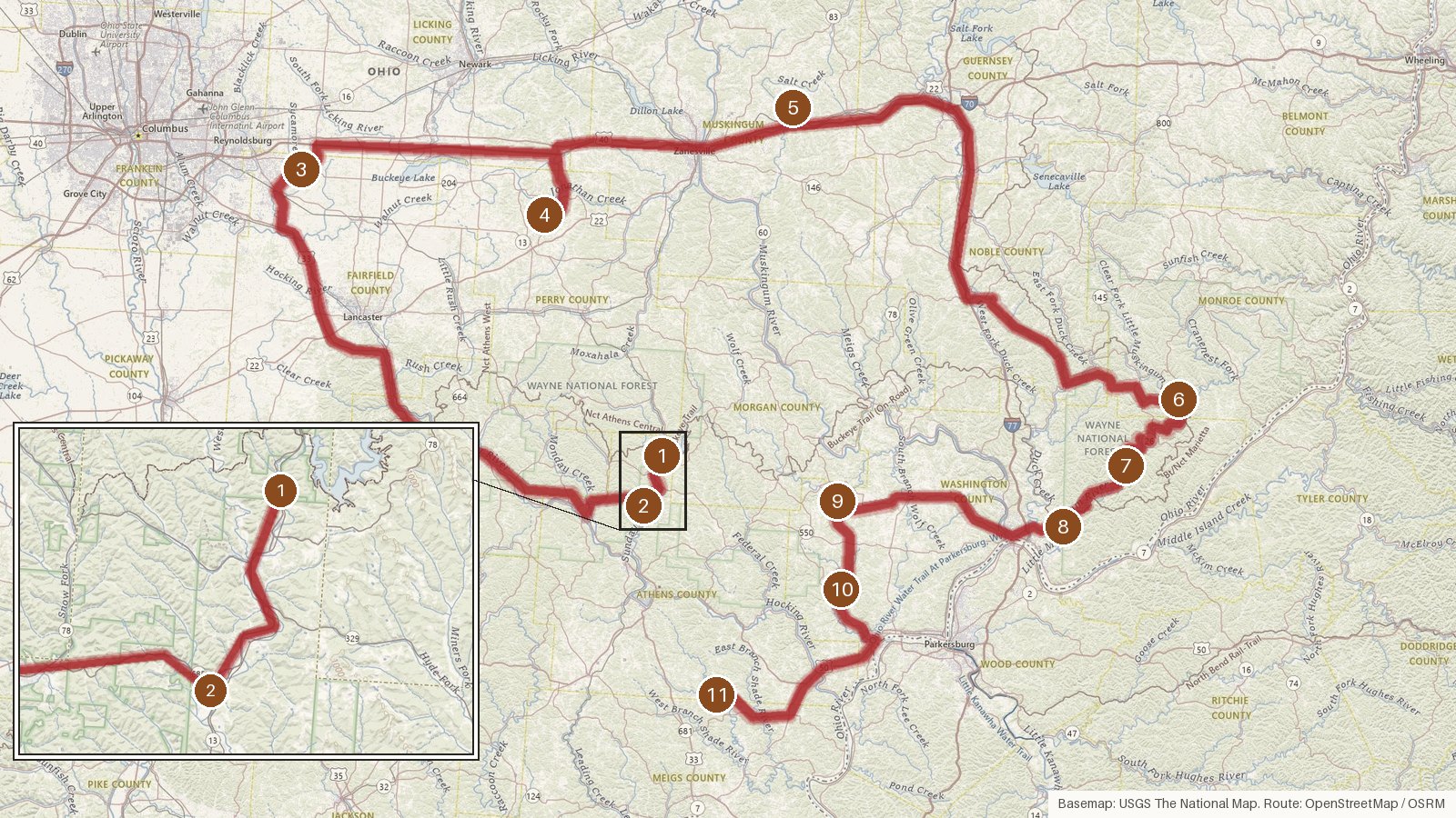
This loop takes in 11 covered bridges across six Ohio counties: Athens, Fairfield, Perry, Muskingum, Monroe and Washington. It runs about 301 miles, with close to eight hours of driving in total, so it works as one long day or a more relaxed two. Most of these bridges went up between the mid-1870s and 1891, and every stop is listed on the National Register of Historic Places. Water ties much of the route together. Two bridges cross Sunday Creek and three span the Little Muskingum River, while others cross Painter Creek, West Branch Wolf Creek and the Shade River. A couple of builders' names survive in the records, J.W. Buchanan and Rolla Merydith. Start early, check access locally before you set out, and expect patchy cell coverage on the rural roads between stops.
Route and drive times from OpenStreetMap routing (OSRM). Times are estimates without stops; roads to remote sites can be unpaved or seasonal.
-
1. Palos Covered Bridge
Athens County, Ohio
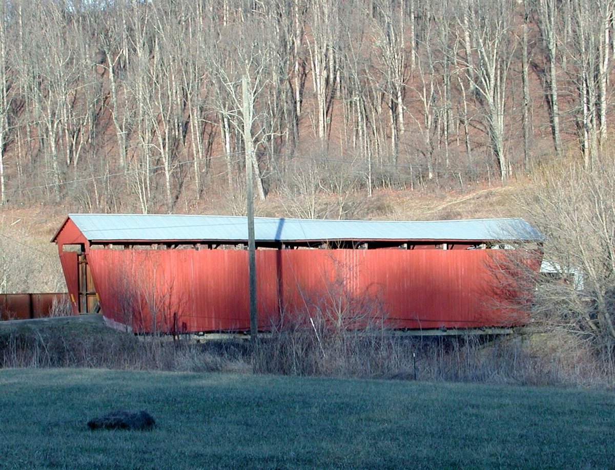
Jaknouse / Wikimedia Commons · CC BY-SA 3.0 Start at Palos Covered Bridge, also known as Newton Bridge, a multiple-kingpost span over Sunday Creek in Athens County. It joined the National Register in 1977. Its records don't quite agree. Sources put construction at 1875, 1876 or around the late 1870s to 1880s, and give its length as 75, 78.1 or 81 ft.
-
↓ 6.8 miles, about 11 min
2. Kidwell Covered Bridge
Athens County, Ohio · built 1880
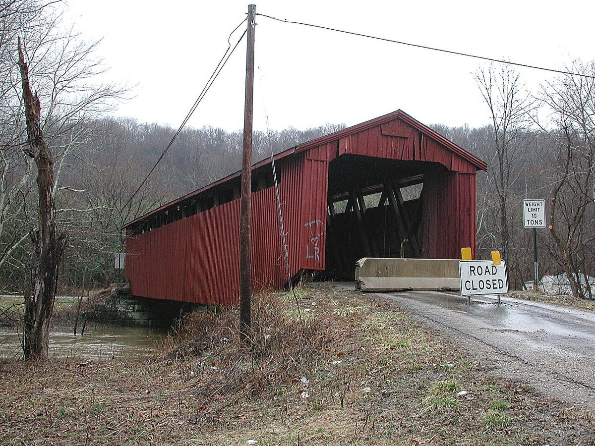
Jaknouse / Wikimedia Commons · CC BY-SA 3.0 Only 6.8 miles and about 11 minutes on, Kidwell Covered Bridge is a Howe truss over the same Sunday Creek, in Dover Township. Built in 1880, it closed in 1978 after an overweight truck damaged it, then was restored and reopened. Detailed sources measure it at about 96 ft, though one travel blog says 70.
-
↓ 59.8 miles, about 1 hr 17 min
3. Hizey Covered Bridge
Fairfield County, Ohio · built 1891
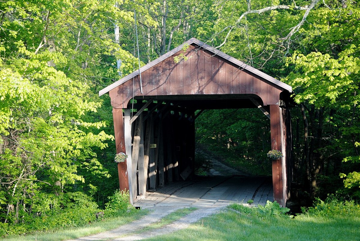
Wdzinc / Wikimedia Commons · CC BY-SA 3.0 A longer leg of 59.8 miles, about 77 minutes, brings you to Fairfield County's Violet Township. J.W. Buchanan built Hizey Covered Bridge in 1891 over Poplar Creek. It was later moved to a private drive on Tollgate Rd, where it crosses Sycamore Creek, though sources split between 1979 and 1986 for the move. It measures 83 ft. Check access locally.
-
↓ 35.6 miles, about 51 min
4. Parks Covered Bridge
Perry County, Ohio
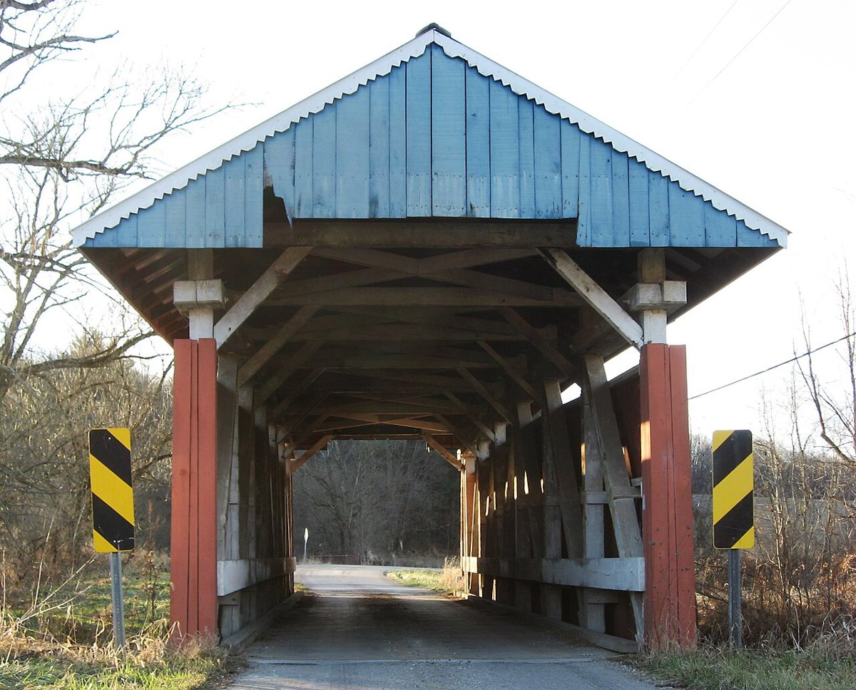
Nyttend / Wikimedia Commons · Public domain Perry County's Parks Covered Bridge is 35.6 miles, about 51 minutes, from Hizey. It's a multiple-kingpost bridge on County Road 33 in Hopewell Township, crossing Painter Creek. Sources disagree on whether it went up in 1882 or 1883, and its length couldn't be confirmed, so you won't find a figure for it here.
-
↓ 34.5 miles, about 55 min
5. Salt Creek Covered Bridge
Muskingum County, Ohio · built 1876
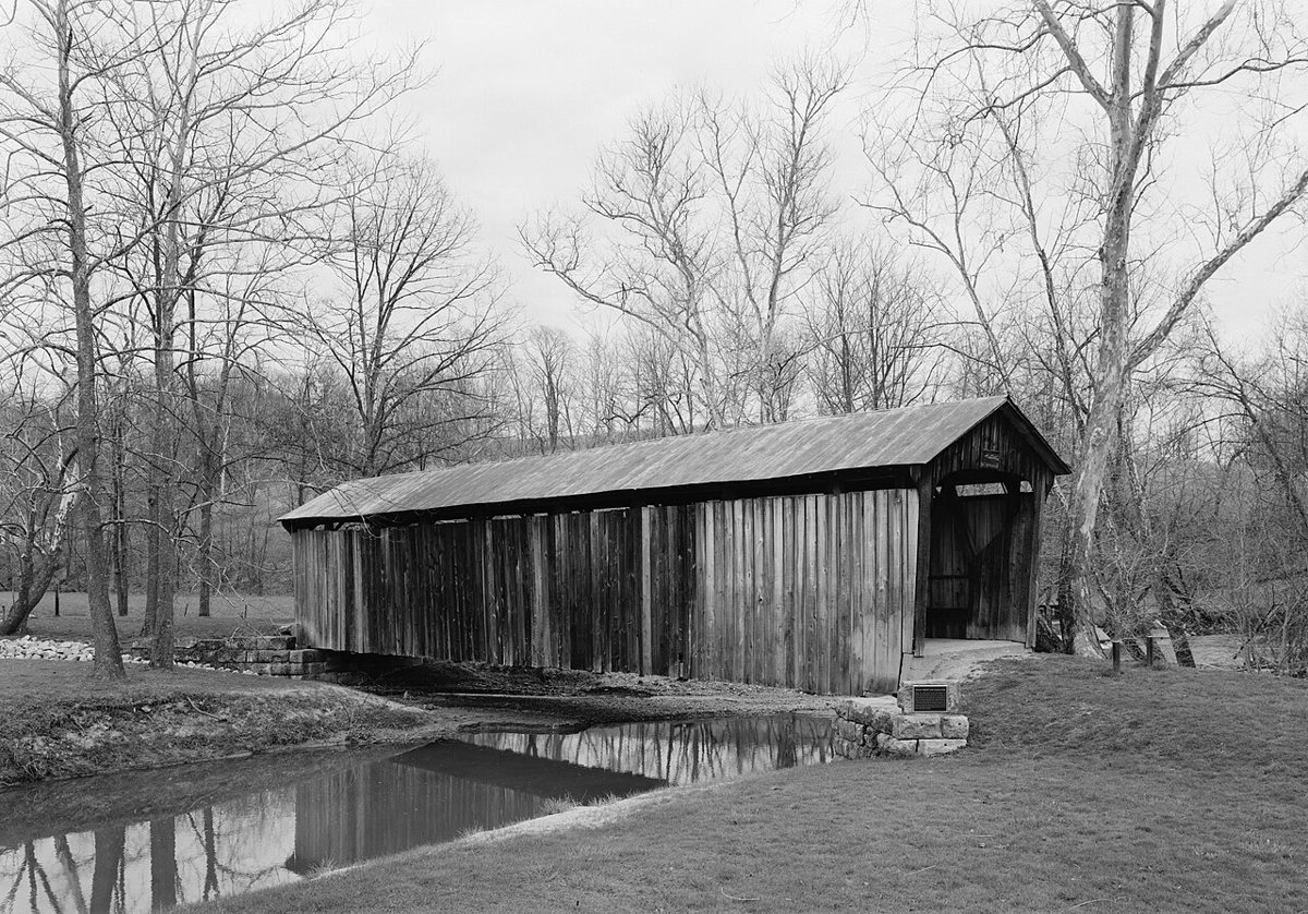
Jet Lowe / Wikimedia Commons · Public domain Allow about 55 minutes for the 34.5 miles to Salt Creek Covered Bridge, near Norwich in Muskingum County. It's described as the only surviving pure Warren truss covered bridge in the US. The bridge dates to 1876, measures 87 ft and was rehabilitated in 1998.
-
↓ 69.7 miles, about 1 hr 48 min
6. Knowlton Covered Bridge
Monroe County, Ohio
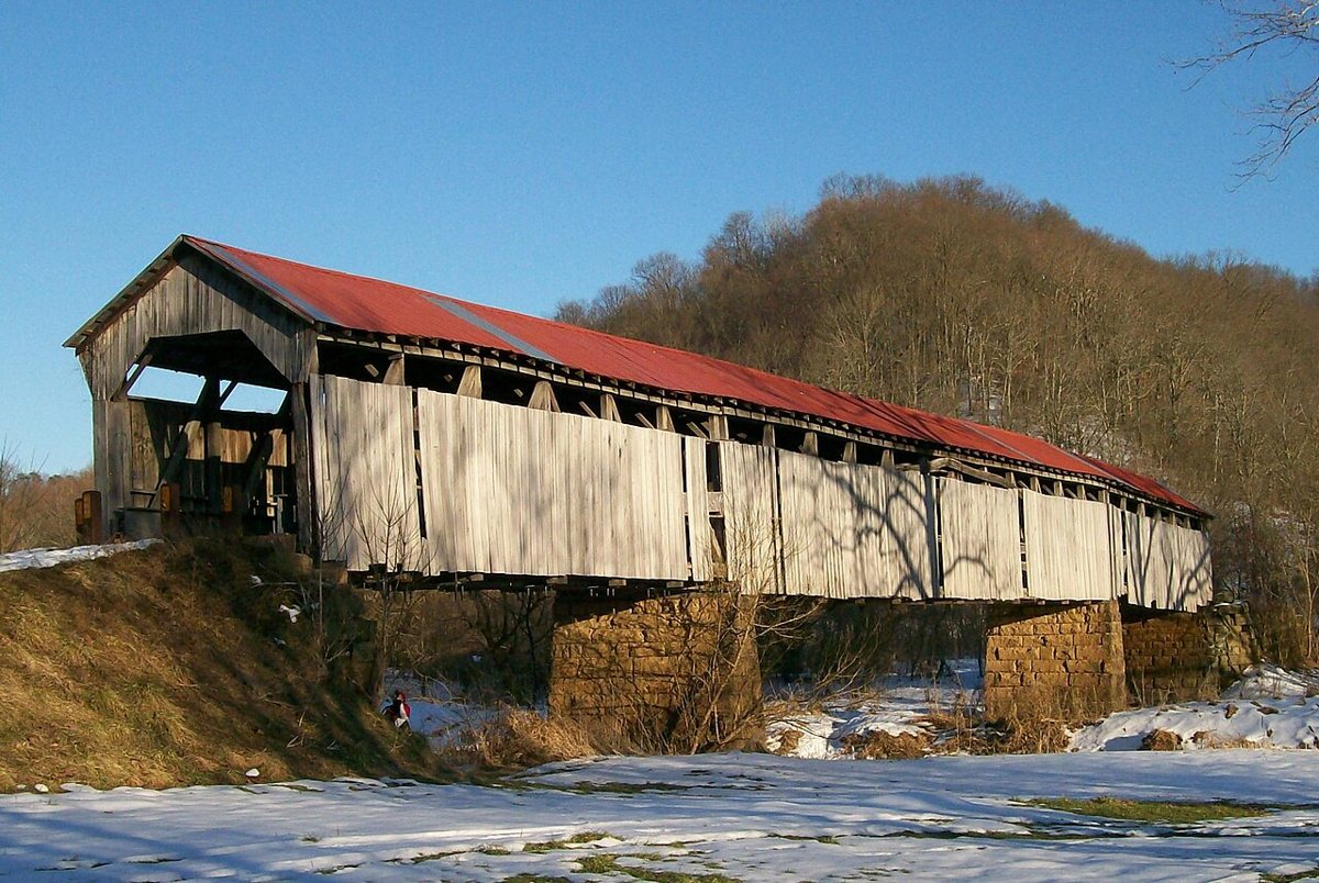
Bwsmith84 (talk) / Wikimedia Commons · CC BY 3.0 Set aside about 108 minutes for the 69.7-mile drive to Knowlton Covered Bridge over the Little Muskingum River in Monroe County's Washington Township. Its center span collapsed in July 2019 and its south span in June 2020. The surviving span was repaired and two were rebuilt from local white oak, with work finishing in 2024, so old and new parts sit together. Sources give 192 or 195 ft.
-
↓ 14.2 miles, about 23 min
7. Hune Covered Bridge
Washington County, Ohio · built 1879
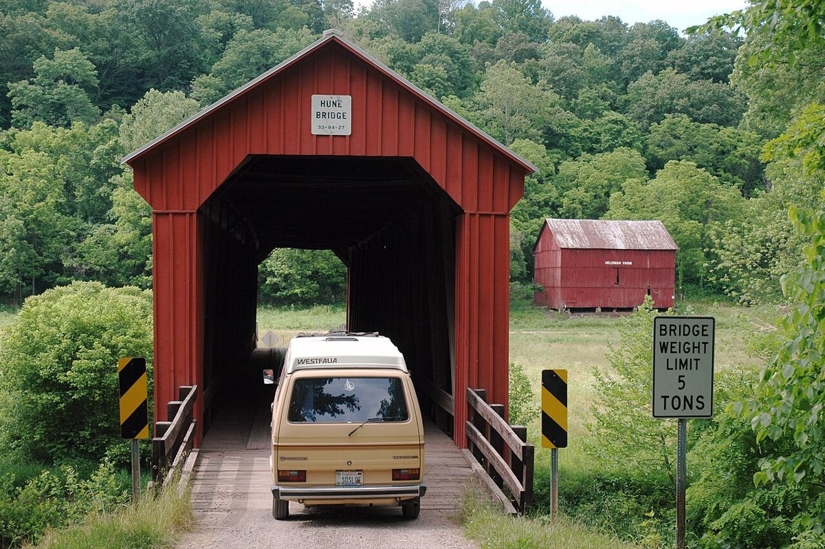
Linda Tanner / Wikimedia Commons · CC BY 2.0 Staying with the Little Muskingum River, Hune Covered Bridge is 14.2 miles and about 23 minutes away in Washington County. Rolla Merydith built this Long-truss bridge in 1879. Its length depends on what's being measured. Some sources give a 128 to 129 ft span, others a 164 ft total.
-
↓ 12.5 miles, about 19 min
8. Hildreth Covered Bridge
Washington County, Ohio
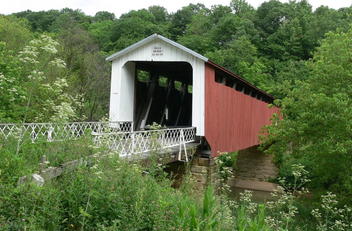
Linda Tanner / Wikimedia Commons · CC BY 2.0 Also called Hills Covered Bridge, Hildreth is a short hop of 12.5 miles, about 19 minutes, along the Little Muskingum. It closed in 2016 because of rot, was restored with about $900K in mostly federal funds, and reopened to pedestrians in November 2023. Build dates on record are 1878, 1881 or 1871 to 1881, and lengths 122, 128 or 140.5 ft.
-
↓ 28.1 miles, about 56 min
9. Shinn Covered Bridge
Washington County, Ohio · built 1886
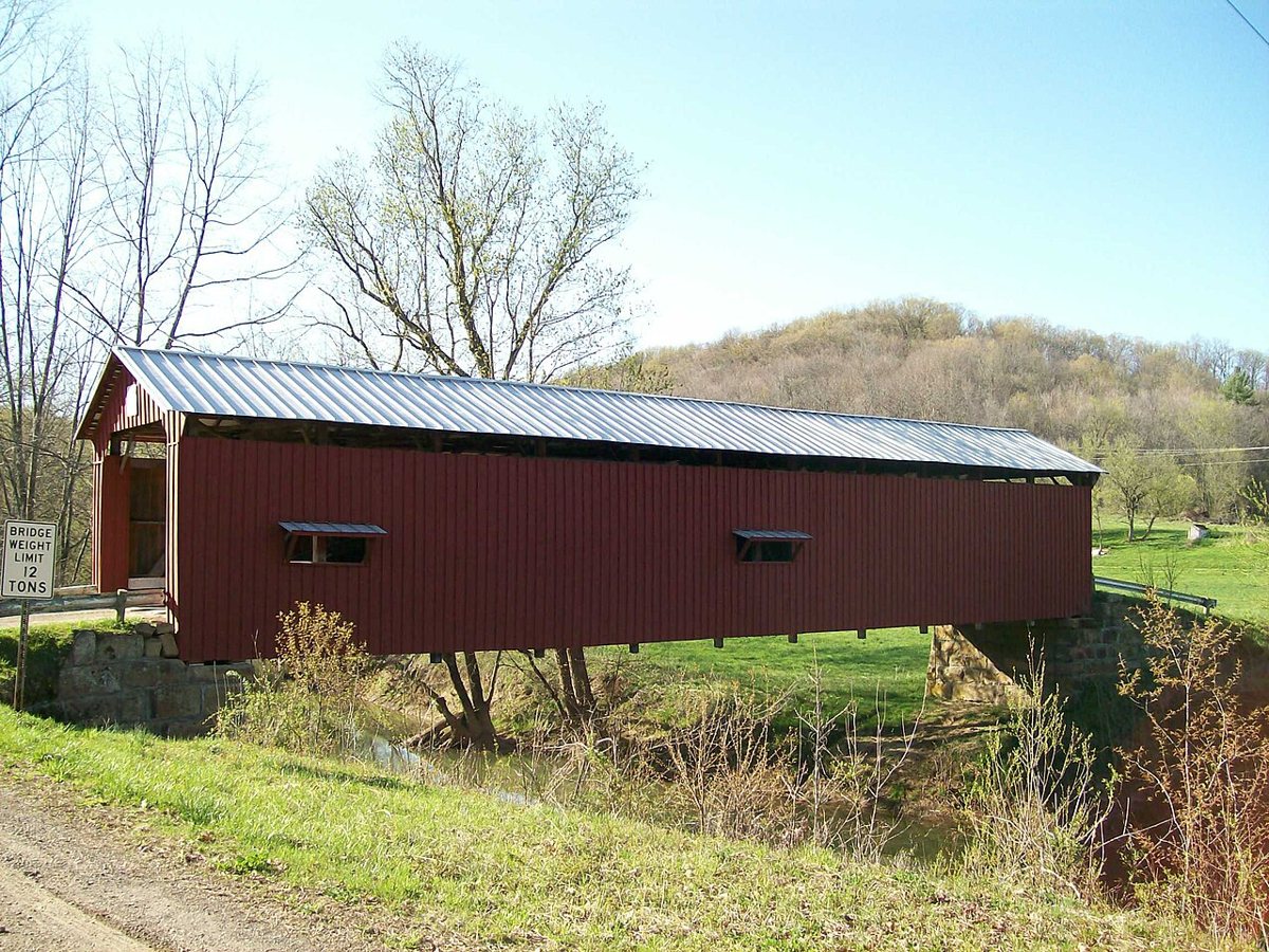
Bwsmith84 (talk) / Bwsmith84 at en.wikipedia / Wikimedia Commons · CC BY 3.0 Plan on about 56 minutes for the 28.1 miles to Shinn Covered Bridge, a Burr arch truss over West Branch Wolf Creek in Washington County. It was built in 1886 and rehabilitated in 1998. Measurements don't line up across sources, which give 98, 90 and 100.1 ft.
-
↓ 11.5 miles, about 34 min
10. Root Covered Bridge
Washington County, Ohio · built 1878
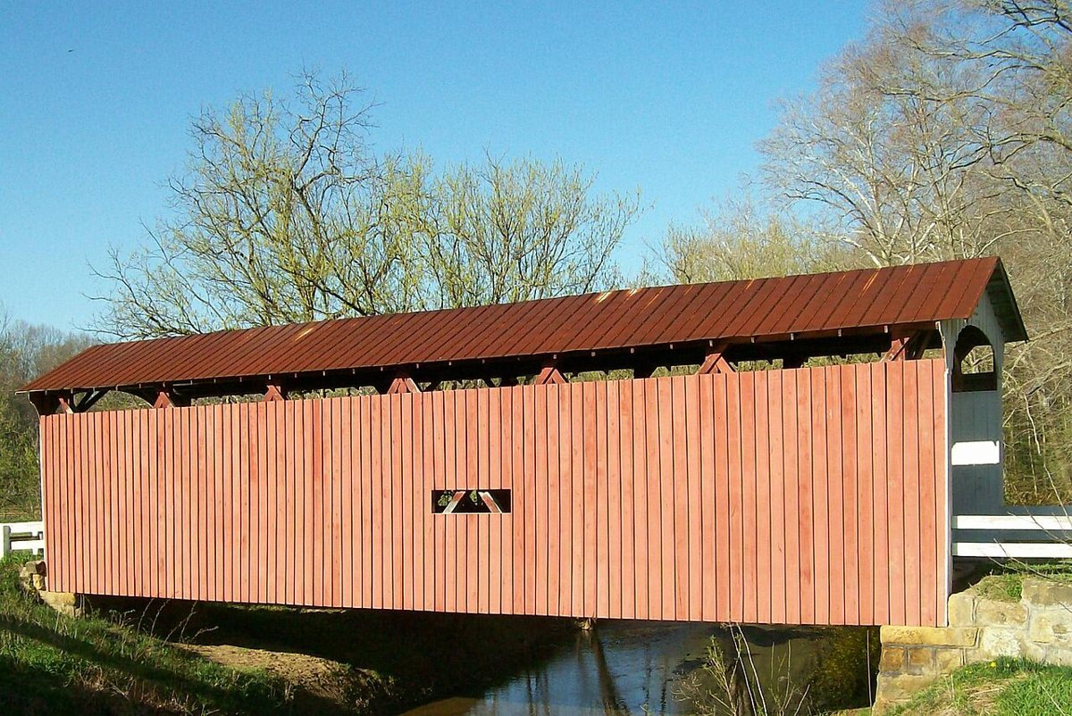
Bwsmith84 (talk) / Wikimedia Commons · CC BY 3.0 Root Covered Bridge, near Decaturville, is a rare Long-truss bridge that a modern bridge bypassed in 1975. The NRHP gives 1878 as its build year, while a 2015 Marietta Times article says 1888. The one length on record, 70 ft 6 in, comes from the NRHP nomination text. It's 11.5 miles and about 34 minutes from Shinn.
-
↓ 27.7 miles, about 46 min
11. Blackwood Covered Bridge
Athens County, Ohio · built 1881
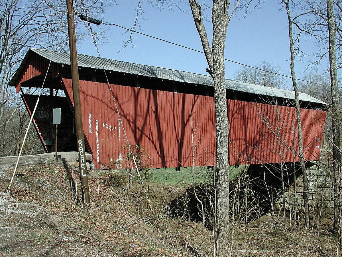
Jaknouse / Wikimedia Commons · CC BY-SA 3.0 Finish back in Athens County, 27.7 miles and about 46 minutes on, at Blackwood Covered Bridge. This single-span kingpost bridge over the Shade River was built in 1881 and listed on the National Register in 1978. One non-official source suggests 1879 and 70 ft instead, but neither claim could be confirmed.
Every stop on this route links to its own page with coordinates, sourced facts and image licences. The text above was written from those records and checked against them before publishing. More covered bridges: all covered bridges in Ohio.