 Wayfarrow
Lane and Lincoln Counties, Oregon Covered Bridge Road Trip: 11 Bridges, About 8 Hours of Driving
11 stops279 milesabout 7 hr 49 min of drivingLane and Lincoln Counties, Oregon
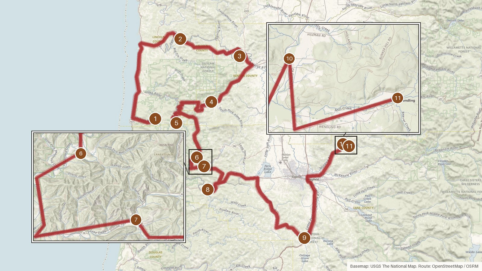
This loop links 11 covered bridges across Lincoln, Benton and Lane counties in western Oregon. It covers 279 miles, with just under eight hours of driving in total. It starts near the coast on the North Fork Yachats River and heads inland over the Yaquina, Marys and Alsea rivers and Five Rivers. From there it works toward the Siuslaw River at Austa and down to the Coast Fork Willamette at Cottage Grove, then finishes on Mill Creek. Most of the bridges are Howe trusses, and all 11 are listed on the National Register of Historic Places. Their recorded dates run from 1918 to 1938, and many have been rehabilitated, restored or rebuilt since, from the 1980s work on several spans to Chambers' 2011 reconstruction. The legs add up, so start early, and check access locally before you set out. Cell coverage can be patchy in the rural stretches between stops.
Route and drive times from OpenStreetMap routing (OSRM). Times are estimates without stops; roads to remote sites can be unpaved or seasonal.
-
1. North Fork of the Yachats Bridge
Lincoln County, Oregon · built 1938
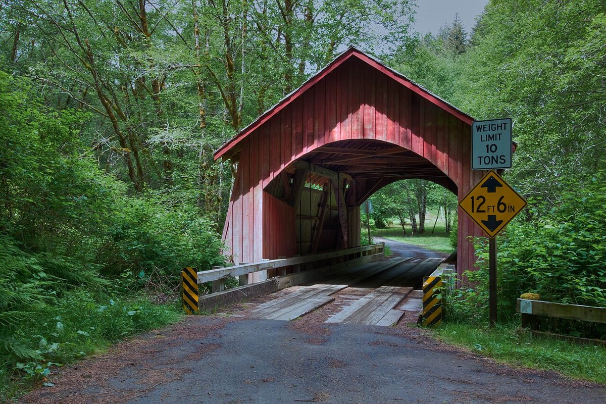
Sandy Horvath-Dori from Grand Junction, CO, USA / Wikimedia Commons · CC BY 2.0 The route opens with Otis Hamer's last covered bridge, a 1938 queenpost truss over the North Fork Yachats River and one of Oregon's shortest at 42 ft. Wikidata lists 78.1 ft, but every other source agrees on 42. The trusses were replaced in a 1989 rehabilitation, and a further restoration project was planned around 2020.
Facts, map and sources for North Fork of the Yachats Bridge →
-
↓ 48.1 miles, about 1 hr 17 min
2. Chitwood Bridge
Lincoln County, Oregon · built 1926
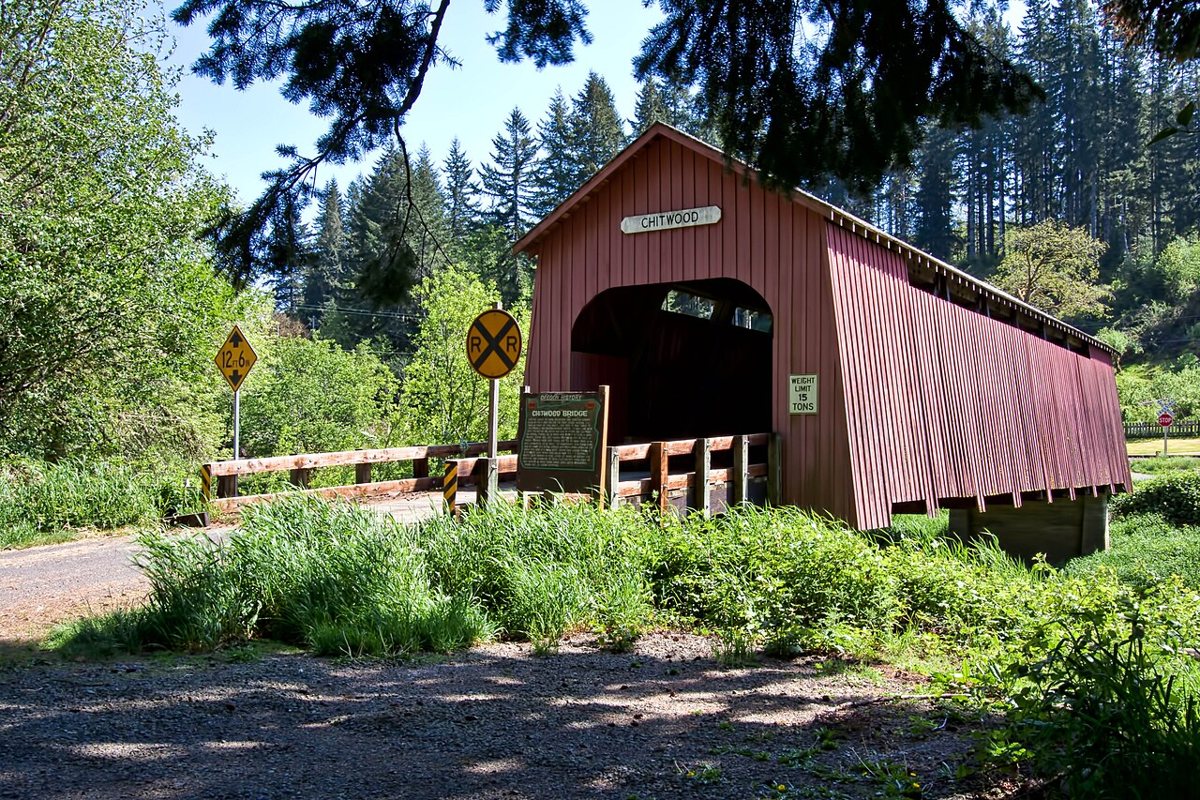
Sandy Horvath-Dori from Grand Junction, CO, USA / Wikimedia Commons · CC BY 2.0 About 77 minutes and 48.1 miles on from the Yachats bridge, Chitwood Bridge crosses the Yaquina River. It dates from 1926 and is a 96-ft Howe truss span, stretching to about 162 ft once the approaches are counted. It was rehabilitated or reconstructed in 1984.
-
↓ 28.4 miles, about 48 min
3. Harris Bridge
Benton County, Oregon
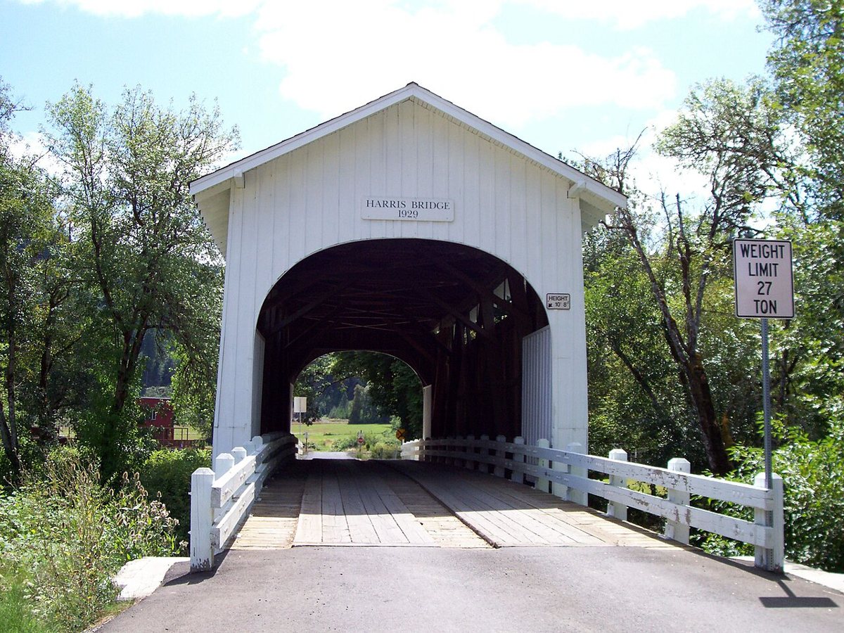
46percent / Wikimedia Commons · Public domain A 48-minute drive takes you into Benton County and Harris Bridge near Wren, a Howe truss over the Marys River. Its age is a small local argument. County records say 1936, while locals and the bridge sign say 1929. The length figures don't agree either, with sources giving 75 ft or 137 ft.
-
↓ 25.4 miles, about 43 min
4. Hayden Bridge
Benton County, Oregon
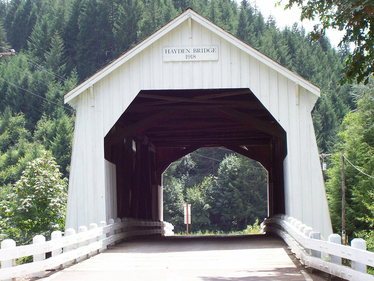
46percent / Wikimedia Commons · Public domain Hayden Bridge is 25.4 miles further on, about 43 minutes, over the Alsea River. This Howe truss is dated 1918 but was partly or fully rebuilt in 1945. The covered span measures 91 ft, and one source puts the overall length at 150 ft.
-
↓ 27.2 miles, about 38 min
5. Fisher School Bridge
Lincoln County, Oregon
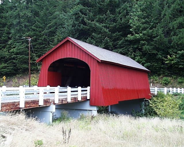
Katr67 / Wikimedia Commons · Public domain Back in Lincoln County, 38 minutes from Hayden, Fisher School Bridge spans Five Rivers. Records split on whether it went up in 1919 or 1927. The 72-ft Howe truss hasn't always stood in the same spot. In 2003 to 2004 it was taken apart and rebuilt about 50 ft downstream.
-
↓ 30.2 miles, about 1 hr 6 min
6. Deadwood Creek Bridge
Lane County, Oregon · built 1932
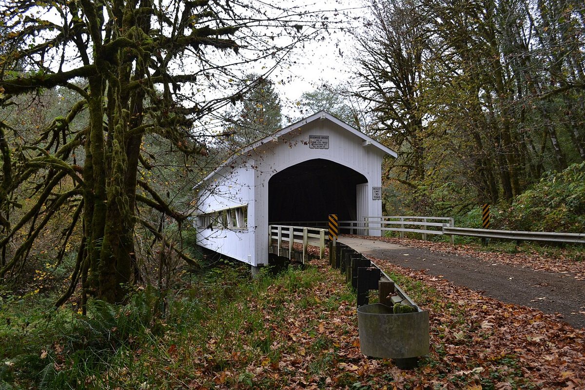
Visitor7 / Wikimedia Commons · CC BY-SA 3.0 Allow a little over an hour, 66 minutes, for the 30.2 miles into Lane County and Deadwood Creek Bridge. Built in 1932, this 105-ft Howe truss has a floor laid on a slant for traffic coming round the curve. A concrete bridge bypassed it in the 1970s, and it was restored and reopened to vehicles in 1986.
-
↓ 9.8 miles, about 20 min
7. Lake Creek Bridge
Lane County, Oregon · built 1928
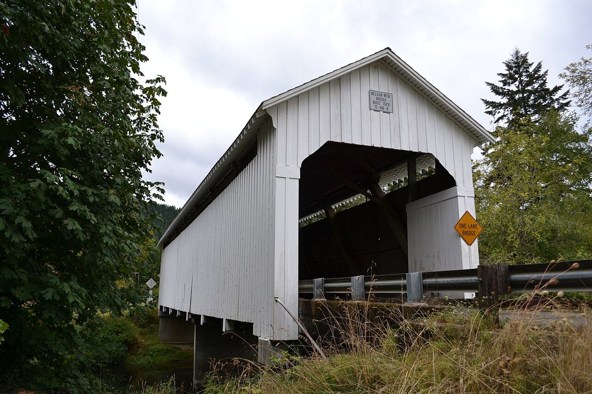
Visitor7 / Wikimedia Commons · CC BY-SA 3.0 Only 20 minutes away, Lake Creek Bridge crosses Lake Creek on a 105-ft Howe truss. It's also known as Nelson Mountain Bridge. It went up in 1928 and was renovated in 1984. It's the same length as Deadwood Creek, which makes for an easy comparison back to back.
-
↓ 17.1 miles, about 37 min
8. Wildcat Creek Bridge
Lane County, Oregon · built 1925
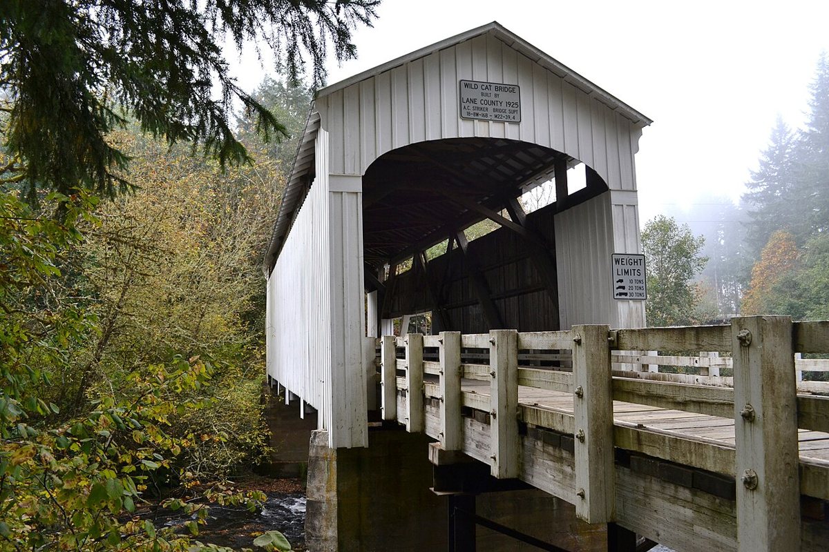
Visitor7 / Wikimedia Commons · CC BY-SA 3.0 Lane County built Wildcat Creek Bridge in 1925 at Austa, near where Wildcat Creek meets the Siuslaw River. It's about 37 minutes on from Lake Creek. The Howe truss was listed on the National Register in 1979, and its 75-ft figure is the span length given in that nomination.
-
↓ 51.6 miles, about 1 hr 17 min
9. Chambers Covered Bridge
Lane County, Oregon · built 2011
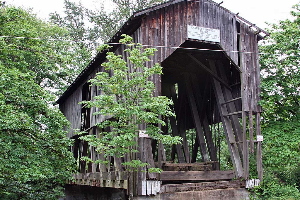
Bruce Fingerhood from Springfield, Oregon, US / Wikimedia Commons · CC BY 2.0 Plan on about 77 minutes for the 51.6 miles to Cottage Grove and Chambers Covered Bridge, a 1925 covered railroad bridge over the Coast Fork Willamette River. After it began leaning, it was taken apart in an emergency in 2010. It was rebuilt on site in 2011 using original materials where possible. Tourism sources give its length as 78 ft, but the project engineer, DOWL, says 92.
-
↓ 37.9 miles, about 55 min
10. Earnest Bridge
Lane County, Oregon · built 1938
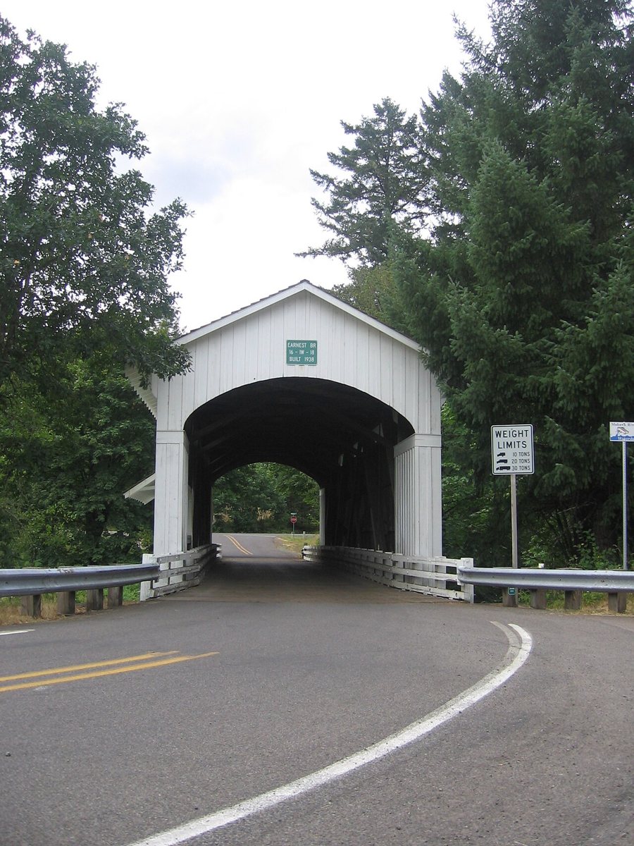
Laura Alier / Wikimedia Commons · CC BY-SA 3.0 Film fans may know Earnest Bridge from the 1965 film Shenandoah. The National Register spells it 'Ernest'. This 75-ft Howe truss dates from 1938 and replaced the 1903 Adams Bridge. It's about 55 minutes and 37.9 miles on from Chambers.
-
↓ 3.3 miles, about 8 min
11. Wendling Bridge
Lane County, Oregon · built 1938
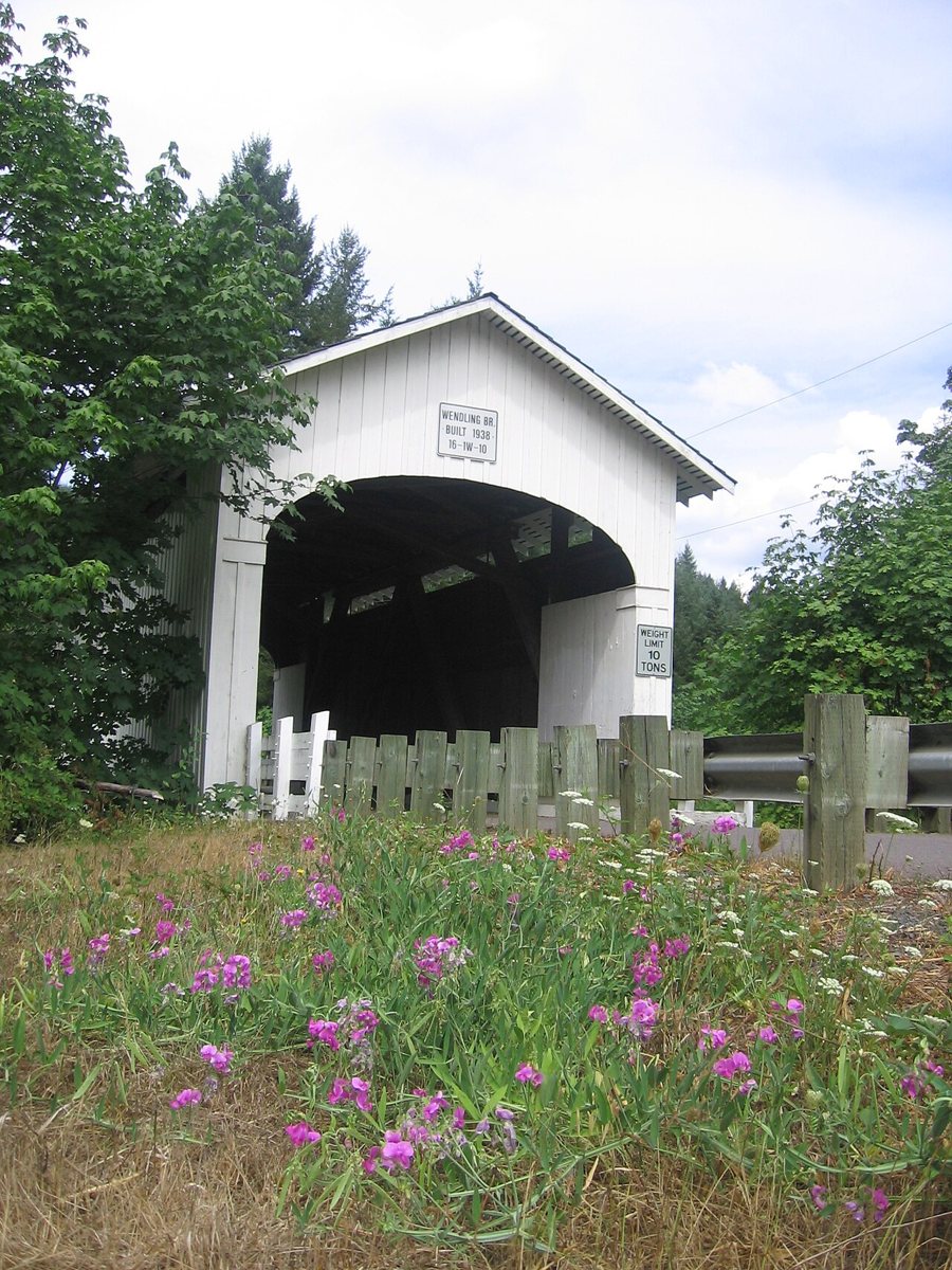
Laura Alier / Wikimedia Commons · CC BY-SA 3.0 The last stop is close by, just 3.3 miles and about 8 minutes from Earnest. Lane County built Wendling Bridge over Mill Creek in 1938 for $2,241, and it's a 60-ft Howe truss. Bridgehunter alone gives 1936 and an 85-ft total length, probably counting the approaches.
Every stop on this route links to its own page with coordinates, sourced facts and image licences. The text above was written from those records and checked against them before publishing. More covered bridges: all covered bridges in Oregon.