 Wayfarrow
Newport and Washington Counties, Rhode Island Lighthouse Road Trip: 11 Lights, About 7 Hours of Driving
11 stops167 milesabout 6 hr 35 min of drivingNewport and Washington Counties, Rhode Island
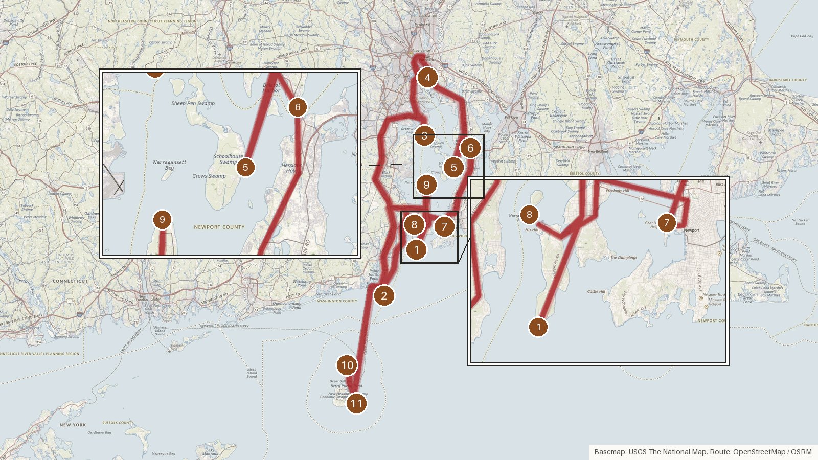
This route strings together 11 lighthouses across Rhode Island, covering 167 miles with about six and a half hours of driving, going by the leg times. Most stops are in Newport and Washington counties, and the route also takes in lights in Kent, Providence and Bristol counties, including one on the Providence River. The current towers span more than a century, from the granite Prudence Island Light, built in 1823, to Warwick's cast-iron tower of 1932. Several stand where earlier towers burned, fell in storms or were torn down. A number went dark over the years: Bristol Ferry in 1927, Conanicut Island in 1933, Pomham Rocks in 1974 and Dutch Island in 1979. Some have since been relit. Every stop is on the National Register of Historic Places. Start early, check access for each site locally before setting out, and expect cell coverage to be patchy in places.
Route and drive times from OpenStreetMap routing (OSRM). Times are estimates without stops; roads to remote sites can be unpaved or seasonal.
-
1. Beavertail Lighthouse
Newport County, Rhode Island · built 1856
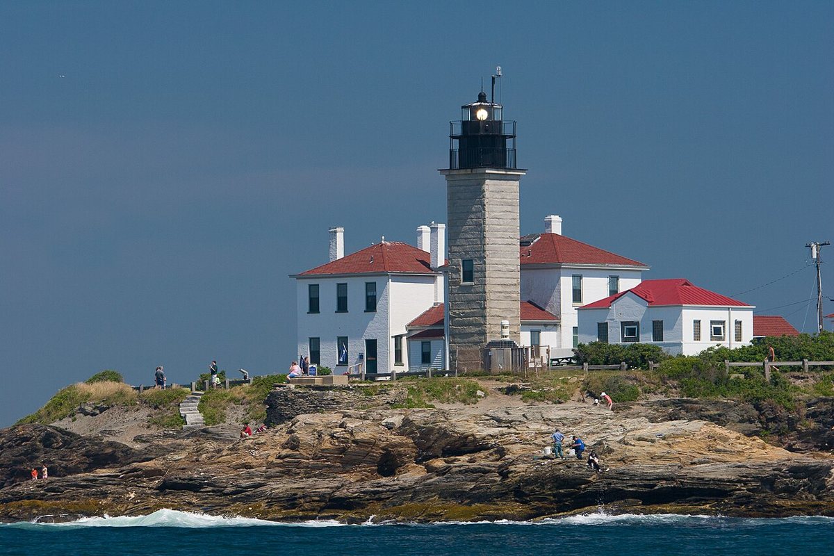
Kenneth C. Zirkel / Wikimedia Commons · CC BY-SA 3.0 Start at Beavertail, where the station goes back to 1749. That first wooden tower burned, and the current square granite tower, the third on the site, dates from 1856. It stands 45 ft, with a focal height of 69 ft. Its white light is listed as flashing every 10 seconds, with a range of 15 nautical miles. It's on the National Register of Historic Places.
-
↓ 22.1 miles, about 41 min
2. Point Judith Light
Washington County, Rhode Island · built 1857
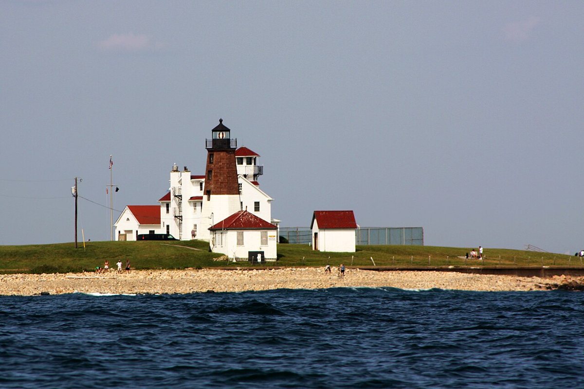
JacobKlinger / Wikimedia Commons · CC BY-SA 3.0 About 41 minutes and 22.1 miles on, Point Judith has a long story of rebuilding. The 1810 wooden tower was destroyed in the Great Gale of 1815. A 35-ft stone tower followed in 1816, and the present brownstone tower dates from 1857. One local letter suggests that year may mark an alteration rather than a full rebuild, though most sources say rebuilt. It stands 51 ft.
-
↓ 32.7 miles, about 52 min
3. Warwick Light
Kent County, Rhode Island · built 1932
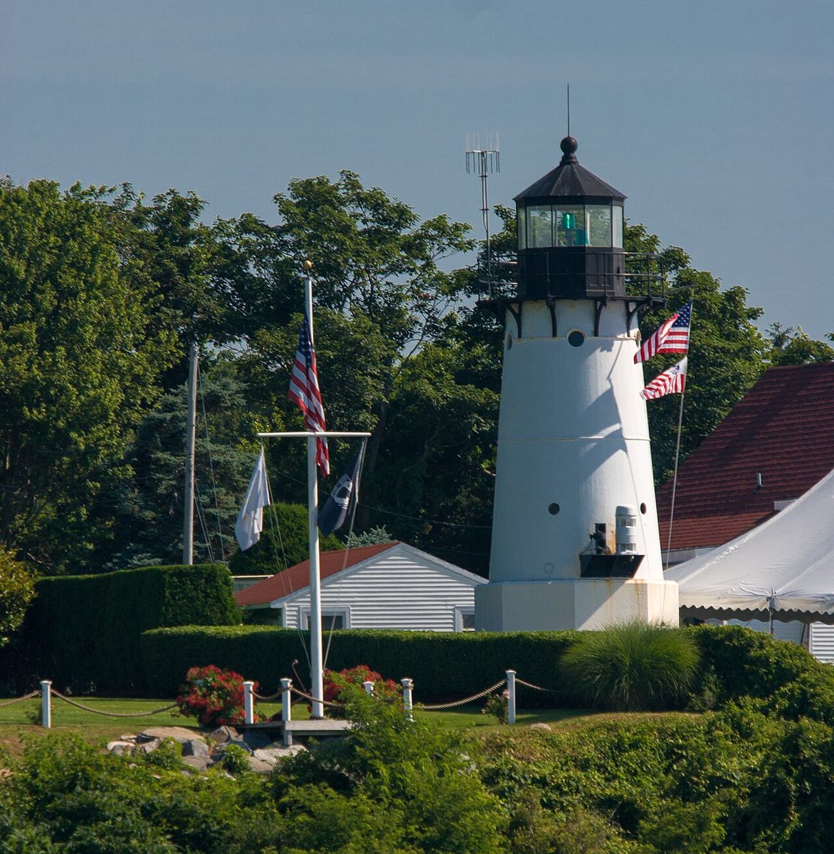
Kenneth C. Zirkel / Wikimedia Commons · CC BY-SA 3.0 Warwick Light, in Kent County, is about 52 minutes up the road. The first light here was a stone tower of 1826-27. The current cast-iron tower went up farther inland in 1932 because of erosion, then was moved another 50 ft inland in 1939 after the 1938 hurricane. Its height depends on the source: most say 51 ft, while Lighthousefriends says 31 ft.
-
↓ 16.2 miles, about 31 min
4. Pomham Rocks Light
Providence County, Rhode Island · built 1871
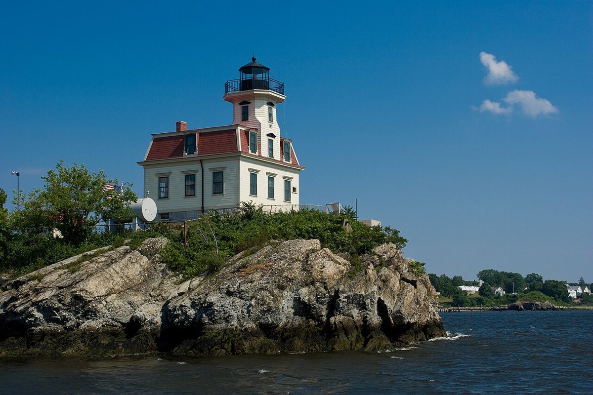
Kenneth C. Zirkel / Wikimedia Commons · CC BY-SA 3.0 Next comes the Providence River and Pomham Rocks, about 31 minutes from Warwick. The original 1871 wooden tower is on the keeper's house. It was dark from 1974 to 2006, and the American Lighthouse Foundation has owned it since 2010. Sources put the tower at 40 or 42 ft. The fixed red light has a focal height of 54 ft.
-
↓ 15.5 miles, about 52 min
5. Prudence Island Light
Newport County, Rhode Island · built 1823
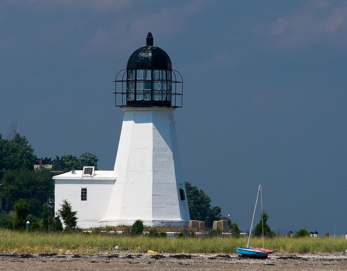
Kenneth C. Zirkel / Wikimedia Commons · CC BY-SA 3.0 Rhode Island's oldest lighthouse, according to the record, is a granite tower built in 1823 on Goat Island in Newport. It was later moved to Sandy Point and lit there in January 1852. Heights vary by source, at 25, 28 or 30 ft. The leg here covers 15.5 miles but takes about 52 minutes, so build in time.
-
↓ 7.1 miles, about 39 min
6. Bristol Ferry Light
Bristol County, Rhode Island · built 1855
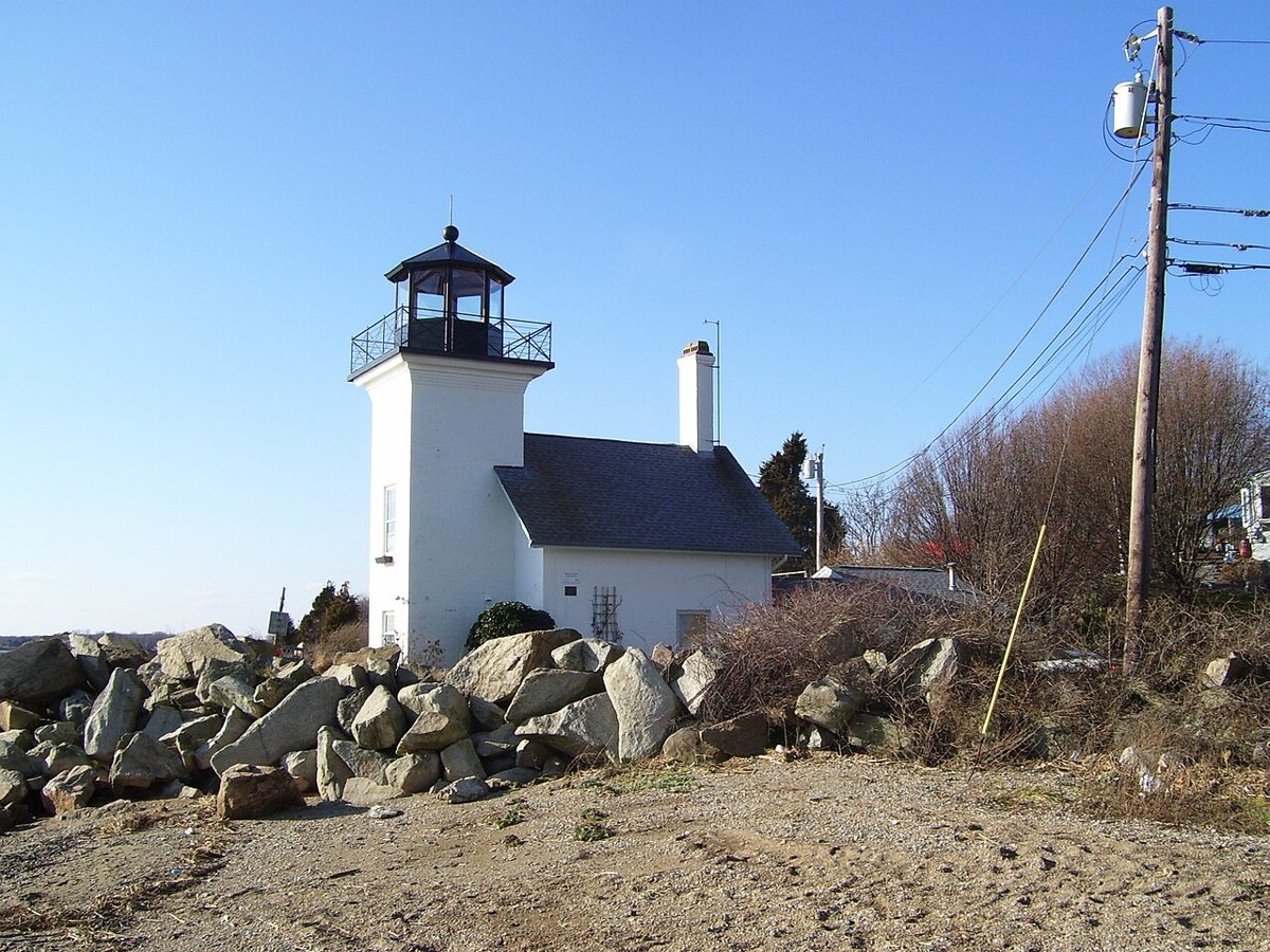
Swampyank at English Wikipedia / Wikimedia Commons · CC BY-SA 3.0 It's only 7.1 miles to Bristol Ferry Light, though the drive runs about 39 minutes. This brick tower with an attached keeper's house was built in 1855 and deactivated in 1927-28. It's now a private residence. The lantern was removed in 1928, and a replica was installed in the 1990s. Sources give the height as 28 or 34 ft.
-
↓ 13.3 miles, about 30 min
7. Newport Harbor Light
Newport County, Rhode Island · built 1842
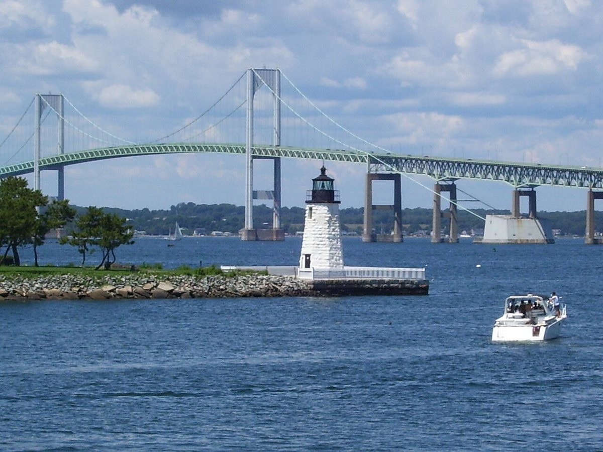
Swampyank at English Wikipedia / Wikimedia Commons · Public domain Half an hour on, Newport Harbor Light ties back to Prudence Island. The 1823 date belongs to the first tower, which was moved there in 1851. The current granite tower was lit in 1842, though one source says it was finished in 1838. It's listed at 35 ft, with some sources saying 29 ft. It shows a fixed green light.
-
↓ 8.1 miles, about 19 min
8. Dutch Island Light
Newport County, Rhode Island · built 1857
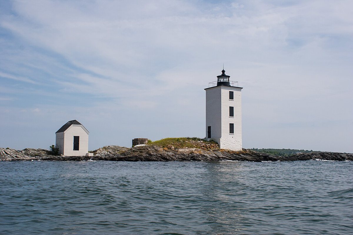
Kenneth C. Zirkel / Wikimedia Commons · CC BY-SA 3.0 Some 19 minutes away, Dutch Island Light is a brick tower from 1857. It replaced an 1826 stone tower, which was torn down. It stands 42 ft with a focal height of 56 ft. The light was shut off in 1979 and relit in 2007. Its listed characteristic is a red flash every 6 seconds.
-
↓ 7.4 miles, about 17 min
9. Conanicut Island Light
Newport County, Rhode Island · built 1886
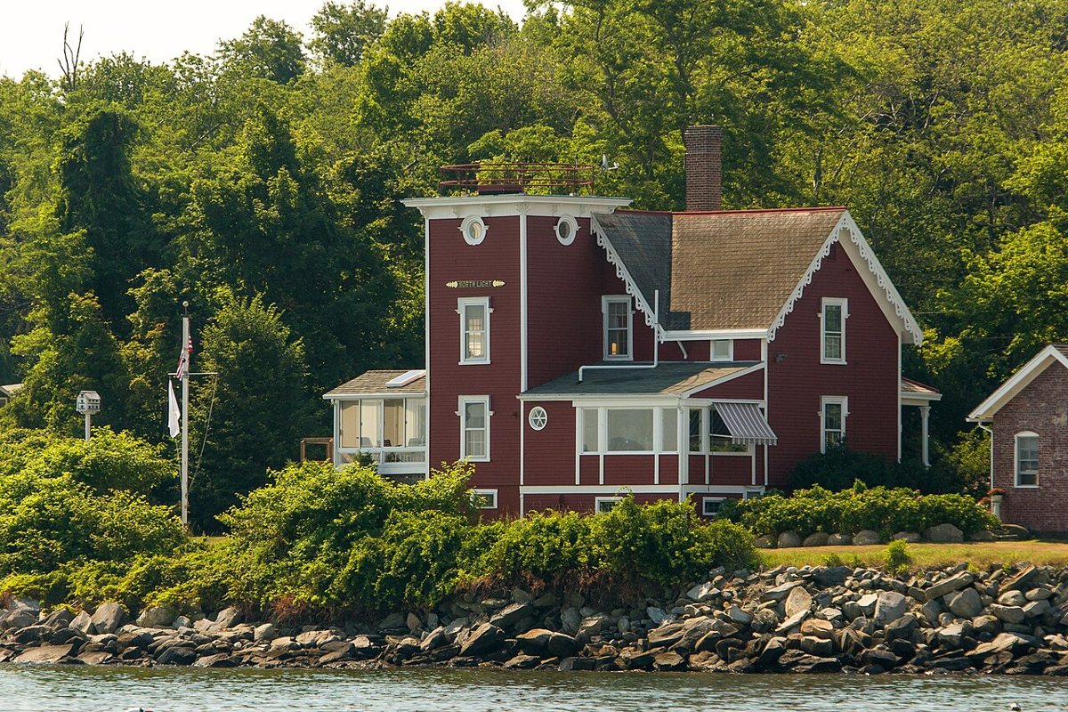
Kenneth C. Zirkel / Wikimedia Commons · CC BY-SA 3.0 A short 17-minute hop brings you to Conanicut Island Light, built in 1886. It was turned off in 1933, when its lantern was removed, and sold as government surplus in 1934. It's now a private residence. Only one source gives a tower height, so the record leaves it blank, and so do we.
-
↓ 39.3 miles, about 1 hr 39 min
10. Block Island North Light
Washington County, Rhode Island · built 1867
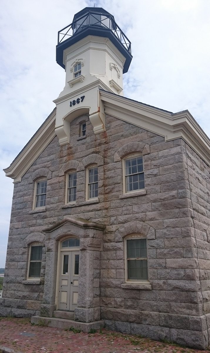
Waz8 / Wikimedia Commons · CC0 Allow about 99 minutes for the 39.3 miles to Block Island North Light. The 1867 granite tower is the fourth lighthouse at Sandy Point. One source says it was built in 1868, but the USCG gives 1867. It stands 55 ft. It was turned off in the 1970s, with the record giving 1973, and relit as a private aid to navigation in 2010.
-
↓ 5.7 miles, about 15 min
11. Block Island Southeast Light
Washington County, Rhode Island · built 1875
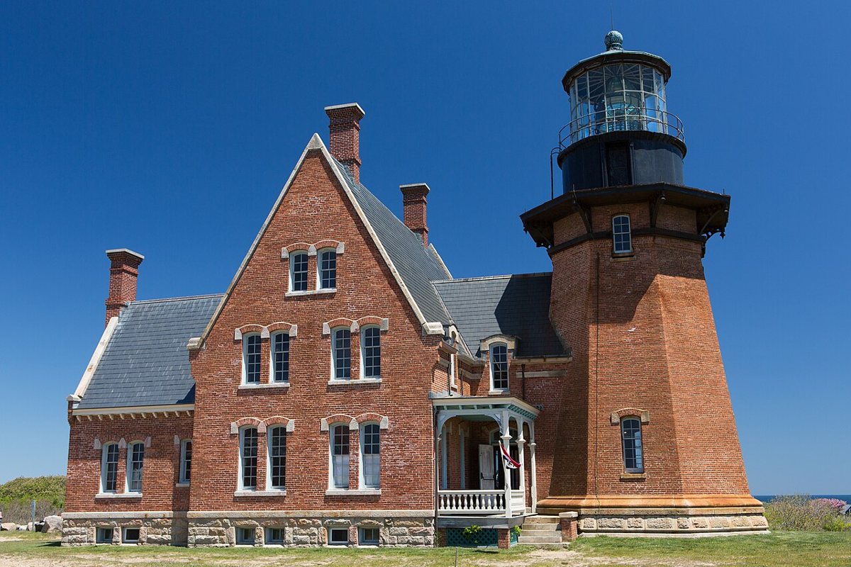
Brett Weinstein / Wikimedia Commons · CC BY-SA 4.0 The final stop is about 15 minutes away. Block Island Southeast Light is a brick tower from 1875, 52 ft tall by the record, though one source says 67 ft. In 1993 the whole lighthouse was moved about 300 ft back from the eroding bluffs. Its focal height is 262 ft, it was deactivated in 1990, and it's a National Historic Landmark.
Every stop on this route links to its own page with coordinates, sourced facts and image licences. The text above was written from those records and checked against them before publishing. More lighthouses: all lighthouses in Rhode Island.