 Wayfarrow
Northern Pennsylvania Covered Bridge Road Trip: 11 Bridges in One Day
11 stops205 milesabout 5 hr 38 min of drivingNorthern Pennsylvania
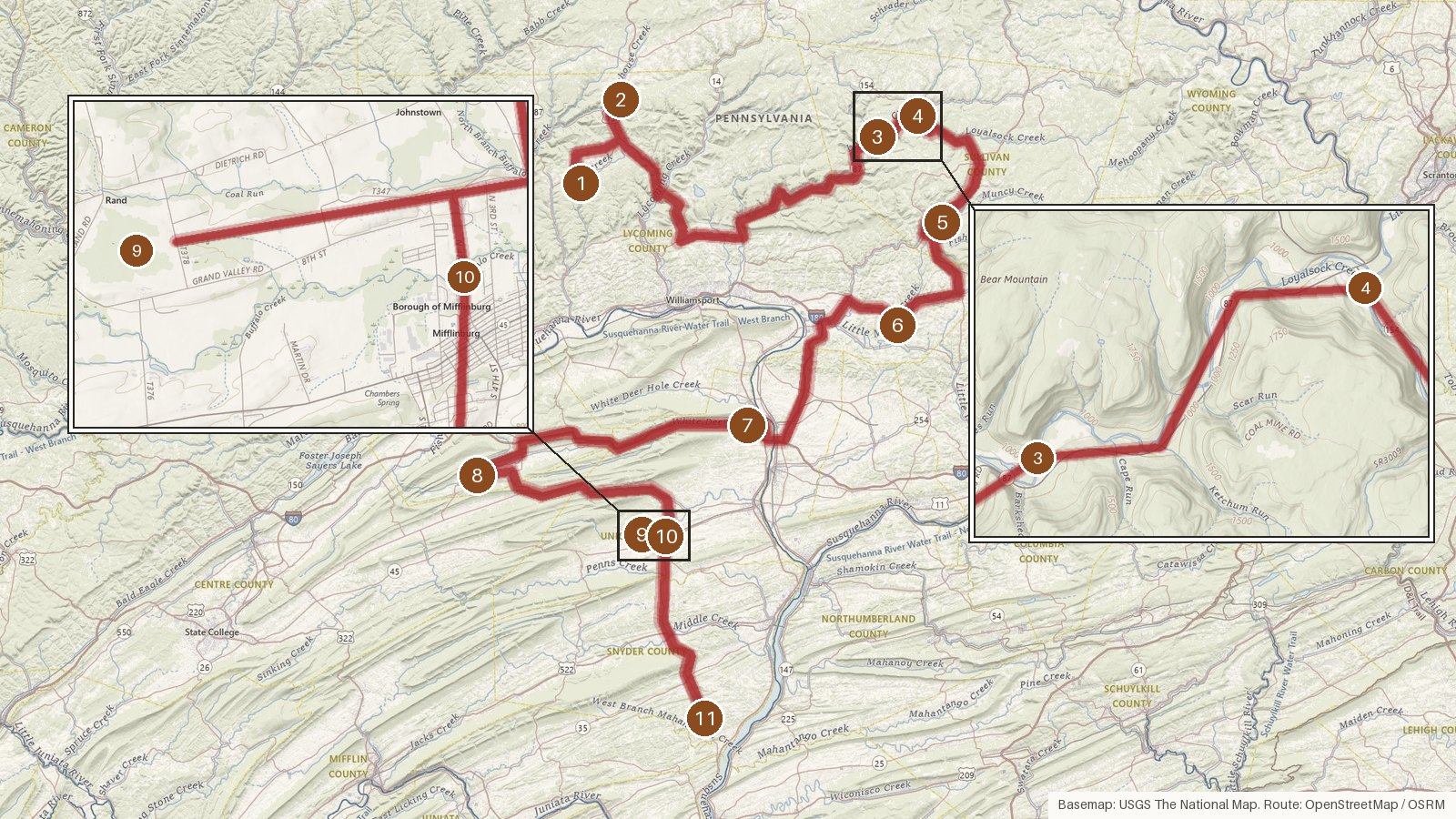
This route links 11 covered bridges across five central Pennsylvania counties: Lycoming, Sullivan, Clinton, Union and Snyder. It covers 205 miles with roughly five hours and forty minutes of driving, so once you add time at each bridge it fills a full day. Every bridge here is listed on the National Register of Historic Places, and the recorded dates run from 1825 at Hassenplug Bridge through the late 1800s. Several are Burr arch trusses, and two, Hillsgrove and Forksville, are credited to the same builder, Sadler Rogers. The waters repeat too. Loyalsock Creek runs under two of the Sullivan County bridges, and Buffalo Creek runs under two in Union County. The last stop, Aline Covered Bridge, was bypassed by a new bridge in 1982. Start early, check access locally before you set out, and expect cell coverage to be patchy on the rural stretches.
Route and drive times from OpenStreetMap routing (OSRM). Times are estimates without stops; roads to remote sites can be unpaved or seasonal.
-
1. Cogan House Covered Bridge
Lycoming County, Pennsylvania · built 1877
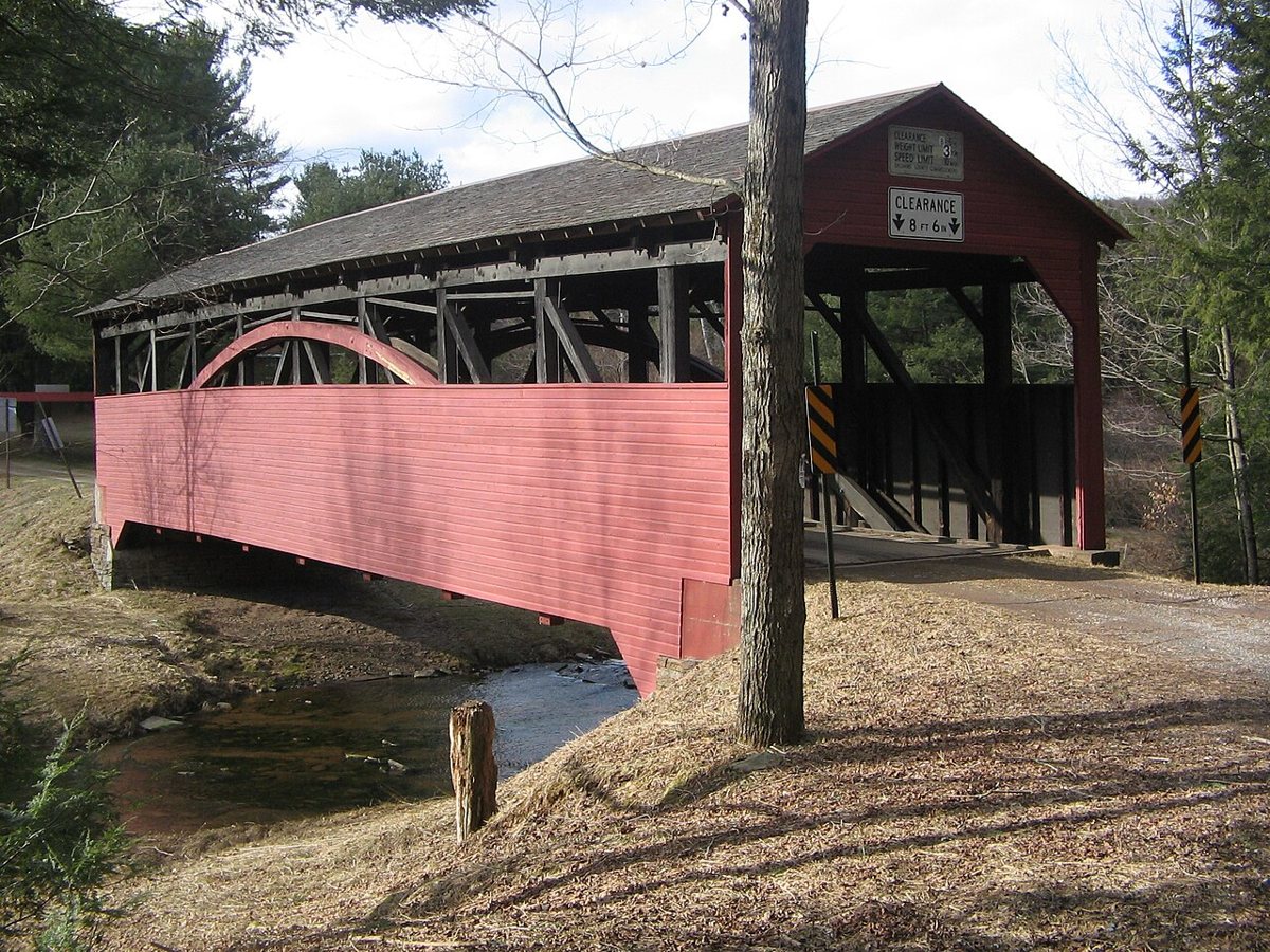
User:Ruhrfisch / Wikimedia Commons · CC BY-SA 3.0 Start in Lycoming County at Cogan House Covered Bridge, also known as Buckhorn Covered Bridge. This wooden Burr arch truss spans Larrys Creek and dates to 1877, with a restoration in 1998. If the length you read elsewhere doesn't match, that's because sources give 82, 93, or 94 ft 2 in. It's NRHP listed, like every stop on this route.
-
↓ 12.3 miles, about 24 min
2. Buttonwood Covered Bridge
Lycoming County, Pennsylvania
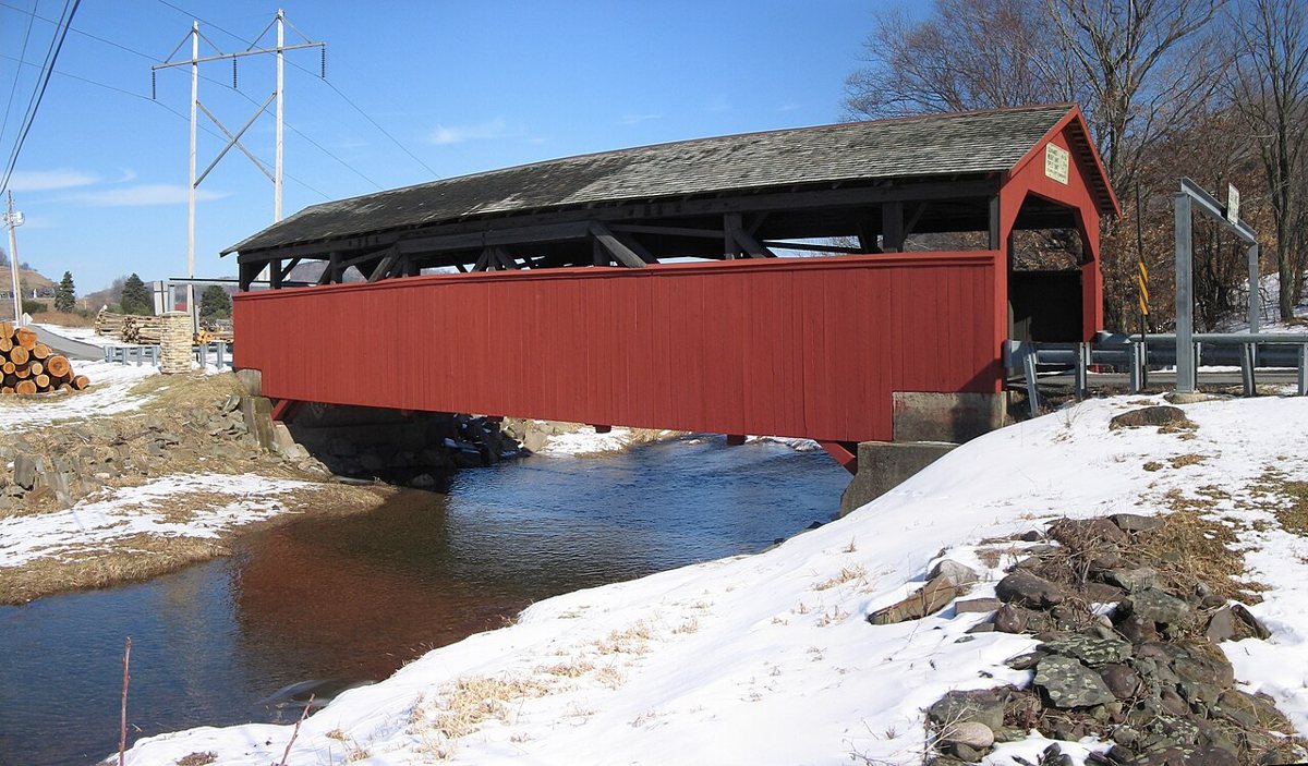
User:Ruhrfisch / Wikimedia Commons · CC BY-SA 3.0 About 24 minutes and 12.3 miles on, Buttonwood Covered Bridge crosses Blockhouse Creek, still in Lycoming County. Its records don't agree on much. Different sources date it to 1878 or 1898, and the NRHP gives its length as 63.5 ft while others say 74 ft. What's settled is its place on the National Register of Historic Places.
-
↓ 46.9 miles, about 1 hr 9 min
3. Hillsgrove Covered Bridge
Sullivan County, Pennsylvania · built 1850
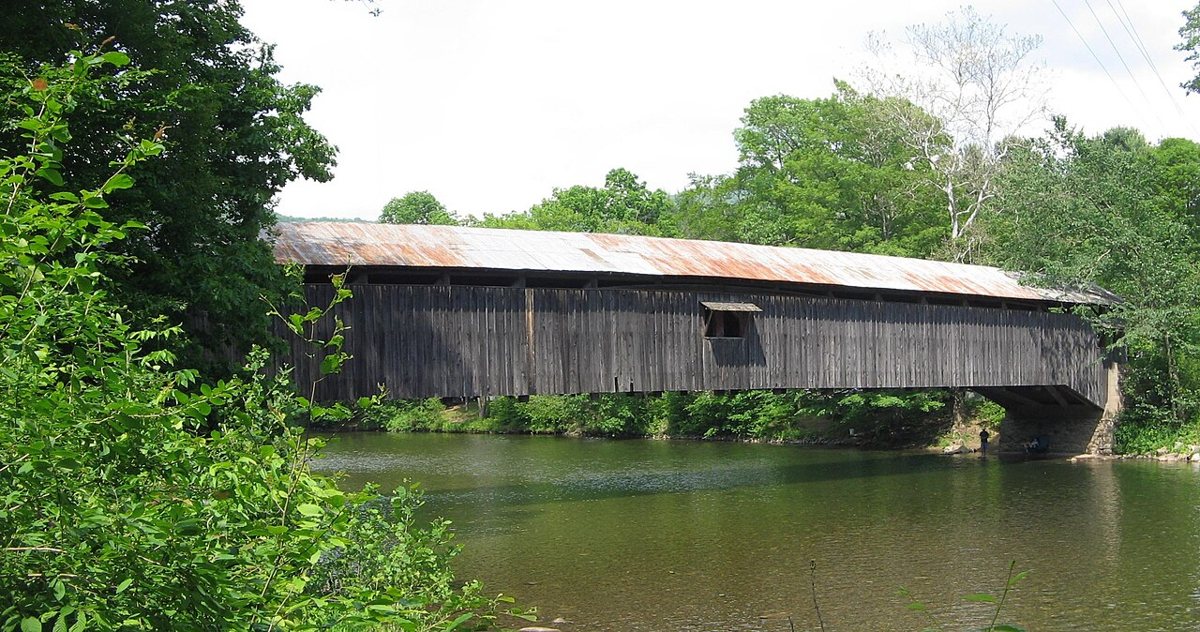
Ruhrfisch / Wikimedia Commons · CC BY-SA 3.0 Settle in for a longer drive here, 46.9 miles and about 69 minutes, into Sullivan County and Hillsgrove Covered Bridge over Loyalsock Creek. Sadler Rogers built it, some sources say about 1850. Tropical Storms Irene and Lee badly damaged it in 2011, and it was restored in 2012. Its length is disputed, with sources giving 186 ft or 171 ft.
-
↓ 5.3 miles, about 9 min
4. Forksville Covered Bridge
Sullivan County, Pennsylvania · built 1850
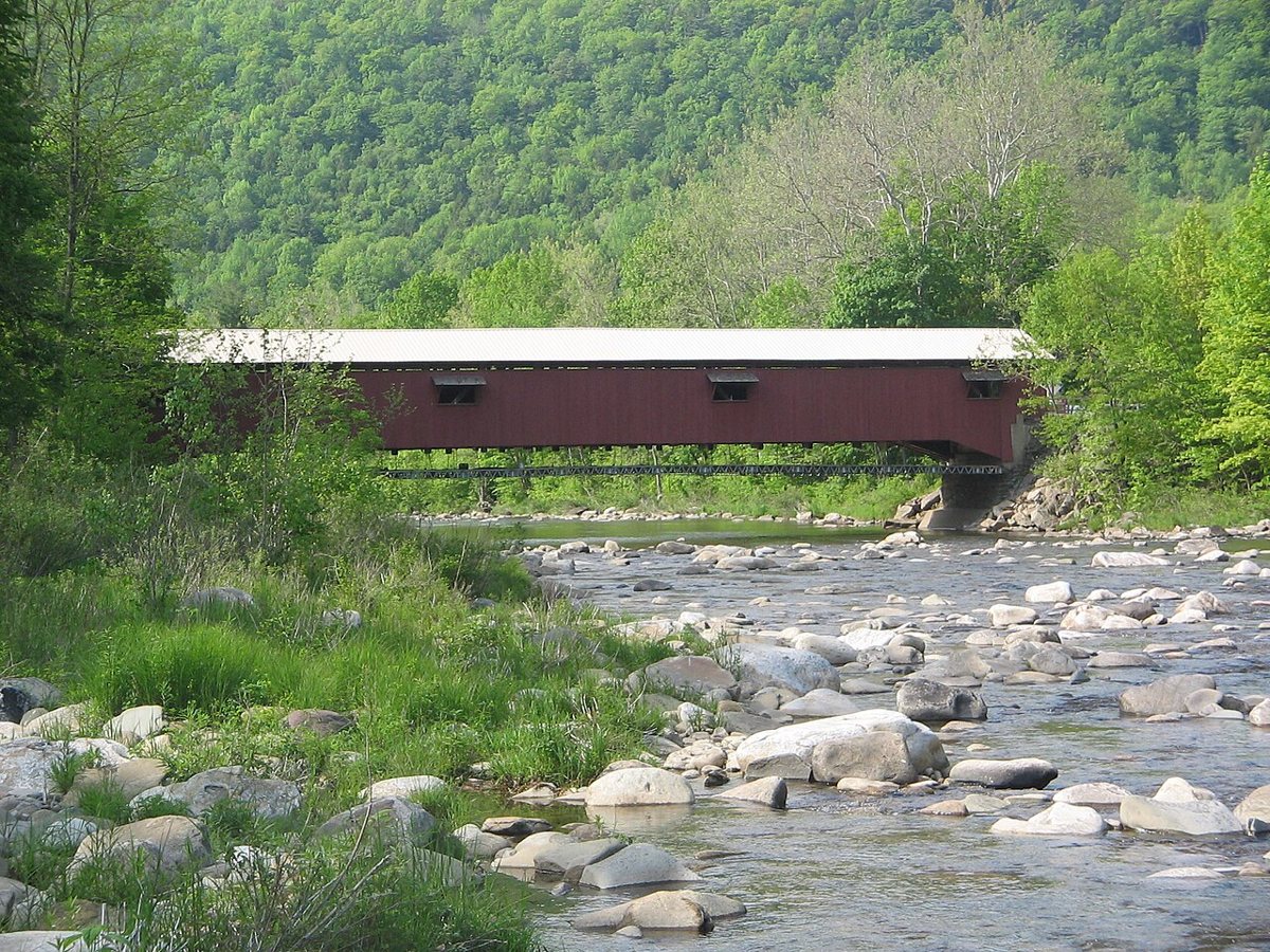
Ruhrfisch / Wikimedia Commons · CC BY-SA 3.0 Just 5.3 miles and about 9 minutes away, Forksville Covered Bridge spans the same Loyalsock Creek. This Burr arch truss dates to 1850 and was built by Sadler Rogers when he was 18. It was restored in 1970 and again in 2004. Most sources put its length at 152 ft 11 in, though the NRHP-based list gives 146 ft.
-
↓ 16.8 miles, about 27 min
5. Sonestown Covered Bridge
Sullivan County, Pennsylvania
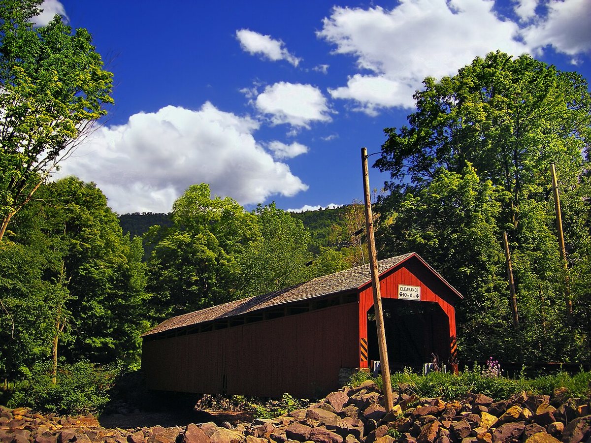
Nicholas / Wikimedia Commons · CC BY 2.0 Muncy Creek is the water under Sonestown Covered Bridge, about 27 minutes from Forksville. The Burr arch bridge is usually dated about 1850, but a Bucknell archive photo says John F. Hazen built it in 1873. Most sources call it 110 ft long, the NRHP list says 99 ft, and it has been repaired several times.
-
↓ 17.5 miles, about 29 min
6. Lairdsville Covered Bridge
Lycoming County, Pennsylvania · built 1888
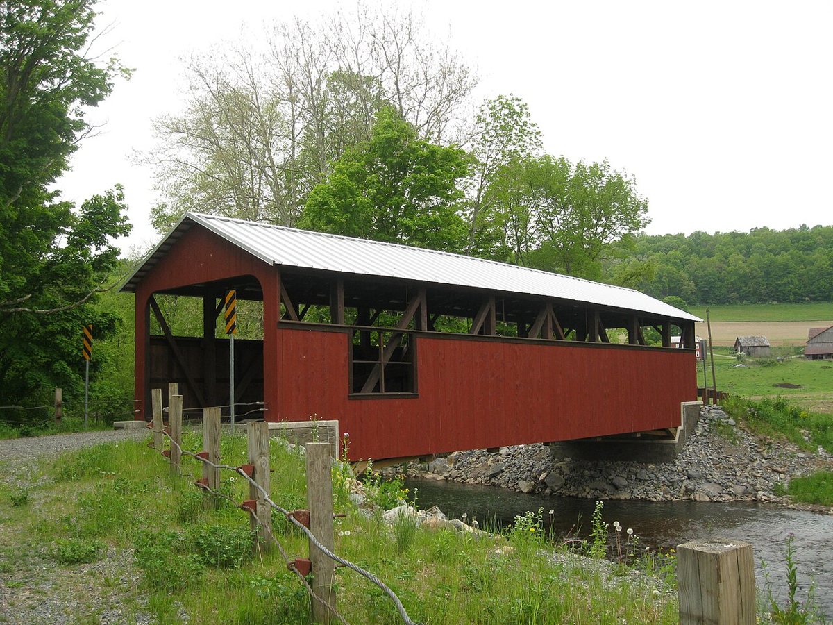
Ruhrfisch / Wikimedia Commons · CC BY-SA 3.0 Back in Lycoming County after about 29 minutes, Lairdsville Covered Bridge goes by a few names, including the Moreland and Frazier Bridge. Built in 1888, this Burr-arch bridge over Little Muncy Creek measures 78 ft. One travel site's figure of 186 ft looks like an error. The road now uses a newer bridge nearby.
-
↓ 27 miles, about 42 min
7. Factory Bridge
Union County, Pennsylvania · built 1880
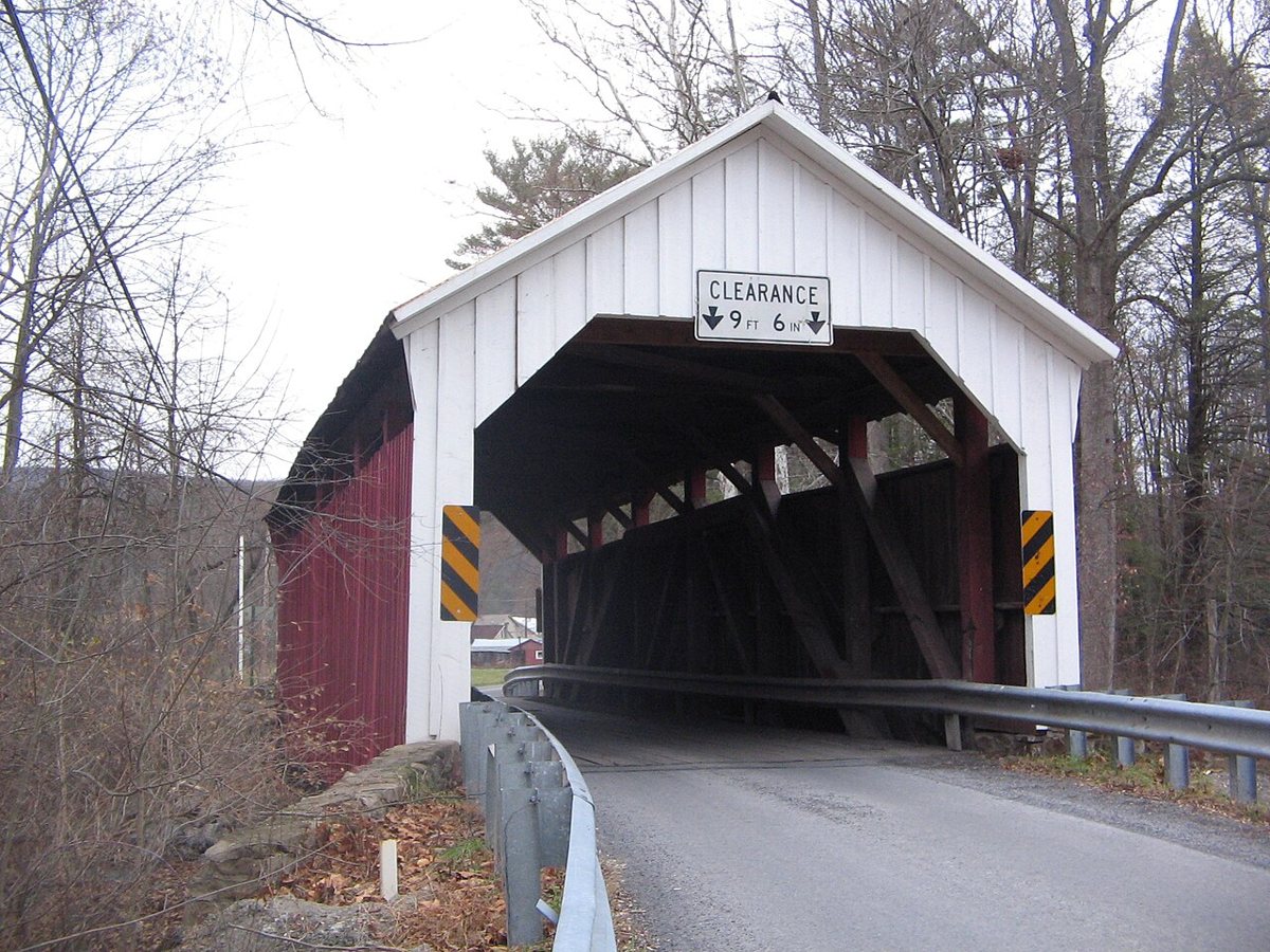
Ruhrfisch / Wikimedia Commons · CC BY-SA 3.0 Allow about 42 minutes and 27 miles to reach Union County and Factory Bridge, also called Horsham Bridge. Unlike the Burr arches earlier in the day, this 60 ft span over White Deer Creek is a king-and-queen truss. It was built in 1880 and repaired in 1954 and again in 1976.
-
↓ 29.3 miles, about 47 min
8. Logan Mills Covered Bridge
Clinton County, Pennsylvania · built 1874
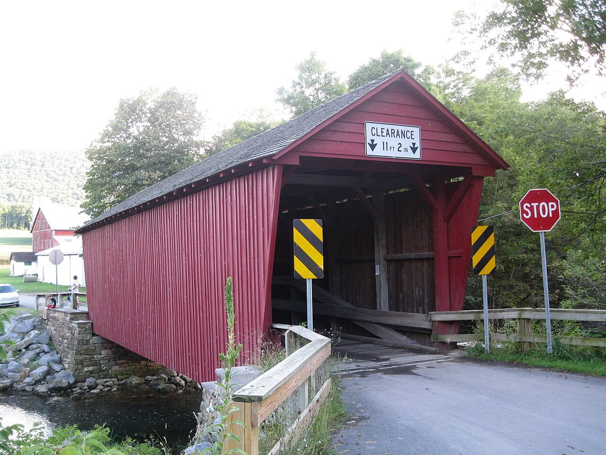
Ruhrfisch / Wikimedia Commons · CC BY-SA 3.0 Logan Mills Covered Bridge is Clinton County's only remaining covered bridge, roughly 47 minutes and 29.3 miles from Factory Bridge. Built in 1874, the queen post truss crosses Fishing Creek, and PennDOT refurbished it in 2003. Its length depends on which source you check, with figures of 55, 63 and 64 ft all on record.
-
↓ 27 miles, about 52 min
9. Hayes Bridge
Union County, Pennsylvania · built 1882
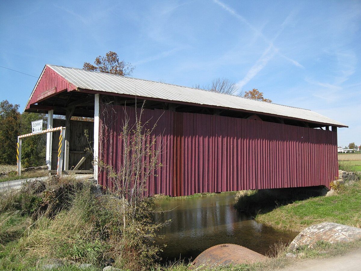
dougtone / Wikimedia Commons · CC BY-SA 2.0 Expect about 52 minutes on the road back into Union County for Hayes Bridge, a king truss over Buffalo Creek west of Mifflinburg. It dates to 1882 and is listed on the National Register of Historic Places. Sources give its length as either 63 ft or 70 ft, so the record leaves that figure blank.
-
↓ 2.9 miles, about 9 min
10. Hassenplug Bridge
Union County, Pennsylvania · built 1825
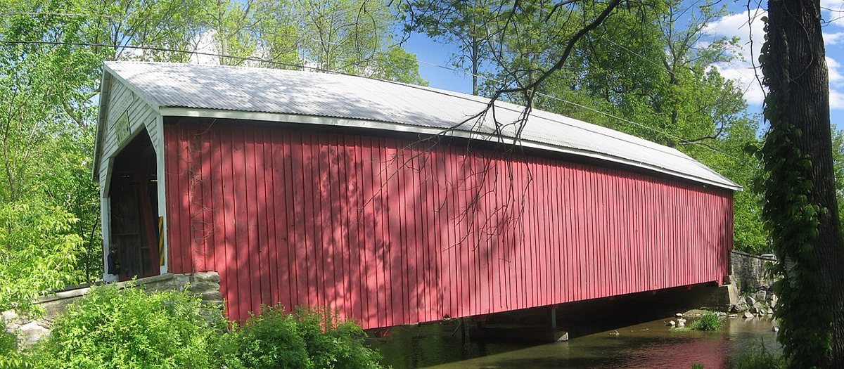
User:Ruhrfisch / Wikimedia Commons · CC BY-SA 4.0 Only 2.9 miles and about 9 minutes further, Hassenplug Bridge also spans Buffalo Creek. Dated 1825, this Burr arch-truss is often called the oldest covered bridge in Pennsylvania. It was rehabilitated in 1959 and again in 2022. Reported lengths include 80 ft, about 70 ft, and a 67 ft 8 in deck, so no single figure is recorded.
-
↓ 19.4 miles, about 31 min
11. Aline Covered Bridge
Snyder County, Pennsylvania · built 1884
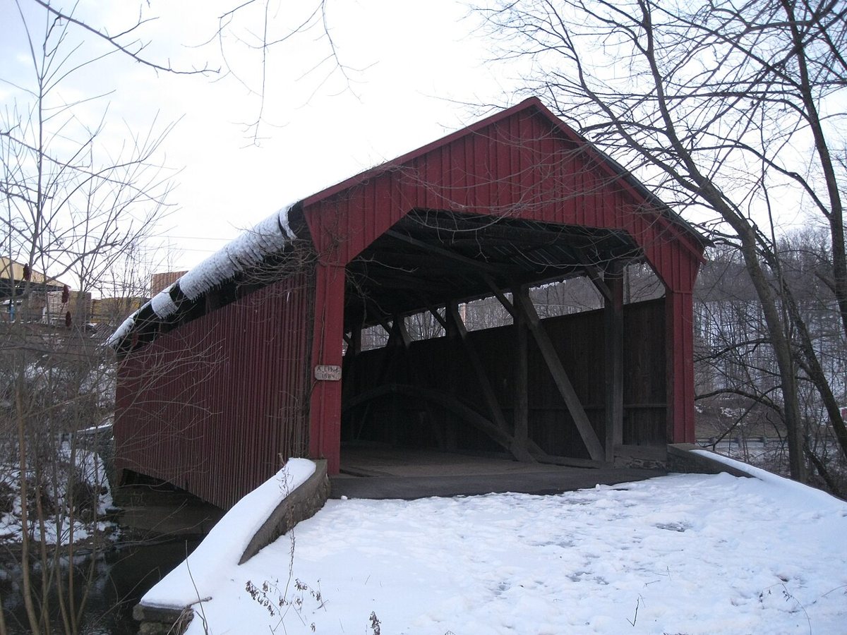
Ruhrfisch (talk) / Wikimedia Commons · CC BY-SA 4.0 Finish in Snyder County, about 31 minutes and 19.4 miles on, at Aline Covered Bridge, also known as the Meiserville Covered Bridge. The 1884 Burr truss crosses North Branch Mahantango Creek in Perry Township. A new bridge bypassed it in 1982. With sources split between 60 ft and 70 ft, its length stays unrecorded. Check access locally before you go.
Every stop on this route links to its own page with coordinates, sourced facts and image licences. The text above was written from those records and checked against them before publishing. More covered bridges: all covered bridges in Pennsylvania.