 Wayfarrow
Northern Vermont Covered Bridge Road Trip: 11 Bridges in One Day
11 stops201 milesabout 5 hr 33 min of drivingNorthern Vermont
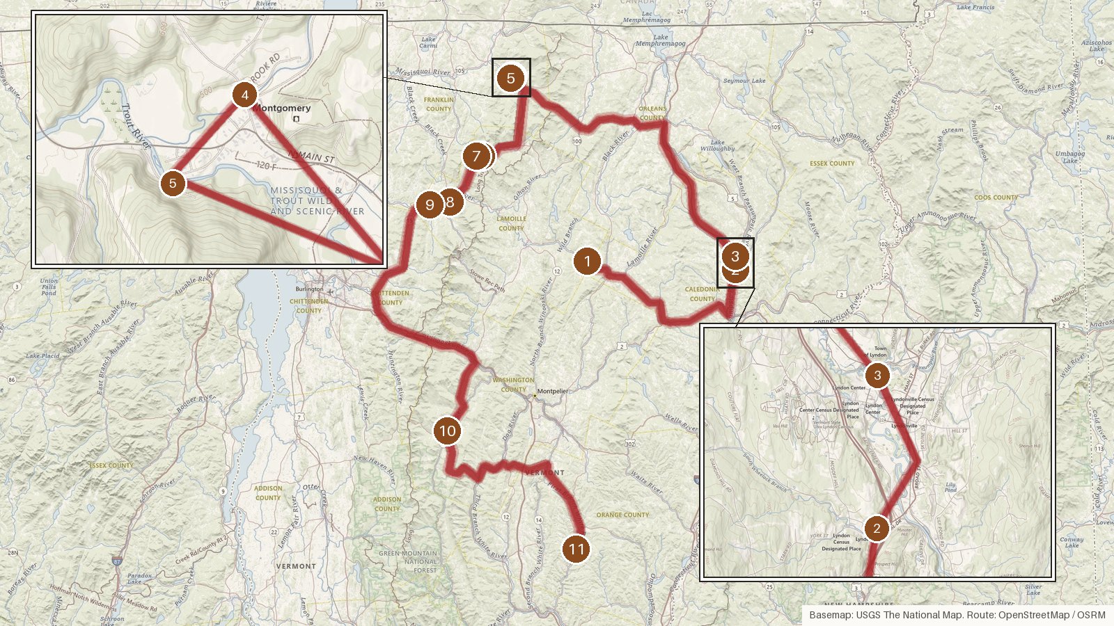
This route strings together eleven covered bridges across five Vermont counties: Lamoille, Caledonia, Franklin, Washington and Orange. It covers 201 miles with roughly five and a half hours of actual driving, so it makes a long day once you add time at each bridge. The dated spans range from 1833 at Waitsfield's Great Eddy Bridge to 1908 at the Fisher Covered Railroad Bridge in Wolcott. Several cross the Lamoille River or its North Branch. Others span the Passumpsic, the Trout River, the Mad River and the First Branch of the White River. The Jewett name is attached to both Montgomery bridges, and every stop is listed on the National Register of Historic Places. Expect a few dating puzzles along the way, where sources disagree on years and lengths. Start early and check access locally before you set out. Download maps ahead of time, since cell coverage can be patchy in rural areas.
Route and drive times from OpenStreetMap routing (OSRM). Times are estimates without stops; roads to remote sites can be unpaved or seasonal.
-
1. Fisher Covered Railroad Bridge
Lamoille County, Vermont · built 1908
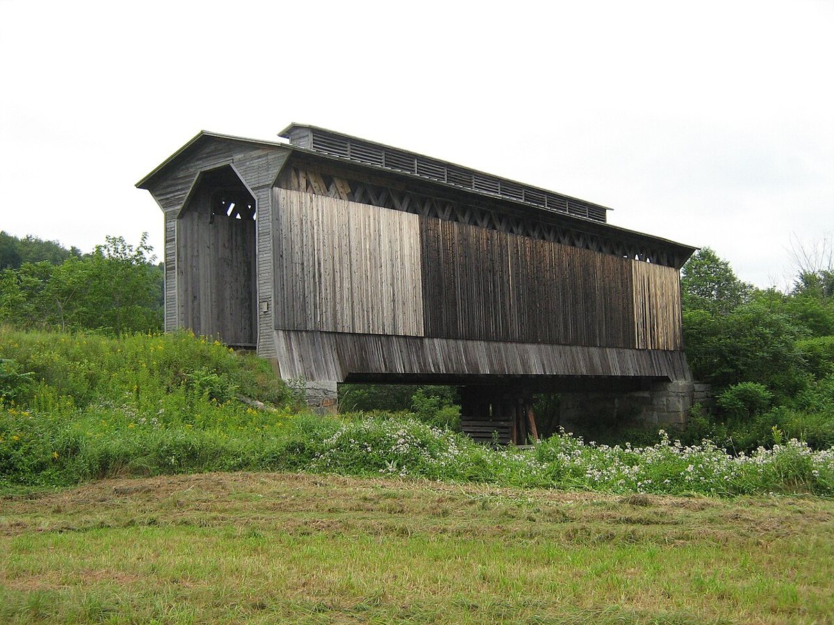
Mfwills / Wikimedia Commons · CC BY-SA 3.0 Start in Wolcott with a real rarity. Built of wood in 1908, this 103.5-foot double Town-lattice bridge carried the Lunenburg-Maquam railroad line over the Lamoille River. It was the last covered railroad bridge in use in the US, and trains ended in 1994. It now carries the Lamoille Valley Rail Trail and is listed on the National Register of Historic Places.
-
↓ 33.9 miles, about 46 min
2. Chamberlin Mill Covered Bridge
Caledonia County, Vermont · built 1881
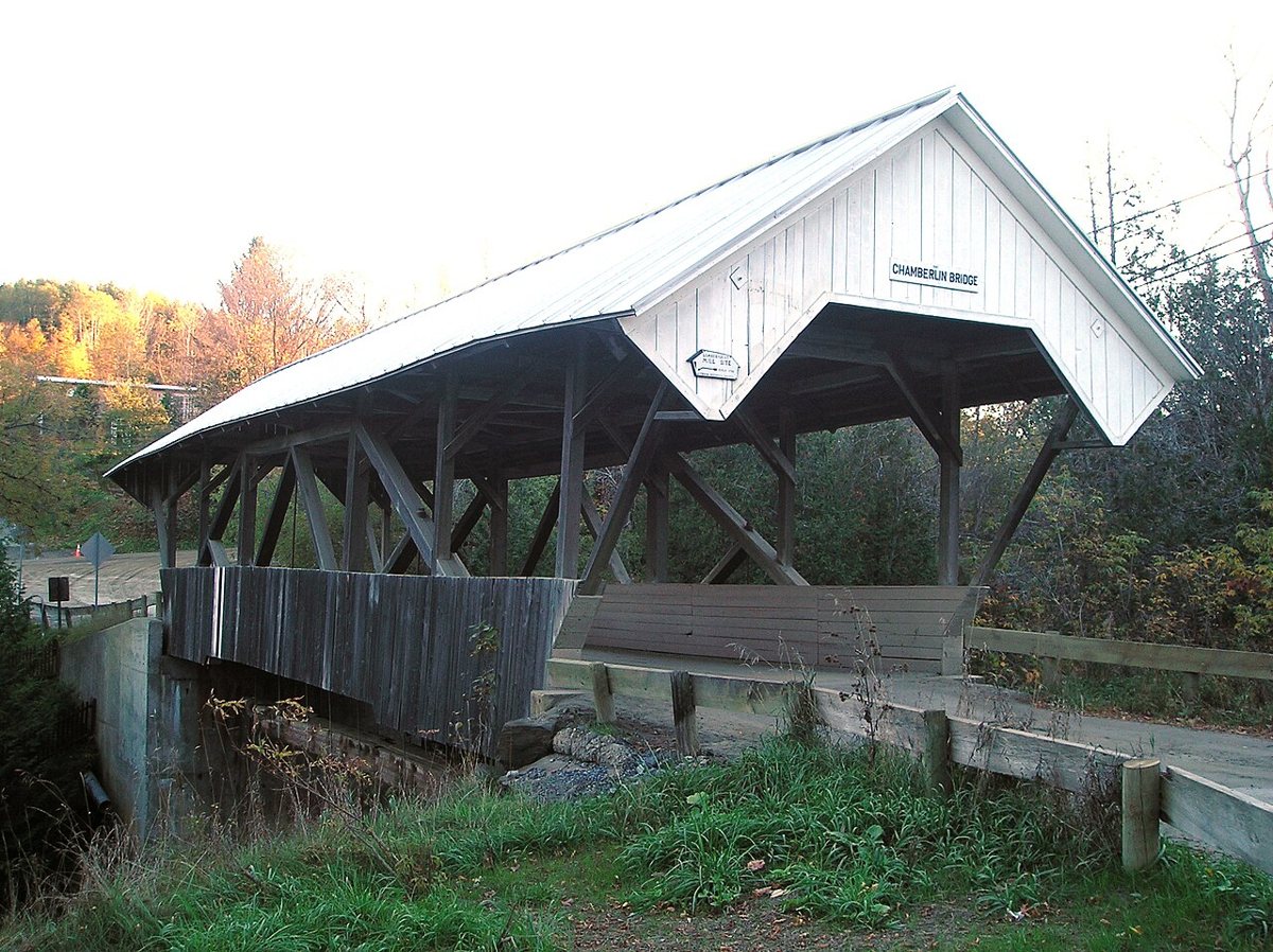
Mfwills / Wikimedia Commons · CC BY-SA 3.0 About 46 minutes and 33.9 miles on, in Lyndon, this National Register bridge crosses the Passumpsic River. The year attached to it, 1881, is when it was covered, and the open span may be older. Even the length depends on who you ask. The NRHP gives 66 feet at floor level, while other sources say 69.
-
↓ 2.6 miles, about 5 min
3. Bradley Covered Bridge
Caledonia County, Vermont
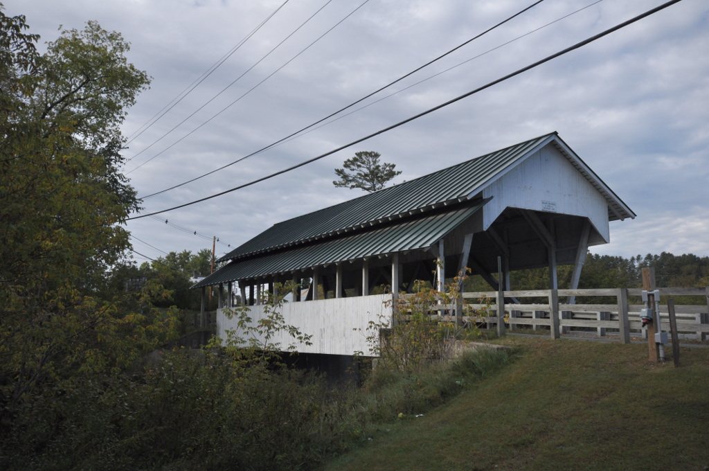
Magicpiano / Wikimedia Commons · CC BY-SA 4.0 Only 2.6 miles and about five minutes away, still in Lyndon, is the Bradley, also called Miller's Run Bridge. It was built in 1878 but reported as completely rebuilt in 1995, then repaired again after damage in 2019. That leaves the year of the current structure honestly unclear. It measures 56.5 feet and is on the National Register.
-
↓ 49.3 miles, about 1 hr 16 min
4. Fuller Covered Bridge
Franklin County, Vermont
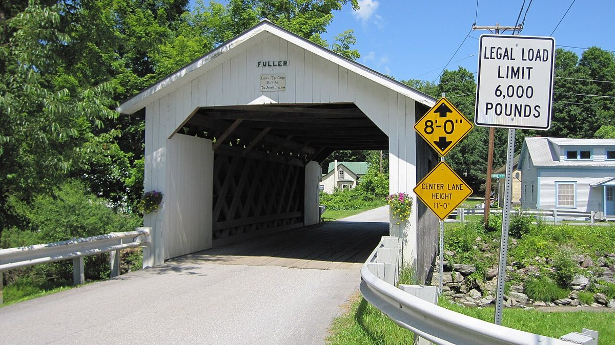
Steven Bergeron Srbergeron (talk) / Wikimedia Commons · CC BY 3.0 Allow about 76 minutes for the 49.3-mile drive to Montgomery. The Jewett brothers built this Town lattice bridge over Black Falls Brook in 1890. Severe decay and flood damage led to it being taken apart and fully rebuilt in 2000, so whether you call it an 1890 or a 2000 bridge is a fair question. It's 49.5 feet long and National Register listed.
-
↓ 0.4 miles, about 1 min
5. Comstock Covered Bridge
Franklin County, Vermont · built 1883
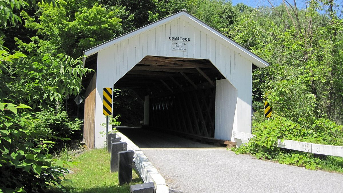
Steven Bergeron Srbergeron (talk) / Wikimedia Commons · CC BY 3.0 Barely 0.4 miles away, about a minute's drive, Montgomery's second Jewett bridge crosses the Trout River. Sheldon and Savannah Jewett built this 69-foot Town lattice span in 1883, and it was fully renovated in 2003. Coming straight from the Fuller, you get an easy side-by-side look at the same truss style. It's listed on the National Register too.
-
↓ 16.6 miles, about 30 min
6. Morgan Covered Bridge
Lamoille County, Vermont · built 1887
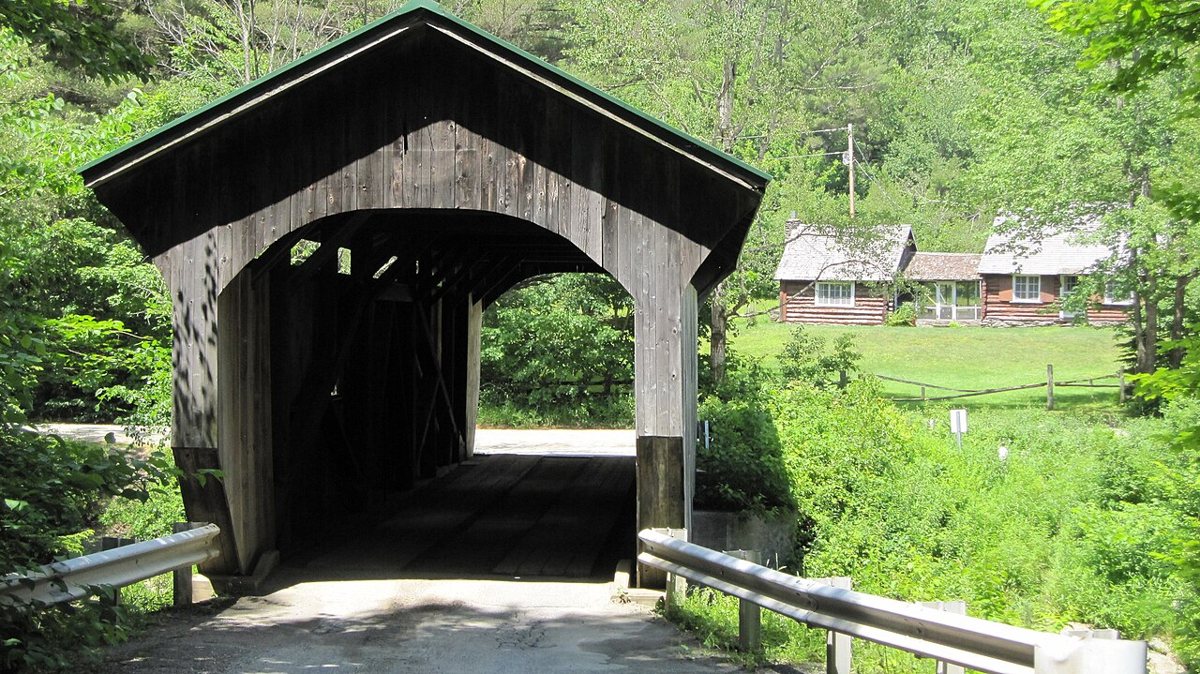
Steven Bergeron Srbergeron (talk) / Wikimedia Commons · CC BY 3.0 Half an hour and 16.6 miles later you reach Belvidere and the Morgan Covered Bridge, an 1887 queenpost bridge over the North Branch of the Lamoille River. It runs about 71 feet overall, with a truss of roughly 62 to 64 feet. There may have been a rebuild around 1898, though it's poorly documented. It's on the National Register.
-
↓ 0.7 miles, about 3 min
7. Mill Covered Bridge (Belvidere, Vermont)
Lamoille County, Vermont
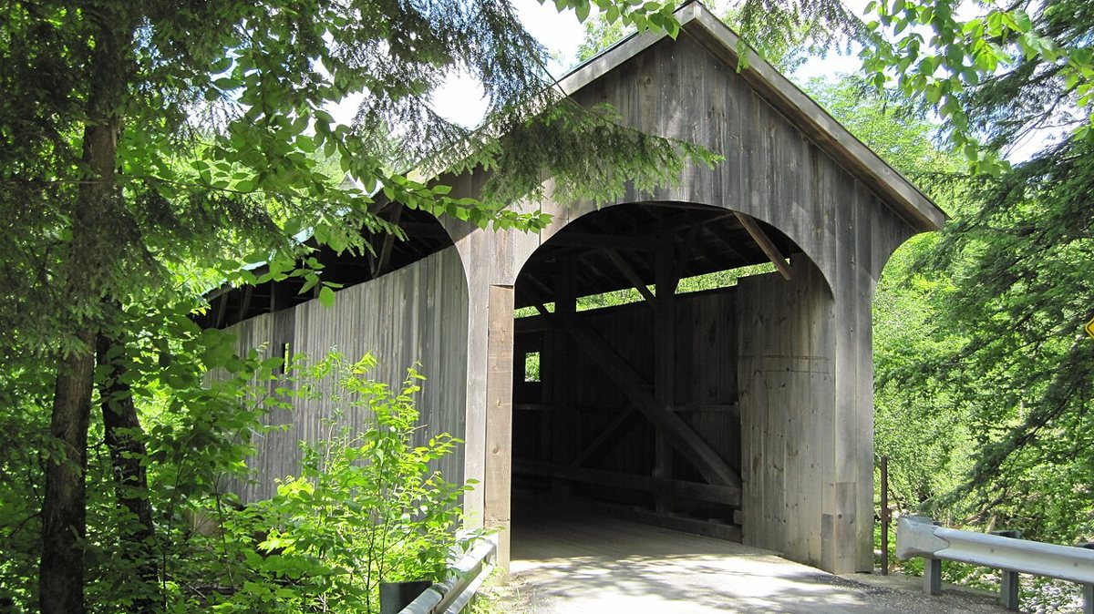
Steven Bergeron Srbergeron (talk) / Wikimedia Commons · CC BY 3.0 Belvidere's second queenpost bridge is just 0.7 miles and about three minutes away, crossing the North Branch of the Lamoille River on Back Road. The NRHP dates it to around 1890, while the Vermont Covered Bridge Society says 1895. Steel deck beams were added after a 1971 snowplow accident. It's 70.5 feet long and National Register listed.
Facts, map and sources for Mill Covered Bridge (Belvidere, Vermont) →
-
↓ 8.1 miles, about 16 min
8. Poland Covered Bridge
Lamoille County, Vermont · built 1887
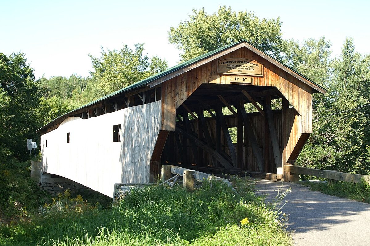
Steven Bergeron Srbergeron (talk) / Wikimedia Commons · CC BY-SA 3.0 Head 8.1 miles, about 16 minutes, to Cambridge for the Poland Covered Bridge, also known as the Cambridge Junction Bridge. George W. Holmes built it over the Lamoille River in 1887, and it was raised and restored between 2001 and 2004. With a 153-foot truss and 152.5 feet at floor level, it's a long one. It's on the National Register.
-
↓ 3.3 miles, about 6 min
9. Gates Farm Covered Bridge
Lamoille County, Vermont · built 1897
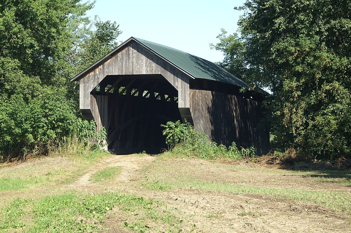
Srbergeron at en.wikipedia / Wikimedia Commons · CC BY-SA 3.0 Six minutes and 3.3 miles on, still in Cambridge, this 1897 bridge holds a real distinction: it's the last historic-period Burr arch covered bridge built in Vermont. It was moved a few hundred feet in 1950 and taken off its abutments for restoration in 1994. The floor length is 82.5 feet, though Wikipedia's infobox says 60.
-
↓ 47.7 miles, about 1 hr 16 min
10. Great Eddy Covered Bridge
Washington County, Vermont · built 1833
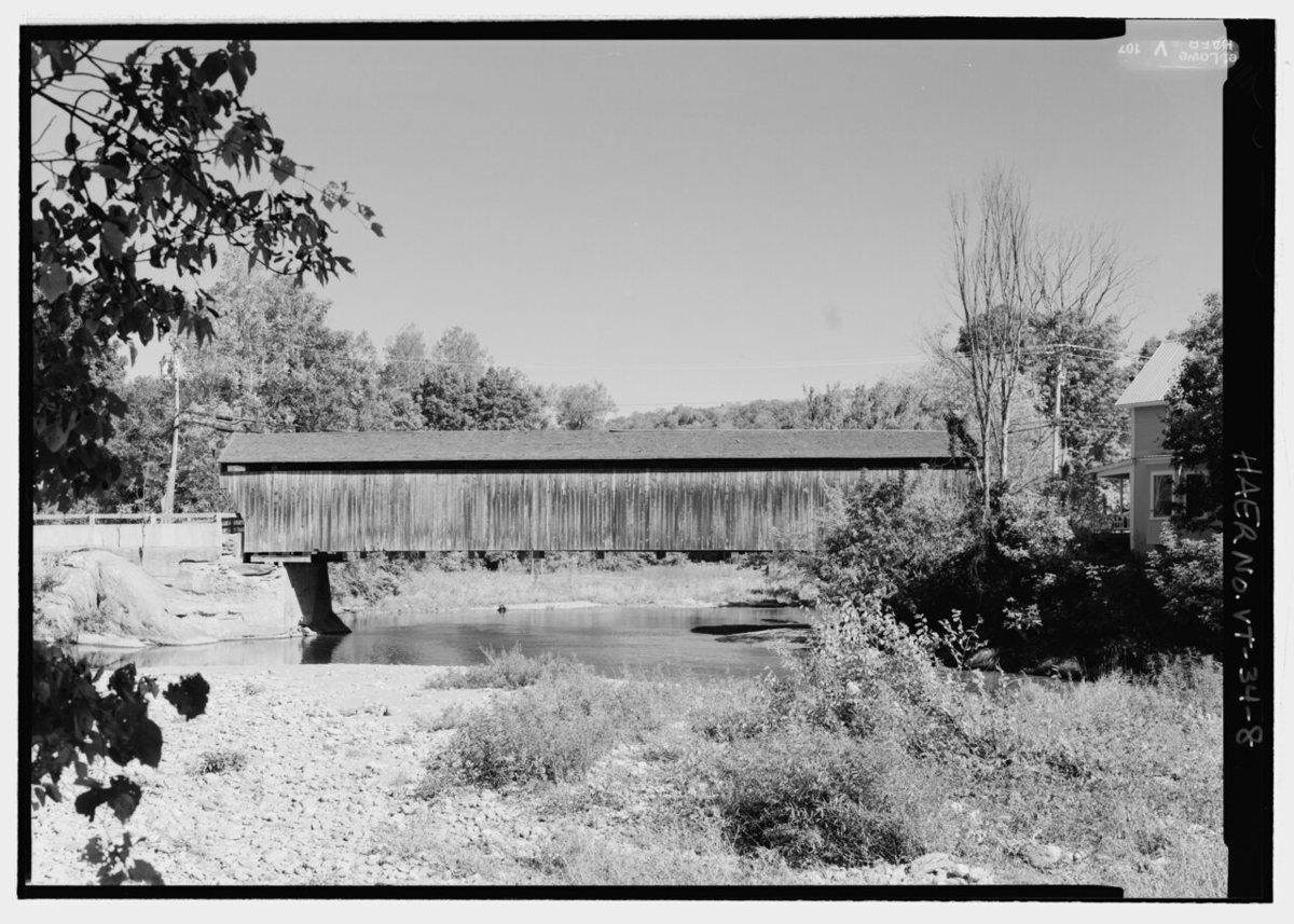
Lowe, Jet / Wikimedia Commons · Public domain Set aside about 76 minutes for the 47.7-mile drive to Waitsfield. Built in 1833 over the Mad River, the Great Eddy, also called the Big Eddy or Village Bridge, is one of Vermont's oldest covered bridges. It reopened in November 2016 after repairs. Sources split between 105 feet for the truss and floor and 107.25 feet overall.
-
↓ 38.6 miles, about 1 hr 14 min
11. Flint Covered Bridge
Orange County, Vermont
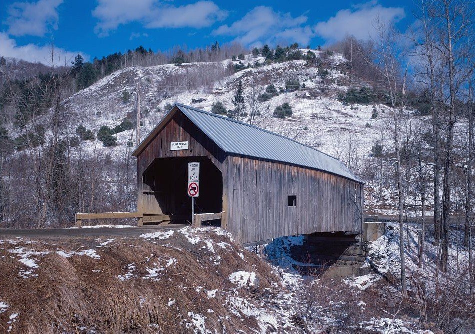
Jet Lowe / Wikimedia Commons · Public domain The final leg is 38.6 miles and about 74 minutes into Orange County, where the Flint Covered Bridge crosses the First Branch of the White River. Its date is disputed. The NRHP nomination says 1845, while the World Guide to Covered Bridges and old portal signs say 1874. The length wobbles too: 88 feet per the NRHP, 87 to 87.5 elsewhere.
Every stop on this route links to its own page with coordinates, sourced facts and image licences. The text above was written from those records and checked against them before publishing. More covered bridges: all covered bridges in Vermont.