 Wayfarrow
Ohio Lighthouse Road Trip: 8 Lights in One Day
8 stops174 milesabout 4 hr 59 min of drivingOhio
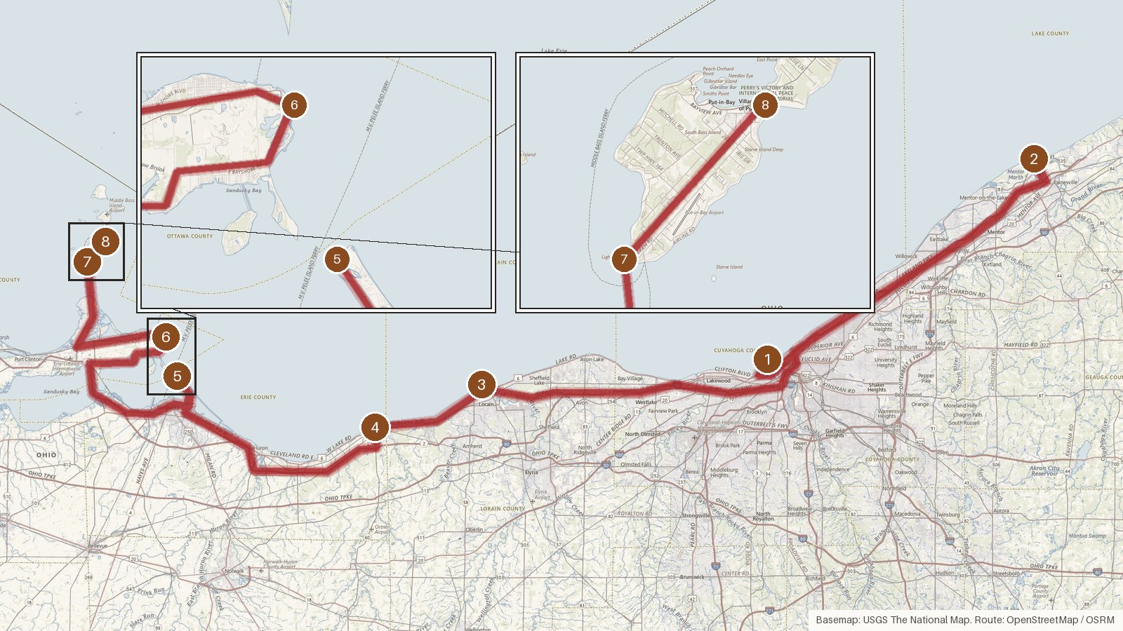
This route strings together eight stops across five Ohio counties: Cuyahoga, Lake, Lorain, Erie and Ottawa. Most of them list Lake Erie as their water. It covers 174 miles with roughly five hours of driving, so plan on a full day once you add time at each stop. The building years run from Marblehead's limestone tower of 1821 to Vermilion's 1991 replica. Several lights went dark along the way: Cedar Point in 1904, Fairport Harbor in 1925, South Bass Island in 1962 and Lorain in 1965, though Lorain was relit in 2001. Seven of the eight stops are listed on the National Register of Historic Places. One honest caveat is that the final stop is a memorial column, not a lighthouse. Start early, and check access locally before you set out, because the details here don't cover it.
Route and drive times from OpenStreetMap routing (OSRM). Times are estimates without stops; roads to remote sites can be unpaved or seasonal.
-
1. Cleveland West Pierhead Light
Cuyahoga County, Ohio · built 1911
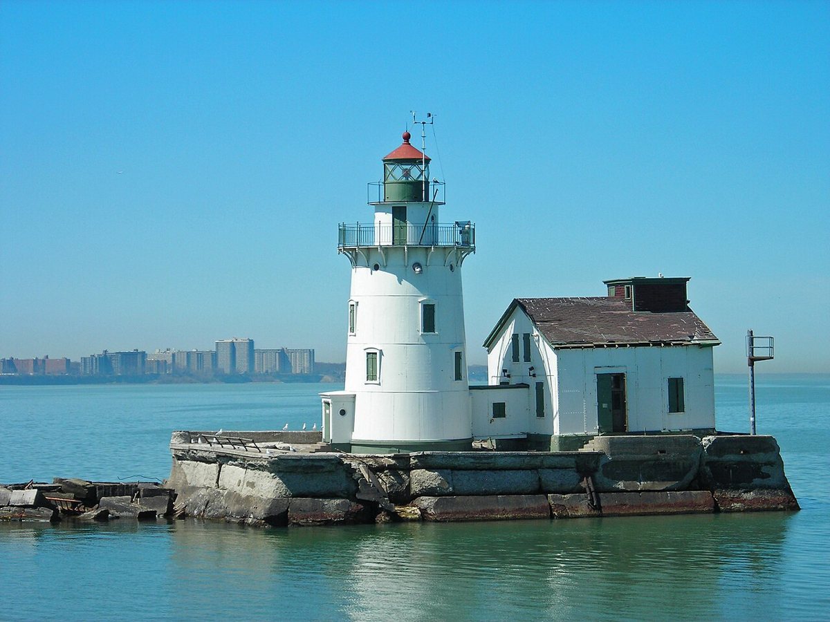
User:Kuyacmh / Wikimedia Commons · CC BY-SA 3.0 Start at the Cleveland West Pierhead Light, a cast iron tower on Lake Erie first lit on March 25, 1911. GSA gives its height as 50 ft, while Clio says 67 ft. It flashes Fl WR 6s from a focal height of 63 ft, with an 11-nautical-mile range. Listed on the National Register, it was sold at a 2023 federal auction to private owners who plan to preserve it.
-
↓ 35.1 miles, about 58 min
2. Fairport Harbor Light
Lake County, Ohio · built 1871
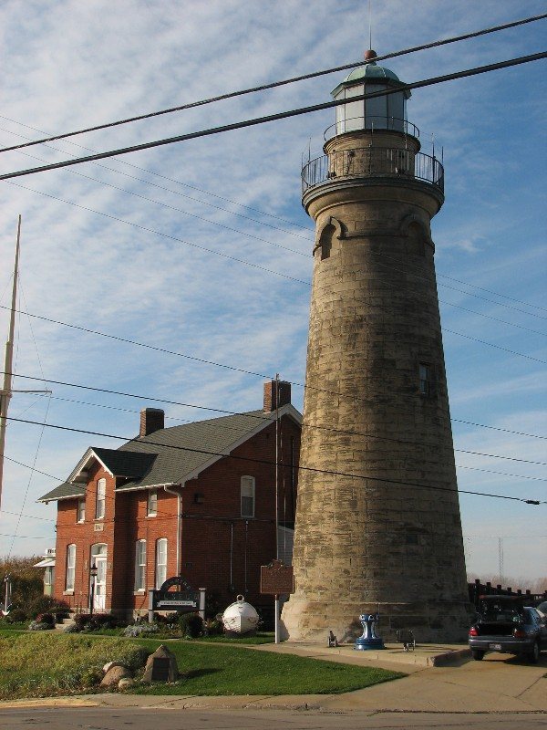
Rona Proudfoot (ronnie44052) / Wikimedia Commons · CC BY-SA 2.0 About an hour from Cleveland (35.1 miles, 58 minutes), Fairport Harbor Light dates to 1871, when it replaced the original 1825 tower. It was switched off in 1925 and now houses the Fairport Harbor Marine Museum. The historical society and Coast Guard history both give its height as 60 ft, though one site claims 69. It's listed on the National Register.
-
↓ 59.3 miles, about 1 hr 24 min
3. Lorain West Breakwater Light
Lorain County, Ohio · built 1917
A 59.3-mile drive, about 84 minutes, brings you to the Lorain West Breakwater Light of 1917. Retired in 1965 and slated for demolition, it was saved by local preservationists, relit in 2001 and is now run by the Lorain Lighthouse Foundation. The tower is 51 ft, with a focal height of 57 ft, and its light is listed as Fl R 4s.
-
↓ 10.7 miles, about 19 min
4. Vermilion Light
Erie County, Ohio · built 1991
Just 10.7 miles on (about 19 minutes), Vermilion Light is a 16-ft working replica put up in 1991 and dedicated in 1992. The original 1877 tower was taken down around 1929 and moved to Lake Ontario, where it became East Charity Shoal Light. The replica's light is listed as F R, at a focal height of 36 ft.
-
↓ 25.8 miles, about 42 min
5. Cedar Point Light
Erie County, Ohio
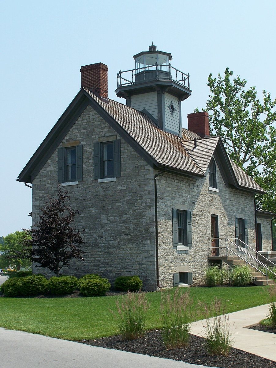
Matt Dempsey / Wikimedia Commons · CC BY-SA 2.0 Cedar Point Light comes 25.8 miles and about 42 minutes later. Sources split on when the current limestone lighthouse went up: 1862 according to the National Register and Wikipedia, 1867 according to Lighthouse Digest and Lighthousefriends. After the light was discontinued (one source says 1904), the tower was removed, then rebuilt by Cedar Point in the 1990s. It's now part of the park's Lighthouse Point lodging.
-
↓ 24.2 miles, about 48 min
6. Marblehead Light
Ottawa County, Ohio · built 1821
Here's the one with a genuine record attached: Marblehead Light is the oldest light in continuous operation on the US side of the Great Lakes. Its limestone tower dates to 1821 and was raised 15 ft in 1897, reaching 65 ft. It flashes Fl G 6s from a focal height of 67 ft, with an 11-nautical-mile range. Allow about 48 minutes for the 24.2 miles from Cedar Point.
-
↓ 16.5 miles, about 44 min
7. South Bass Island Light
Ottawa County, Ohio · built 1897
South Bass Island Light, 16.5 miles and about 44 minutes from Marblehead, is a brick Queen Anne dwelling with an attached tower, first lit on July 10, 1897. It was deactivated in 1962 and is now used by Ohio State University. Its focal height is 74 ft, though sources can't agree whether the tower itself is 45 or 60 ft. The record lists Fl R 6s.
-
↓ 2.5 miles, about 6 min
8. Perry's Victory and International Peace Memorial
Ottawa County, Ohio · built 1915
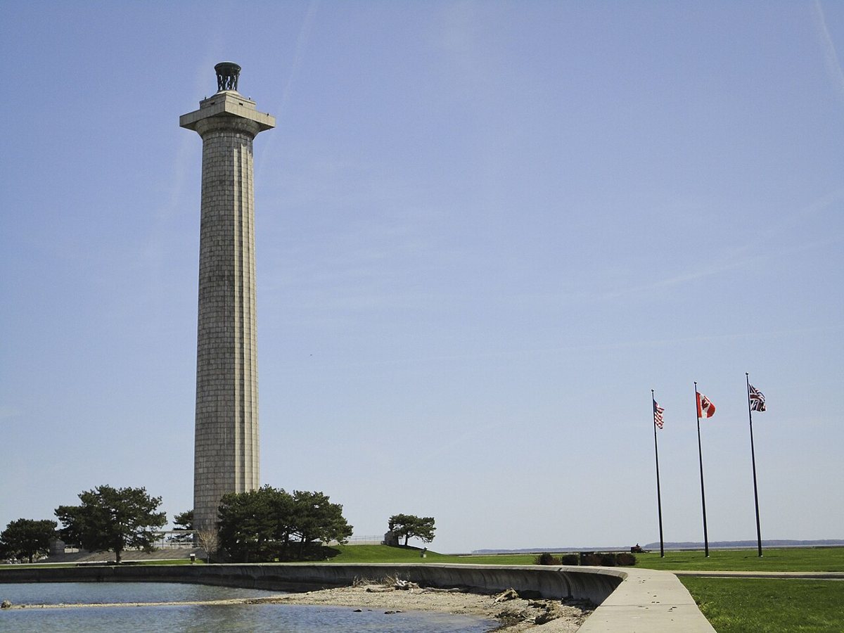
NPS Photo / Wikimedia Commons · Public domain Only 2.5 miles and about 6 minutes away, the last stop isn't a lighthouse at all. Perry's Victory and International Peace Memorial is a 352-ft granite Doric column, built 1912 to 1915 as a War of 1812 and peace memorial. The National Park Service operates it, and it's on the National Register. Check access locally before you go.
Facts, map and sources for Perry's Victory and International Peace Memorial →
Every stop on this route links to its own page with coordinates, sourced facts and image licences. The text above was written from those records and checked against them before publishing. More lighthouses: all lighthouses in Ohio.