 Wayfarrow
Perry County, Pennsylvania Covered Bridge Road Trip: 11 Bridges in One Day
11 stops175 milesabout 5 hr 16 min of drivingPerry County, Pennsylvania
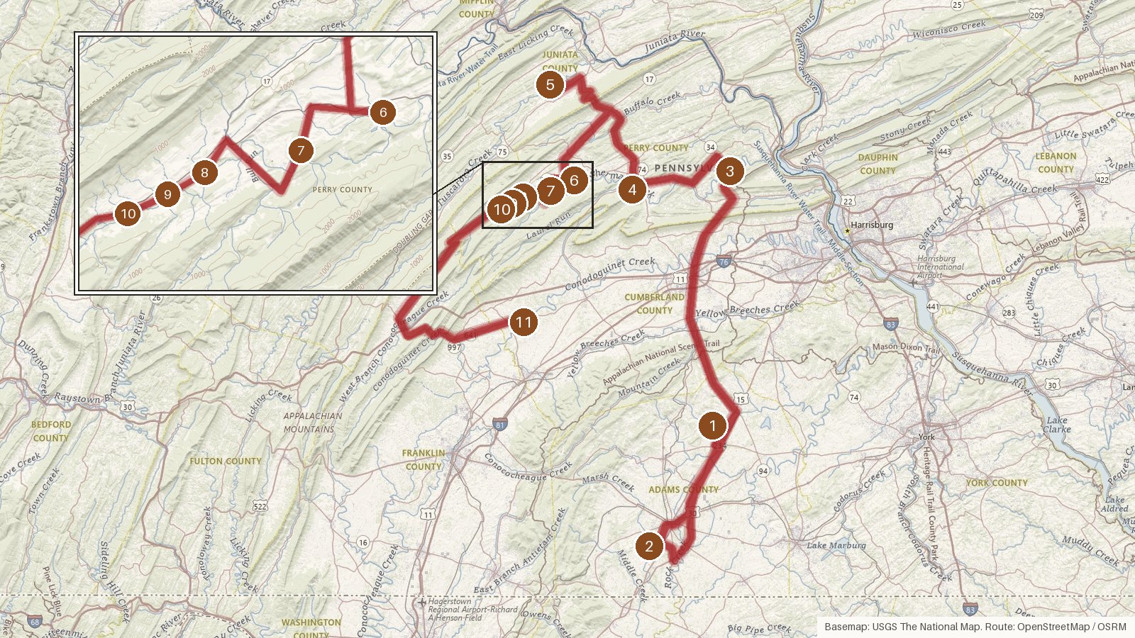
This route links eleven covered bridges across four Pennsylvania counties: Adams, Perry, Juniata and Cumberland, with most of the stops in Perry County. It runs about 175 miles, and the driving alone comes to roughly five and a quarter hours, so with time at each bridge it fills a full day. Every bridge here is listed on the National Register of Historic Places, and seven of them cross Shermans Creek, some only a few minutes apart. The dates on record run from the 1850s at Sachs to 1902 at Academia Pomeroy, with later rebuilds in 1918, 2008 and 2019. Truss types range from Burr arch and Town lattice to kingpost and queenpost, and two builders are named: L. M. Wentzel and John W. Fry. Start early, check access locally before you go, and expect patchy cell coverage on rural roads.
Route and drive times from OpenStreetMap routing (OSRM). Times are estimates without stops; roads to remote sites can be unpaved or seasonal.
-
1. Heikes Covered Bridge
Adams County, Pennsylvania · built 1892
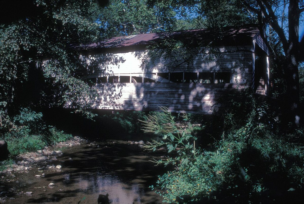
JERRYE & ROY KLOTZ MD / Wikimedia Commons · CC BY-SA 3.0 Your first stop is a 67 ft Burr truss bridge built in 1892 over Bermudian Creek in Huntington Township, Adams County. It was listed on the National Register of Historic Places in 1980. It now sits on private property, so check access locally before planning to stop.
-
↓ 18.5 miles, about 35 min
2. Sachs Covered Bridge
Adams County, Pennsylvania
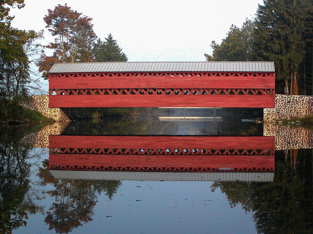
MGVH / Wikimedia Commons · CC BY-SA 3.0 About 35 minutes and 18.5 miles on, Sachs Covered Bridge carries a Town lattice truss over Marsh Creek, and both armies used it in 1863. A flood knocked it off an abutment in June 1996, and it was restored and rededicated in 1997. The state marker says 1852, other sources say around 1854, and its length is given as 100 or 101.2 ft.
-
↓ 51.2 miles, about 1 hr 30 min
3. Dellville Covered Bridge
Perry County, Pennsylvania · built 2019
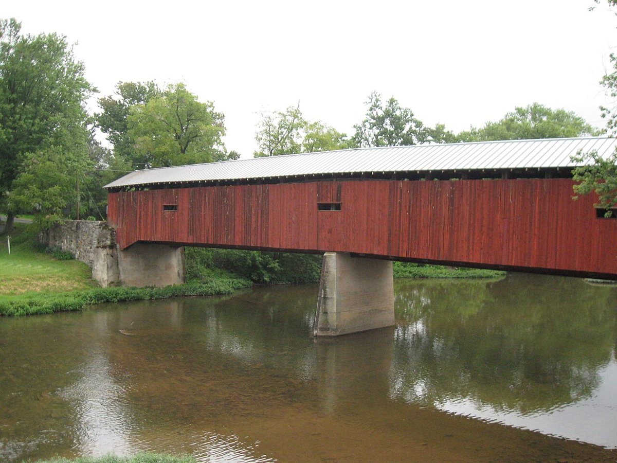
Ken Gallager / Wikimedia Commons · CC BY-SA 3.0 Allow about 90 minutes for the 51.2-mile drive to Dellville, where a 174 ft bridge crosses Shermans Creek. Arson destroyed the original 1889 bridge in November 2014. It was rebuilt from the original plans and reopened in July 2019, so the structure here dates from 2019 while following the old design.
-
↓ 13.2 miles, about 25 min
4. Rice Covered Bridge
Perry County, Pennsylvania · built 1869
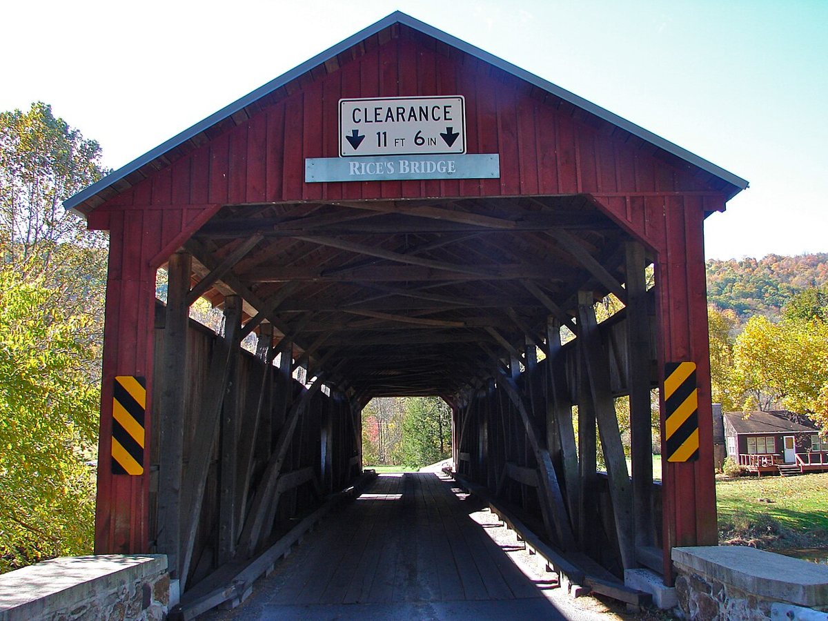
Smallbones / Wikimedia Commons · Public domain Also known as Landisburg Covered Bridge, Rice dates from 1869 and is about 25 minutes (13.2 miles) from Dellville. It crosses Shermans Creek in Tyrone Township, Perry County, using a combination of Burr arch and queenpost trusses. Sources disagree on its length, giving either 123 ft or 132 ft.
-
↓ 22.2 miles, about 40 min
5. Academia Pomeroy Covered Bridge
Juniata County, Pennsylvania · built 1902
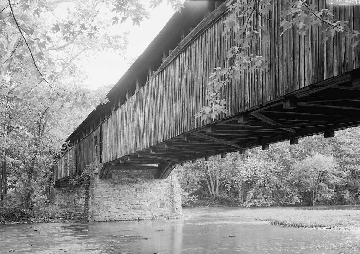
Jet Lowe / Wikimedia Commons · Public domain Crossing into Juniata County takes about 40 minutes. The Academia Pomeroy bridge, a two-span Burr arch truss over Tuscarora Creek, is the longest remaining covered bridge in Pennsylvania at 278 ft 4 in portal to portal, per its owner, the Juniata County Historical Society. The PennDOT marker says 270 ft. Built in 1902 to replace a bridge damaged in the 1901 floods, it was restored in 2009.
Facts, map and sources for Academia Pomeroy Covered Bridge →
-
↓ 22.7 miles, about 38 min
6. Adairs Covered Bridge
Perry County, Pennsylvania · built 1864
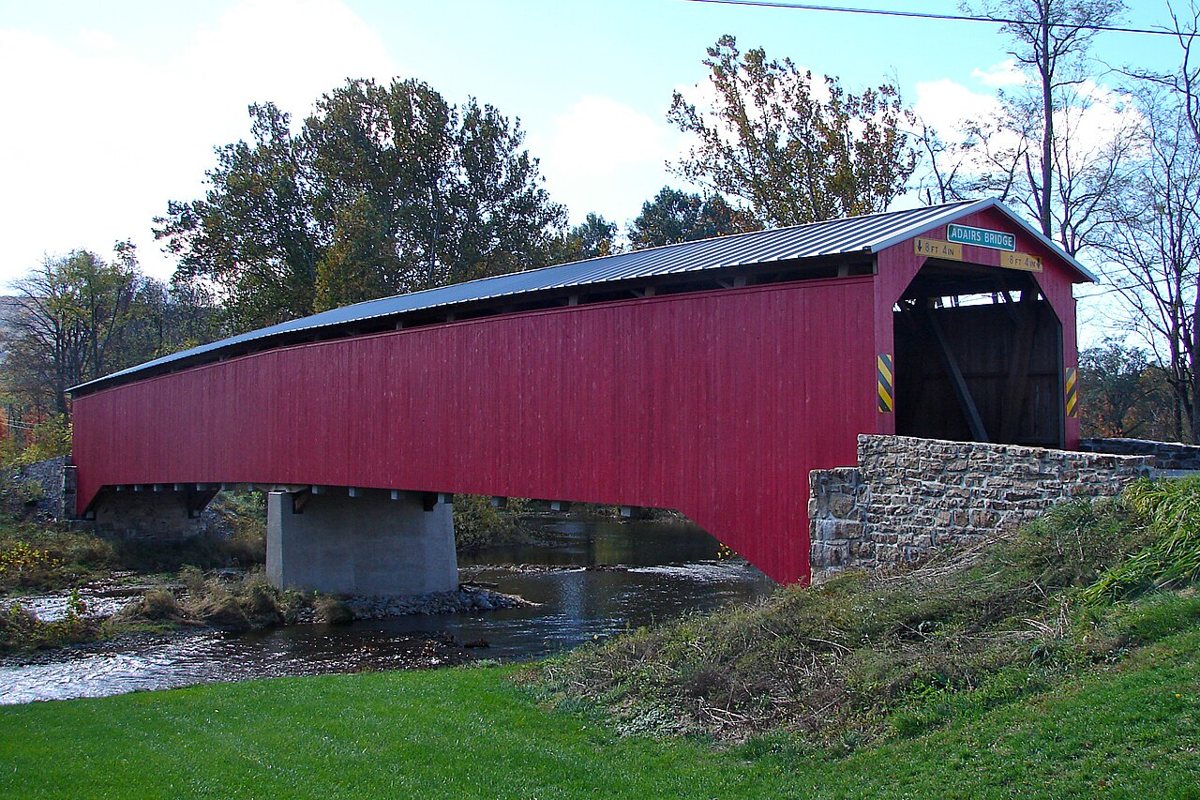
Smallbones / Wikimedia Commons · Public domain Back on Shermans Creek after about 38 minutes, Adairs is the oldest covered bridge in Perry County, built in 1864 as a Burr truss. It was rebuilt and reinforced with steel I-beams in 1919 and refurbished in 2007. Most sources put it at 150 ft long, though Clarks Ferry Tavern gives 176 ft.
-
↓ 4 miles, about 10 min
7. Bistline Covered Bridge
Perry County, Pennsylvania · built 1871
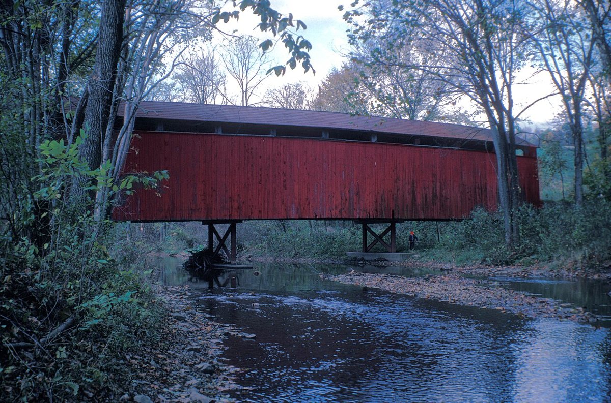
JERRYE & ROY KLOTZ MD / Wikimedia Commons · CC BY-SA 3.0 Only 10 minutes and 4 miles further, Bistline Covered Bridge, also called Flickinger's Mill Bridge, is an 1871 Burr truss over Shermans Creek. It was rebuilt in 2008. Reported overall lengths don't line up: you'll see 96, 103 and 106 ft depending on the source.
-
↓ 5.4 miles, about 13 min
8. Book's Covered Bridge
Perry County, Pennsylvania
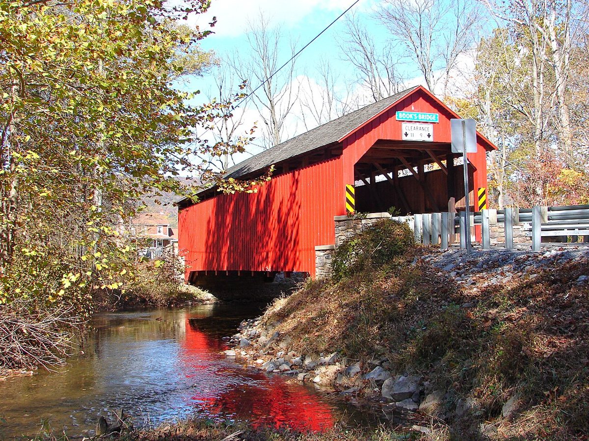
Smallbones / Wikimedia Commons · Public domain Book's Covered Bridge, about 13 minutes on, was originally built in 1884 as a Burr truss over Shermans Creek. One source says it had collapsed into the creek by 2003 and was rebuilt by the community, so the date of the current structure is unclear. Its length is given as 70, 81 or 87.9 ft.
-
↓ 1.8 miles, about 4 min
9. Mount Pleasant Covered Bridge
Perry County, Pennsylvania · built 1918
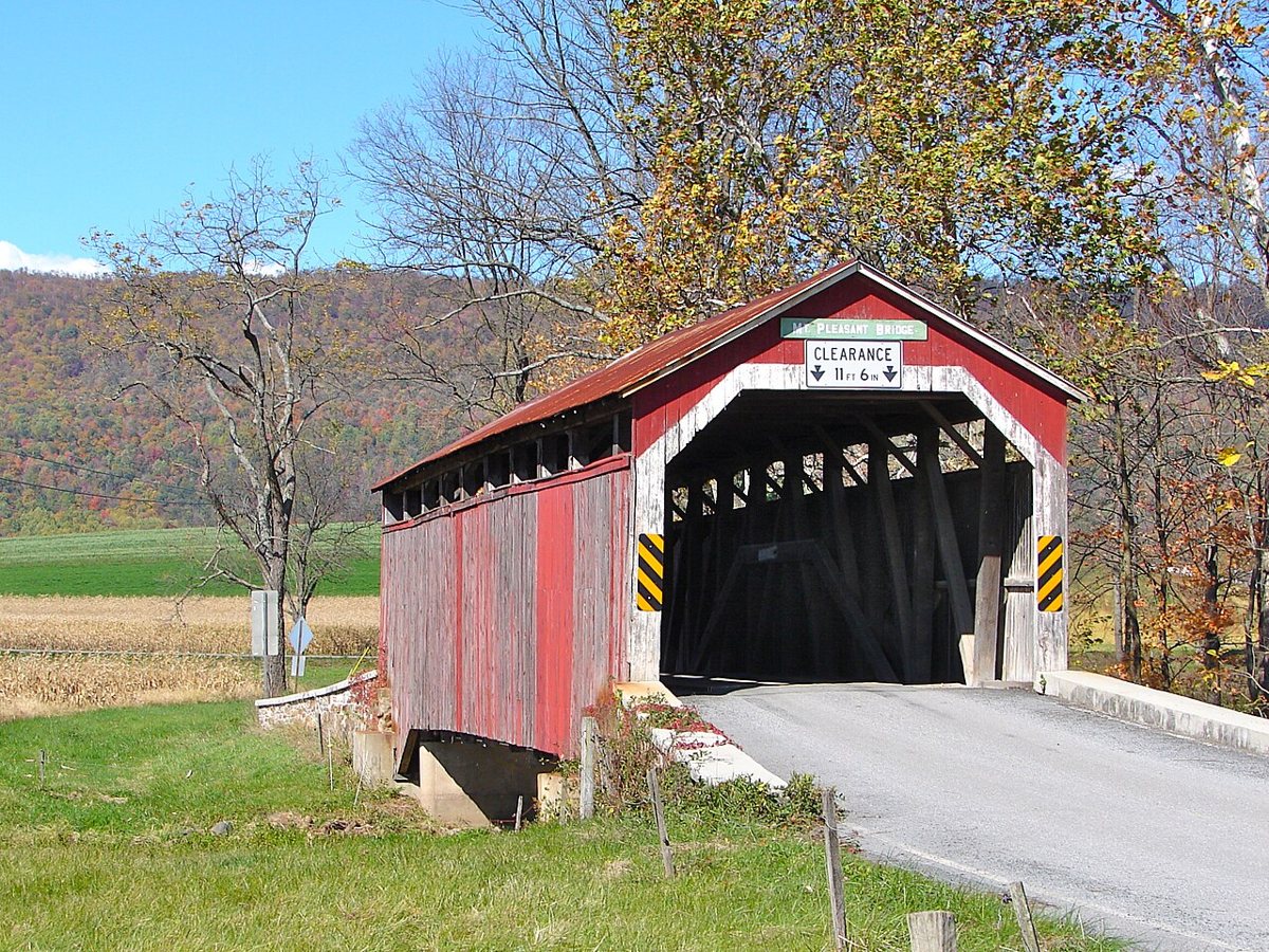
Smallbones / Wikimedia Commons · Public domain Just 4 minutes and 1.8 miles away, Mount Pleasant is a 60 ft king post bridge over Shermans Creek in Jackson Township, built by L. M. Wentzel. The crossing wasn't covered at first; it was rebuilt as a covered bridge in 1918 and listed on the National Register in 1980.
-
↓ 1.8 miles, about 4 min
10. New Germantown Covered Bridge
Perry County, Pennsylvania · built 1891
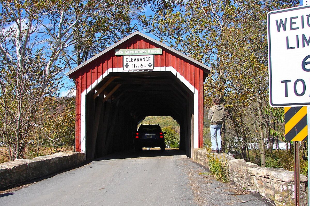
Smallbones / Wikimedia Commons · Public domain John W. Fry built this 74 ft wooden kingpost-and-queenpost truss bridge over Shermans Creek in 1891, and it's the westernmost covered bridge in Perry County. It's another short hop, about 4 minutes and 1.8 miles from Mount Pleasant, and the last of the Shermans Creek crossings on this route.
-
↓ 34.4 miles, about 56 min
11. Ramp Covered Bridge
Cumberland County, Pennsylvania
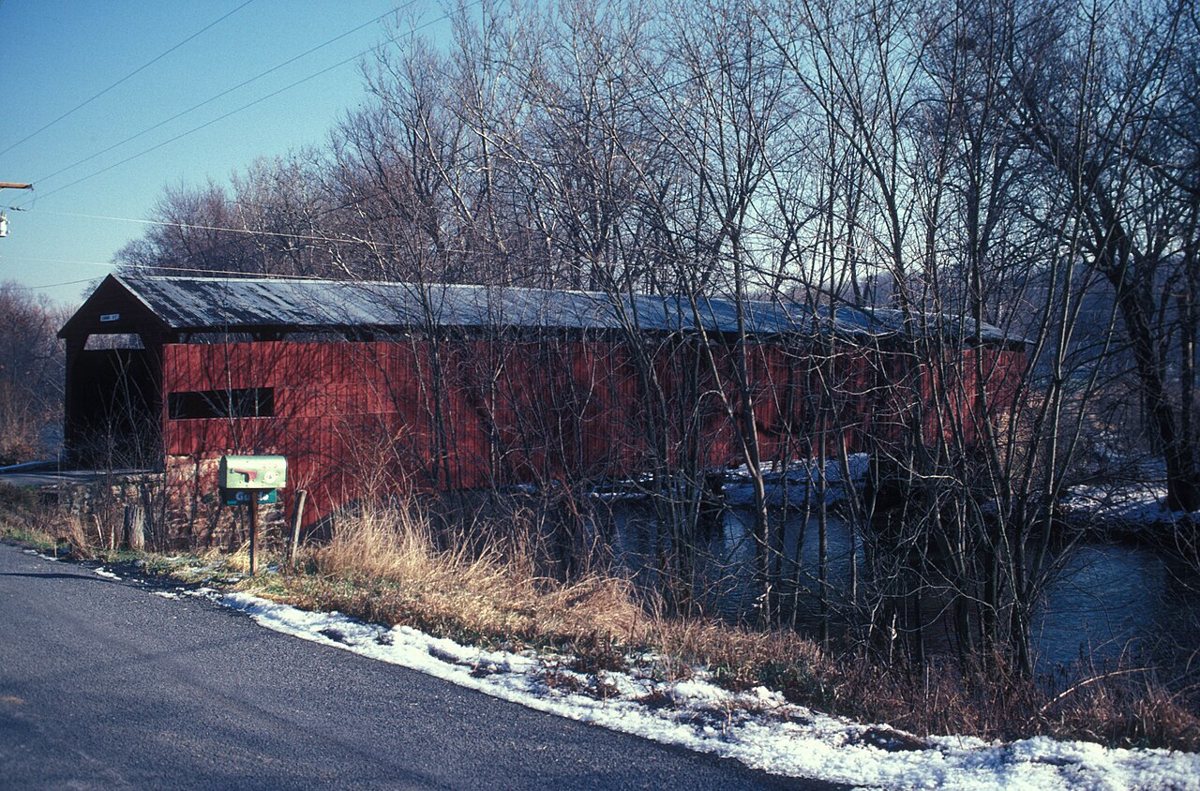
JERRYE & ROY KLOTZ MD / Wikimedia Commons · CC BY-SA 3.0 The final leg is 34.4 miles, about 56 minutes, to Ramp Covered Bridge, a 130 ft Burr arch over Conodoguinet Creek in Hopewell Township, Cumberland County. Its date depends on who you ask: the NRHP-based Wikipedia entry says 1870, while the county and township say 1882. It reopened to traffic on Oct 15, 2021 after a $788,777 rehabilitation.
Every stop on this route links to its own page with coordinates, sourced facts and image licences. The text above was written from those records and checked against them before publishing. More covered bridges: all covered bridges in Pennsylvania.