 Wayfarrow
Southern Massachusetts Lighthouse Road Trip: 10 Lights, About 7 Hours of Driving
10 stops202 milesabout 6 hr 56 min of drivingSouthern Massachusetts
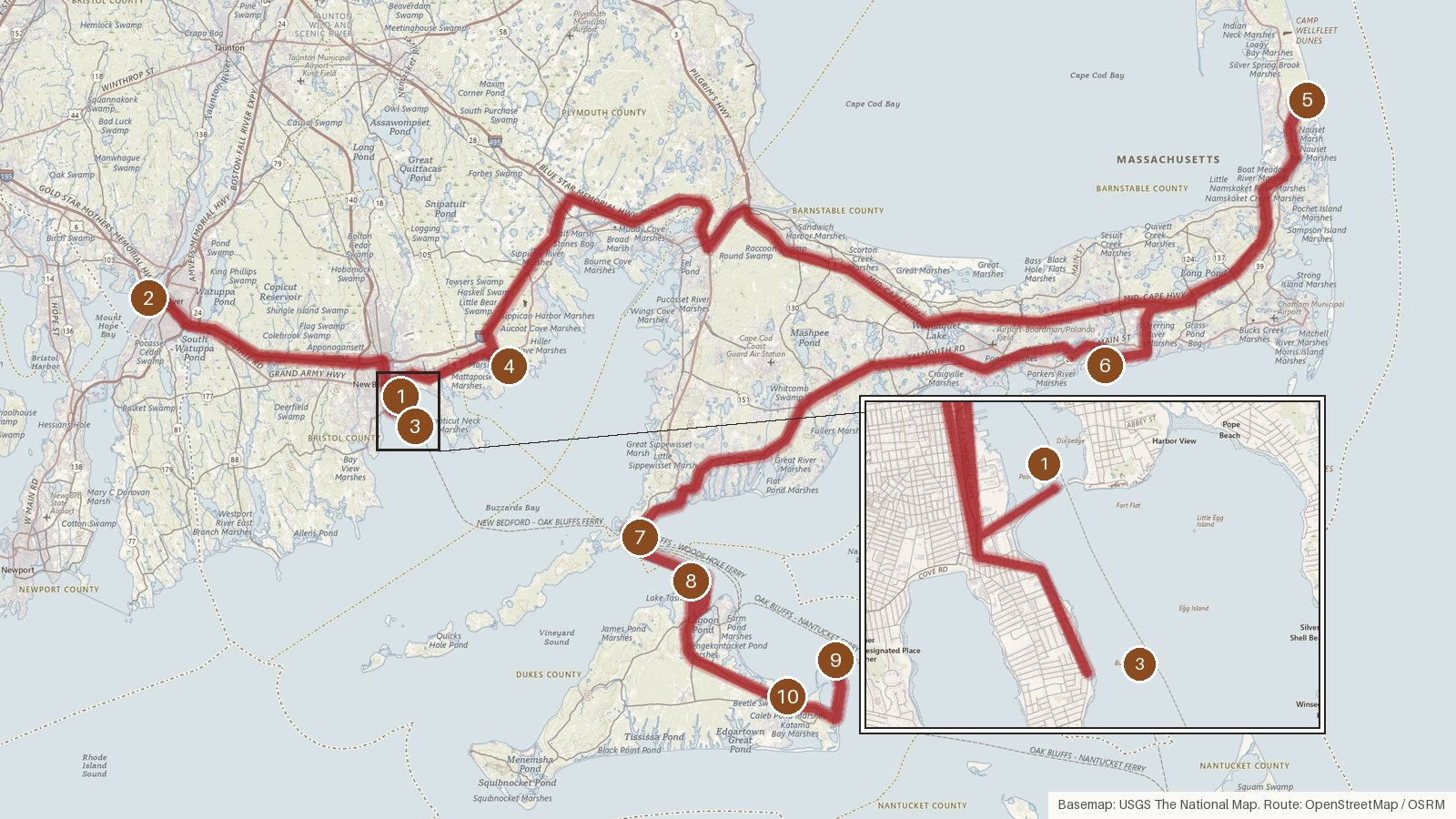
This route strings together ten Massachusetts lighthouses across four counties: Bristol, Plymouth, Barnstable and Dukes. It runs about 202 miles, with just under seven hours of driving spread over the legs, so it fits a long day or splits comfortably across two. Start on Buzzards Bay at Palmer Island, work through the sparkplug towers of the Bristol shore, then head out to Barnstable and finish among the Dukes County lights. Most of the towers date from between 1838 and 1898, built in stone, brick, wood and cast iron, and nine of the ten are listed on the National Register of Historic Places. Several went dark for years before being relit, and a few have been moved, whether inland from eroding bluffs or by barge from Ipswich. Start early, since some legs run close to an hour or more, and check access locally before you set out.
Route and drive times from OpenStreetMap routing (OSRM). Times are estimates without stops; roads to remote sites can be unpaved or seasonal.
-
1. Palmer Island Light
Bristol County, Massachusetts · built 1849
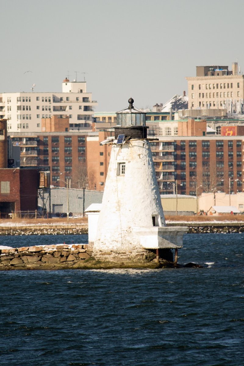
Schlitzer90 / Wikimedia Commons · CC BY-SA 3.0 The trip opens on Buzzards Bay with Palmer Island Light, the original 1849 rubblestone tower. It was shut down in 1962 and relit in 1999 as one of New Bedford's Millennium projects. Most sources put it at 24 ft, though Wikipedia says 23 and USBeacons 33. Its light sits 43 ft up and flashes white every eight seconds.
-
↓ 17.5 miles, about 29 min
2. Borden Flats Light
Bristol County, Massachusetts · built 1881
About half an hour on (17.5 miles), Borden Flats Light is a cast-iron sparkplug tower first lit on October 1, 1881, replacing an earlier beacon. Sources split on its height, 48 ft or 50 ft, so take either with a pinch of salt. The focal height is 46 ft, with an 11-nautical-mile range and a white flash every 2.5 seconds.
-
↓ 17.8 miles, about 28 min
3. Butler Flats Light
Bristol County, Massachusetts · built 1898
Francis Hopkinson Smith is the architect on record for Butler Flats Light, a caisson or sparkplug tower first lit on April 30, 1898. It stands 53 ft with its light at 52 ft. One 2014 source says it was deactivated that year and is privately owned, which clashes with an older 'still active' listing. It's 17.8 miles, about 28 minutes, from Borden Flats.
-
↓ 10.7 miles, about 22 min
4. Ned Point Light
Plymouth County, Massachusetts · built 1838
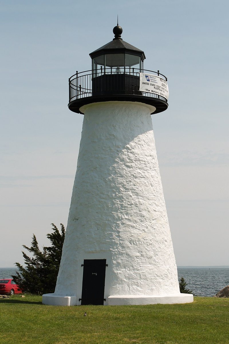
Schlitzer90 / Wikimedia Commons · CC BY-SA 3.0 Into Plymouth County now, 10.7 miles and roughly 22 minutes along. Ned Point Light is the original 1838 stone tower, listed as an active light in a town park after going dark from about 1951/52 to about 1961/63. Most sources give 39 ft, one says 35. Its isophase white light, at a 41 ft focal height, reaches 12 nautical miles.
-
↓ 66.4 miles, about 1 hr 39 min
5. Three Sisters of Nauset
Barnstable County, Massachusetts · built 1892
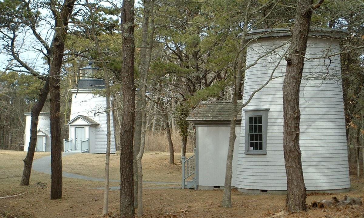
T.S. Custadio aka ToddC4176 at en.wikipedia / Wikimedia Commons · CC BY-SA 3.0 Budget for the big drive here: 66.4 miles, about an hour and 40 minutes. The Three Sisters of Nauset are three 22 ft wooden towers from 1892 that replaced 1838 brick towers. Sold off after leaving service, they were brought back together on Cable Road in Eastham by the National Park Service in 1983 and restored by 1989.
-
↓ 22.5 miles, about 41 min
6. West Dennis Light
Barnstable County, Massachusetts · built 1855
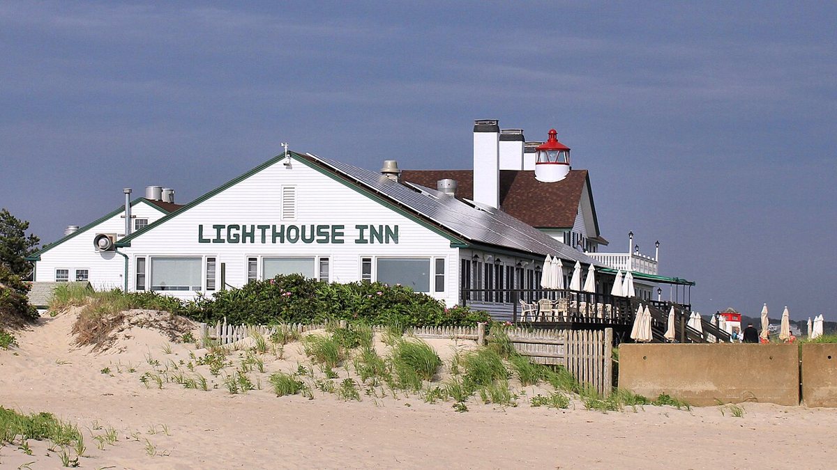
Larry D. Moore / Wikimedia Commons · CC BY 4.0 Also known as Bass River Light, West Dennis Light is the original 1855 tower on the roof of the old keeper's house, now the Lighthouse Inn. It was dark from 1914 until 1989, when the owners relit it as a private aid to navigation. The tower and its focal height are both 44 ft. Expect around 41 minutes (22.5 miles) from Nauset.
-
↓ 32.4 miles, about 1 hr 1 min
7. Nobska Light
Barnstable County, Massachusetts · built 1876
Roughly an hour's drive (32.4 miles) brings you to Nobska Light, a cast-iron tower with a brick lining dating from 1876. It replaced an 1828 light that sat on a house. Most sources say 40 ft, but the on-site marker says 42. Its light sits 87 ft up, flashing white every six seconds with a red sector, and carries 13 nautical miles.
-
↓ 11.2 miles, about 54 min
8. West Chop Light
Dukes County, Massachusetts · built 1891
Erosion has shaped West Chop's story. The station dates to 1817 and was moved back from the eroding bluff in 1830 and 1846. The current 45 ft brick tower went up in 1891, replacing the 1846 stone one, and was automated in 1976. Its occulting white light, with a red sector, sits at 85 ft. The leg is 11.2 miles, about 54 minutes.
-
↓ 16.6 miles, about 50 min
9. Cape Poge Light
Dukes County, Massachusetts · built 1893
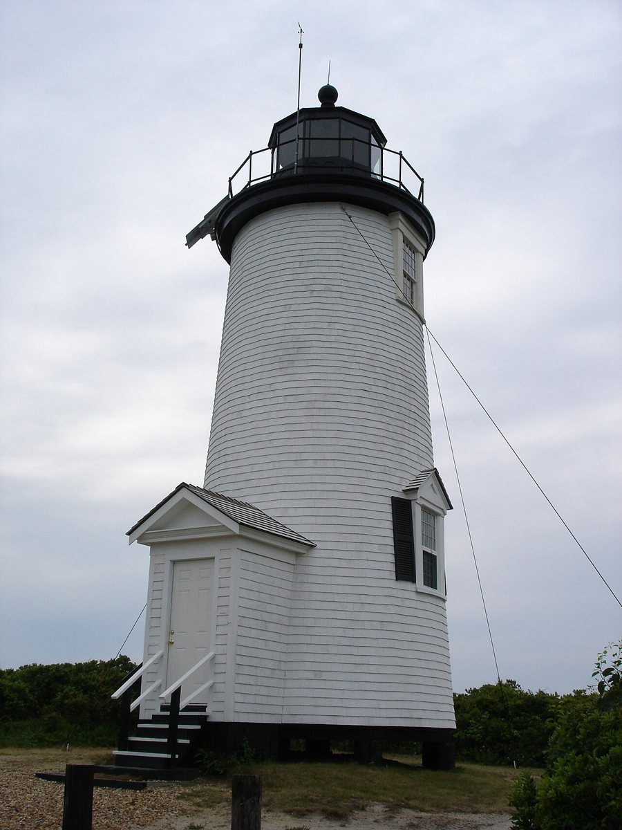
Tjbeach at English Wikipedia / Wikimedia Commons · CC BY-SA 3.0 The 1801 date at Cape Poge Light belongs to the first tower. Today's 35 ft wooden tower was built in 1893 as a 'temporary' structure and has been shifted inland in 1907, 1922, 1960 and 1987, with a helicopter move reported in 2015. Its light, 66 ft up, flashes white every six seconds. Allow about 50 minutes for the 16.6 miles.
-
↓ 7.2 miles, about 31 min
10. Edgartown Harbor Light
Dukes County, Massachusetts
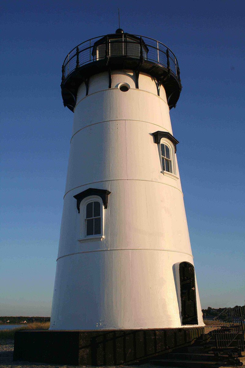
Williamwaterway / Wikimedia Commons · CC BY-SA 3.0 Last stop, 7.2 miles and around 31 minutes on. Edgartown Harbor Light's 1828 lighthouse was replaced in 1939 by a cast-iron tower moved by barge from Ipswich. Sources disagree on when that tower was built, 1875 or 1881, and on its height: 44, 45 or 58 ft. Its light, at a 46 ft focal height, flashes red every six seconds.
Every stop on this route links to its own page with coordinates, sourced facts and image licences. The text above was written from those records and checked against them before publishing. More lighthouses: all lighthouses in Massachusetts.