 Wayfarrow
Southern New York Lighthouse Road Trip: 9 Lights in One Day
9 stops167 milesabout 5 hr 12 min of drivingSouthern New York
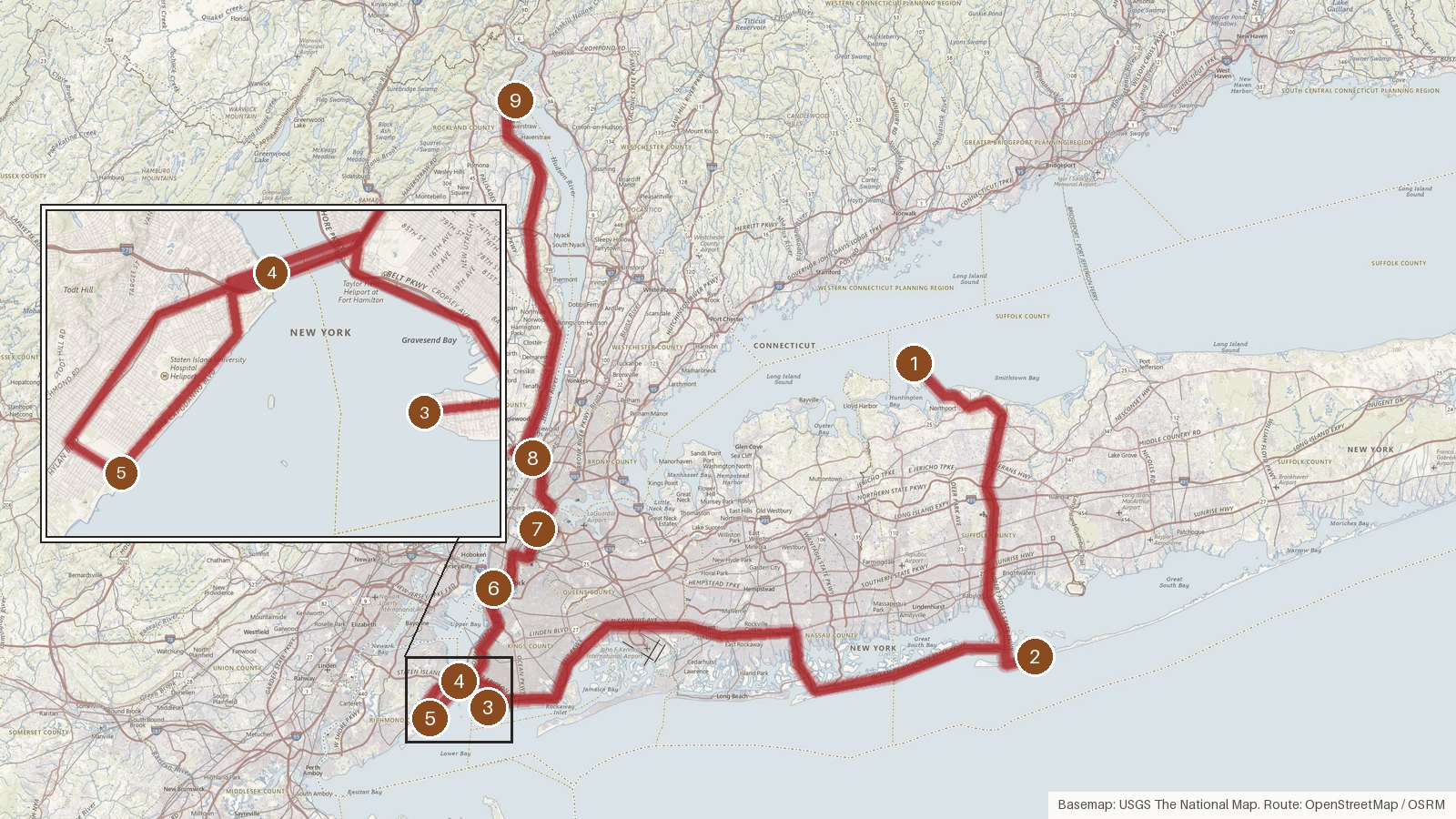
This one-way route links nine New York lights, starting at Eatons Neck Light in Suffolk County and finishing at Stony Point Light in Rockland County. It covers 167 miles, a little over five hours of driving before you add any time at the stops. Along the way it passes through Kings, Richmond and New York counties, with lights on New York Harbor, the East River and the Hudson River. The towers span well over a century of building, from Eatons Neck in 1798 to the concrete Elm Tree Beacon of 1939, and two of them were designed by noted architects, John McComb Jr. and James Renwick Jr. Many went dark long ago: Stony Point in 1925, Blackwell Island around 1940, Jeffrey's Hook in 1947, Elm Tree in 1964 and Fort Wadsworth in 1965. Start early, and check access locally for each stop before you set out.
Route and drive times from OpenStreetMap routing (OSRM). Times are estimates without stops; roads to remote sites can be unpaved or seasonal.
-
1. Eatons Neck Light
Suffolk County, New York · built 1798
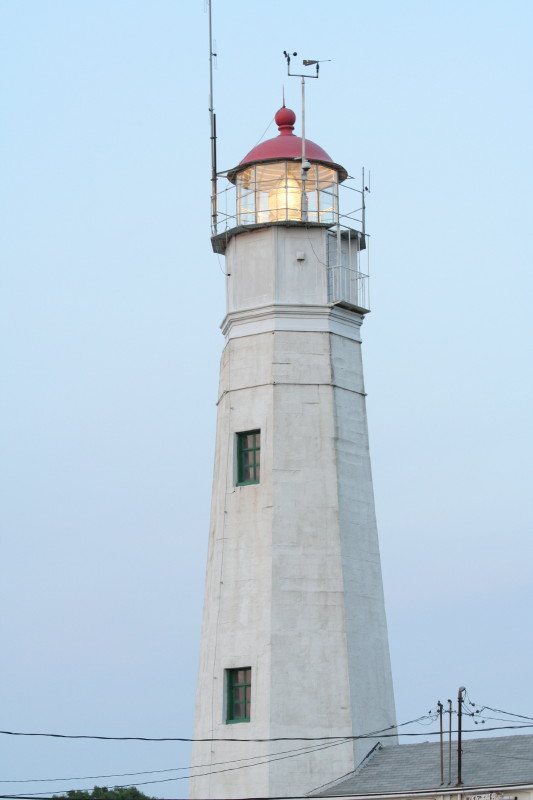
skapur / Wikimedia Commons · CC BY 2.5 First up is Eatons Neck Light, a 73-foot fieldstone tower designed by John McComb Jr. It was finished on December 6, 1798 and first lit on January 1, 1799, which is why some databases give 1799 as the build year. The original tower is still in place and still uses a third-order Fresnel lens. Its fixed white light sits 144 feet up, with an 18-nautical-mile range.
-
↓ 32.7 miles, about 59 min
2. Fire Island Light
Suffolk County, New York · built 1858
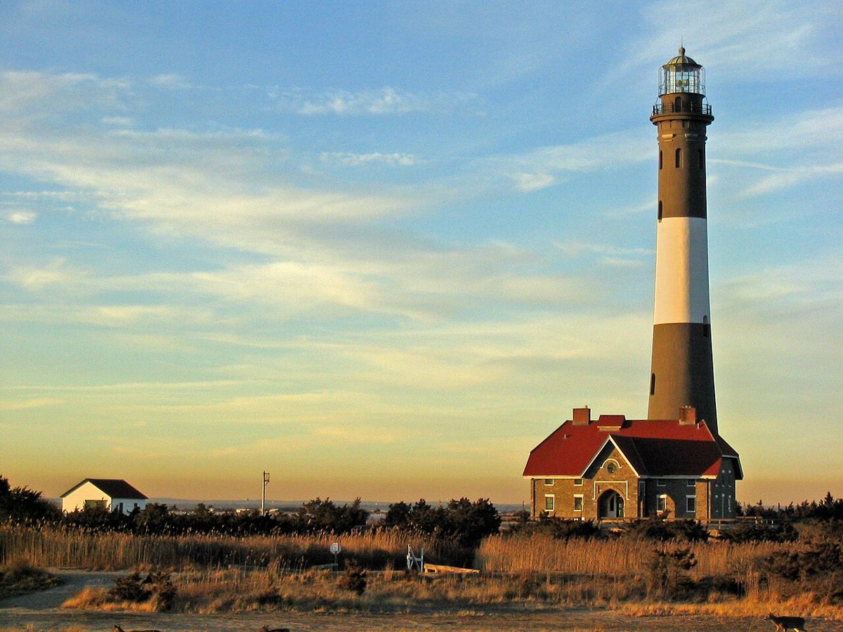
Don Fick / Wikimedia Commons · CC BY-SA 3.0 At 168 feet, Fire Island Light is about an hour on from Eatons Neck (32.7 miles, 59 minutes). This tower was finished in 1858, replacing a 74-foot tower from 1826. It was shut down in 1974 and relit in 1986. It flashes white every 7.5 seconds from a focal height of 180 feet, with a range of 24 nautical miles, and it's on the National Register of Historic Places.
-
↓ 51.8 miles, about 1 hr 21 min
3. Coney Island Light
Kings County, New York
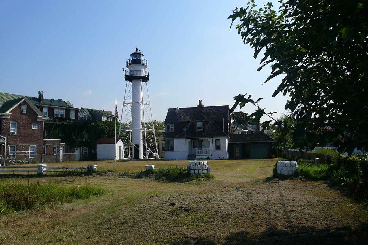
Jeffrey Lewis Riehle / Wikimedia Commons · CC BY-SA 3.0 Allow about 81 minutes for the 51.8-mile run to Coney Island Light on New York Harbor. Its date is disputed: Lighthousefriends says the original 1890 tower still stands, while the USCG and USLHS say the current tower was first lit in 1920. The tower is 61 feet tall, and the 75-foot figure you may see quoted is the focal height. It flashes red every five seconds.
-
↓ 8.5 miles, about 19 min
4. Fort Wadsworth Light
Richmond County, New York · built 1903
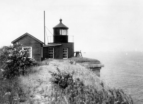
Unknown authorUnknown author / Wikimedia Commons · Public domain Just 19 minutes away in Richmond County, Fort Wadsworth Light is a small 15-foot brick tower on top of Battery Weed, built in 1903. It was shut off in 1965 after the Verrazano-Narrows Bridge was built, then restored and relit on September 24, 2005. Its focal height is 75 feet, and the record gives a range of 14 nautical miles.
-
↓ 5.2 miles, about 17 min
5. Elm Tree Beacon Light
Richmond County, New York · built 1939
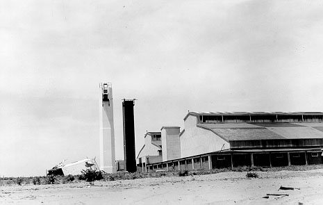
Unknown authorUnknown author / Wikimedia Commons · Public domain Seventeen minutes further on, Elm Tree Beacon Light is a 1939 concrete tower that replaced an 1856 wooden one and was shut off in 1964. Its height is debated: the USCG, Lighthouse Friends and Lighthouse Digest say 65 feet, while other sources say 59. The tower is part of the National Register-listed Miller Army Air Field Historic District, and its fixed white light was visible on the range line only.
-
↓ 14.3 miles, about 31 min
6. Titanic Memorial
New York County, New York · built 1913
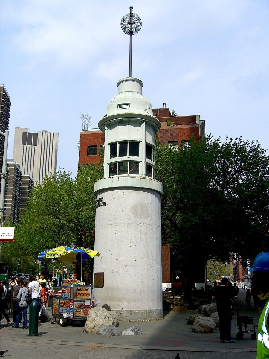
Nightscream / Wikimedia Commons · CC BY 3.0 Here's a lighthouse built as a memorial. The 60-foot Titanic Memorial went up in 1913 on top of the Seamen's Church Institute and was rebuilt at Fulton and Pearl Streets in 1976. Only the green metal top is original, and the base is newer concrete. Give yourself about 31 minutes for the 14.3-mile drive from Elm Tree Beacon.
-
↓ 8.5 miles, about 24 min
7. Blackwell Island Light
New York County, New York · built 1872
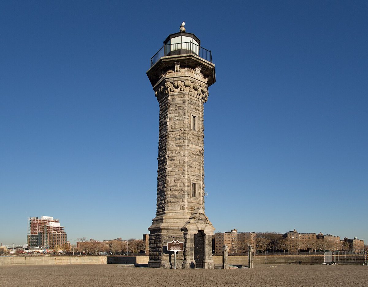
Rhododendrites / Wikimedia Commons · CC BY-SA 4.0 On the East River, Blackwell Island Light, now called the Roosevelt Island Lighthouse, is a 50-foot Gothic-style stone tower designed by James Renwick Jr. and built in 1872. It was decommissioned around 1940, went on the National Register in 1972 and became a NYC Landmark in 1976. The leg from the Titanic Memorial is 8.5 miles, about 24 minutes.
-
↓ 13.4 miles, about 30 min
8. Jeffrey's Hook Light
New York County, New York
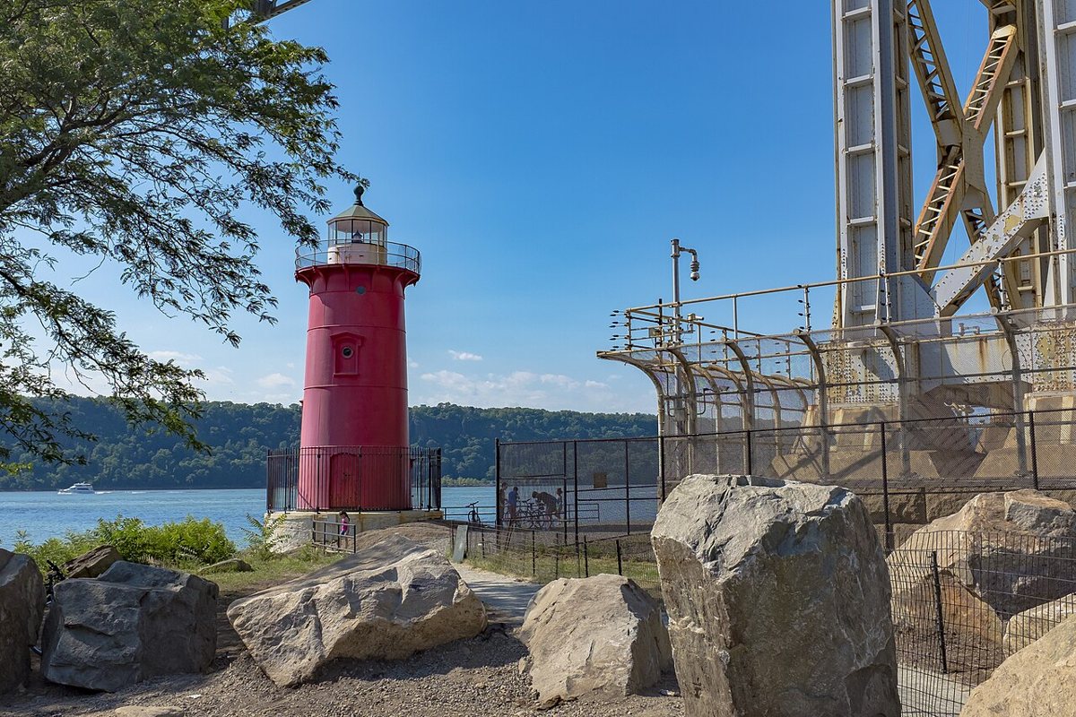
Billie Grace Ward / Wikimedia Commons · CC BY 2.0 About 30 minutes on, Jeffrey's Hook Light stands on the Hudson River in a tower that started life elsewhere. It was built at Sandy Hook, NJ in 1880 and put up again at Jeffrey's Hook in 1921, shortened from 55 to 40 feet, so sources disagree on which year counts as the build date. It was deactivated in 1947, flashes red every three seconds, and is on the National Register.
-
↓ 32.6 miles, about 51 min
9. Stony Point Light
Rockland County, New York · built 1826
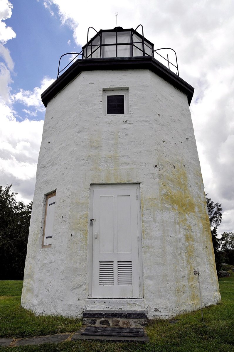
Tony / Wikimedia Commons · CC BY 2.0 The last leg, 32.6 miles and about 51 minutes, ends at Stony Point Light in Rockland County, the oldest lighthouse on the Hudson River. The 30-foot octagonal stone tower is the original 1826 structure, with a focal height of 177 feet. It was decommissioned in 1925, is now part of Stony Point Battlefield State Historic Site, and is listed on the National Register.
Every stop on this route links to its own page with coordinates, sourced facts and image licences. The text above was written from those records and checked against them before publishing. More lighthouses: all lighthouses in New York.