 Wayfarrow
Southern Wisconsin Lighthouse Road Trip: 9 Lights in One Day
9 stops75 milesabout 2 hr 33 min of drivingSouthern Wisconsin
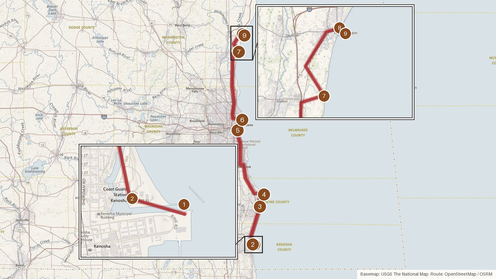
This route follows Wisconsin's Lake Michigan shore through Kenosha, Racine, Milwaukee and Ozaukee counties, linking nine lighthouses over about 75 miles. The driving adds up to roughly two and a half hours, which leaves time to linger at each stop. The towers span more than a century of building: the 1860 Port Washington station, the 1866 lights at Kenosha and Racine, Orlando Poe's 1880 Wind Point tower, a pair of 1906 steel pier lights, a 1935 Art Deco breakwater tower and a privately built 1981 lighthouse home. Retirements run through the route too. Kenosha's 1866 tower gave way to the 1906 pier light, Racine's light moved to a pierhead tower, Port Washington's station went dark in 1903 and North Point followed in 1994. Start early, and check access locally before heading to any stop.
Route and drive times from OpenStreetMap routing (OSRM). Times are estimates without stops; roads to remote sites can be unpaved or seasonal.
-
1. Kenosha North Pier Light
Kenosha County, Wisconsin · built 1906
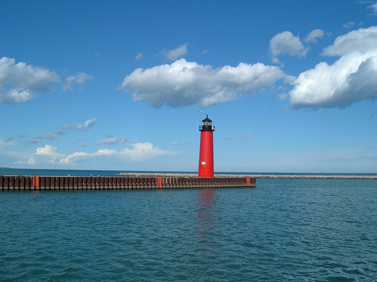
Wrongdave at English Wikipedia / Wikimedia Commons · Public domain Start at the harbor with this red riveted-steel pierhead tower, put up in 1906 to replace the old Kenosha (Southport) Light Station. It stands 50 ft, with a 49 ft focal height and an 11-nautical-mile range, showing Iso R 6s over Lake Michigan. It's privately owned but still serves as the harbor's active light, and it's listed on the National Register of Historic Places.
-
↓ 1.3 miles, about 4 min
2. Kenosha Light
Kenosha County, Wisconsin · built 1866
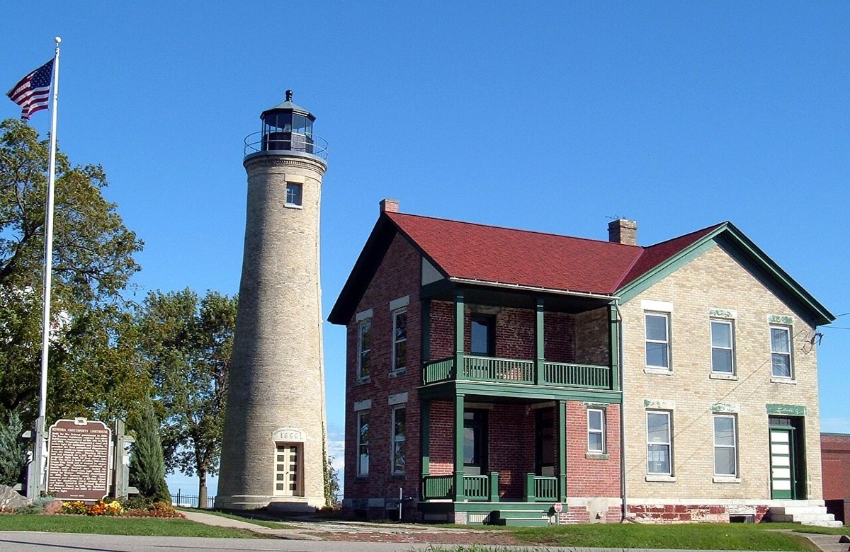
Dave Piasecki / Wikimedia Commons · Public domain Only 1.3 miles and about 4 minutes away, Kenosha Light, also called Southport Light, is the third tower at its site. Built in 1866, it stands 55 ft with a 75 ft focal height. It was retired as a navigation light in 1906, got a replica lantern in 1994 and has been lit nightly since 1996. It's now a museum and on the National Register.
-
↓ 11.4 miles, about 23 min
3. Racine Harbor Lighthouse and Life Saving Station
Racine County, Wisconsin · built 1866
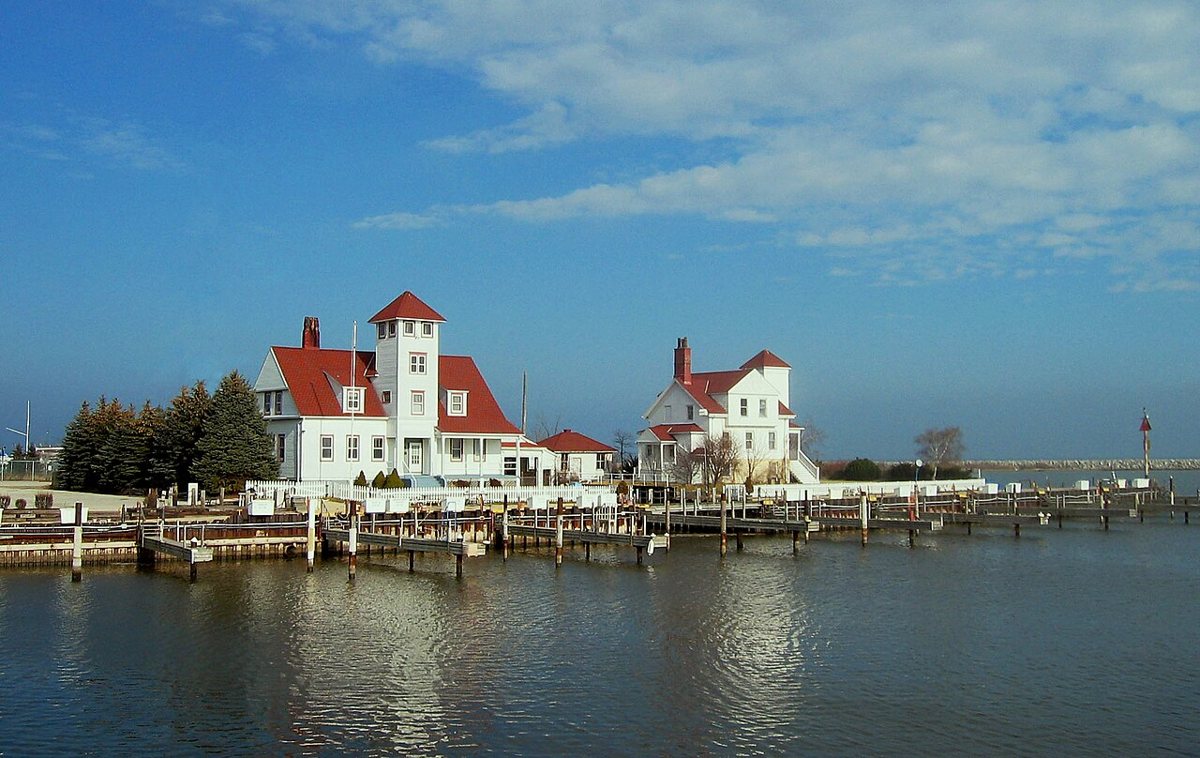
User:JeremyA / Wikimedia Commons · CC BY-SA 2.5 About 23 minutes and 11.4 miles on, Racine's 1866 brick lighthouse and keeper's dwelling still stand, now privately owned. The light was shut down when it moved to a pierhead tower, in 1901 by one account and 1903 by the record's deactivation date, and the tower was capped. The 1837 date sometimes attached to it belongs to the first Root River light. It's on the National Register.
Facts, map and sources for Racine Harbor Lighthouse and Life Saving Station →
-
↓ 4.4 miles, about 11 min
4. Wind Point Light
Racine County, Wisconsin · built 1880
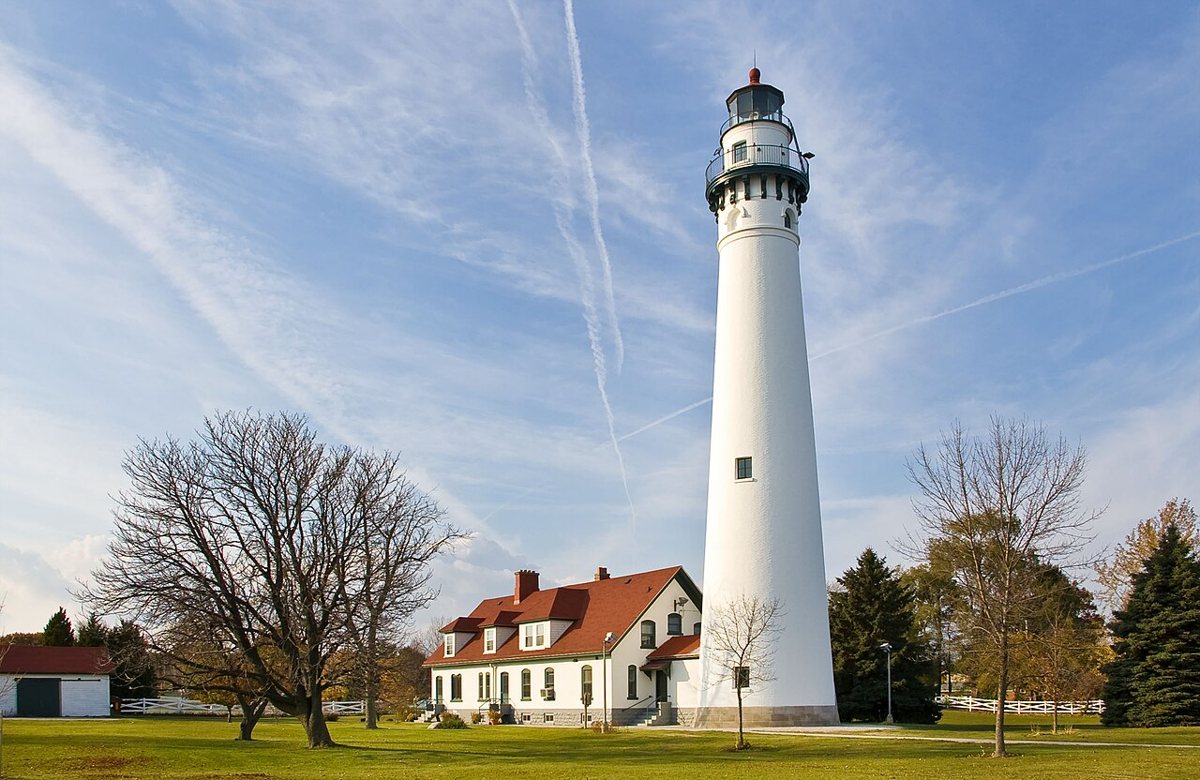
User:JeremyA / Wikimedia Commons · CC BY-SA 3.0 Orlando Metcalfe Poe designed Wind Point Light, a 108 ft tower first lit on November 15, 1880. One source gives 112 ft, but the official site and most others say 108. It's still an active aid to navigation on Lake Michigan, was listed on the National Register in 1984 and has belonged to the Village of Wind Point since 1997. It's 4.4 miles, about 11 minutes, from Racine.
-
↓ 23.5 miles, about 47 min
5. Milwaukee Pierhead Light
Milwaukee County, Wisconsin · built 1906
Plan on about 47 minutes for the 23.5 miles to Milwaukee's north pier, where a light first went up in 1872. The current steel conical tower replaced it in 1906. Height sources disagree: 42 ft per the Wisconsin Historical Society, 41 ft per Wikipedia. The focal height is 43 ft, the range 7 nautical miles and the characteristic Fl R 4s. It's on the National Register.
-
↓ 3.8 miles, about 12 min
6. North Point Light
Milwaukee County, Wisconsin · built 1888
A short hop of 3.8 miles, about 12 minutes, brings you to North Point Light. Its 1888 cast-iron tower replaced an 1855 tower, and in 1912 it was set on a new steel base to reach 74 ft. The record lists a focal height of 154 ft. Deactivated in 1994, it's now a museum and is listed on the National Register.
-
↓ 22 miles, about 34 min
7. Kevich Light
Ozaukee County, Wisconsin · built 1981
Head 22 miles, about 34 minutes, into Ozaukee County for Kevich Light in Grafton, a privately built 1981 lighthouse home that has been an active private aid to navigation since 1990. Its focal plane, given as 163 ft in the notes and 164 ft in the record, ranks second highest on the Great Lakes. The range is 20 nautical miles, showing Iso W 8s. Tower height varies by source.
-
↓ 6.9 miles, about 14 min
8. Port Washington Light
Ozaukee County, Wisconsin · built 1860
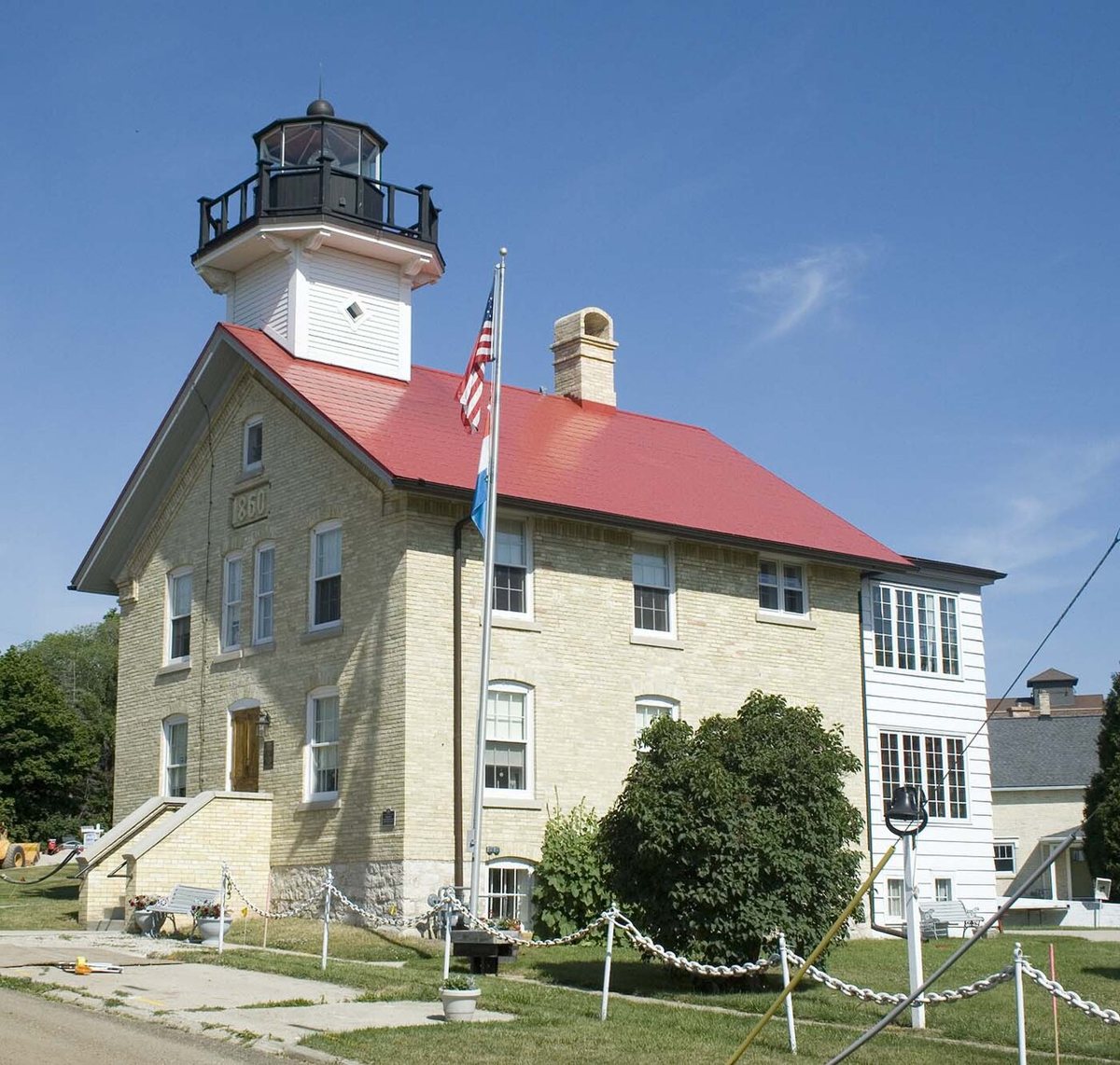
Freekee / Wikimedia Commons · Public domain Port Washington's 1860 light station is the building standing today. The 1849 date in the record belongs to the first tower, which was demolished. The station went dark in 1903, its tower was later removed, and a replica tower and lantern were added in 2001-02. It's now a museum, with a 112 ft focal height. It's 6.9 miles, about 14 minutes, from Kevich Light.
-
↓ 1.3 miles, about 8 min
9. Port Washington Breakwater Light
Ozaukee County, Wisconsin · built 1935
Finish 1.3 miles and about 8 minutes away at the Port Washington Breakwater Light, a 1935 Art Deco steel tower that replaced an 1889 wooden pierhead light. Sources split on its height, 59 ft or 71 ft, but its focal height is 79 ft. It shows Fl R 6s over Lake Michigan with an 8-nautical-mile range, and it's on the National Register.
Facts, map and sources for Port Washington Breakwater Light →
Every stop on this route links to its own page with coordinates, sourced facts and image licences. The text above was written from those records and checked against them before publishing. More lighthouses: all lighthouses in Wisconsin.