 Wayfarrow
Suffolk and Ulster Counties, New York Lighthouse Road Trip: 7 Lights, About 6 Hours of Driving
7 stops218 milesabout 6 hr 10 min of drivingSuffolk and Ulster Counties, New York
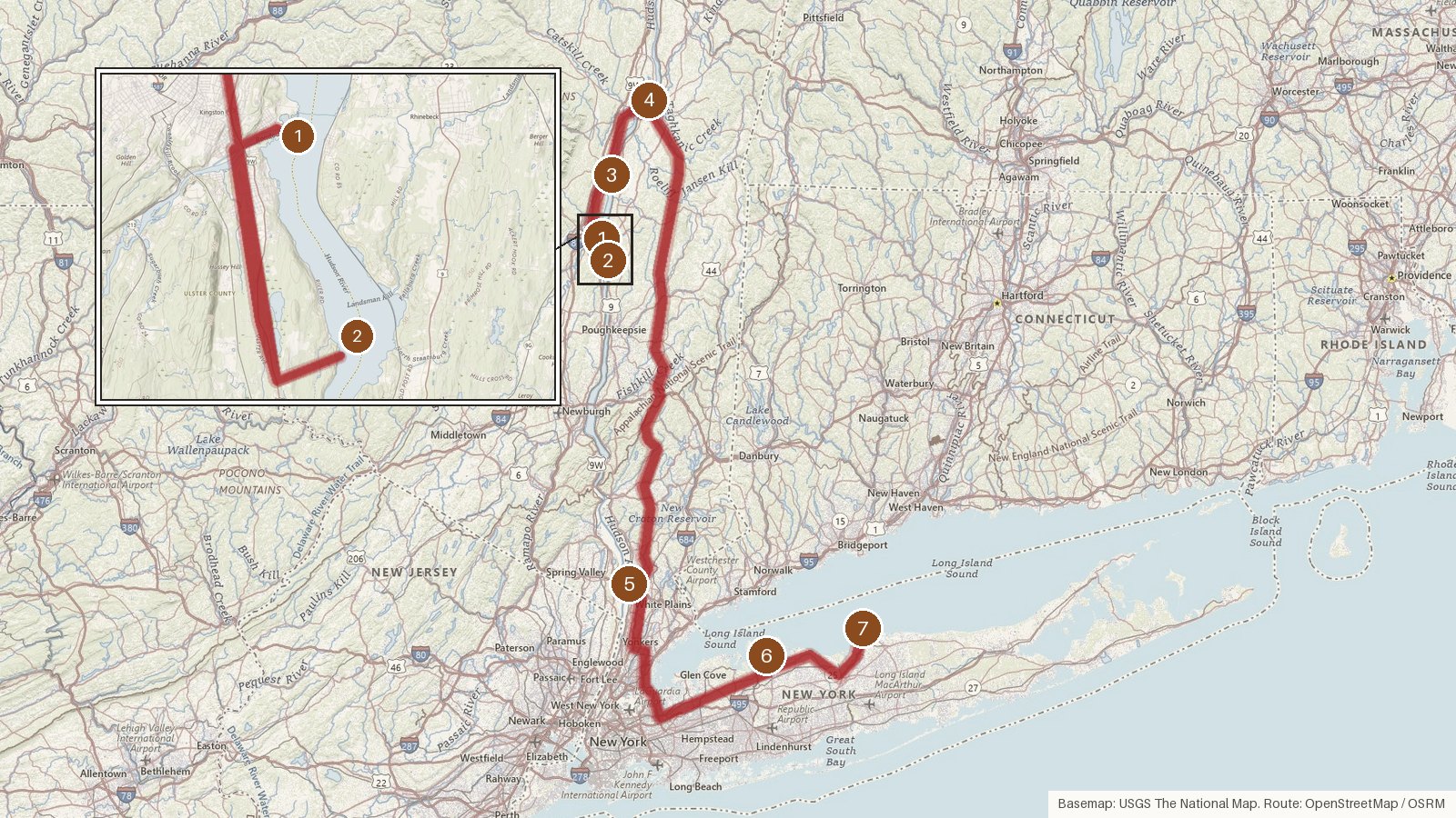
This route strings together seven lighthouses across four New York counties: Ulster, Greene, Westchester and Suffolk. It covers about 218 miles, with roughly six hours and ten minutes of driving. The biggest single leg is the run of about 93 miles from Hudson–Athens to Tarrytown, which takes a bit over two hours. The first five lights all stand on the Hudson River. The towers with a single recorded build year went up between 1869 and 1915. Old Field Point's granite lighthouse dates to 1868 or 1869. Materials run from wood and brick to cast iron, poured concrete and stone. Several of these lights went dark along the way: Old Field Point in 1933, Saugerties in 1954, Tarrytown in 1961 and Esopus Meadows in 1965. Saugerties and Old Field Point were later relit. Six of the seven are listed on the National Register of Historic Places. Start early, and check access locally before setting out.
Route and drive times from OpenStreetMap routing (OSRM). Times are estimates without stops; roads to remote sites can be unpaved or seasonal.
-
1. Rondout Light
Ulster County, New York · built 1915
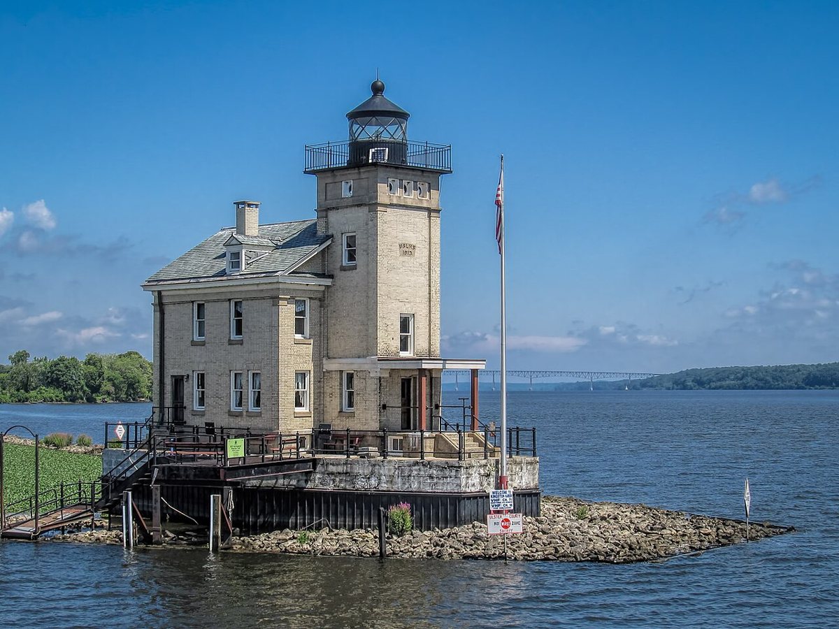
John S. Hirth / Wikimedia Commons · CC BY-SA 3.0 Start at Rondout Creek, where this yellow-brick tower lit in 1915 is the third light to stand here. An 1837 wooden light and an 1867 bluestone light came first, and the stone one was torn down in the 1950s. The tower stands 48 feet, with a 52-foot focal height, and its white flash every six seconds has a range of 9 nautical miles.
-
↓ 7.3 miles, about 16 min
2. Esopus Meadows Light
Ulster County, New York · built 1871
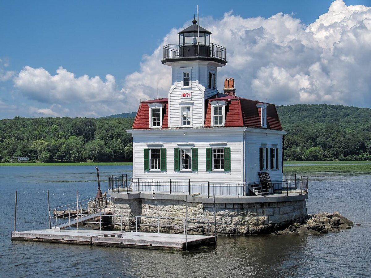
John S. Hirth / Wikimedia Commons · CC BY-SA 3.0 Just 7.3 miles and about 16 minutes on, Esopus Meadows Light is the wooden lighthouse of the trip. It was finished in 1871 and first lit in 1872, replacing an 1839 original. Reported heights don't agree, ranging from 25 to 56 feet, though the focal height is listed at 59 feet. It flashed white every 2.5 seconds until it was deactivated in 1965.
-
↓ 19.6 miles, about 38 min
3. Saugerties Light
Ulster County, New York · built 1869
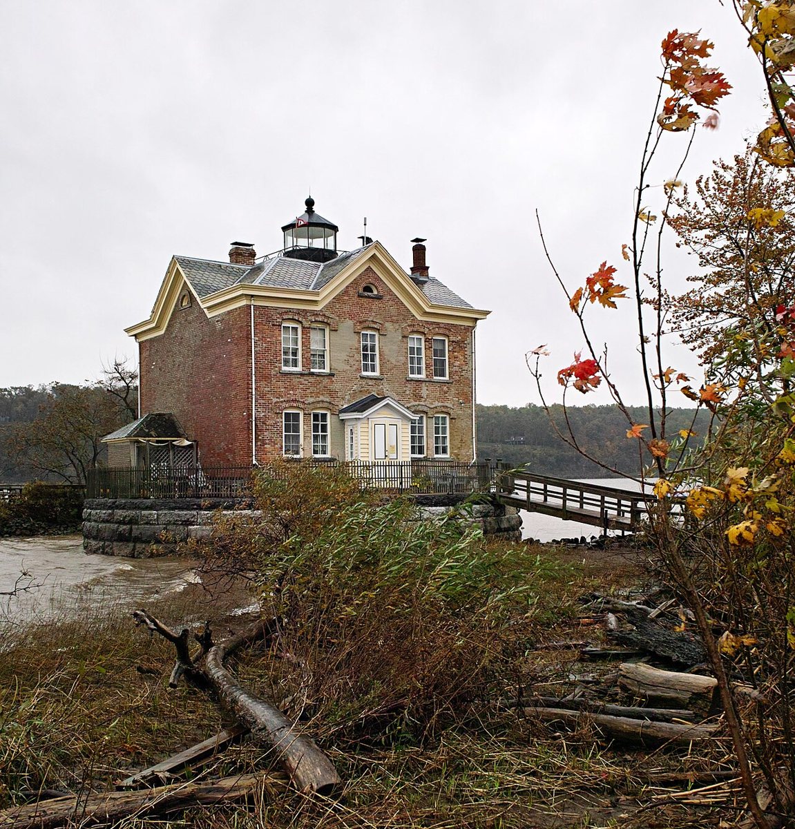
Dicklyon / Wikimedia Commons · CC BY-SA 3.0 Give yourself about 38 minutes for the 19.6 miles to Saugerties Light. This 1869 lighthouse replaced an earlier one and was deactivated in 1954. The Saugerties Lighthouse Conservancy bought it in 1986 and rebuilt it, and the light was turned back on in 1990. It stands 46 feet, with a 43-foot focal height and an occulting white light on a four-second cycle.
-
↓ 18.8 miles, about 37 min
4. Hudson–Athens lighthouse
Greene County, New York · built 1874
The route moves into Greene County next, 18.8 miles and about 37 minutes away. The Hudson–Athens lighthouse is a Second Empire brick building set in the middle of the river. It was first lit on November 14, 1874, and automated in 1949. Sources give its height as 30, 36 or 46 feet. The focal height is listed at 49 feet, with an occulting green light.
-
↓ 92.9 miles, about 2 hr 17 min
5. Tarrytown Light
Westchester County, New York · built 1883
This is the long haul: 92.9 miles and about 137 minutes to Westchester County. Tarrytown Light, also called Sleepy Hollow or Kingsland Point Light, is a cast-iron sparkplug lighthouse from 1883 that was deactivated in 1961. USCG gives 60 feet to the top and 56 feet to the focal plane, though some sites call the tower 56 feet. Its light characteristic is listed as fixed red.
-
↓ 51.7 miles, about 1 hr 29 min
6. Huntington Harbor Light
Suffolk County, New York · built 1912
After 51.7 miles and about 89 minutes, Huntington Harbor Light in Suffolk County marks a light station that dates to 1857. The current poured-concrete tower went up in 1912 and is still active, owned by a preservation society. It's listed at 42 feet, though one tourism listing says 54. Its isophase white light, on a six-second cycle, has a range of 9 nautical miles.
-
↓ 27.3 miles, about 53 min
7. Old Field Point Light
Suffolk County, New York
The last leg is 27.3 miles, about 53 minutes. Old Field Point's 1823 tower is gone, and the granite lighthouse here dates to 1868 or 1869, as sources differ. It was deactivated in 1933 and relit in 1991. Reported heights conflict: about 46 feet, about 50, or 74 feet above sea level. The focal height is 75 feet, and its red and green light alternates on a 24-second cycle.
Every stop on this route links to its own page with coordinates, sourced facts and image licences. The text above was written from those records and checked against them before publishing. More lighthouses: all lighthouses in New York.