 Wayfarrow
West Virginia Covered Bridge Road Trip: 9 Bridges in One Day
9 stops229 milesabout 5 hr 9 min of drivingWest Virginia
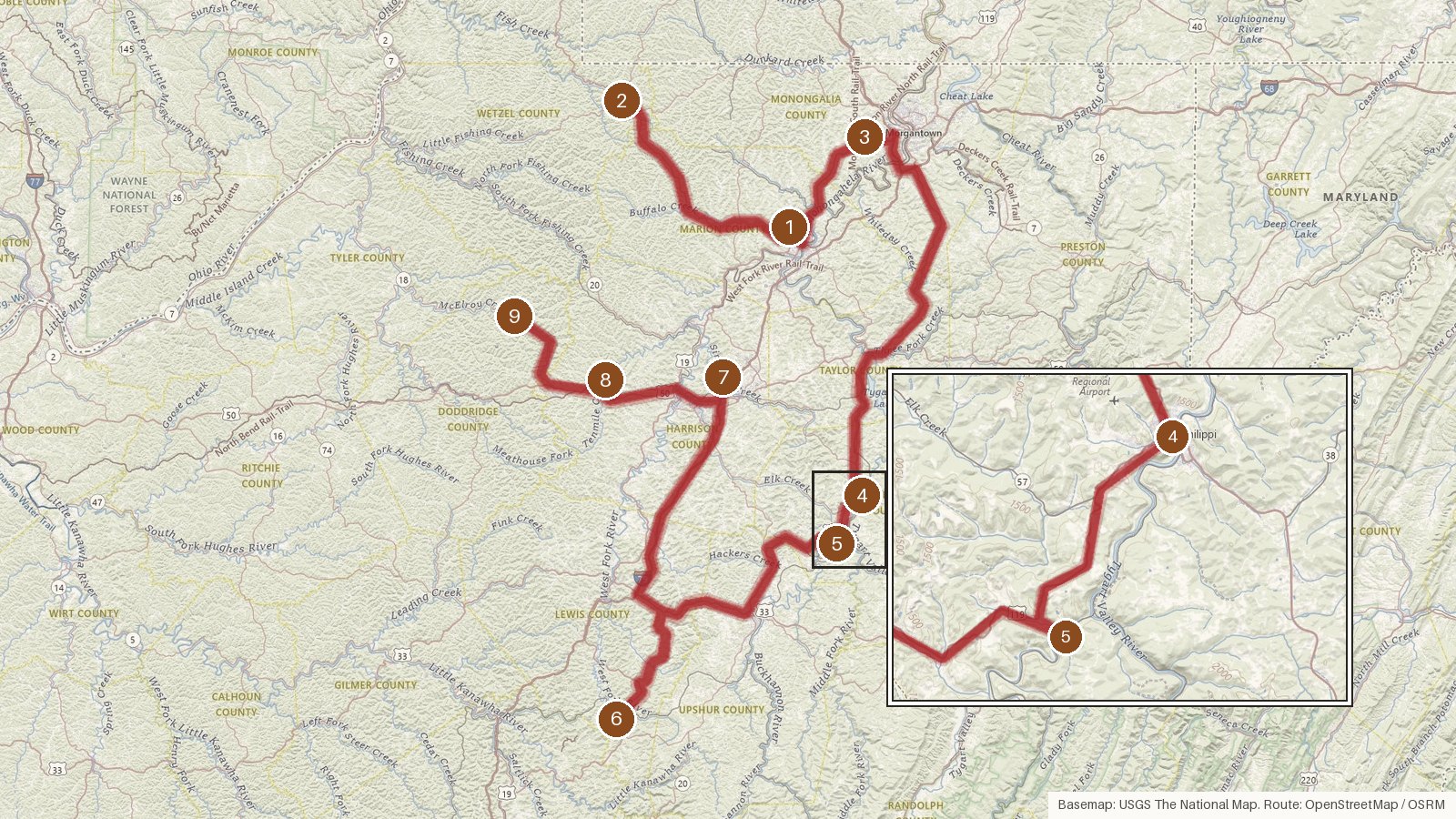
This route links nine covered bridges across seven West Virginia counties: Marion, Wetzel, Monongalia, Barbour, Lewis, Harrison and Doddridge. It covers about 229 miles. The leg-by-leg driving adds up to a little over five hours, before any time spent at the bridges themselves. All nine are listed on the National Register of Historic Places. Three date from the 1850s: Philippi (1852), Barrackville (1853) and Carrollton (1856). Most of the rest come from the 1880s and 1890s, and Walkersville followed in 1903. Along the way you'll see Burr arch, kingpost, multiple-kingpost and Long truss designs over waters such as Buffalo Creek, the Tygart Valley River, the Buckhannon River and Tenmile Creek. Several builders are known by name, including Lemuel Chenoweth, Asa Hugill and Solomon Swiger. Start early, check access locally before you set out, and expect patchy cell coverage on the rural stretches.
Route and drive times from OpenStreetMap routing (OSRM). Times are estimates without stops; roads to remote sites can be unpaved or seasonal.
-
1. Barrackville Covered Bridge
Marion County, West Virginia · built 1853
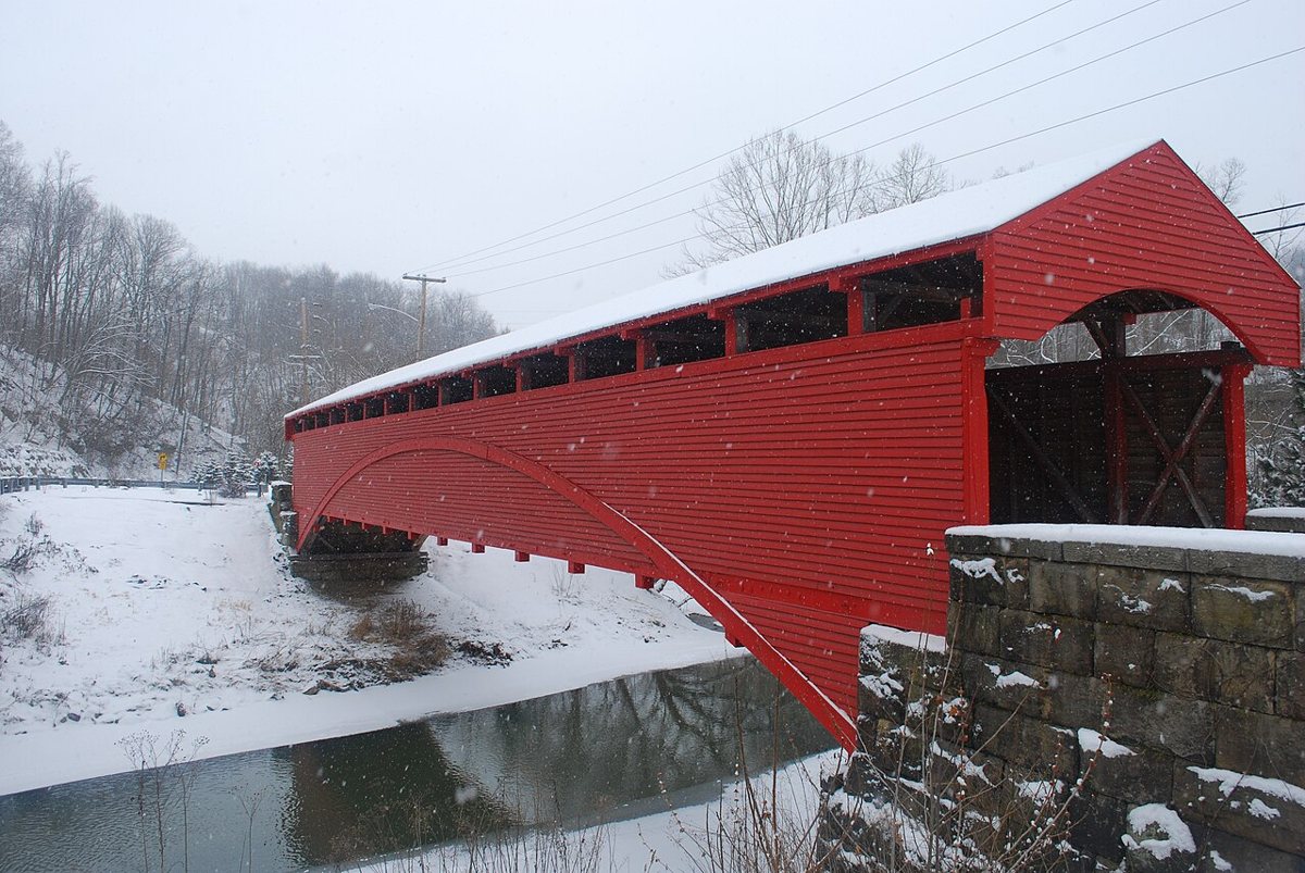
Brian M. Powell (user Bitmapped on en.wikipedia) / Wikimedia Commons · CC BY-SA 3.0 Start at Barrackville in Marion County, where Lemuel and Eli Chenoweth built this Burr arch truss over Buffalo Creek in 1853. It was spared during the 1863 Jones-Imboden Raid. The bridge was closed in 1987 and replaced by a nearby modern bridge. Reported lengths range from 145 to 148 ft, and it's listed on the National Register of Historic Places.
-
↓ 26 miles, about 31 min
2. Fish Creek Covered Bridge
Wetzel County, West Virginia · built 2001
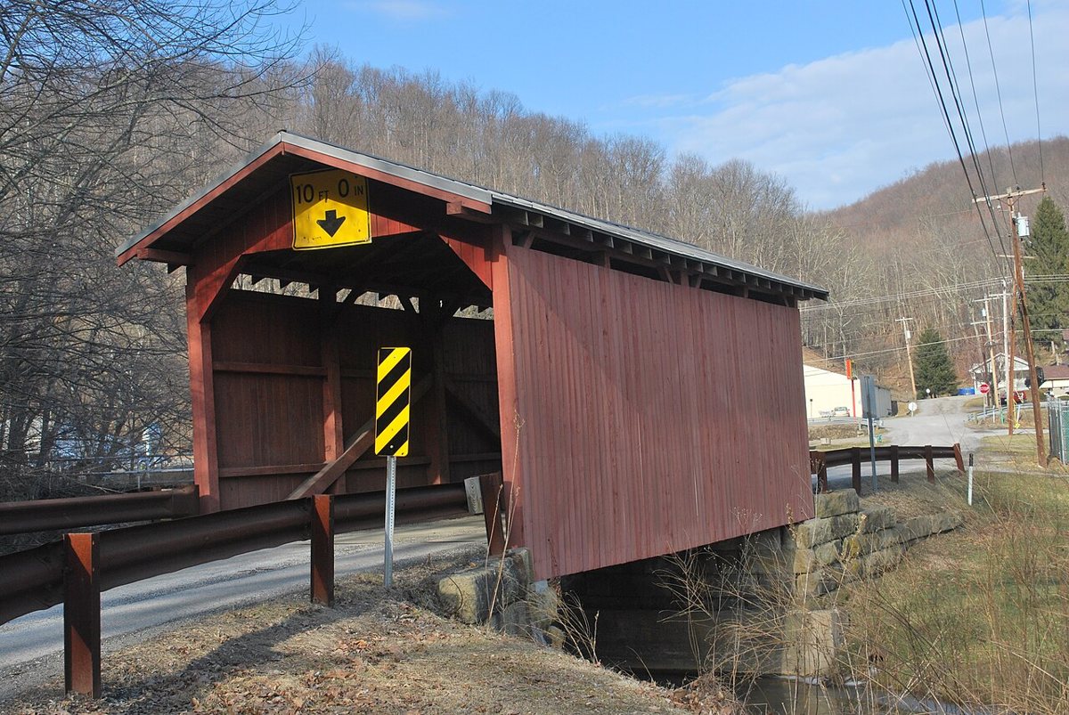
Brian M. Powell (user Bitmapped on en.wikipedia) / Wikimedia Commons · CC BY-SA 3.0 About 31 minutes and 26 miles on, in Hundred in Wetzel County, Fish Creek Covered Bridge crosses the West Virginia Fork Fish Creek. The original from about 1881 was completely rebuilt in 2001, keeping only four timber braces and the stone abutments. WVDOT calls that a renovation. The length is listed as 36 ft, though one Wikipedia list says 30 ft.
-
↓ 41 miles, about 54 min
3. Dents Run Covered Bridge
Monongalia County, West Virginia · built 1889
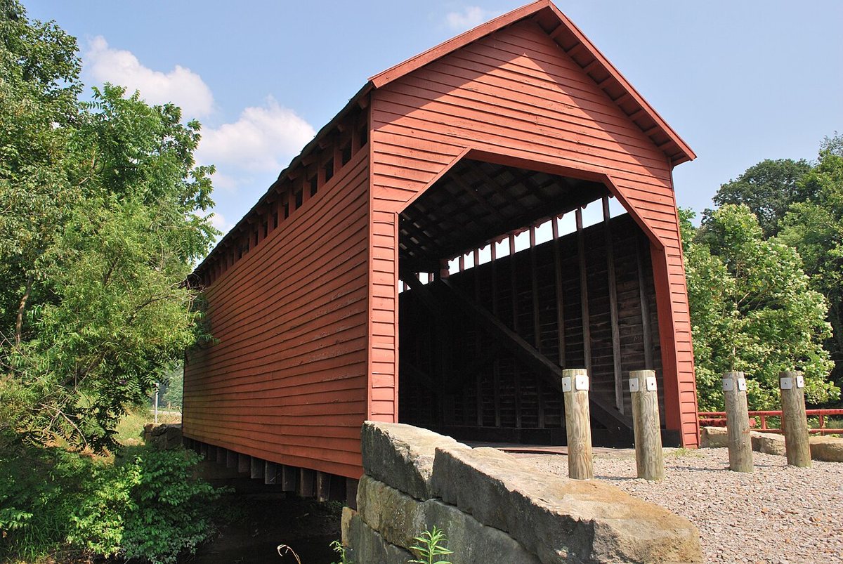
Brian M. Powell (user Bitmapped on en.wikipedia) / Wikimedia Commons · CC BY-SA 3.0 Allow about 54 minutes for the 41 miles to Dents Run, a kingpost truss bridge from 1889. It's the only covered bridge left in Monongalia County, and the record notes that it now carries foot traffic only. The listed length is 40 ft, while one source gives the total as 42 ft. It's on the National Register of Historic Places.
-
↓ 45.7 miles, about 56 min
4. Philippi Covered Bridge
Barbour County, West Virginia · built 1852
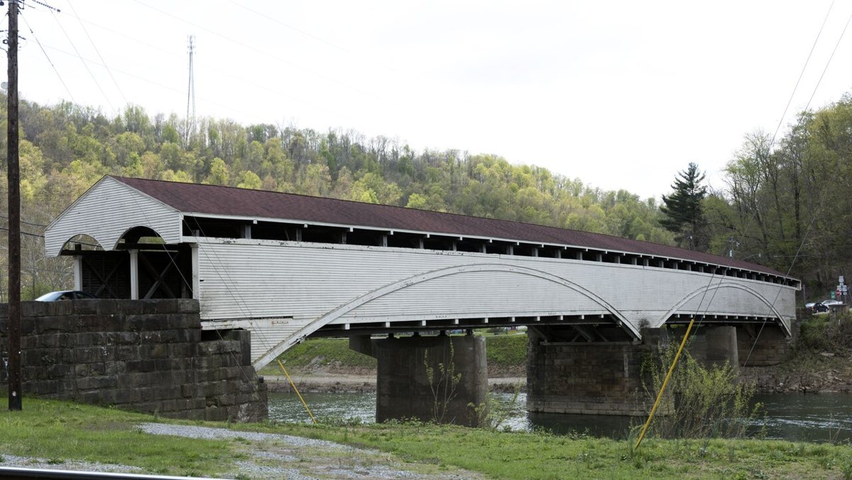
Carol M. Highsmith / Wikimedia Commons · Public domain Expect about 56 minutes and 45.7 miles to reach Philippi in Barbour County. This two-lane Burr arch bridge on US 250 crosses the Tygart Valley River and dates from 1852. It was rebuilt in 1991 and was originally 312 ft long. Most sources give 285.5 ft, but some say 304 or 311 ft, so don't be surprised by differing figures.
-
↓ 6.4 miles, about 10 min
5. Carrollton Covered Bridge
Barbour County, West Virginia · built 1856
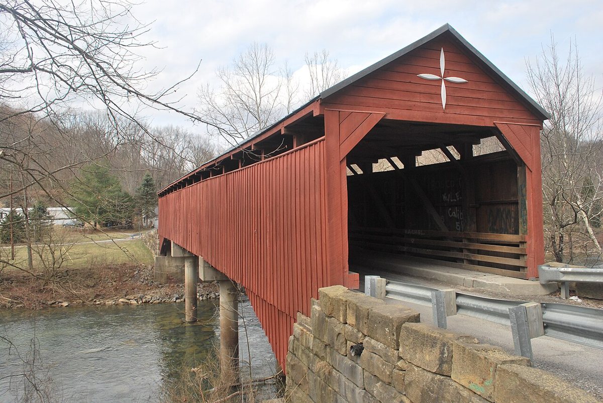
Brian M. Powell (user Bitmapped on en.wikipedia) / Wikimedia Commons · CC BY-SA 3.0 Only about 10 minutes (6.4 miles) away, and still in Barbour County, Carrollton Covered Bridge has crossed the Buckhannon River since 1856. Arson damaged it in August 2017. WVDOH replaced most of the truss work and reopened it to traffic in May 2023. It's listed at 140 ft and appears on the National Register of Historic Places.
-
↓ 37.8 miles, about 56 min
6. Walkersville Covered Bridge
Lewis County, West Virginia · built 1903
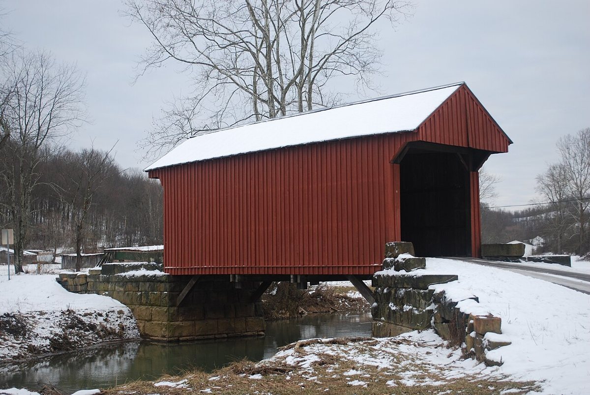
Brian M. Powell (user Bitmapped on en.wikipedia) / Wikimedia Commons · CC BY-SA 3.0 Lewis County's only remaining covered bridge is about 56 minutes and 37.8 miles on. John G. Sprigg built it in 1903, not 1902 as the record says. The NRHP length is 39 ft 4 in, though one list says 54 ft and another 42 ft. That's a good reminder of how loosely these numbers travel between sources.
-
↓ 39.3 miles, about 53 min
7. Simpson Creek Covered Bridge
Harrison County, West Virginia
Asa Hugill built the Simpson Creek Covered Bridge in Harrison County in 1881, about 53 minutes and 39.3 miles from Walkersville. A flood later washed it away, and it was re-erected about half a mile downstream in 1888, 1889 or 1899, depending on the source. Restored in 2002, it's listed as pedestrian-only. The state marker says 75 ft, and another source says 79 ft.
-
↓ 16 miles, about 23 min
8. Fletcher Covered Bridge
Harrison County, West Virginia · built 1891
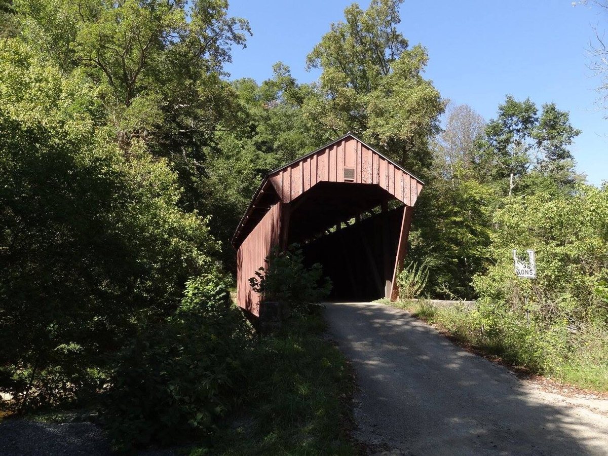
Bill Eichelberger / Wikimedia Commons · CC BY-SA 4.0 Still in Harrison County and about 23 minutes (16 miles) away, Fletcher Covered Bridge is a multiple-kingpost span over Tenmile Creek. Solomon Swiger built it in 1891, and records describe it as still in regular use. WVDOH gives its length as 58.25 ft, while other sources say 62 ft. It's listed on the National Register of Historic Places.
-
↓ 16.4 miles, about 27 min
9. Center Point Covered Bridge
Doddridge County, West Virginia
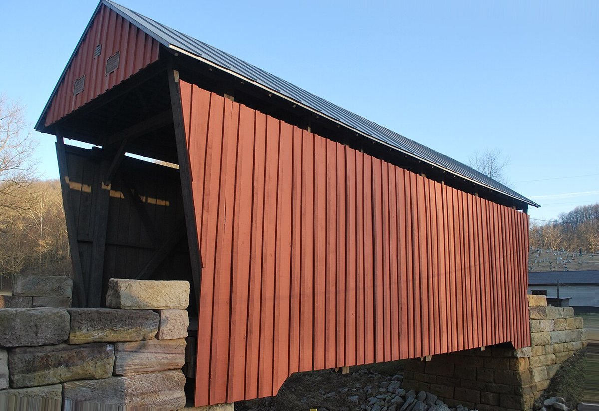
Brian M. Powell (user Bitmapped on en.wikipedia) / Wikimedia Commons · CC BY-SA 3.0 Finish about 27 minutes and 16.4 miles away at Center Point, the only covered bridge left in Doddridge County. It's a Long truss bridge that sources date to 1888, 1889 or 1888-1890. It no longer carries traffic and was renovated in 2002. The listed length is 42 ft. Check access locally before heading out for this last stop.
Every stop on this route links to its own page with coordinates, sourced facts and image licences. The text above was written from those records and checked against them before publishing. More covered bridges: all covered bridges in West Virginia.