 Wayfarrow
Western Ohio Covered Bridge Road Trip: 11 Bridges, About 7 Hours of Driving
11 stops284 milesabout 7 hr 22 min of drivingWestern Ohio
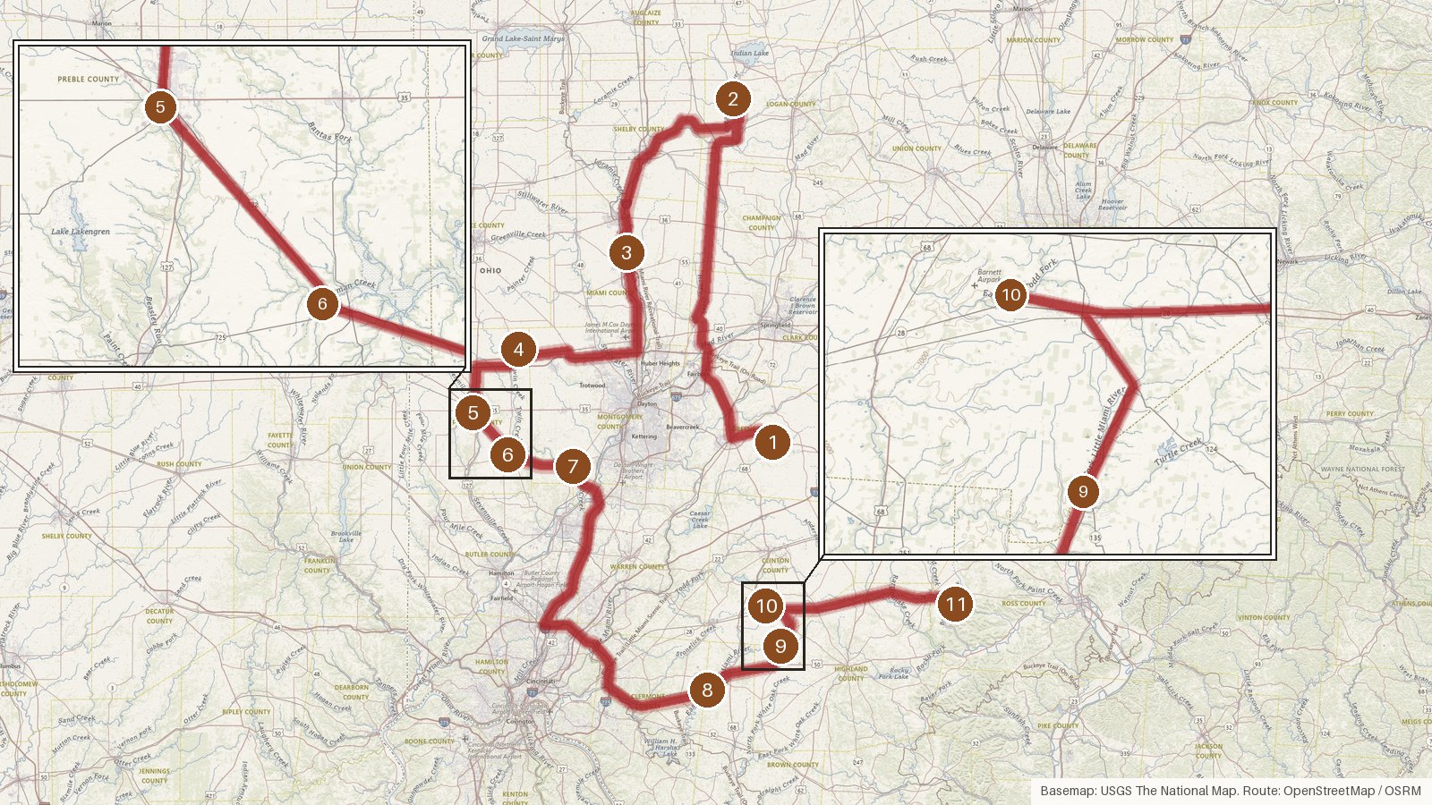
This route links 11 covered bridges across nine Ohio counties. It covers 284 miles, with about seven hours and 20 minutes of driving in total. The bridges span most of the 1800s, from Roberts Covered Bridge, Ohio's oldest, built in 1829, to Warnke, finished early in 1896. A few names come up more than once. Everett S. Sherman built both Warnke and Brubaker, and the Smith Bridge Company is behind McCafferty Road and South Salem. Along the way you'll see Howe, Long, Childs and Smith trusses, cross the Great Miami River twice and spend three stops in Preble County. Many of these bridges have conflicting length figures on record, and we've noted those rather than smoothing them over. Start early, check access locally before you set out, and don't count on steady cell coverage on rural roads.
Route and drive times from OpenStreetMap routing (OSRM). Times are estimates without stops; roads to remote sites can be unpaved or seasonal.
-
1. Ballard Road Covered Bridge
Greene County, Ohio · built 1883
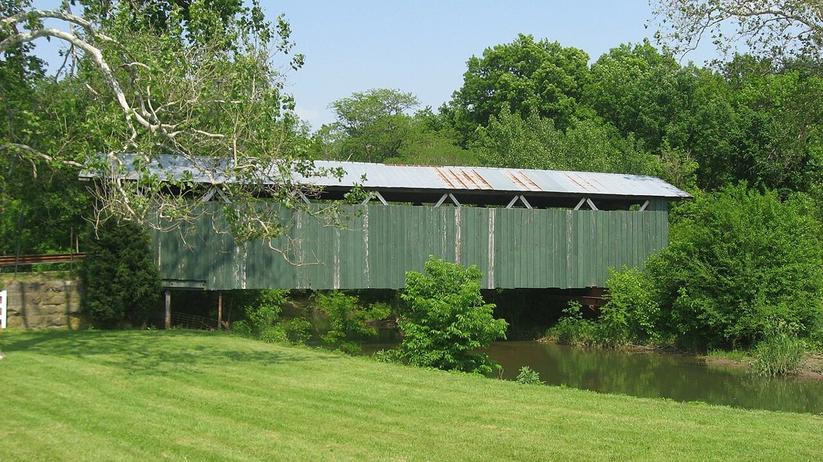
Nyttend / Wikimedia Commons · Public domain The trip starts at Ballard Road Covered Bridge in Greene County, a Howe truss that James E. Brown built in 1883 over North Branch Caesar Creek. It's listed on the National Register of Historic Places and was restored in 2016 and 2017. Don't expect a tidy length figure, because sources disagree between 80 ft and a 92-ft span.
-
↓ 62.9 miles, about 1 hr 39 min
2. McColly Covered Bridge
Logan County, Ohio · built 1876
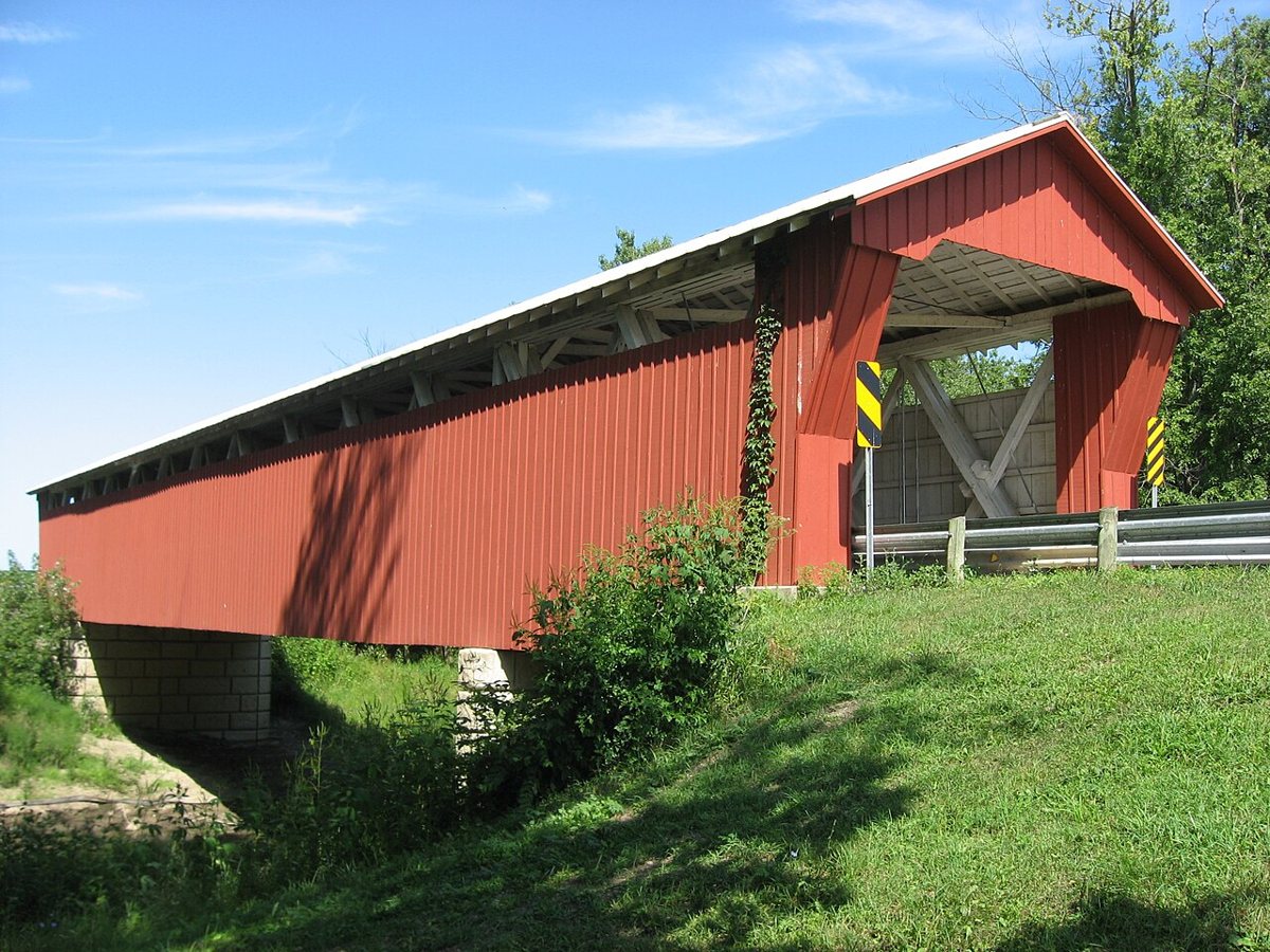
User:Nyttend / Wikimedia Commons · Public domain Allow about 99 minutes for the 62.9 miles to Logan County. McColly Covered Bridge is an 1876 Howe truss built by the Anderson Green Company over the Great Miami River. It was restored in 2000 and is on the National Register of Historic Places. Reported lengths vary between 125 and 130 ft.
-
↓ 37.3 miles, about 54 min
3. Eldean Covered Bridge
Miami County, Ohio · built 1860
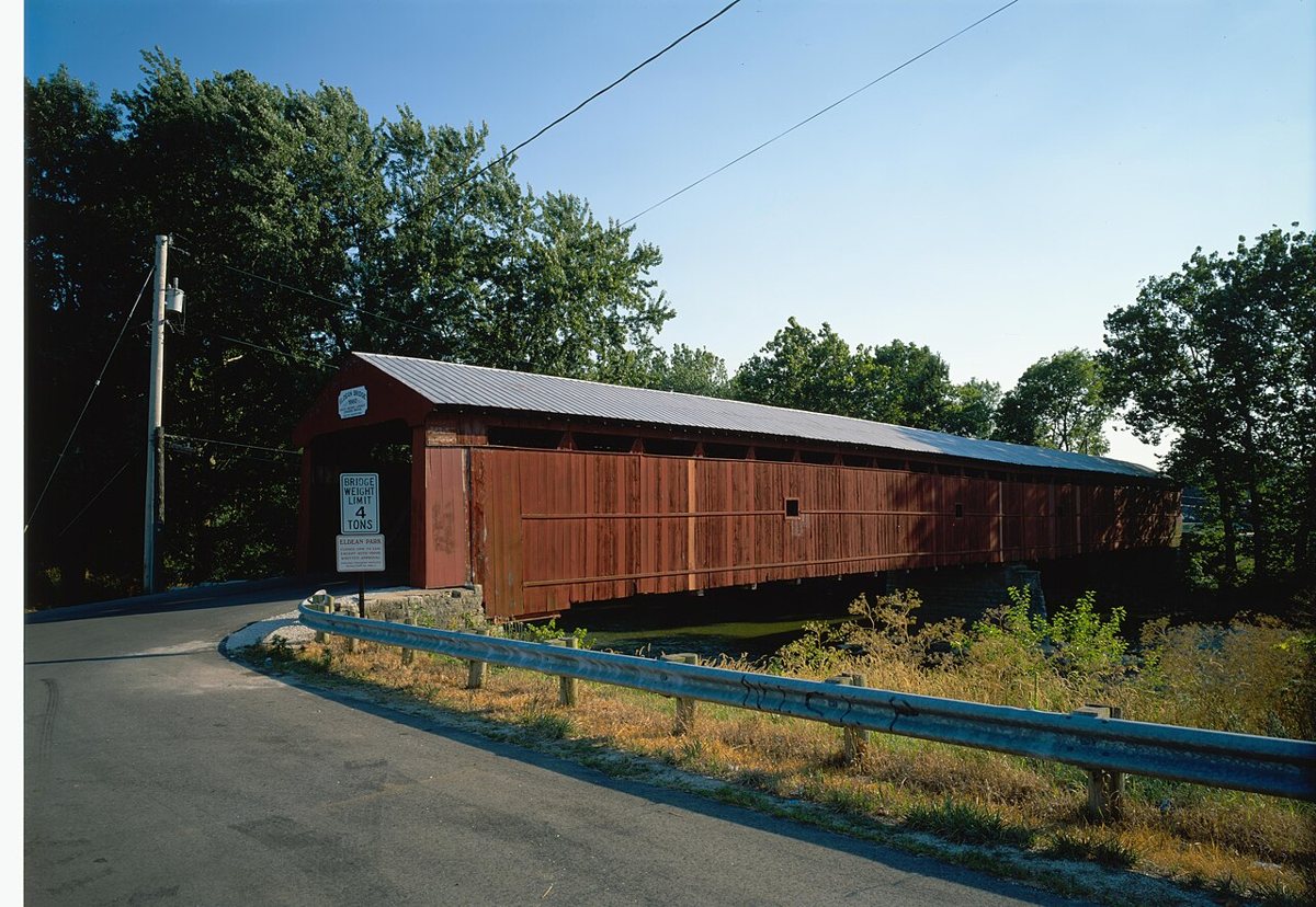
Jet Lowe / Wikimedia Commons · Public domain Eldean Covered Bridge, 37.3 miles and about 54 minutes on in Miami County, is the longest surviving Long truss. The two-span bridge over the Great Miami River dates to 1860, was restored in 2005 and 2006, and is a National Historic Landmark. Its length depends on how it's measured, with sources ranging from about 219 to 235 ft.
-
↓ 34.7 miles, about 52 min
4. Warnke Covered Bridge
Preble County, Ohio · built 1895
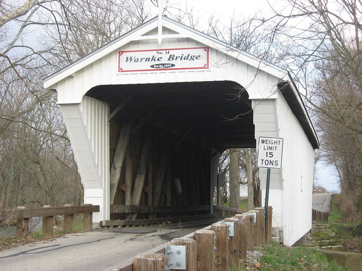
Nyttend / Wikimedia Commons · Public domain Everett S. Sherman's last bridge is on Swamp Creek Rd in Preble County, about 52 minutes (34.7 miles) from Eldean. Warnke Covered Bridge is a Childs truss built in 1895 and finished early in 1896, then rehabilitated in 2008. It's on the National Register of Historic Places. Most listings give 51 ft, though one source puts the total length at 52.2 ft.
-
↓ 14.8 miles, about 25 min
5. Roberts Covered Bridge
Preble County, Ohio · built 1829
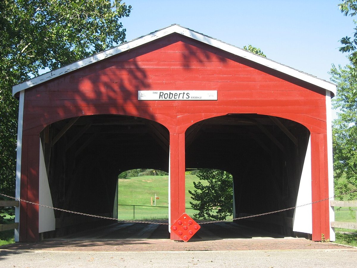
Nyttend / Wikimedia Commons · Public domain About 25 minutes on, Roberts Covered Bridge holds two distinctions. Built in 1829, it's Ohio's oldest covered bridge and its only double-barrel, two-lane one. Arsonists badly damaged it in 1986, and in 1990 and 1991 it was restored and moved to a city park in Eaton. Its record lists Sevenmile Creek as the water crossed. Sources give lengths of 79, 90 and 91.5 ft.
-
↓ 9 miles, about 18 min
6. Brubaker Covered Bridge
Preble County, Ohio · built 1887
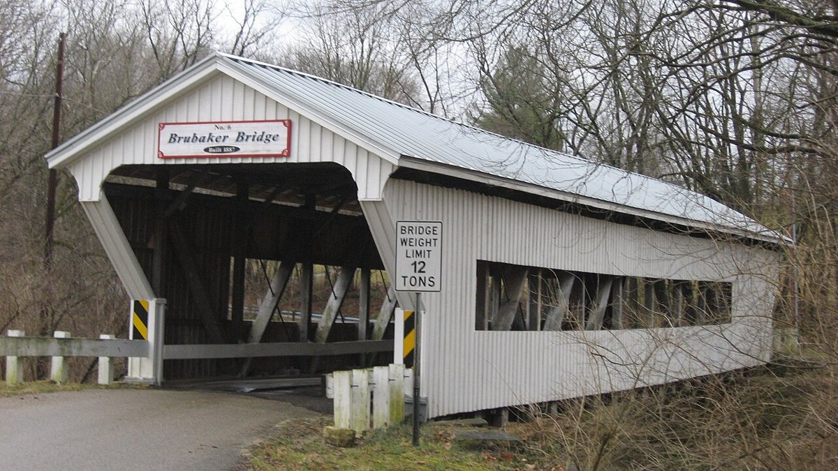
Nyttend / Wikimedia Commons · Public domain Just 18 minutes (9 miles) away, Brubaker Covered Bridge is another Childs truss by Everett S. Sherman. It dates to 1887 and is listed on the National Register of Historic Places. A semi truck badly damaged it in August 2022, and it had been repaired by early 2024. Its length is given as either 85 or 88 ft.
-
↓ 10.2 miles, about 20 min
7. Germantown Covered Bridge
Montgomery County, Ohio
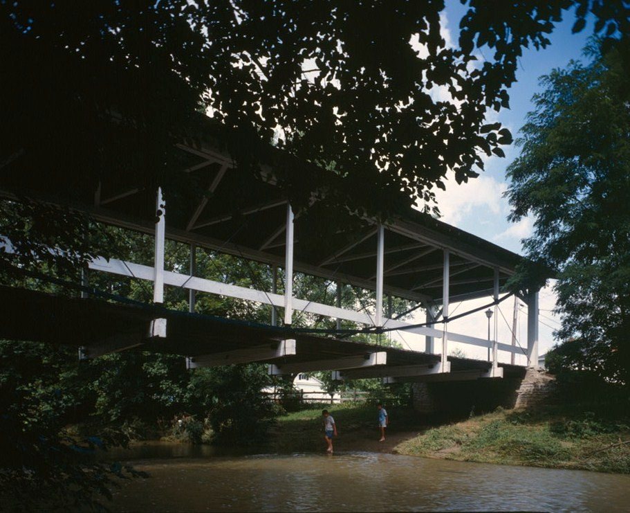
Joseph Elliott, Photographer / Wikimedia Commons · Public domain Twenty minutes and 10.2 miles later you reach Montgomery County and the Germantown Covered Bridge over Twin Creek. It's believed to be the only surviving inverted-bowstring truss covered bridge. It was moved to East Center St in 1911 and rebuilt after a 1981 crash, and it's on the National Register. Sources split on the build year, 1865 or 1870, and on the length, 100 or 105 ft.
-
↓ 61.4 miles, about 1 hr 26 min
8. McCafferty Road Covered Bridge
Brown County, Ohio · built 1877
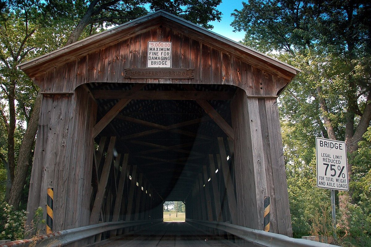
Rich Moffitt from Boston, USA / Wikimedia Commons · CC BY 2.0 Set aside about 86 minutes for the 61.4 miles to Brown County. McCafferty Road Covered Bridge is an 1877 Howe truss built by the Smith Bridge Company over the East Fork Little Miami River. It was last rehabilitated in 1963. Sources give lengths of 157, 160 and 170 ft, so there's no settled figure.
-
↓ 14.1 miles, about 22 min
9. Lynchburg Covered Bridge
Highland County, Ohio · built 1870
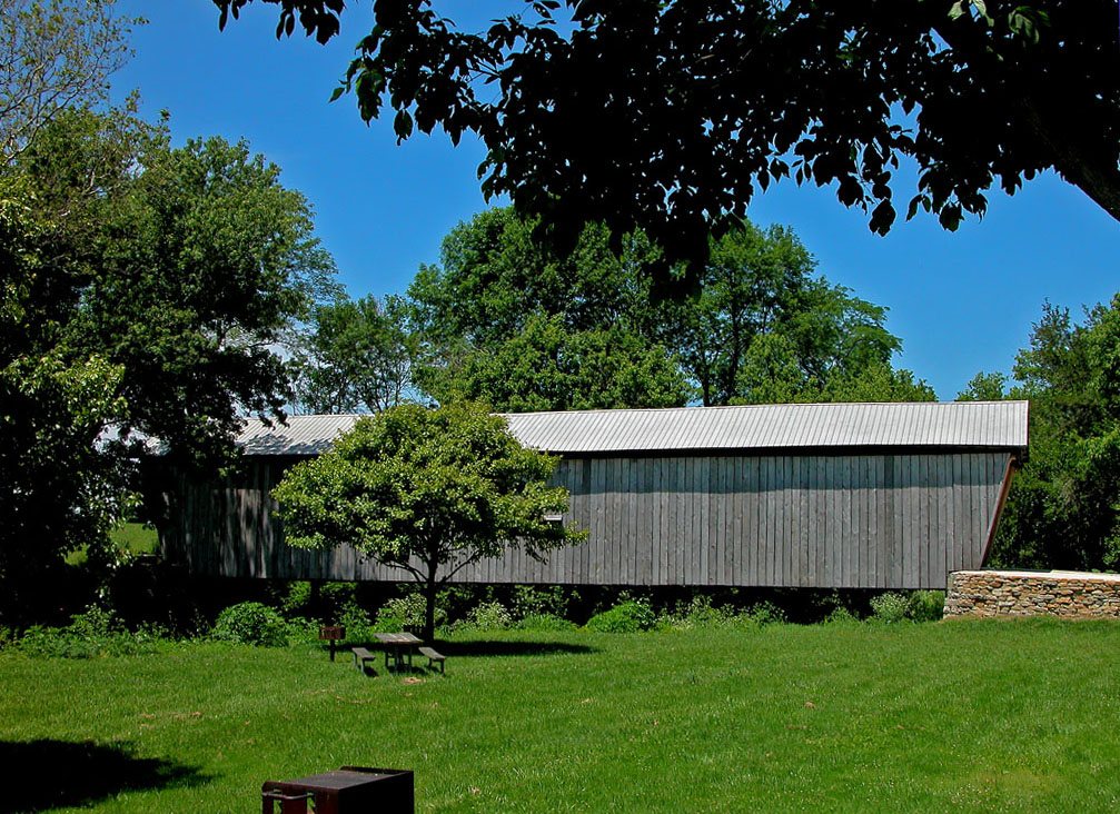
dok1 / Wikimedia Commons · CC BY 2.0 John C. Gregg built the Lynchburg Covered Bridge in 1870. It's a Long truss on the Highland and Clinton county line, about 22 minutes (14.1 miles) from McCafferty Road. It measures 120 ft and is listed on the National Register of Historic Places. Fire damaged it in 2019, and it was rehabilitated in 2022 and rededicated in 2023.
-
↓ 9.1 miles, about 16 min
10. Martinsville Road Covered Bridge
Clinton County, Ohio · built 1871
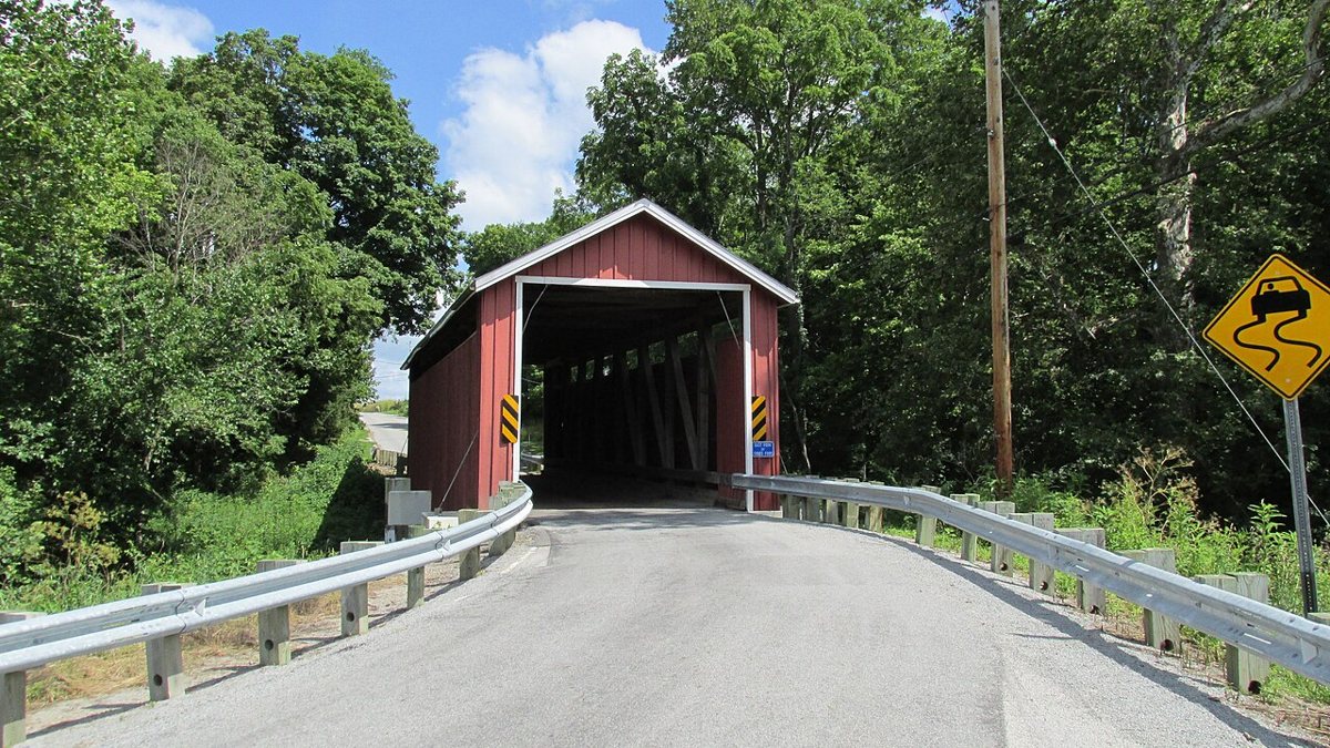
Aesopposea / Wikimedia Commons · CC BY-SA 3.0 It's only 16 minutes (9.1 miles) to Martinsville Road Covered Bridge over Todd Fork in Clark Township. It's the last covered bridge entirely within Clinton County. Zimri Wall, co-founder of the Champion Bridge Company, built it in 1871. It's listed on the National Register of Historic Places, and sources give its length as 67.9 or 72 ft.
Facts, map and sources for Martinsville Road Covered Bridge →
-
↓ 30.9 miles, about 49 min
11. South Salem Covered Bridge
Ross County, Ohio · built 1873
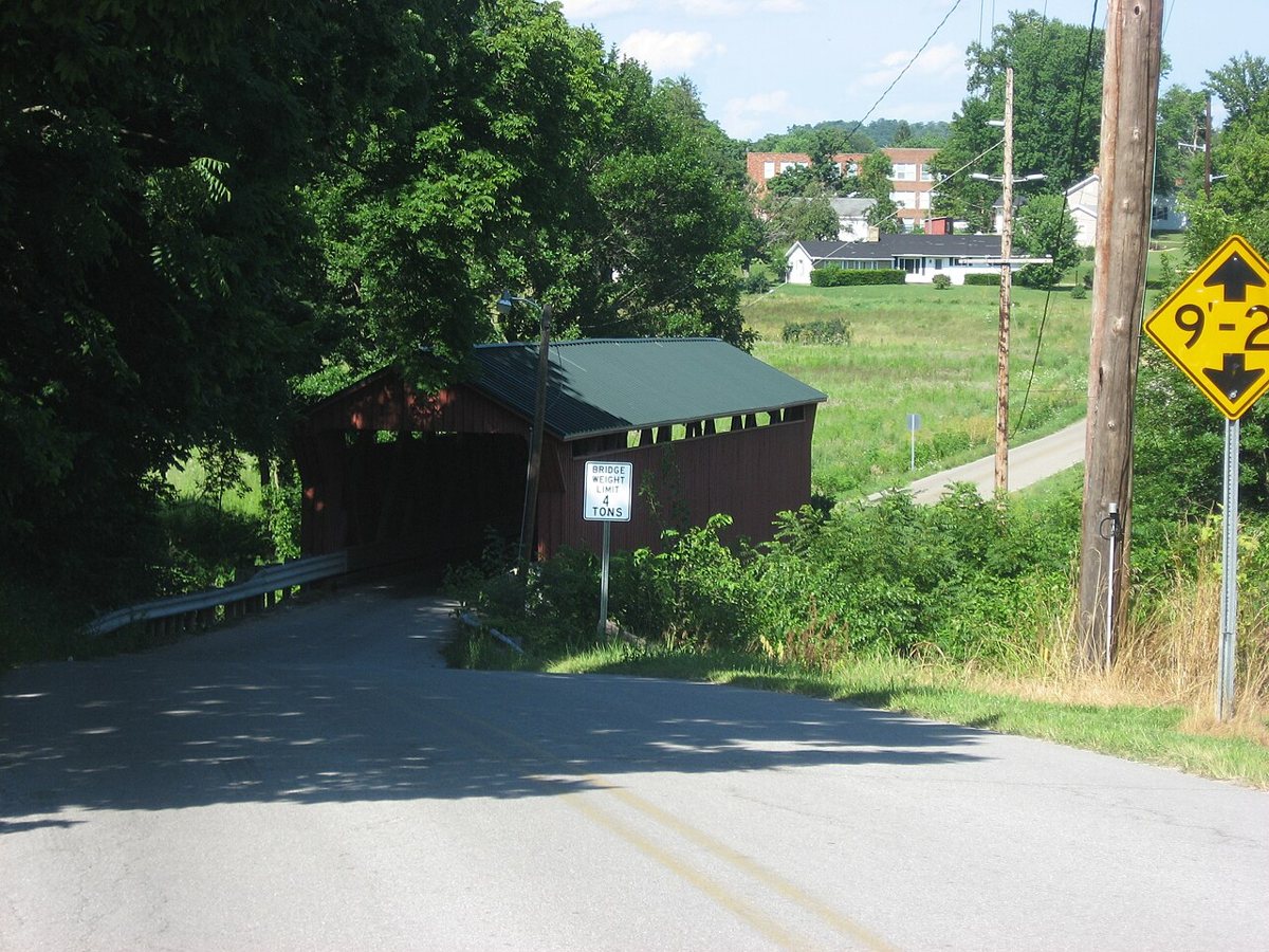
Nyttend / Wikimedia Commons · Public domain The route ends in Ross County, about 49 minutes (30.9 miles) on, at the South Salem Covered Bridge. The Smith Bridge Company built this Smith truss in 1873. It's the last covered bridge in Ross County, with a rebuild noted for 2006, and it's on the National Register. It's described as 115 ft overall with a 99 ft clear span, though only one source gives the 115 ft figure.
Every stop on this route links to its own page with coordinates, sourced facts and image licences. The text above was written from those records and checked against them before publishing. More covered bridges: all covered bridges in Ohio.