 Wayfarrow
Porter-Parsonfield Bridge
Covered bridge · Oxford County, Maine
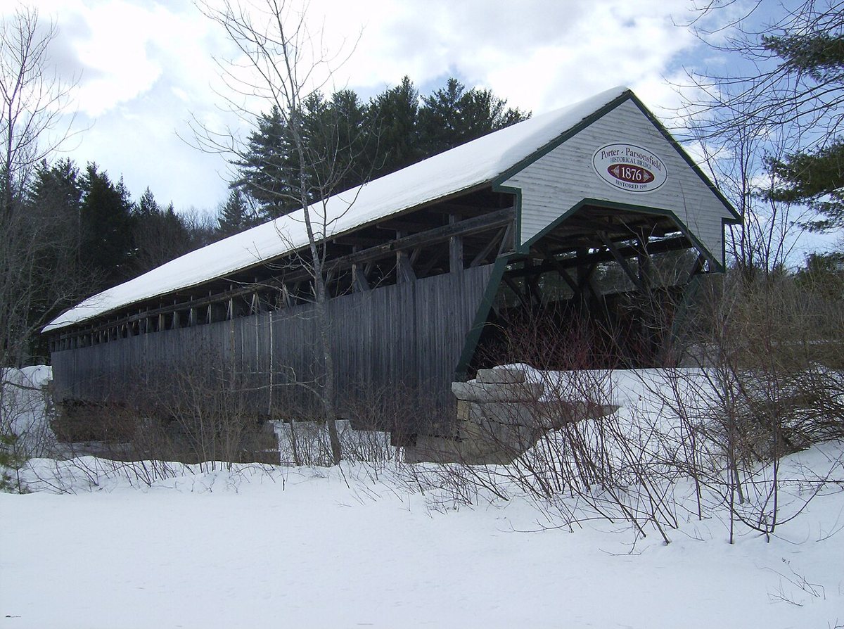
Porter-Parsonfield Bridge is a covered bridge in Oxford County, Maine, described in its record as place in Maine listed on National Register of Historic Places. Maine has 14 covered bridges on record at Wayfarrow, 6 of them in Oxford County.
It crosses Ossipee River.
Status check, 2026-11: Two-span Paddleford bridge over the Ossipee River, closed to vehicles in 1960 and restored in 1999. A plaque on the bridge says 1876 but MaineDOT lists 1859, and lengths are given as 152 or 160 ft, so both are left null. Porter-Parsonfield Bridge is listed on the National Register of Historic Places. It stands at 43.7917° N, 70.9383° W.
Key facts
| Crosses | Ossipee River |
|---|---|
| Heritage designation | National Register of Historic Places listed place |
| National Register | Listed |
| Coordinates | 43.79170, -70.93830 |
Nearby places
- Lords Hillghost town · Carroll County · 6 mi
- Brownfield Covered Bridgecovered bridge · Oxford County · 11.7 mi
- Whittier Bridgecovered bridge · Carroll County · 13.8 mi
- Saco River Bridgecovered bridge · Carroll County · 16 mi
- Swift River Bridgecovered bridge · Carroll County · 16.1 mi
- Hemlock Bridgecovered bridge · Oxford County · 20 mi
- Albany Bridgecovered bridge · Carroll County · 21.1 mi
- Durgin Bridgecovered bridge · Carroll County · 21.7 mi
- Great Fallsghost town · Cumberland County · 24.5 mi
- Babb's Bridgecovered bridge · Cumberland County · 24.5 mi
- Lowells Cornerghost town · Cumberland County · 24.8 mi
- Gates Hillghost town · Cumberland County · 25.3 mi
Questions
Where is Porter-Parsonfield Bridge?
Porter-Parsonfield Bridge is in Oxford County, Maine, at 43.7917, -70.9383.
How many covered bridges are in Oxford County?
Oxford County, Maine has 6 covered bridges on record at Wayfarrow.
- Wikidata — Wikidata item (CC0)
- National Register of Historic Places — National Register of Historic Places record (public-domain)
- Wikidata — Wikipedia article (linked as a source; text not used) (CC0)
- Wayfarrow status check (web sources) — Checked for current status (facts)
- Wayfarrow status check (web sources) — Checked for current status (facts)
- Wayfarrow status check (web sources) — Checked for current status (facts)
- Wayfarrow status check (web sources) — Checked for current status (facts)
Facts marked "approximately" carry an uncertain date in the source. Text on this page is generated from the sources above; no encyclopedia prose is copied. Last updated 2026-11-05.