 Wayfarrow
Gregg Mill Covered Bridge
Covered bridge · Licking County, Ohio
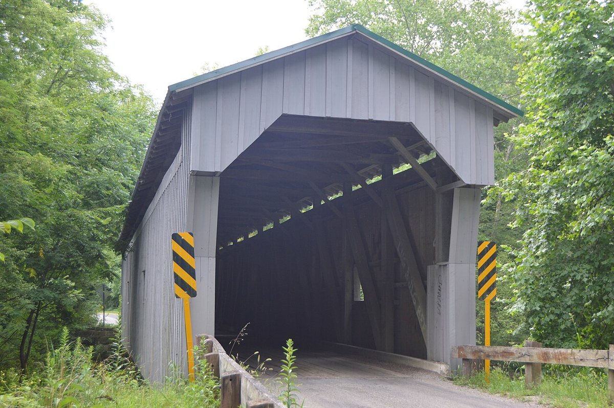
Gregg Mill Covered Bridge is a covered bridge in Licking County, Ohio. Ohio has 147 covered bridges on record at Wayfarrow, 4 of them in Licking County.
It was built in 1881, in the late 19th century, making it the 45th oldest of the 75 in Ohio with a recorded construction date.
Status check, 2026-11: Two-span multiple kingpost bridge over Wakatomika Creek on Frampton Road, rebuilt around 1992–93 and repaired after a 2005 flood and 2008 vehicle damage; length is null because sources give 124 ft vs 118.7 ft. It stands at 40.2218° N, 82.2383° W.
Nearby places
- Long Runghost town · Licking County · 2.7 mi
- Front Royalghost town · Knox County · 5.5 mi
- Davis Farm Covered Bridgecovered bridge · Licking County · 6.9 mi
- Owls Townghost town · Coshocton County · 10.5 mi
- Bluffghost town · Coshocton County · 11 mi
- Hollistersghost town · Knox County · 11.2 mi
- Umbriaghost town · Knox County · 12.6 mi
- Claypoolsghost town · Muskingum County · 13.1 mi
- Wakatomikaghost town · Muskingum County · 13.9 mi
- Pleasantvilleghost town · Coshocton County · 14.5 mi
- Rossvilleghost town · Knox County · 15 mi
- Pleasant Valleyghost town · Muskingum County · 15.3 mi
Questions
Where is Gregg Mill Covered Bridge?
Gregg Mill Covered Bridge is in Licking County, Ohio, at 40.2218, -82.2383.
How many covered bridges are in Licking County?
Licking County, Ohio has 4 covered bridges on record at Wayfarrow.
- Wikidata — Wikidata item (CC0)
- Wayfarrow status check (web sources) — Checked for current status (facts)
- Wayfarrow status check (web sources) — Checked for current status (facts)
- Wayfarrow status check (web sources) — Checked for current status (facts)
Facts marked "approximately" carry an uncertain date in the source. Text on this page is generated from the sources above; no encyclopedia prose is copied. Last updated 2026-11-05.