 Wayfarrow
Ebenezer Covered Bridge
Covered bridge · Washington County, Pennsylvania
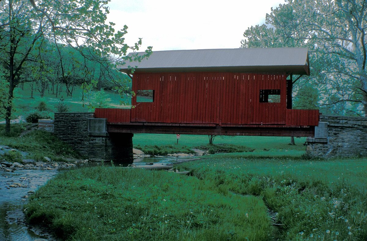
Ebenezer Covered Bridge is a covered bridge in Washington County, Pennsylvania. Pennsylvania has 231 covered bridges on record at Wayfarrow, 26 of them in Washington County.
It is about 32 feet long (80th longest of 83 measured in Pennsylvania).
Status check, 2026-11: Nobody knows when it was built or who built it. It was moved in 1977 from the South Fork of Maple Creek near Ginger Hill to Mingo Creek County Park, where it sits on an earlier bridge's abutments. One source gives 38 ft, but most sources say 32 ft. Ebenezer Covered Bridge is listed on the National Register of Historic Places. It stands at 40.1911° N, 80.0411° W.
Key facts
| Length | 32 ft |
|---|---|
| Heritage designation | National Register of Historic Places listed place |
| National Register | Listed |
| Coordinates | 40.19111, -80.04111 |
Nearby places
- Henry Covered Bridgecovered bridge · Washington County · 1.5 mi
- Cerl Wright Covered Bridgecovered bridge · Washington County · 2.3 mi
- Clokeyvilleghost town · Washington County · 5.1 mi
- Hughes Covered Bridgecovered bridge · Washington County · 12.6 mi
- Horn Davis Overholtzer Bridgecovered bridge · Washington County · 12.7 mi
- Martin's Mill Covered Bridgecovered bridge · Washington County · 13.2 mi
- Bailey Covered Bridgecovered bridge · Washington County · 14.4 mi
- Blackburnghost town · Westmoreland County · 14.7 mi
- Monongahela Bridgecovered bridge · Allegheny County · 17 mi
- Bridge of Sighscovered bridge · Allegheny County · 17.3 mi
- Day Covered Bridgecovered bridge · Washington County · 17.4 mi
- Grimes Covered Bridgecovered bridge · Greene County · 17.5 mi
Questions
Where is Ebenezer Covered Bridge?
Ebenezer Covered Bridge is in Washington County, Pennsylvania, at 40.1911, -80.0411.
How many covered bridges are in Washington County?
Washington County, Pennsylvania has 26 covered bridges on record at Wayfarrow.
- Wikidata — Wikidata item (CC0)
- National Register of Historic Places — National Register of Historic Places record (public-domain)
- Wikidata — Wikipedia article (linked as a source; text not used) (CC0)
- Wayfarrow status check (web sources) — Checked for current status (facts)
- Wayfarrow status check (web sources) — Checked for current status (facts)
- Wayfarrow status check (web sources) — Checked for current status (facts)
- Wayfarrow status check (web sources) — Checked for current status (facts)
Facts marked "approximately" carry an uncertain date in the source. Text on this page is generated from the sources above; no encyclopedia prose is copied. Last updated 2026-11-05.