 Wayfarrow
Bartonsville Covered Bridge
Covered bridge · Windham County, Vermont
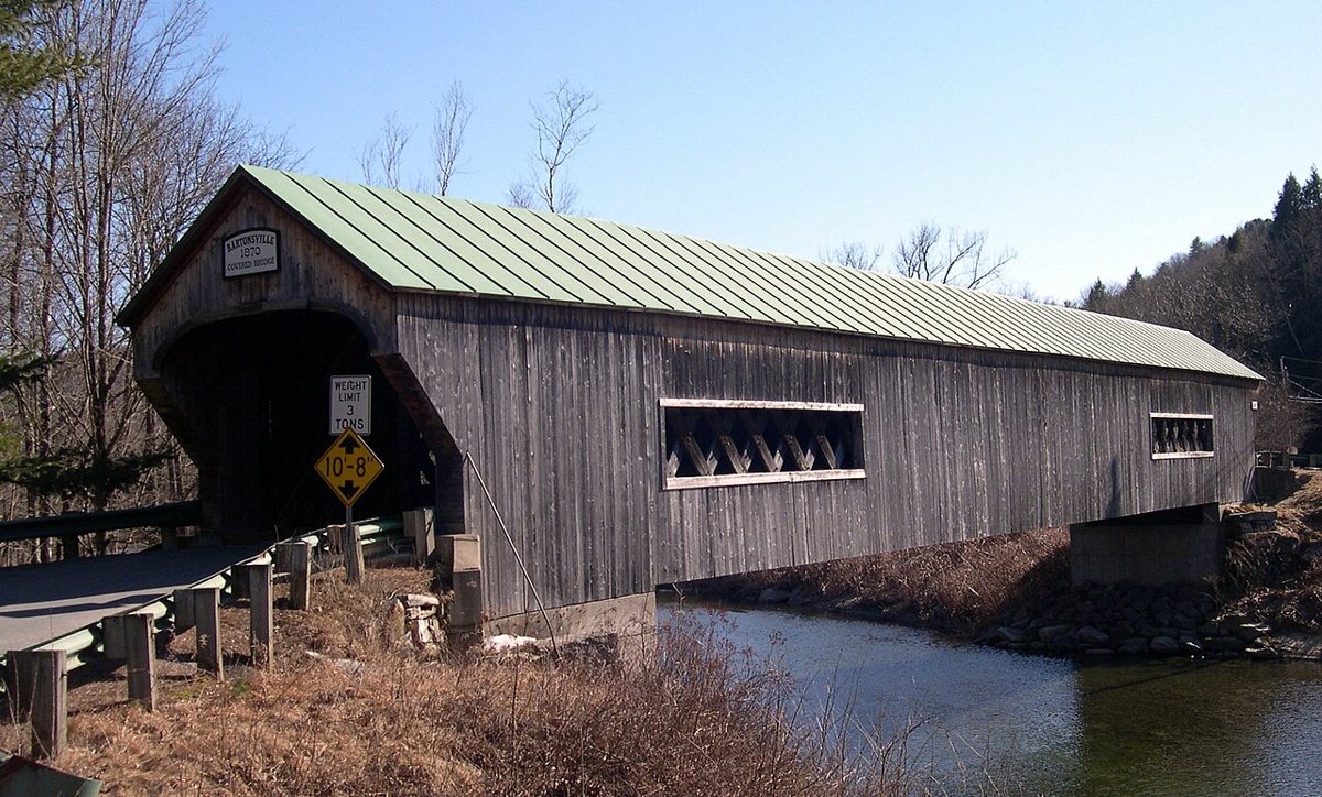
Bartonsville Covered Bridge is a covered bridge in Windham County, Vermont. Vermont has 91 covered bridges on record at Wayfarrow, 9 of them in Windham County.
It was built in 2012, in the postwar decades, making it the 56th oldest of the 57 in Vermont with a recorded construction date; it crosses Williams River; it is about 168 feet long (4th longest of 46 measured in Vermont).
Status check, 2026-11: Tropical Storm Irene destroyed the original 1870 bridge in 2011; the current Town lattice replacement was built in 2012, opened January 26, 2013, and is 17 ft longer than the original. Bartonsville Covered Bridge is listed on the National Register of Historic Places. It stands at 43.2242° N, 72.5368° W.
Key facts
| Current structure built | 2012 |
|---|---|
| Crosses | Williams River |
| Length | 168 ft |
| Heritage designation | National Register of Historic Places listed place |
| National Register | Listed |
| Coordinates | 43.22423, -72.53679 |
Nearby places
- Worrall Covered Bridgecovered bridge · Windham County · 0.9 mi
- Kidder Covered Bridgecovered bridge · Windham County · 5.2 mi
- Hall Covered Bridgecovered bridge · Windham County · 6.5 mi
- Tucker Toll Covered Bridgecovered bridge · Cheshire County · 7.8 mi
- Cheshire Railroad Connecticut River Covered Bridgecovered bridge · Cheshire County · 7.8 mi
- Prentiss Bridgecovered bridge · Sullivan County · 8.7 mi
- Cold River Bridgecovered bridge · Sullivan County · 10.3 mi
- Upper Falls Covered Bridgecovered bridge · Windsor County · 12.1 mi
- Scott Covered Bridgecovered bridge · Windham County · 14.6 mi
- Best's Covered Bridgecovered bridge · Windsor County · 16 mi
- Bowers Covered Bridgecovered bridge · Windsor County · 16.6 mi
- Wright's Bridgecovered bridge · Sullivan County · 16.8 mi
Questions
Where is Bartonsville Covered Bridge?
Bartonsville Covered Bridge is in Windham County, Vermont, at 43.2242, -72.5368.
How many covered bridges are in Windham County?
Windham County, Vermont has 9 covered bridges on record at Wayfarrow.
- Wikidata — Wikidata item (CC0)
- National Register of Historic Places — National Register of Historic Places record (public-domain)
- Wikidata — Wikipedia article (linked as a source; text not used) (CC0)
- Wayfarrow status check (web sources) — Checked for current status (facts)
- Wayfarrow status check (web sources) — Checked for current status (facts)
- Wayfarrow status check (web sources) — Checked for current status (facts)
- Wayfarrow status check (web sources) — Checked for current status (facts)
Facts marked "approximately" carry an uncertain date in the source. Text on this page is generated from the sources above; no encyclopedia prose is copied. Last updated 2026-11-05.