 Wayfarrow
Cumberland and Sagadahoc Counties, Maine Lighthouse Road Trip: 9 Lights in One Day
9 stops117 milesabout 3 hr 26 min of drivingCumberland and Sagadahoc Counties, Maine
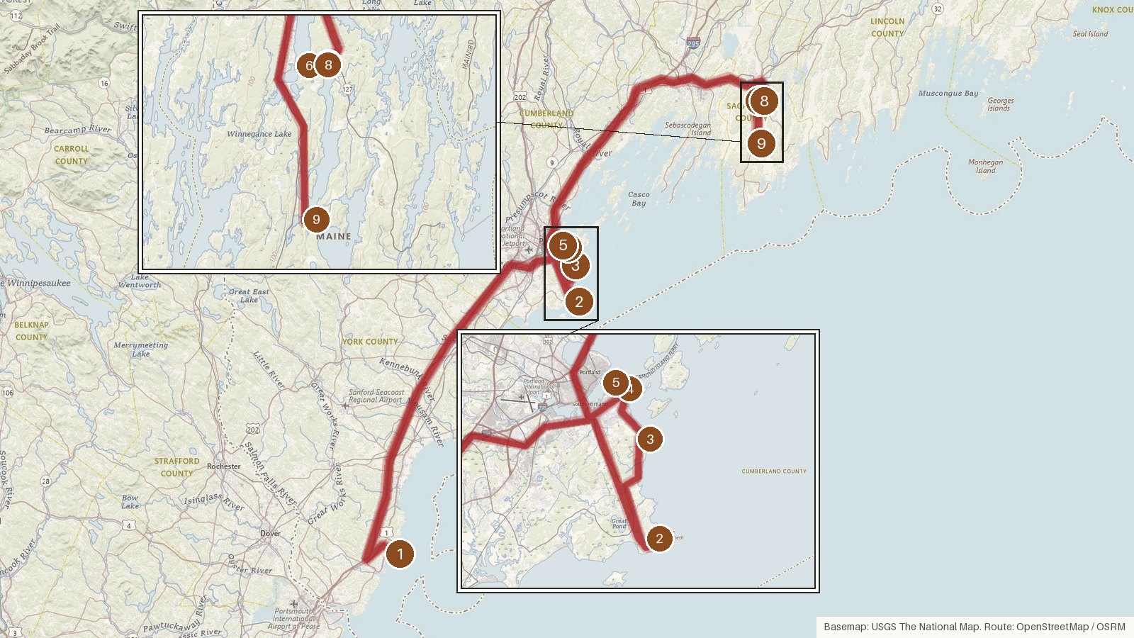
This route strings together nine lighthouse stops across three Maine counties. It opens in York County at Cape Neddick, moves up to the Cumberland County shore around Cape Elizabeth and South Portland, then heads to the Kennebec River in Sagadahoc County. Expect about 117 miles and roughly three and a half hours behind the wheel. Two long legs, of about 77 and 64 minutes, bookend a tight cluster of short hops near Portland. The towers span more than a century, from Portland Head's 1791 rubblestone tower to a group of 1898 wooden towers on the Kennebec. The materials change along the way too, from stone and cast iron on the Gulf of Maine to octagonal wood on the river. The Army Corps of Engineers is the listed architect at two stops. Start early, and check access locally before you set out. These notes cover history, not visiting arrangements.
Route and drive times from OpenStreetMap routing (OSRM). Times are estimates without stops; roads to remote sites can be unpaved or seasonal.
-
1. Cape Neddick Light
York County, Maine · built 1879
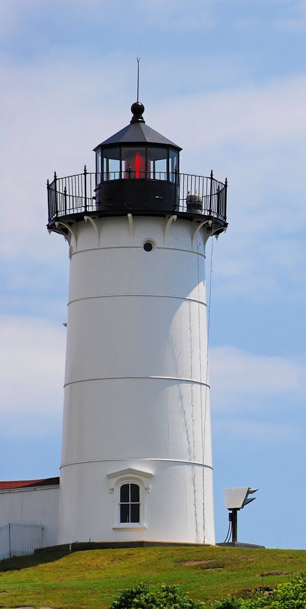
Stefan Hillebrand / Wikimedia Commons · CC BY-SA 3.0 Start at Cape Neddick Light, better known as 'Nubble Light'. It's a brick-lined cast-iron tower first lit on July 1, 1879, and it's still working, owned by the Town of York. The tower stands 41 feet, with its light 89 feet up. It shows an isophase red signal every 6 seconds with a 13 nautical mile range. It's listed on the National Register of Historic Places.
-
↓ 53.9 miles, about 1 hr 17 min
2. Cape Elizabeth Light
Cumberland County, Maine · built 1874
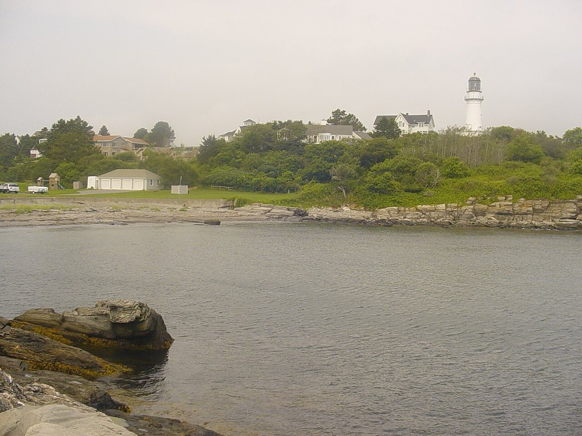
Original uploader was Dk69 at en.wikipedia / Wikimedia Commons · Public domain After 53.9 miles, about 77 minutes, you reach Cape Elizabeth Light. Twin stone towers went up here in 1828 and were replaced in 1874 by cast-iron ones. The east tower is the active light, 67 feet tall with a focal height of 128 feet and a four-flash white signal every 15 seconds. The west tower was deactivated in 1924 but, per the record, still stands.
-
↓ 6.2 miles, about 19 min
3. Portland Head Light
Cumberland County, Maine · built 1791
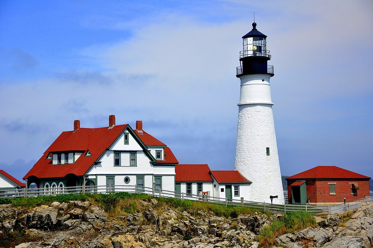
Aniarku / Wikimedia Commons · CC BY-SA 3.0 About 19 minutes on (6.2 miles), Portland Head Light dates to 1791. Its original rubblestone tower still stands on the Gulf of Maine. The tower's height was cut and raised several times, and it's been 80 feet tall since an 1885 raise. The light sits 102 feet up, flashing white every 4 seconds with a 24 nautical mile range.
-
↓ 2.7 miles, about 11 min
4. Spring Point Ledge Light
Cumberland County, Maine · built 1897
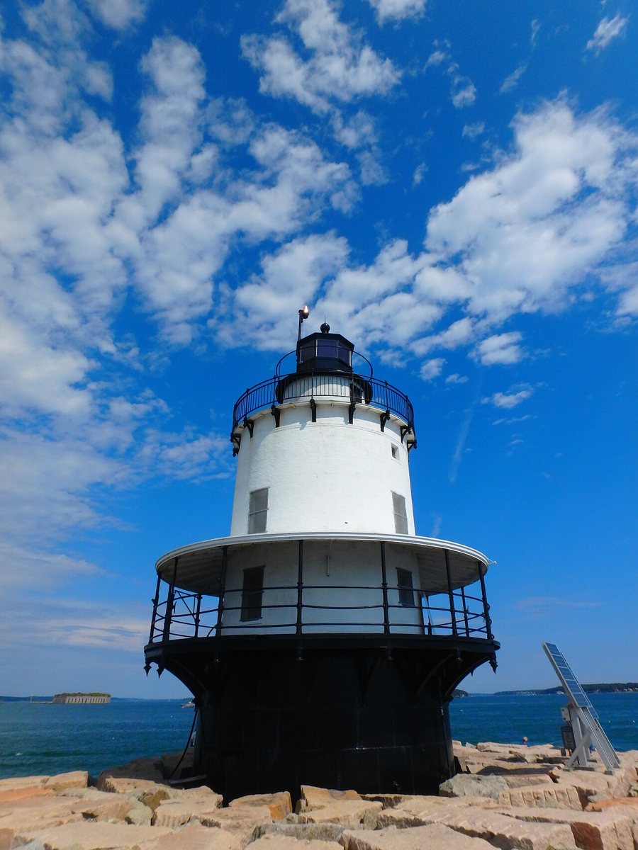
Oguevara / Wikimedia Commons · CC BY-SA 4.0 Spring Point Ledge Light is 2.7 miles and about 11 minutes away in South Portland. It's a sparkplug, or caisson, lighthouse from 1897, with the United States Army Corps of Engineers as architect. A 1951 breakwater runs out to it. Most sources put the tower at 54 feet, matching its focal height, though one says 25. The light flashes white every 6 seconds, with two red sectors.
-
↓ 1.1 miles, about 5 min
5. Portland Breakwater Light
Cumberland County, Maine · built 1875
Known as 'Bug Light', Portland Breakwater Light is just 1.1 miles on, about 5 minutes. This 1875 cast-iron tower, designed by Thomas Ustick Walter, replaced an 1855 wooden one. It was deactivated in 1942 and relit in 2002 as a private aid to navigation. It now flashes white every 4 seconds from a focal height of 33 feet. Sources put the tower itself at 24 to 26 feet.
-
↓ 42.1 miles, about 1 hr 4 min
6. Doubling Point Light
Sagadahoc County, Maine · built 1898
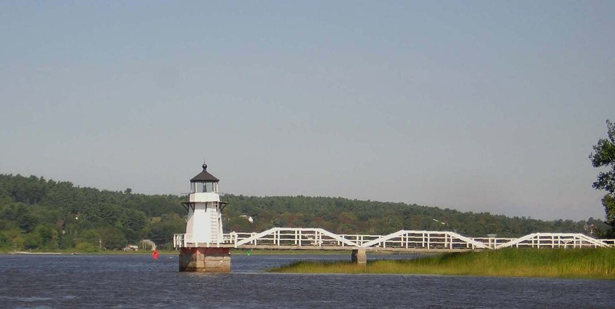
Jameslwoodward / Wikimedia Commons · CC BY-SA 3.0 The second long leg, 42.1 miles and about 64 minutes, brings you to the Kennebec River and Doubling Point Light. It's an octagonal wooden tower from 1898, 23 feet tall, with the United States Army Corps of Engineers listed as architect. It flashes white every 4 seconds with a 9 nautical mile range. Don't confuse it with the nearby Doubling Point Range Lights.
-
↓ 0.6 miles, about 2 min
7. Doubling Point Rear Range Light
Sagadahoc County, Maine · built 1898
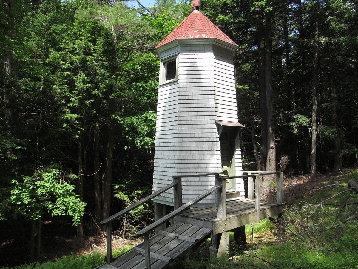
Dougtone / Wikimedia Commons · CC BY-SA 2.0 Those range lights come next, 0.6 miles and about 2 minutes away. The rear tower is the original 1898 white octagonal wooden structure of the Kennebec River (Doubling Point) Range Lights. It's still active and operated by the United States Coast Guard. Sources disagree on its height, 13 or 18 feet, but its focal plane is 33 feet, showing an isophase white light every 6 seconds.
Facts, map and sources for Doubling Point Rear Range Light →
-
↓ 0 miles, about 0 min
8. Doubling Point Range Lights
Sagadahoc County, Maine · built 1898
No extra driving here. Doubling Point Range Lights is the entry for the pair of octagonal wooden towers on the Kennebec River, also called the Kennebec River Range Lights. They date to 1898 and are still active. Heights vary by source, either 13 and 17 feet or 13 and 21 feet. The pair is listed on the National Register of Historic Places.
-
↓ 10.9 miles, about 27 min
9. Squirrel Point Light
Sagadahoc County, Maine · built 1898
Finish about 27 minutes on, 10.9 miles, at Squirrel Point Light on Arrowsic Island. This active wooden octagonal tower was one of several Kennebec River lights built in 1898. It stands 25 feet, with a focal height of 33 feet. It shows an isophase red signal every 6 seconds and has an 8 nautical mile range. The property is leased to Citizens for Squirrel Point.
Every stop on this route links to its own page with coordinates, sourced facts and image licences. The text above was written from those records and checked against them before publishing. More lighthouses: all lighthouses in Maine.