 Wayfarrow
Kentucky Covered Bridge Road Trip: 10 Bridges, About 7 Hours of Driving
10 stops260 milesabout 6 hr 47 min of drivingKentucky
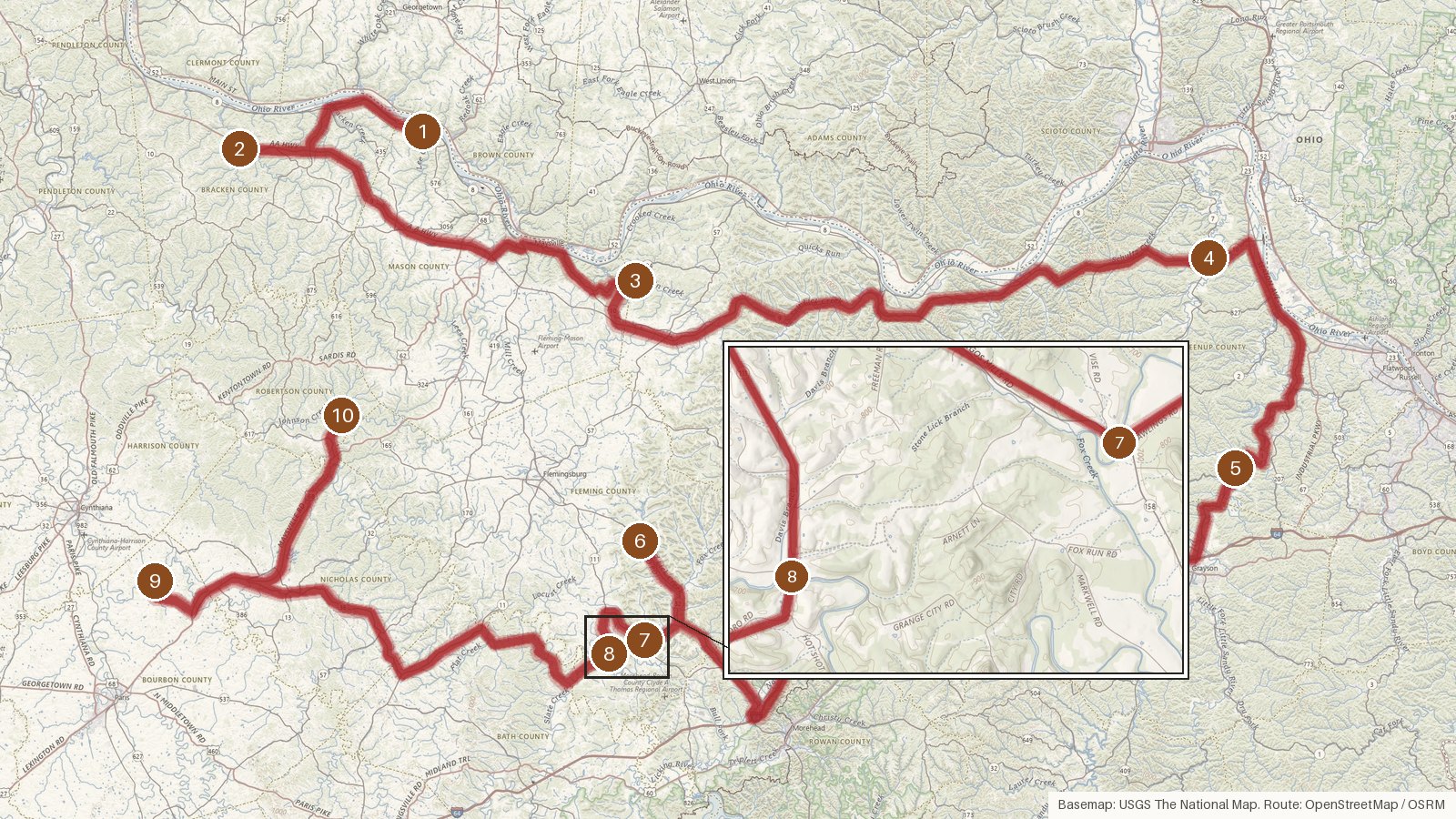
This route strings together ten covered bridges across seven Kentucky counties: Mason, Bracken, Lewis, Greenup, Fleming, Bourbon and Robertson. It covers about 260 miles with roughly 6 hours 45 minutes of driving, so plan on a full day or an easy two. Every bridge on it is listed on the National Register of Historic Places. Build dates mostly fall between the 1850s and the 1880s, and the water underneath includes Lee Creek, Tygarts Creek, the Little Sandy River, Fox Creek and Hinkston Creek. Floods are a common thread. Walcott was hit in 1997 and 1998, Colville collapsed in 1997, and Lee's Creek was badly damaged in 2017, so plenty here has been rebuilt or restored. Ringos Mill and Hillsboro were bypassed in 1970 and 1968. Start early, check access locally, and don't count on steady cell coverage on the rural stretches.
Route and drive times from OpenStreetMap routing (OSRM). Times are estimates without stops; roads to remote sites can be unpaved or seasonal.
-
1. Lee's Creek Covered Bridge
Mason County, Kentucky
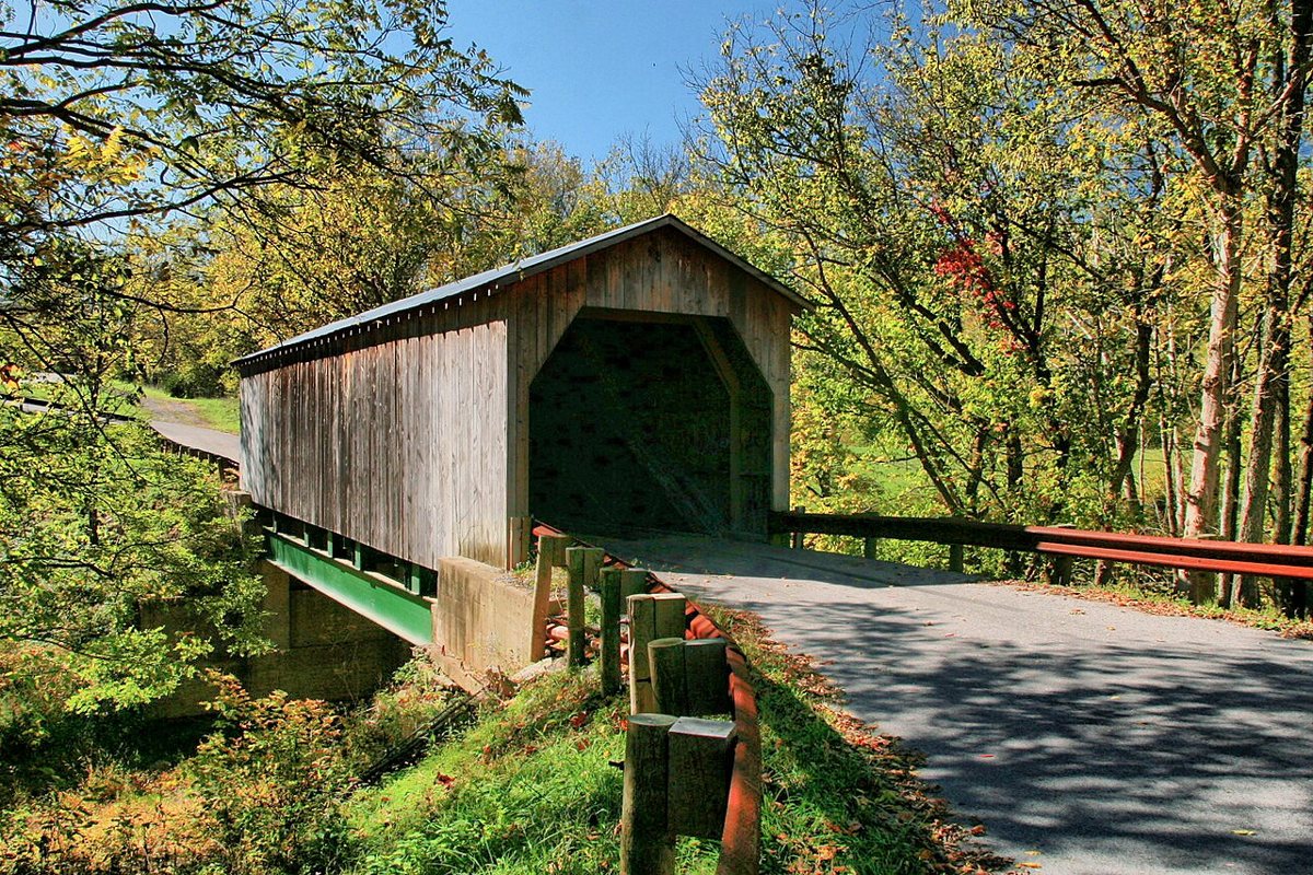
(Greg5030) / Wikimedia Commons · CC BY-SA 3.0 Start near Dover, where Lee's Creek Covered Bridge crosses Lee Creek in Mason County. It's also called the Dover Covered Bridge. Most sources put it at 1835, though the National Register file also mentions around 1845. A flash flood in 2017 (some say 2016) badly damaged it, and it was restored and rededicated on July 23, 2026. Reported lengths run from 60 to 63 ft.
-
↓ 15.1 miles, about 25 min
2. Walcott Covered Bridge
Bracken County, Kentucky · built 2002
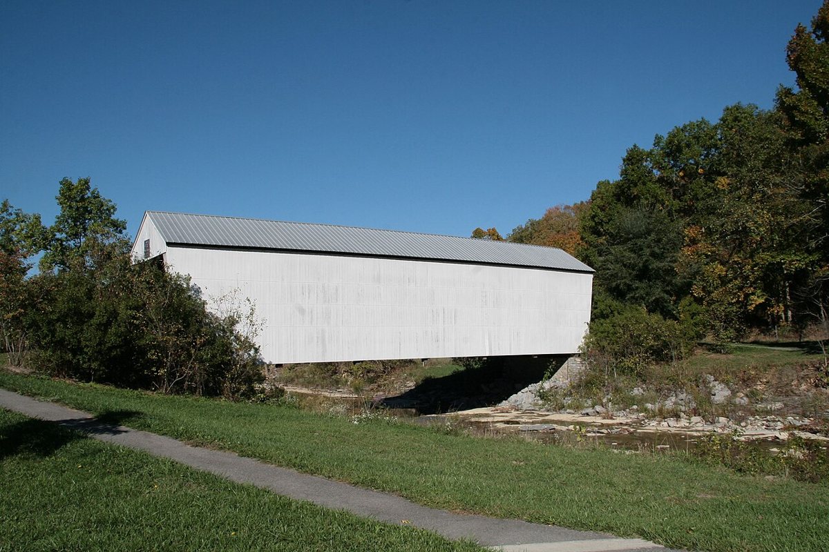
Photo by Greg Hume (Greg5030) / Wikimedia Commons · CC BY-SA 3.0 About 25 minutes and 15.1 miles on, Walcott Covered Bridge in Bracken County has layers to it. The first bridge here dates from 1824 and was replaced around 1880. After floods in 1997 and 1998, it was moved about 400 ft east and rebuilt in 2002, mostly with new materials. Published lengths range from 73 to 76 ft.
-
↓ 32.2 miles, about 50 min
3. Cabin Creek Covered Bridge
Lewis County, Kentucky
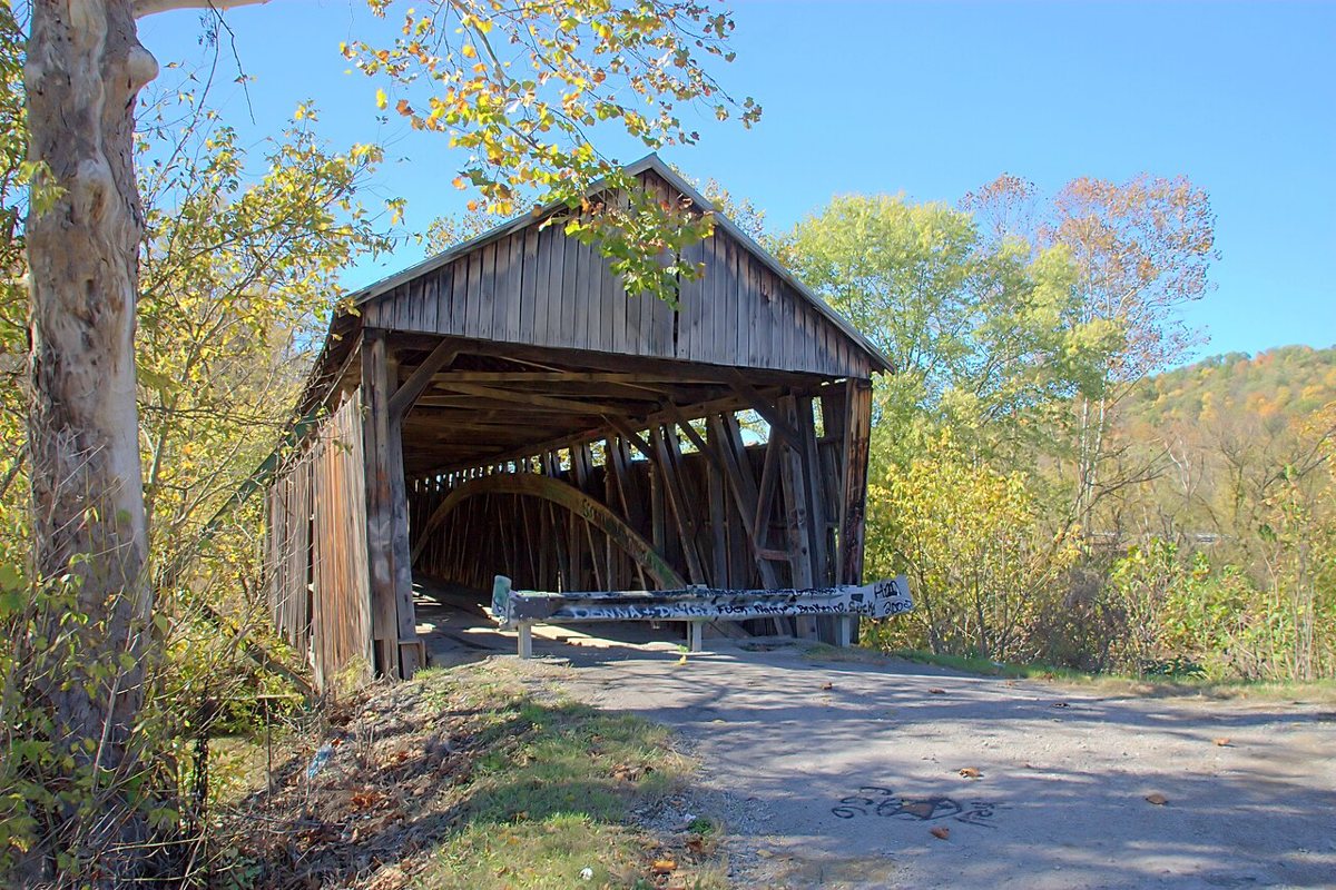
Greg Hume / Wikimedia Commons · CC BY-SA 3.0 Allow about 50 minutes for the 32.2 miles to Cabin Creek Covered Bridge in Lewis County. It measures 114 ft. Build dates differ depending on the source, with around 1867, 1871 and 1873 all turning up. It was closed to cars in 1983, and its restoration was finished in 2014.
-
↓ 50.1 miles, about 1 hr 17 min
4. Bennett's Mill Covered Bridge
Greenup County, Kentucky · built 1855
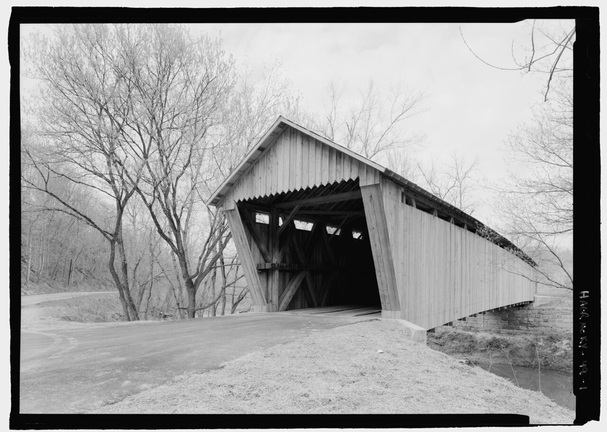
Lowe, Jet, creator / Wikimedia Commons · Public domain It's 50.1 miles, about 77 minutes, to Bennett's Mill Covered Bridge over Tygarts Creek in Greenup County. The National Register and the state historical marker both date it to around 1855 to 1856, which rules out the 1875 date found in some records. Its length is genuinely unsettled. Sources give 195, 159, 155 and 145 ft, and the National Register form itself mentions both 195 and 159.
-
↓ 24.9 miles, about 40 min
5. Oldtown Covered Bridge
Greenup County, Kentucky
Still in Greenup County, about 40 minutes and 24.9 miles away, Oldtown Covered Bridge crosses the Little Sandy River. One record wrongly places it in Ohio. The Burr-truss bridge dates from around 1880 and was taken apart and rebuilt in 1999 with mostly new load-bearing timbers. Reported lengths vary from 178 to 194 ft.
-
↓ 57.7 miles, about 1 hr 12 min
6. Goddard Covered Bridge
Fleming County, Kentucky
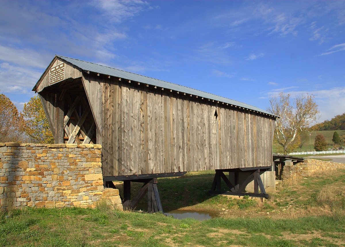
Photo by Greg Hume (Greg5030) / Wikimedia Commons · CC BY-SA 3.0 Here's the one with a distinction. Goddard Covered Bridge in Fleming County is Kentucky's only remaining Town lattice truss covered bridge, 57.7 miles and about 72 minutes from Oldtown. It was moved to its current site around 1932 to 1933 and renovated in 2004 to 2006. National Register sources don't give a build date, lostbridges.org says 1864, and lengths range from 60 to 92.4 ft.
-
↓ 9.4 miles, about 19 min
7. Ringos Mill Covered Bridge
Fleming County, Kentucky · built 1867
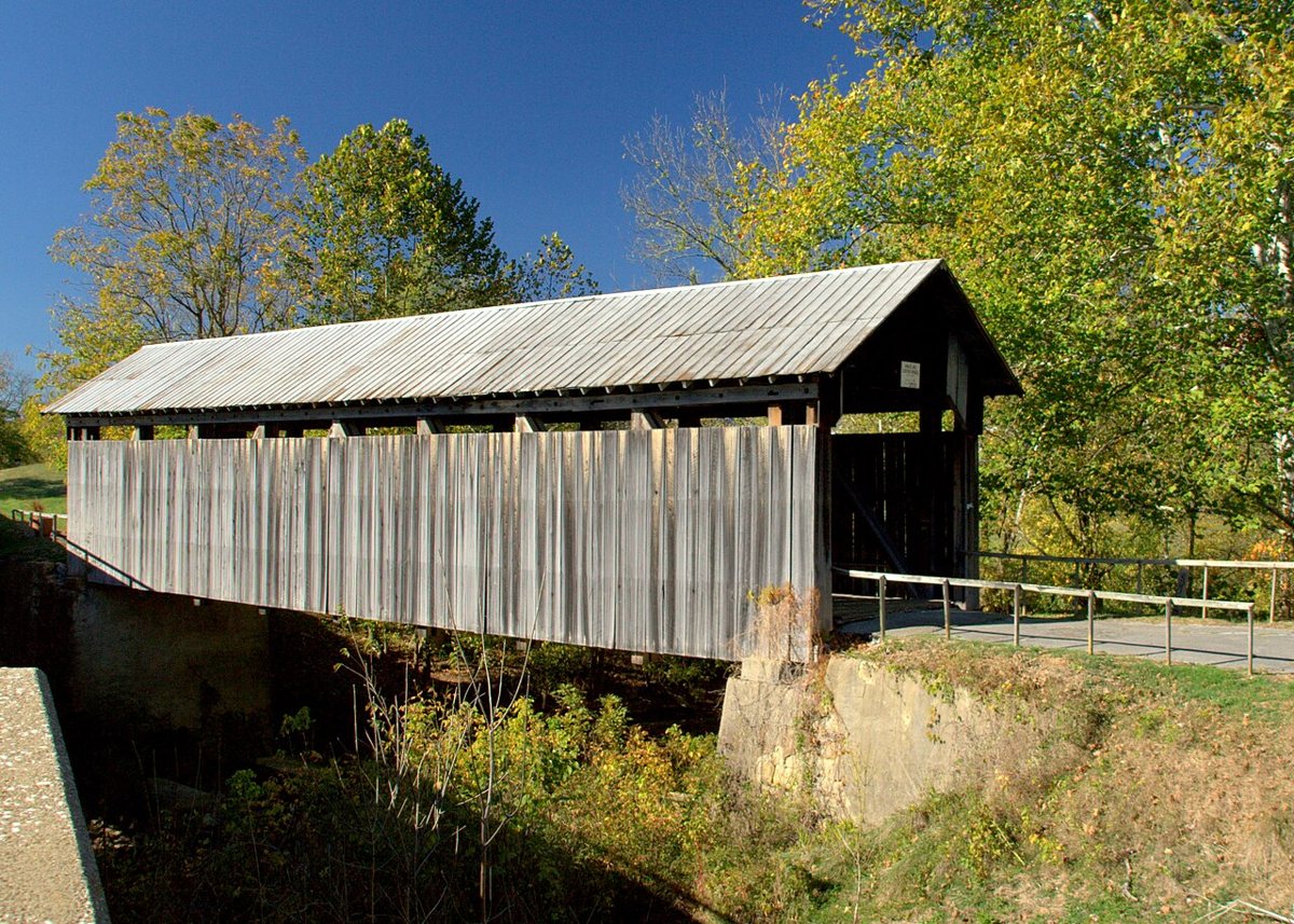
Photo by Greg Hume (Greg5030) / Wikimedia Commons · CC BY-SA 3.0 A short hop of 9.4 miles, about 19 minutes, brings you to Ringos Mill Covered Bridge, an original 1867 multiple-kingpost (Burr) truss over Fox Creek. It was bypassed in 1970 and restored in 1983. The portal sign says around 1869 and gives 81 ft, while the state marker and lostbridges.org say 86 ft and Wikipedia says 90.
-
↓ 6.4 miles, about 14 min
8. Hillsboro Covered Bridge
Fleming County, Kentucky
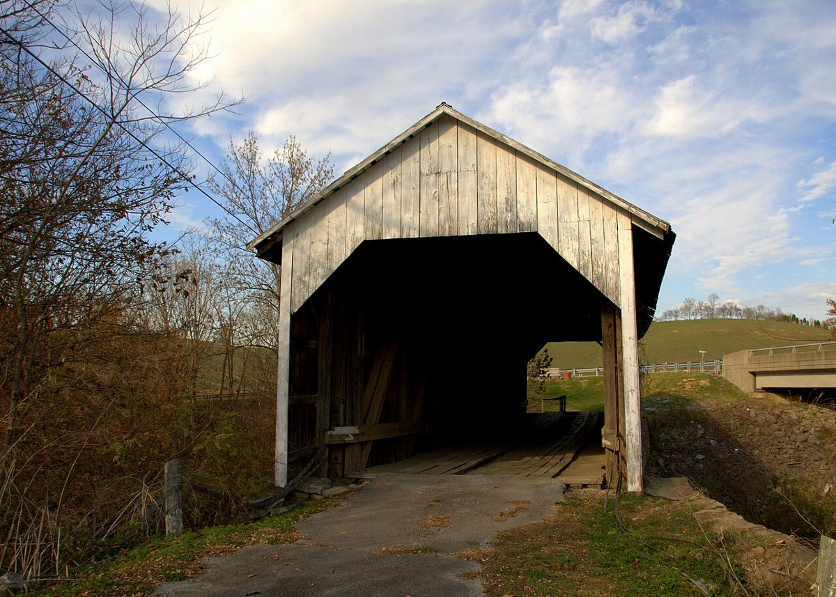
Photo by Greg Hume (Greg5030) / Wikimedia Commons · CC BY-SA 3.0 Fleming County's third bridge, Hillsboro Covered Bridge, also goes by the Grange City Covered Bridge and is 6.4 miles, about 14 minutes, from Ringos Mill. It was built around 1865 to 1870, with sources split between 'ca. 1865', 'between 1865 and 1870' and 'late 1860s'. It was bypassed in 1968. It measures 86 ft, though one list says 80.
-
↓ 41.5 miles, about 1 hr 16 min
9. Colville Covered Bridge
Bourbon County, Kentucky
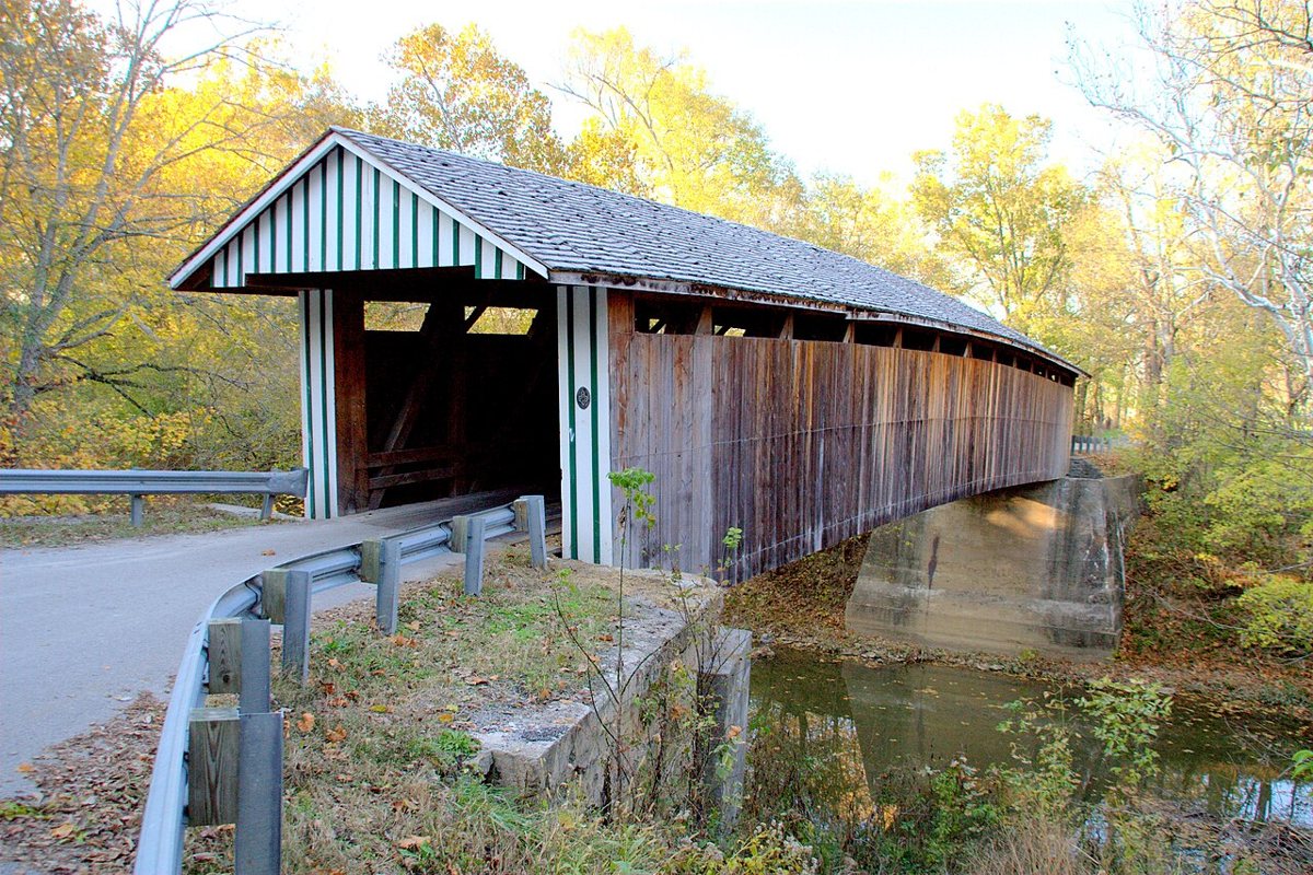
Greg Hume / Wikimedia Commons · CC BY-SA 3.0 Budget about 76 minutes for the 41.5 miles into Bourbon County and Colville Covered Bridge over Hinkston Creek. The 1877 Burr-truss bridge collapsed in a 1997 flood and was rebuilt in 2001 to 2002 with new and salvaged materials, so 1877 isn't clearly the date of the current structure. Sources give its length as 124 ft or 120 ft.
-
↓ 23.1 miles, about 35 min
10. Johnson Creek Covered Bridge
Robertson County, Kentucky
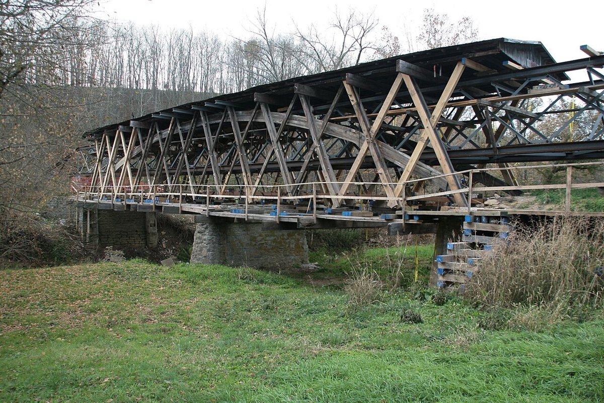
Greg Hume / Wikimedia Commons · CC BY-SA 3.0 The last stop, Johnson Creek Covered Bridge in Robertson County, is about 35 minutes and 23.1 miles on. It's a Smith truss by Jacob N. Bower, partly burned and rebuilt in 1910. Most sources say 1874 but lostbridges says 1882, and lengths range from 110 to 131 ft, so neither the date nor the length is settled.
Every stop on this route links to its own page with coordinates, sourced facts and image licences. The text above was written from those records and checked against them before publishing. More covered bridges: all covered bridges in Kentucky.