 Wayfarrow
Massachusetts Covered Bridge Road Trip: 7 Bridges, About 7 Hours of Driving
7 stops246 milesabout 6 hr 47 min of drivingMassachusetts
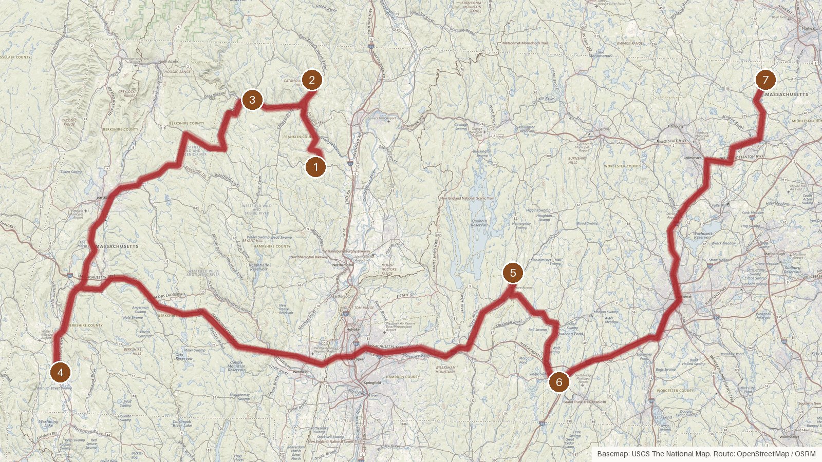
This route links seven covered bridges across five Massachusetts counties: Franklin, Berkshire, Hampshire, Worcester and Middlesex. It runs about 246 miles, with just under seven hours of driving in total, so it fits a long day or splits comfortably over two. Dates here run from around 1870 in Franklin County, where two of the bridges carry flood stories, to 2010 in Pepperell. In between you'll find a 1998 Town lattice replica of a bridge lost to fire, an 1886 crossing of the Ware River, and a Vermont bridge moved to Old Sturbridge Village in 1951. Five of the seven are listed on the National Register of Historic Places, and the rivers crossed include the South, North, Housatonic, Ware and Nashua. The two big legs, each close to two hours, fall in the middle of the day. Start early, check access locally before you set out, and expect patchy cell coverage on rural roads.
Route and drive times from OpenStreetMap routing (OSRM). Times are estimates without stops; roads to remote sites can be unpaved or seasonal.
-
1. Burkeville Covered Bridge
Franklin County, Massachusetts · built 1870
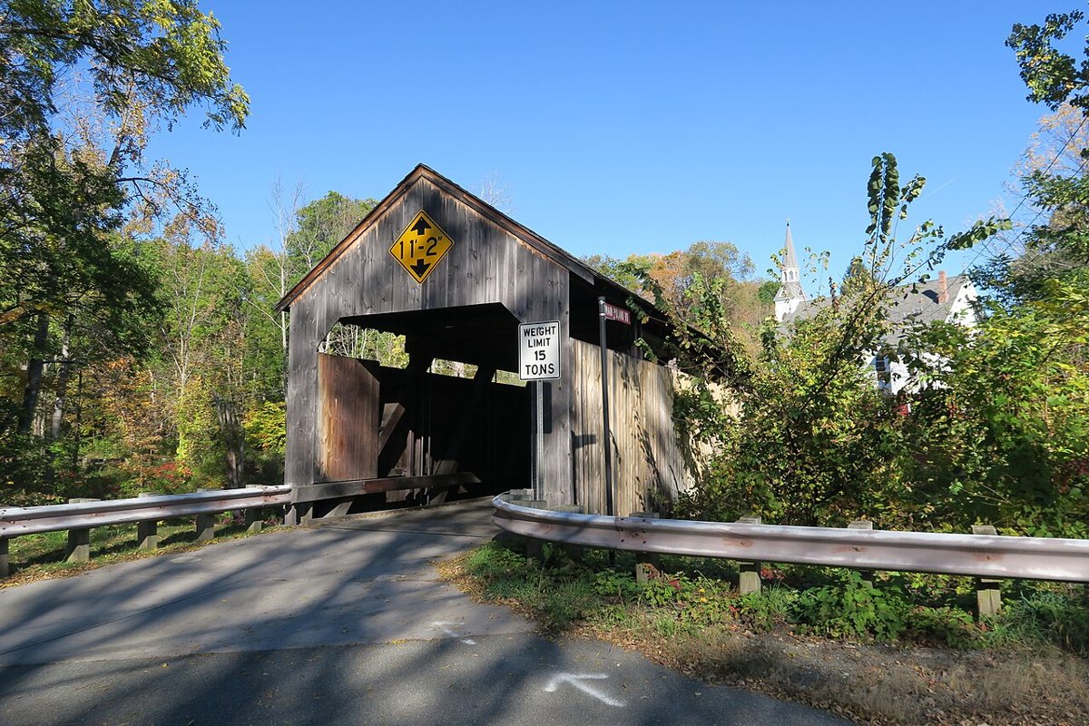
John Phelan / Wikimedia Commons · CC BY-SA 4.0 Start in Conway at the Burkeville Covered Bridge over the South River. It was built in 1870 to replace a bridge damaged in the 1869 flood, though a plaque on it reads 1871. Restored in 2005 and listed on the National Register, it's given as 106, 106.5 or 107 feet long, depending on the source.
-
↓ 15 miles, about 28 min
2. Arthur A. Smith Covered Bridge
Franklin County, Massachusetts
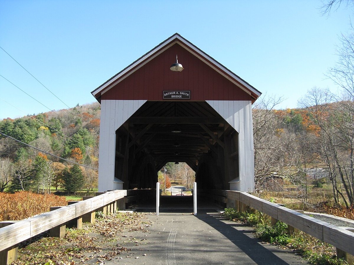
John Phelan / Wikimedia Commons · CC BY 3.0 About 28 minutes and 15 miles on, the Arthur A. Smith Covered Bridge crosses the North River. Its story moves around: built about 1869 to 1870 in Shattuckville, damaged by an 1878 flood, then re-erected at this spot in 1896. A rebuild costing about $2.1 million followed in 2005 to 2007. It's on the National Register, and sources differ on its exact length.
-
↓ 11.5 miles, about 22 min
3. Bissell Bridge
Franklin County, Massachusetts
Bissell Bridge is a short hop, 11.5 miles or about 22 minutes. The 1951 bridge replaced a covered bridge from the 1880s, and a 2007 to 2009 project either rehabilitated it or built a new one, depending on which source you read. Most put its length at 92 feet. Like the first two stops, it's in Franklin County and on the National Register.
-
↓ 57.4 miles, about 1 hr 55 min
4. Old Covered Bridge
Berkshire County, Massachusetts · built 1998
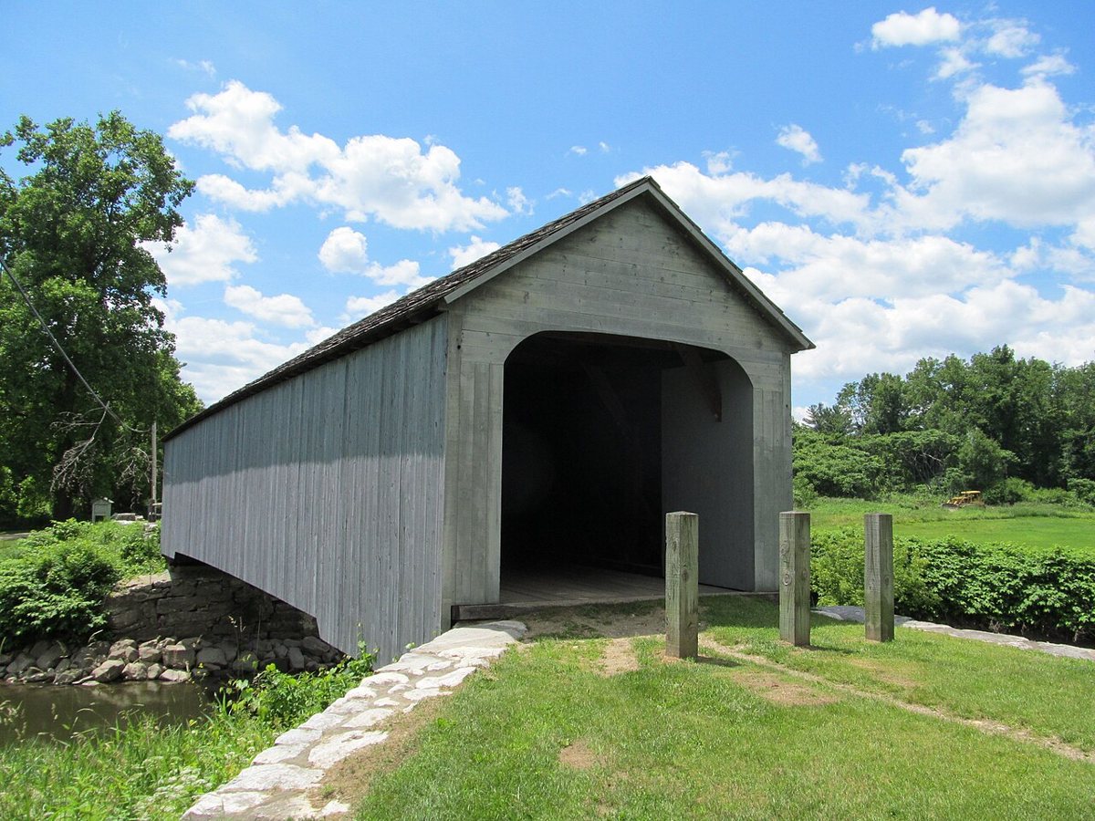
John Phelan / Wikimedia Commons · CC BY-SA 3.0 Settle in for the drive to Sheffield: 57.4 miles, close to two hours. The original Old Covered Bridge here was once the oldest covered bridge in Massachusetts until it burned on August 13, 1994. What spans the Housatonic River now is a Town lattice replica built in 1998, 93 feet long by most accounts. The site is listed on the National Register.
-
↓ 82.5 miles, about 1 hr 58 min
5. Ware–Hardwick Covered Bridge
Hampshire County, Massachusetts · built 1886
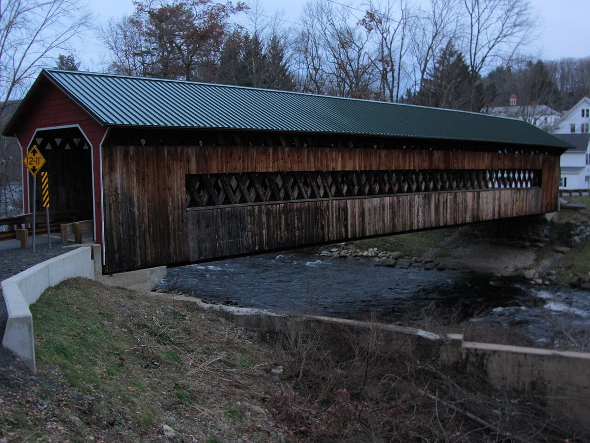
Joel Bradshaw / Wikimedia Commons · CC0 The next leg is the big one, 82.5 miles and just under two hours, ending at the Ware–Hardwick Covered Bridge over the Ware River. Built in 1886 and heavily rebuilt in 1986 to 1987, it closed in 2002 and reopened in October 2010 after restoration. It measures 137 feet and is listed on the National Register of Historic Places.
-
↓ 20.2 miles, about 37 min
6. Vermont Covered Bridge
Worcester County, Massachusetts
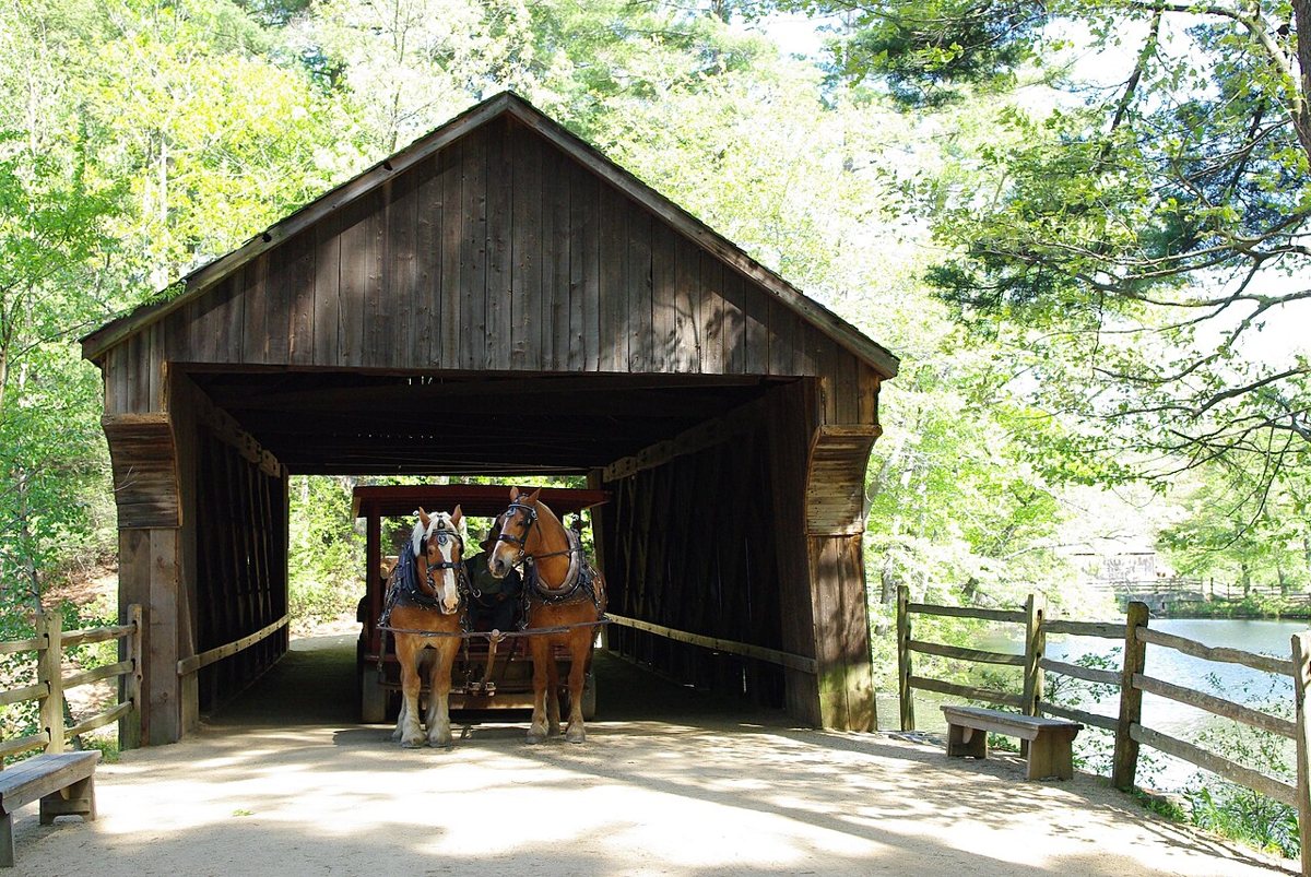
Taken by Dale E. Martin. / Wikimedia Commons · CC BY-SA 3.0 From the Ware River it's about 37 minutes (20.2 miles) to Old Sturbridge Village in Sturbridge, home of the Vermont Covered Bridge. This 55-foot Town lattice truss bridge, once known as the Taft Bridge, stood in Dummerston, Vermont, before it was moved here in 1951. Sources split on its original build date: either around 1870 or 1874.
-
↓ 59.6 miles, about 1 hr 27 min
7. Pepperell Covered Bridge
Middlesex County, Massachusetts · built 2010
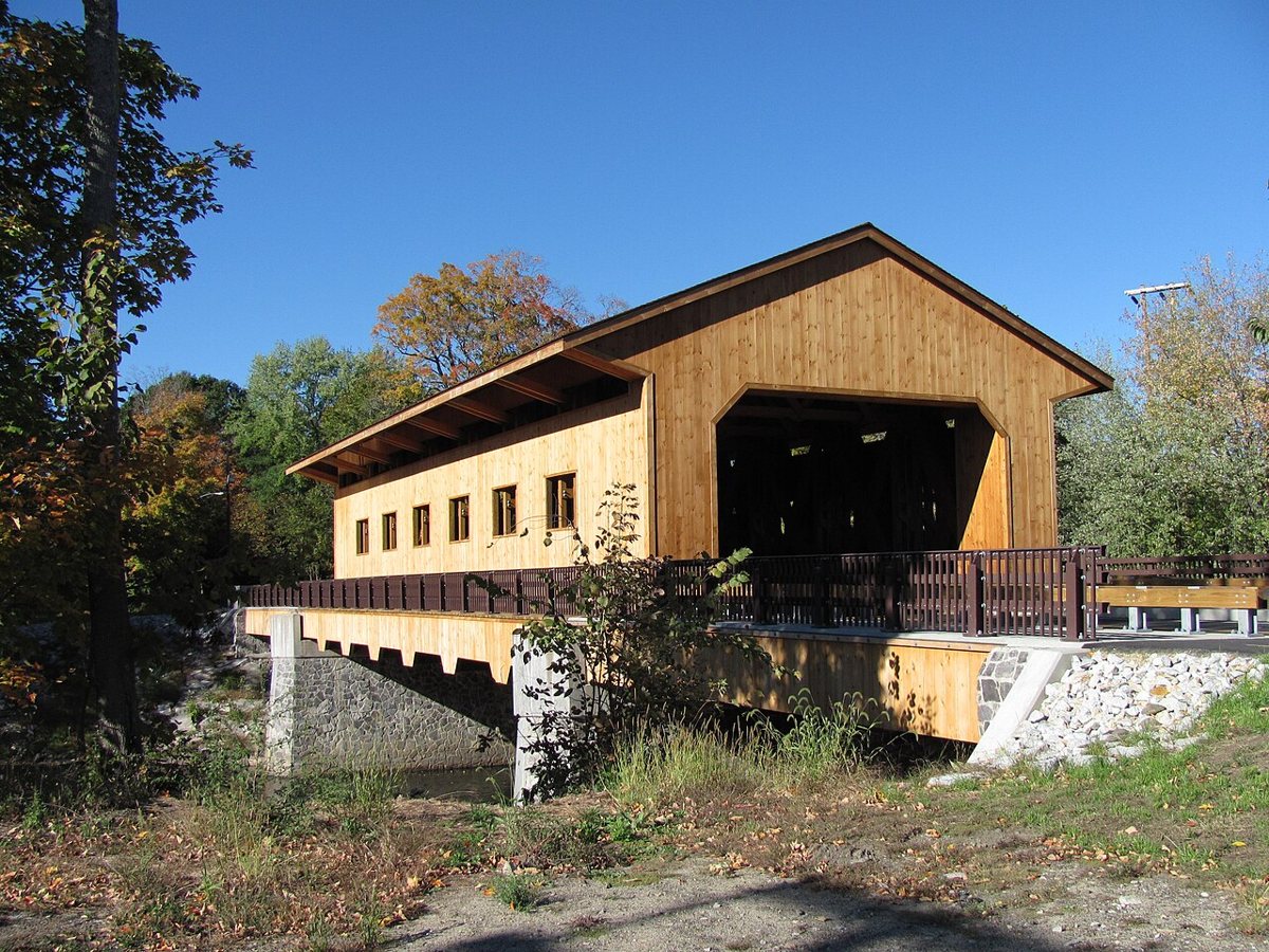
John Phelan / Wikimedia Commons · CC BY 3.0 Finish in East Pepperell, 59.6 miles and about 87 minutes away. The Pepperell Covered Bridge is the third covered bridge at the Groton Street crossing of the Nashua River. This 95-foot span reopened on July 30, 2010, replacing the Chester Waterous covered bridge of 1962 to 1963, which closed in 2008 and was torn down.
Every stop on this route links to its own page with coordinates, sourced facts and image licences. The text above was written from those records and checked against them before publishing. More covered bridges: all covered bridges in Massachusetts.