 Wayfarrow
Southern Indiana Covered Bridge Road Trip: 8 Bridges, About 7 Hours of Driving
8 stops242 milesabout 6 hr 53 min of drivingSouthern Indiana
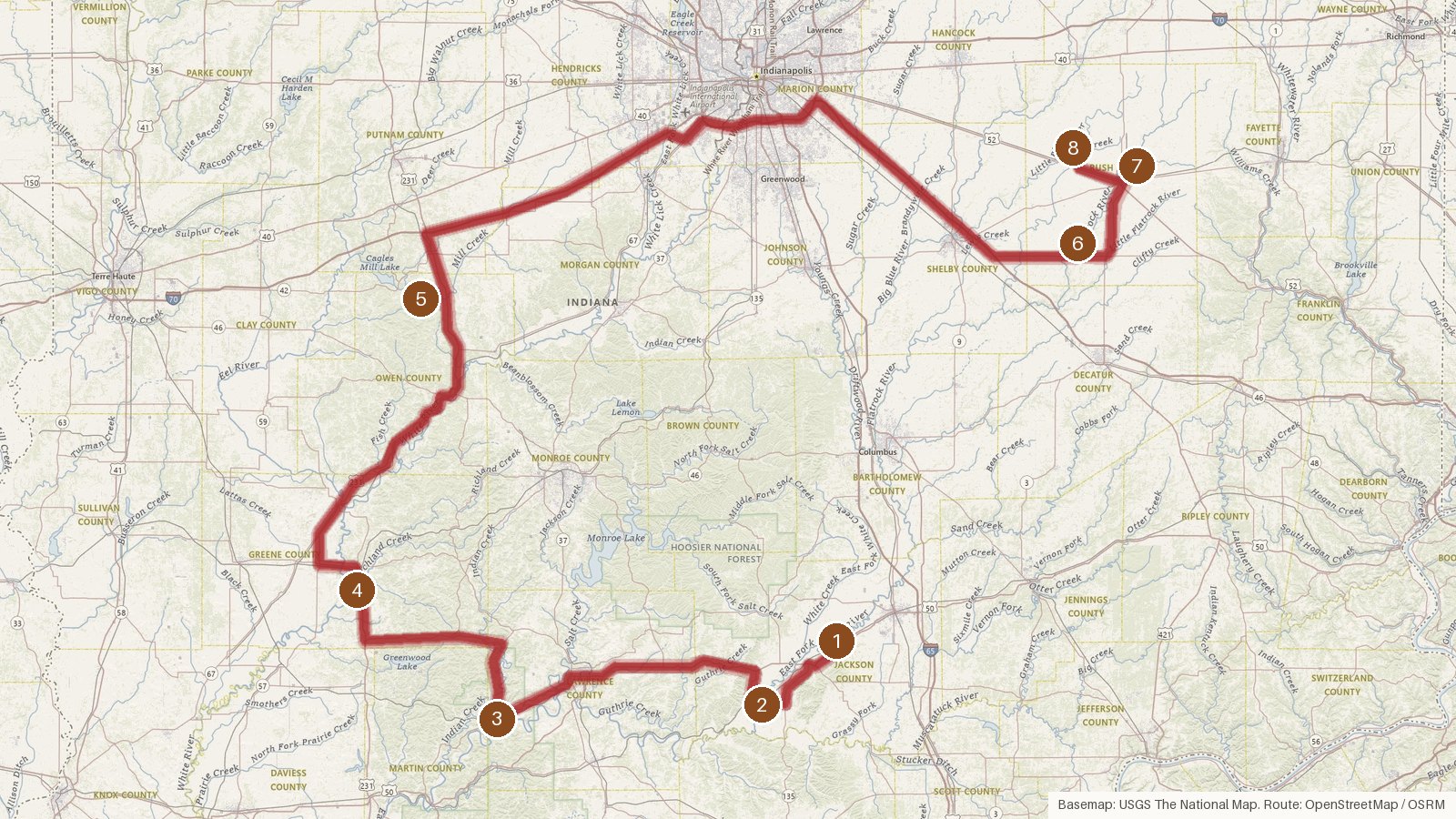
This route links eight covered bridges across five Indiana counties: Jackson, Lawrence, Greene, Owen and Rush. It runs about 242 miles, with roughly seven hours of driving spread over the legs, so plan on a full day or split it in two. All eight are listed on the National Register of Historic Places, and all were built between 1875 and 1888. J.J. Daniels is credited with the first three, which all cross the East Fork White River. Four of the last five carry the Kennedy name in their builder credits: A.M. Kennedy & Sons, Emmett L. Kennedy, and Emmett L. and Charles F. Kennedy. Several have come off the road over the years. Cataract Falls was bypassed in 1988, and Williams closed to vehicles in 2010. Start early, check access locally before you set out, and expect patchy cell coverage on rural stretches.
Route and drive times from OpenStreetMap routing (OSRM). Times are estimates without stops; roads to remote sites can be unpaved or seasonal.
-
1. Shields' Mill Covered Bridge
Jackson County, Indiana · built 1876
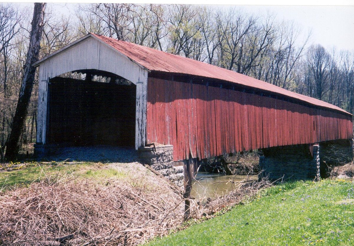
Chris Light / Wikimedia Commons · CC BY-SA 4.0 Start at Shields' Mill (Shieldstown), a two-span Burr arch bridge that J.J. Daniels built in 1876 over the East Fork White River in Jackson County. It closed to traffic at some point, with sources giving 1970, 1977 or 1980, and it was restored in 2019. Its length depends on who's measuring: 331 ft at the floor, 353 ft, or 355 ft at the roofline.
-
↓ 13 miles, about 23 min
2. Medora Covered Bridge
Jackson County, Indiana · built 1875
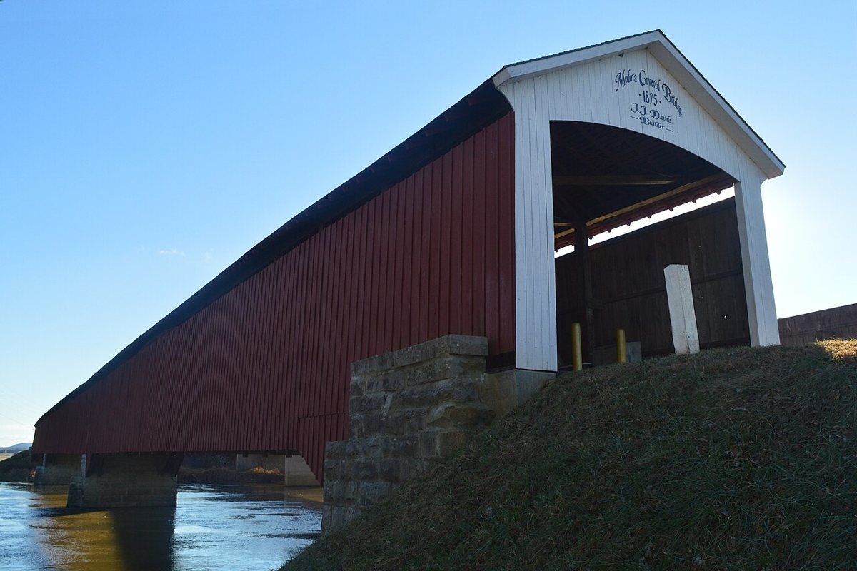
MedoraCoveredBridgeGuy / Wikimedia Commons · CC BY-SA 3.0 About 23 minutes and 13 miles on, Medora is another J.J. Daniels design over the same East Fork White River. This time it's a three-span wooden Burr arch from 1875, restored around 2010 to 2011. Measurements vary: 431 ft 10 in, 432 ft or 434 ft between abutments, and 459 to 462 ft for the floor or roof.
-
↓ 36.2 miles, about 1 hr 1 min
3. Williams Bridge
Lawrence County, Indiana · built 1884
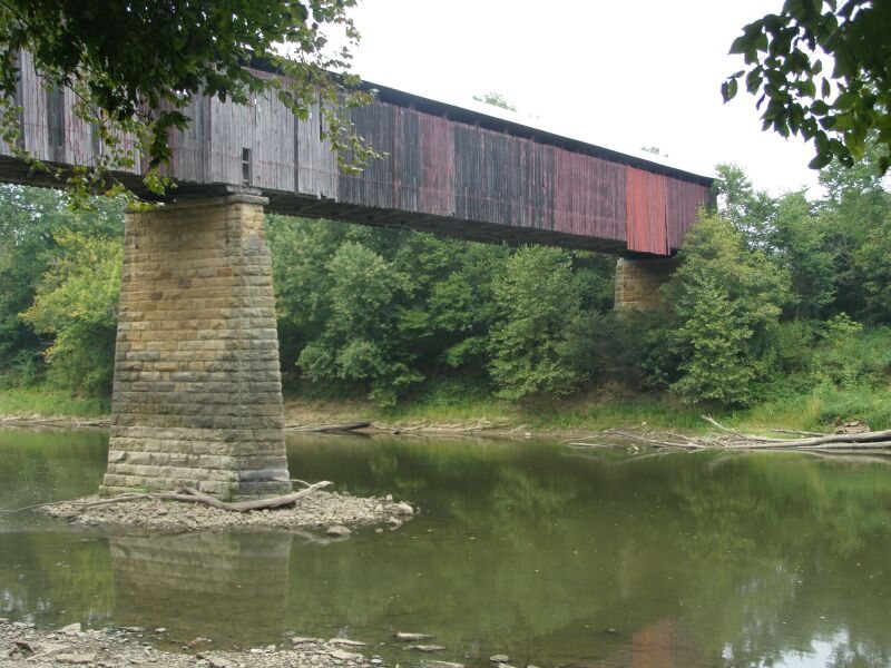
Chris Light (talk) / Wikimedia Commons · CC BY-SA 3.0 Lawrence County's Williams Bridge is 36.2 miles and about 61 minutes from Medora. J.J. Daniels built this two-span Howe truss in 1884, and it's Indiana's longest double-span covered bridge, crossing the East Fork White River once more. It closed to vehicles in 2010. Sources put it at 373, 376 or 402 ft, with the last figure including overhangs.
-
↓ 30.1 miles, about 1 hr 8 min
4. Richland-Plummer Creek Covered Bridge
Greene County, Indiana · built 1883
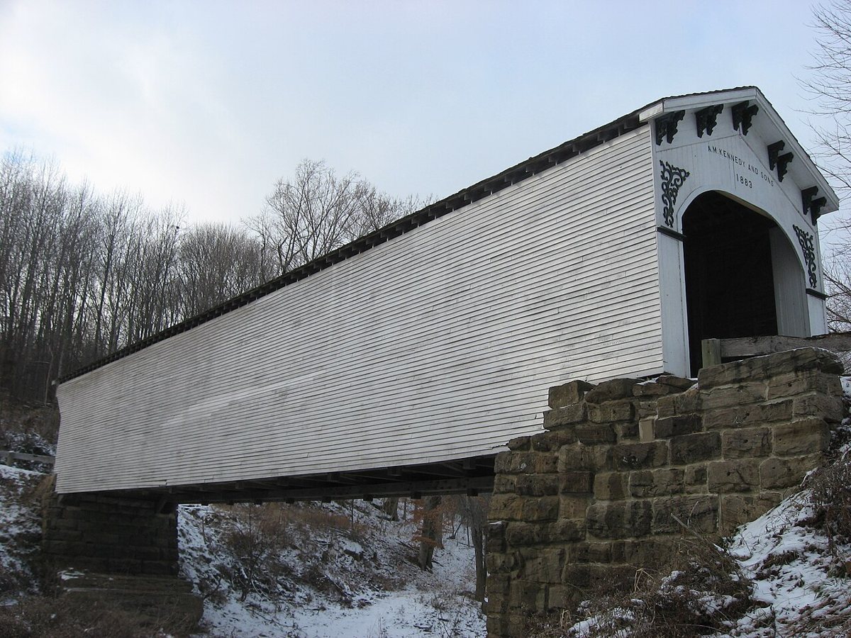
Nyttend / Wikimedia Commons · Public domain Expect about 68 minutes for the 30.1 miles to Greene County. This Burr arch truss over Plummer Creek, in Taylor Township, was built in 1883 by A.M. Kennedy & Sons and measures 102 ft. It closed in 1990 and reopened in 1998 after major structural work that replaced timbers.
Facts, map and sources for Richland-Plummer Creek Covered Bridge →
-
↓ 46.2 miles, about 1 hr 19 min
5. Cataract Falls Covered Bridge
Owen County, Indiana · built 1876
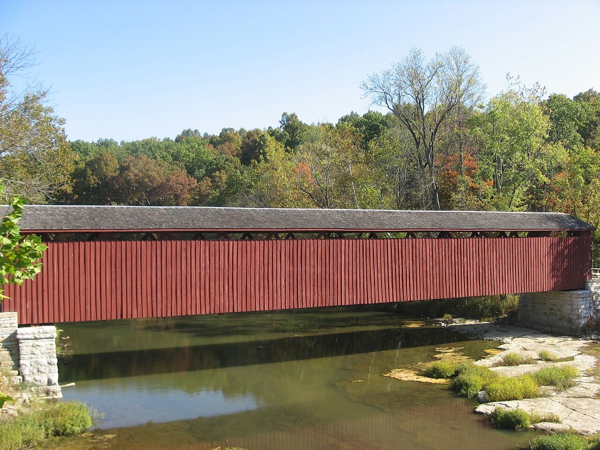
Nyttend / Wikimedia Commons · Public domain At 46.2 miles and about 79 minutes, this leg takes you into Owen County. The Cataract Falls bridge is an 1876 Smith truss over Mill Creek, and the road bypassed it in 1988. The record gives no single length: sources say 140 ft for the bridge and 148 ft for the full wooden structure.
-
↓ 90.2 miles, about 2 hr 5 min
6. Forsythe Covered Bridge
Rush County, Indiana · built 1888
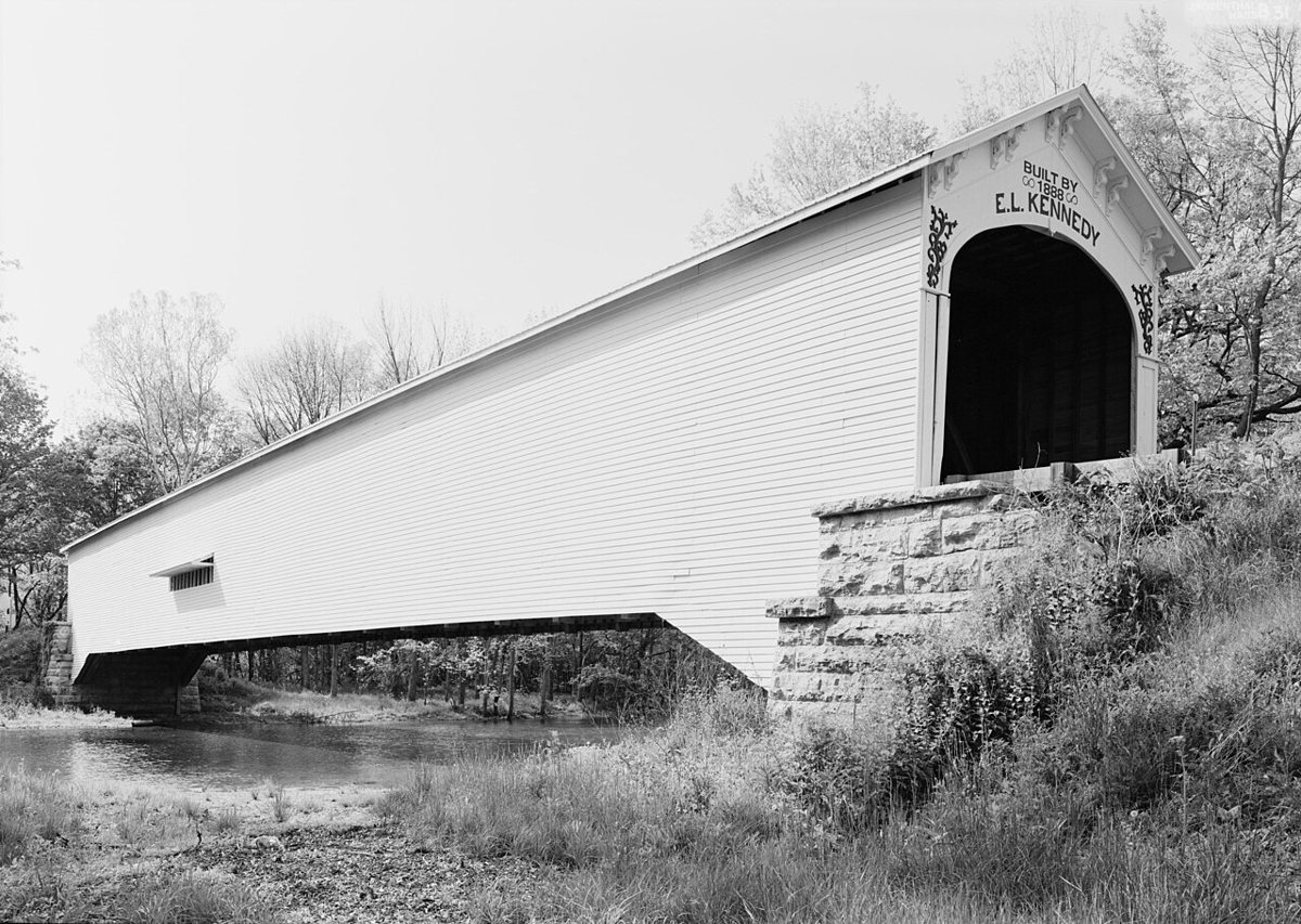
James W. Rosenthal / Wikimedia Commons · Public domain Set aside about two hours here, since it's 90.2 miles and 125 minutes to Rush County. Also called Forsythe Mill Bridge, this 1888 Burr arch by Emmett L. Kennedy crosses Big Flat Rock River, which the record also lists as the Flatrock River. Reported lengths range from 184 to 198 ft.
-
↓ 15.8 miles, about 32 min
7. Smith Covered Bridge
Rush County, Indiana · built 1877
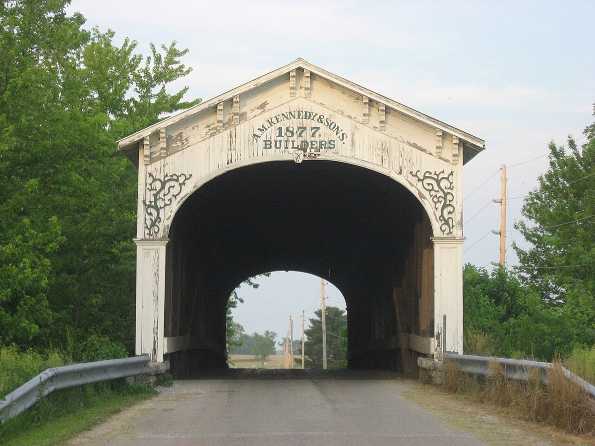
Nyttend / Wikimedia Commons · Public domain Smith Covered Bridge is 15.8 miles and about 32 minutes further on, also over the Flatrock River. A.M. Kennedy & Sons built this Burr arch-truss in 1877, and it was rehabilitated in 1996. Lengths depend on the source: 121 ft from Bridgehunter, 124 ft plus 8-ft overhangs from the Indiana Historical Society, and 136 ft from the Indiana Historical Bureau.
-
↓ 10 miles, about 25 min
8. Offutt Covered Bridge
Rush County, Indiana · built 1884
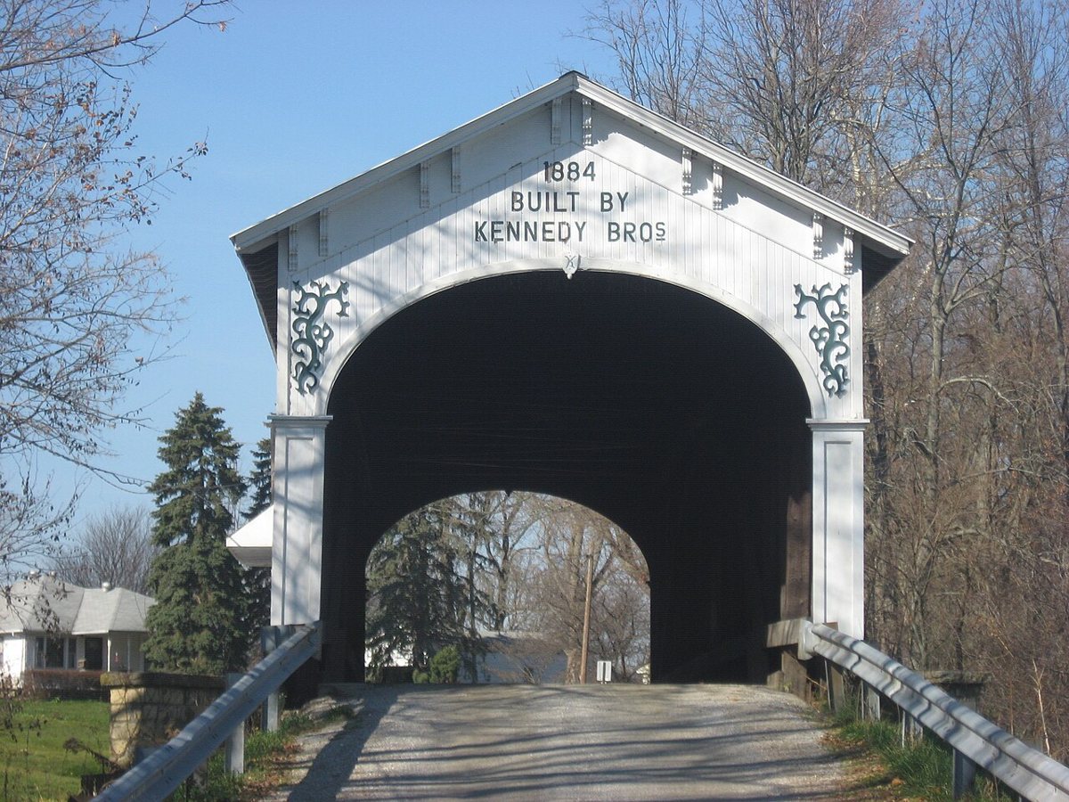
Nyttend / Wikimedia Commons · Public domain Finish 10 miles and about 25 minutes away at Offutt Covered Bridge, an 1884 Burr arch over the Little Blue River built by Emmett L. and Charles F. Kennedy. Its numbers are easy to untangle: the truss is 85 ft, and the 101 ft figure adds the 8-ft overhangs at each end.
Every stop on this route links to its own page with coordinates, sourced facts and image licences. The text above was written from those records and checked against them before publishing. More covered bridges: all covered bridges in Indiana.