 Wayfarrow
Sullivan County, New Hampshire Covered Bridge Road Trip: 11 Bridges, About 6 Hours of Driving
11 stops242 milesabout 6 hr 2 min of drivingSullivan County, New Hampshire
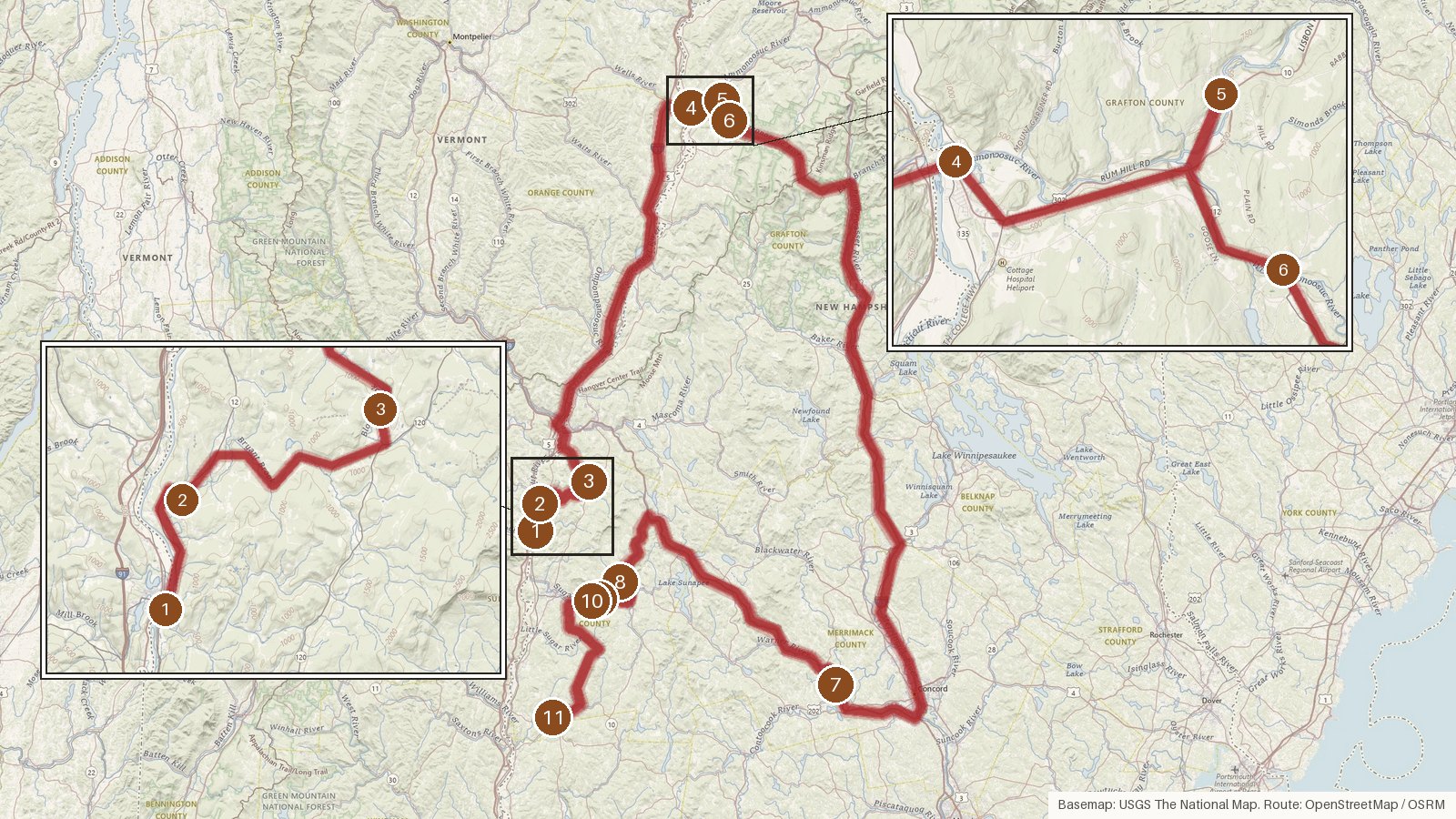
Despite the Sullivan County title, this 11-bridge route also reaches into Grafton and Merrimack counties before finishing back in Sullivan. Expect about 242 miles and roughly six hours behind the wheel, with two long legs: a little over an hour out to Haverhill and about two hours over to Contoocook. Every stop is listed on the National Register of Historic Places, and the dates run from 1829 at Haverhill-Bath to a 1994 replica at Corbin. Town lattice trusses turn up again and again, James Tasker built two of the Sullivan spans, and the Graton name appears at both Blow-Me-Down and Corbin. Three stops are former railroad bridges, and two road bridges were bypassed, in 1964 and 1999. The Ammonoosuc and Sugar rivers each get crossed twice. Start early, check access locally before you set out, and don't count on steady cell coverage on the rural stretches.
Route and drive times from OpenStreetMap routing (OSRM). Times are estimates without stops; roads to remote sites can be unpaved or seasonal.
-
1. Cornish–Windsor Covered Bridge
Sullivan County, New Hampshire · built 1866
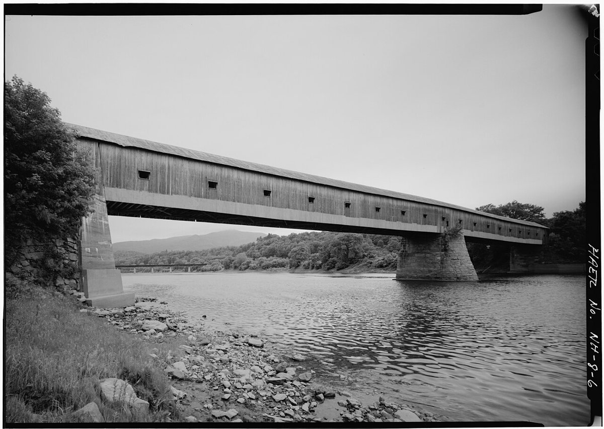
Historic American Engineering Record (HAER), creator / Wikimedia Commons · Public domain Start with the big one. The Cornish–Windsor Covered Bridge, built in 1866, runs 449 ft 5 in across the Connecticut River between New Hampshire and Vermont. It's a two-span timber Town lattice truss and holds two records: the longest wooden covered bridge in the US and the longest two-span covered bridge in the world. It was rehabilitated between 1988 and 1989.
-
↓ 4.4 miles, about 9 min
2. Blow-Me-Down Covered Bridge
Sullivan County, New Hampshire · built 1877
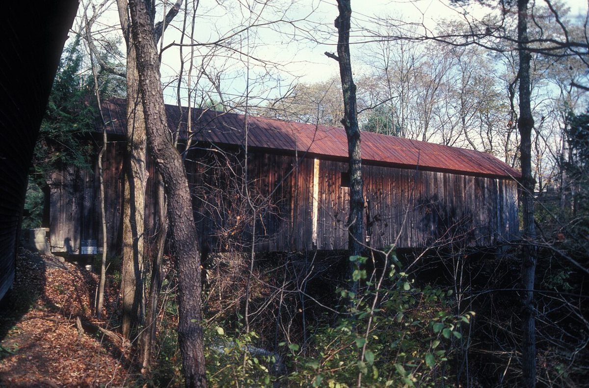
JERRY & ROY KLOTZ MD / Wikimedia Commons · CC BY-SA 3.0 Only 4.4 miles and about 9 minutes on, Blow-Me-Down Covered Bridge crosses Blow-me-down Brook. James Tasker built this multiple kingpost truss in 1877. It measures 85 ft 9 in, though some sources round that down to 85 ft. Milton Graton and his son restored it in 1980.
-
↓ 8.7 miles, about 20 min
3. Meriden Bridge
Sullivan County, New Hampshire · built 1880
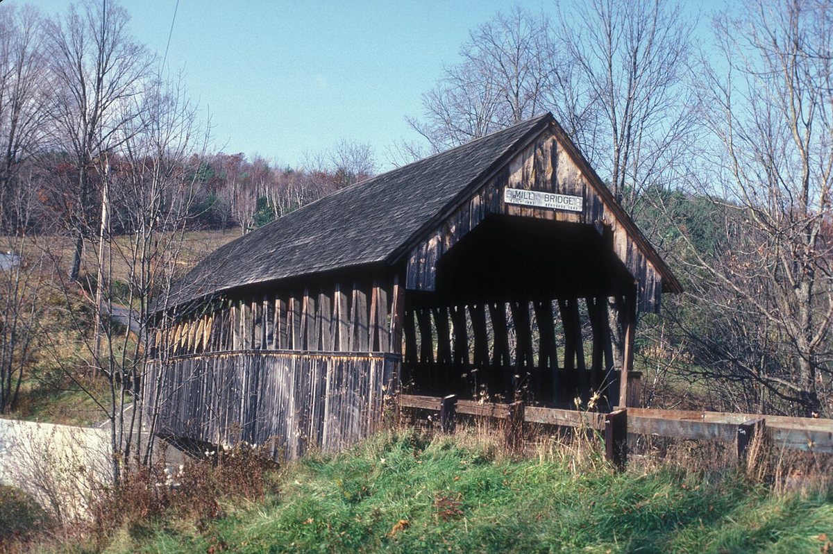
JERRYE & ROY KLOTZ MD / Wikimedia Commons · CC BY-SA 3.0 James F. Tasker shows up again at Meriden Bridge, about 20 minutes from Blow-Me-Down. He built it around 1880 over Bloods Brook. It was rebuilt with steel beams in 1963, and snow caved in the roof in 1977. Don't trust a single length figure here: sources give 80 ft, 82 ft and 85 ft, the last being the NRHP nomination's outside length.
-
↓ 52.8 miles, about 1 hr 13 min
4. Haverhill-Bath Covered Bridge
Grafton County, New Hampshire · built 1829
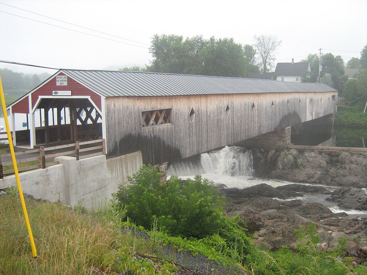
Mfwills / Wikimedia Commons · CC BY-SA 3.0 This is a long haul, 52.8 miles and about 73 minutes, into Grafton County. Haverhill-Bath Covered Bridge, from 1829, is believed to be New Hampshire's oldest covered bridge and the earliest surviving Town lattice truss. It spans the Ammonoosuc River for 256 ft. Car traffic was moved to a bypass in 1999.
-
↓ 5.1 miles, about 9 min
5. Bath Covered Bridge
Grafton County, New Hampshire · built 1832
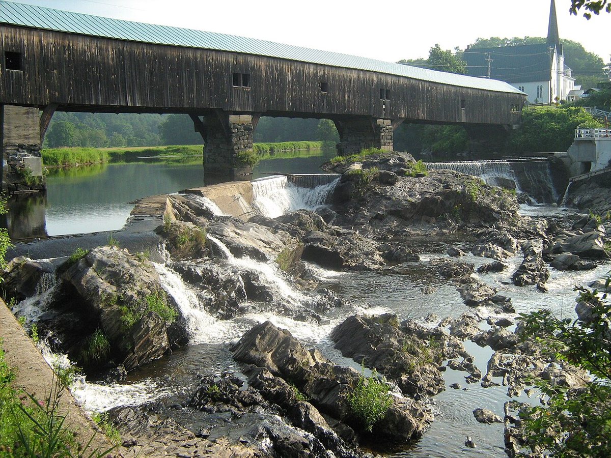
Mfwills / Wikimedia Commons · CC BY-SA 3.0 Stay with the Ammonoosuc River for Bath Covered Bridge, 5.1 miles and about 9 minutes away. Built in 1832 after a fire in 1830, it's the fifth bridge on this site. Reported lengths range widely, from 374 ft 6 in and 375 ft to over 390 and 400 ft. It reopened after a restoration that began in 2013.
-
↓ 3.6 miles, about 7 min
6. Swiftwater Covered Bridge
Grafton County, New Hampshire · built 1849
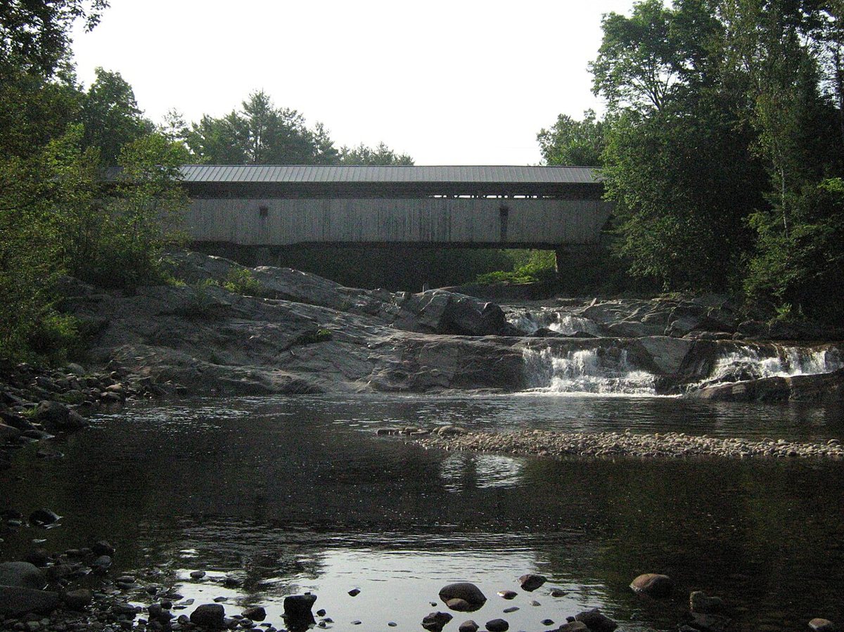
Mfwills / Wikimedia Commons · CC BY-SA 3.0 A short hop of 3.6 miles, about 7 minutes, brings you to Swiftwater Covered Bridge over the Wild Ammonoosuc River. Dating from 1849, it's a Paddleford truss and the fourth bridge at the site. The state rebuilt it in 1977. Published lengths don't agree, with sources giving 158 ft or 173 ft 8 in.
-
↓ 96 miles, about 2 hr 6 min
7. Contoocook Railroad Bridge
Merrimack County, New Hampshire · built 1889
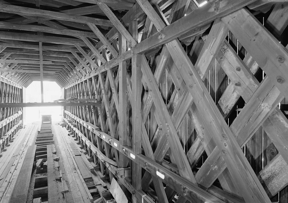
Jet Lowe / Wikimedia Commons · Public domain Settle in for the longest leg: 96 miles, a bit over two hours, to the Contoocook Railroad Bridge in Merrimack County. The 1849 date sometimes attached to it belongs to the first railroad bridge here. This double Town lattice span went up in 1889 on the older abutments, carried trains until 1962, and is called the oldest surviving covered railroad bridge in the US.
-
↓ 41.6 miles, about 56 min
8. Corbin Covered Bridge
Sullivan County, New Hampshire · built 1994
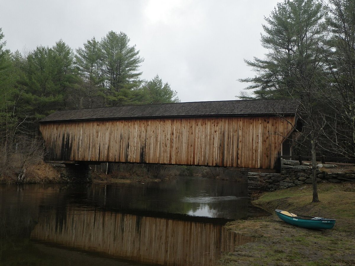
Halpaugh / Wikimedia Commons · CC BY-SA 3.0 Back in Sullivan County after 41.6 miles and about 56 minutes, Corbin Covered Bridge crosses the North Branch Sugar River. The original, from about 1845, burned in a suspected arson on May 25, 1993. Arnold Graton built a replica Town lattice covered bridge in 1994. Sources split on its length, giving either 96 ft or 104 ft.
-
↓ 6.7 miles, about 13 min
9. Pier Bridge
Sullivan County, New Hampshire · built 1907
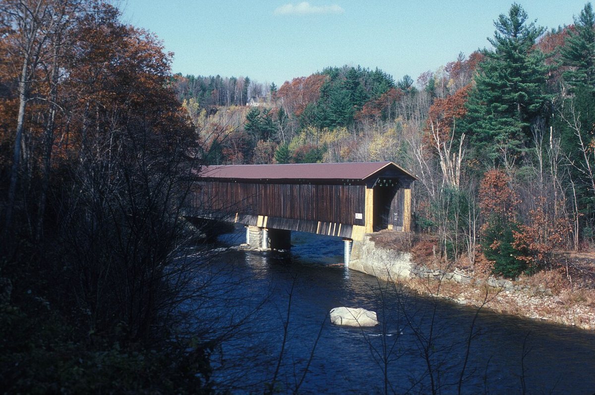
JERRYE & ROY KLOTZ MD / Wikimedia Commons · CC BY-SA 3.0 Pier Bridge, 6.7 miles and about 13 minutes from Corbin, is a 216 ft 7 in railroad covered bridge over the Sugar River. The Boston & Maine built it in 1907 to replace an 1871-72 bridge. It now carries the Sugar River Trail and is described as the longest surviving covered railroad bridge.
-
↓ 1 miles, about 4 min
10. Wright's Bridge
Sullivan County, New Hampshire · built 1906
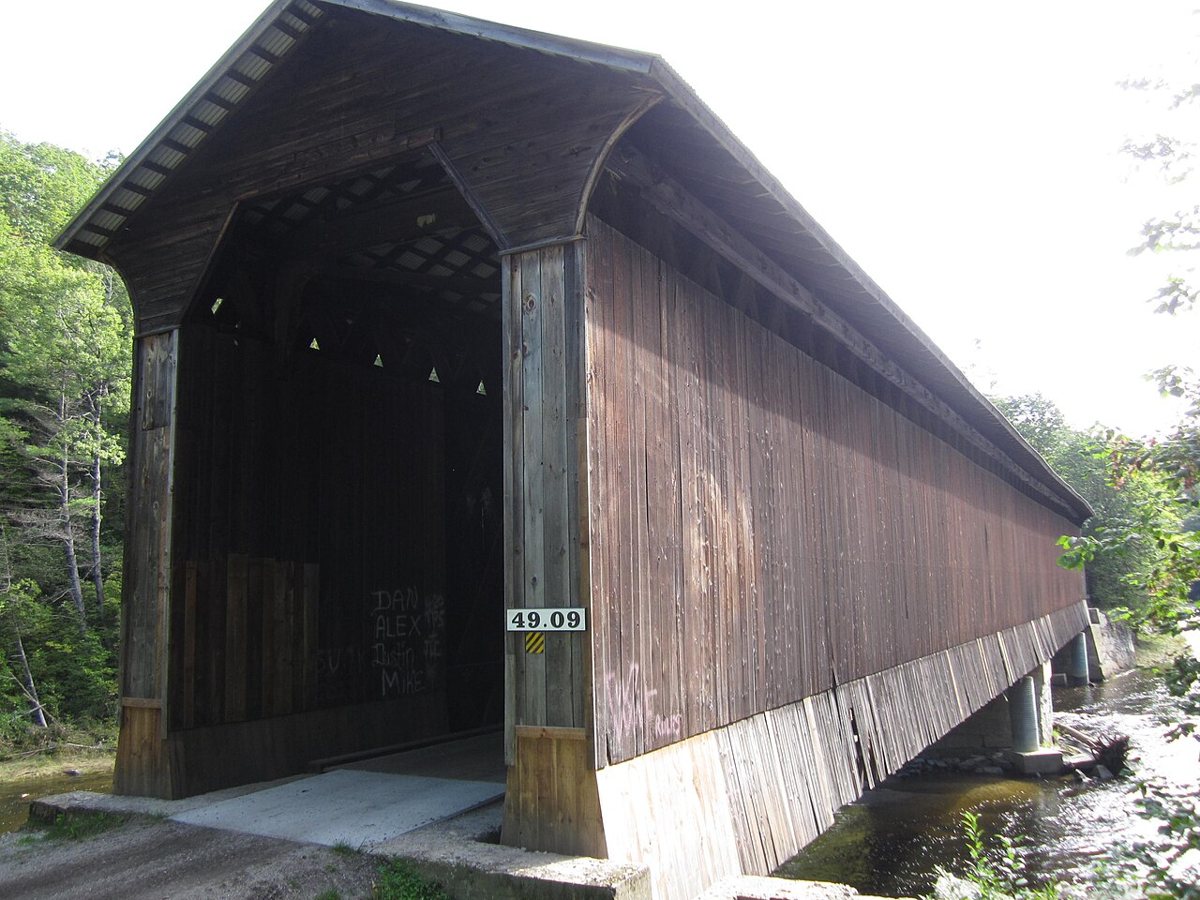
Doug Kerr from Albany, NY, United States / Wikimedia Commons · CC BY-SA 2.0 Just a mile on, about 4 minutes, Wright's Bridge also crosses the Sugar River and also carries the Sugar River Trail. This 1906 covered railroad bridge runs 123 ft 9 in and is the last surviving double Town lattice truss covered bridge with laminated arches.
-
↓ 21.6 miles, about 47 min
11. Cold River Bridge
Sullivan County, New Hampshire · built 1869
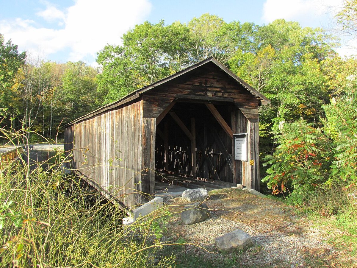
John Phelan / Wikimedia Commons · CC BY-SA 3.0 Finish with a 21.6-mile, roughly 47-minute drive to Cold River Bridge, also called McDermott Bridge. Albert S. Granger built it in 1869. It was bypassed in 1964 and restored in 2008. As with several stops on this route, the length is disputed: 86 ft in the NRHP nomination, with 81 ft and 89.5 ft also reported.
Every stop on this route links to its own page with coordinates, sourced facts and image licences. The text above was written from those records and checked against them before publishing. More covered bridges: all covered bridges in New Hampshire.